 |
||
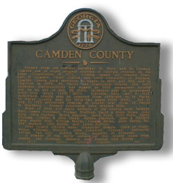
| History of Camden County, Georgia
This Camden County Marker Reads: "Formed from old Colonial parishes: St. Marys and St. Thomas. Camden one of eight original counties of Georgia created by the State Constitution of 1777. County named for Charles Pratt, Earl of Camden, Chief Justice and Lord Chancellor of England. Camden County gave territory to Wayne County in 1808 and 1812, and to Charlton in 1854. St. Marys was temporary County Site until Jefferson (Jeffersonton) was named as first permanent county site by an Act of Nov. 29, 1800. Jefferson seat of government sixty-nine years (1801-1871). Election held Jan. 3, 1871, authorized county seat be removed from Jefferson to St. Marys. St. Marys county seat for fifty-two years (1871-1923). Act of Aug. 11, 1923 authorized removal of county seat from St. Marys to Woodbine. Present Courthouse here erected 1928. Some first and early settlers of the county were: Talmage Hall, James Woodland, Thomas Stafford, David & Hugh Brown, John King, John Hardee, Henry Osborne, Jacob Weed, John Webb, Abner Williams, Charles & John Floyd, Nathan Atkinson, Isaac & Richard Lang, Joseph Hull, William Berrie, Thomas Miller, John Bailey Sr., and nephew John Bailey, and Lewis DuFour. First County officers were: Alexander Semple, Clerk of Court; Wilson Williams, Sheriff; John Crawford, Coroner; Nathaniel Ashley, Tax Col.; Robert Brown, Register of Probates. A number of the early settlers of this county came from Acadia, San Domingo, Minorca, and Spanish East Florida." [End Quote] For the most part, the early history of Camden includes the history of Charlton County, as it was once
The first European to land on what is today Camden County was Captain Jean Ribault of France. He was sent out by Admiral de Chastillan. Also known as Admiral Coligny, de Chastillan was the leader of the Protestant (Huguenot) party in France. Ribault was sent to find a suitable place for a Huguenot settlement. Ribault named the rivers he saw the Seine and the Somme. Today these rivers, which form the northern and southern borders of Camden County, are known as the Satilla and St. Marys Rivers. Other rivers in Camden and Charlton include the Crooked River and the Little Satilla River. Most of the local rivers are tidal rivers. That means the direction of their flow will change depending on whether it is low or high tide. The river water can be salty for much of the way inland. The St. Marys River, however, is fresh water from the Okefenokee Swamp. It empties into the Intracoastal Waterway so it can be salty near the end (depending on the tides).
Because this area was situated between the English to the North, the Spanish to the south, and Indians all around, this area was called the "Neutral Area." The plan was to create a buffer between all these conflicting forces. Of course, settlers moved in regardless of the wishes of the governments! All the nations hoped to lay claim to the area through settlement. A look through the graves of Oak Grove Cemetery in St. Marys will give you a true understanding of the term "melting pot." Bachlott (Bashlott), Arnow (Arnau), Alberti (Alberty), Paxeti (Pacetti/Pacetty), McIntosh, and many others show English, Spanish, Scottish, and French influences.
After many years, the Spaniards abandoned the settlements due to "friction" with the Indians. The Indians had risen up against the Spanish and slaughtered many of the priests. In the Indians' defense, I have not heard what reasons they may have had for their actions. After the abandonment, the English felt the area was now open to their claims. During this time, Spain also continued to claim the area. They lost the claim in 1742 during the decisive battle of Bloody Marsh (off St. Simons Island); General James Oglethorpe led this battle. General Oglethorpe had quite an influence in this area aside from leading battles. He founded a town on St. Simons Island, Frederica, named after a member of the royal family. Oglethorpe designed the town of Savannah and his work can still be seen in the historic district. He was at Cumberland Island when an Indian gave the barrier island its name. Later, he erected a hunting lodge on Cumberland named Dungeness, which was predecessor to the famous Greene and Carnegie Dungeness Mansions. He also founded St. Andrews Fort on the north end of Cumberland Island as well as a strong battery, Fort Williams, on the south end. Fort Williams commanded the entrance to the St. Marys River. In addition to all of the above, he also gave Amelia Island its name. In 1763, Spain, under a treaty of peace with England, ceded Florida to Britain. After this, the boundaries Camden's History in War Georgia was the last state to join in the War for Independence in 1775. It was then that the people renamed the area Camden County to rid themselves
of the European "Parish" title. During this time, the brothers of Governor
Wright of Georgia, Charles and German Wright - who were English Loyalists -
built
In 1784, the British had lost the war and turned Florida over to the Spanish. The English loyalists came home to Camden to find that their property had become property of the state. Despite the population loss during the war, abandoned settlements were soon repopulated, and the area recovered as people were again drawn to the rich Camden County land.
In the beginning slavery was outlawed in the state (then a Parish) of Georgia by General Oglethorpe, who thought that it was barbarous. Georgia's government later legalized it because many landowners feared they would not be able to work the land if they had to pay white laborers. While local plantations owners thought it was in their best interests to see that slavery continued, most also thought it was a curse they'd rather be out from under (but only if it didn't effect their bottom line). Many plantation owners never profited from their landholdings. In many cases, owners lived and died deeply in debt. The Civil War: During the Civil War, Camden had sent out two full divisions of its men to fight against their brothers. This was a huge amount of men to leave such a sparsely populated area.
At the beginning of the Civil War, the population was 5,482 of which only 1,721 were white. The war devastated the area. Several families lost their sons in the fighting. After the War, especially during reconstruction, the local residents learned to live without slave labor and eventually began to prosper again. Even so, many plantation owners left the area leaving only their slaves, their dead and their name. Today, you can see their influence by the surnames of local African American families such as the Parrishes and the Holzendorfs. Camden County seemed able to deal with the changes easier then some other areas. By the turn of the century, about half the land in the County was owned by blacks. The freeing of the slaves appears to be yet another change that the blacks AND whites of this county dealt with in a relatively positive manner. Integration in the 1960's was peaceful. Without getting too much further into Camden's War History, it should be stated that Camden had a definite presence in many U.S. wars such as: the War of 1812, the Civil War, WWI, WWII, the Korean War, the Vietnam War, and the Persian Gulf War. For many of the early years, Point Peter in St. Marys was considered of great military value. Later, the area would once again be of value to the military in the form of a major submarine base – Kings Bay. Source for information: Marguarite Reddick - "Camden's Challenge" - 1976, 1994. Permission to use this book as a source granted by the Guale Historical Society. For further research, please be sure to check out the Bryan - Lang Library. I have a page up with their pamphlet and contact information, but this is not their official web site. |
 Guale
(Pronounced "Wallie" or "Whallie") was the name given by the Spanish to the
area that included the Georgia Coast islands and all the country between the
Altamaha River (Brunswick area, Glynn Co.) and the St. Marys River. The name
is in honor of an Indian Chief.
Guale
(Pronounced "Wallie" or "Whallie") was the name given by the Spanish to the
area that included the Georgia Coast islands and all the country between the
Altamaha River (Brunswick area, Glynn Co.) and the St. Marys River. The name
is in honor of an Indian Chief. a part of Camden. Therefore, rather than repeat myself, I will start here for both counties.
 In 1565, Spain became alarmed by the French settlements and sent out a large force to take over and settle the area. The Spanish held the area for the next 100 years. During that time, the Spaniards attempted to convert all the native Indians they came across to Christianity. One Franciscan party built a mission in what is now St. Marys. The missionaries received permission to build by the Indian
Queen Hiacaia, the ruler over a large Indian village in the area.
In 1565, Spain became alarmed by the French settlements and sent out a large force to take over and settle the area. The Spanish held the area for the next 100 years. During that time, the Spaniards attempted to convert all the native Indians they came across to Christianity. One Franciscan party built a mission in what is now St. Marys. The missionaries received permission to build by the Indian
Queen Hiacaia, the ruler over a large Indian village in the area.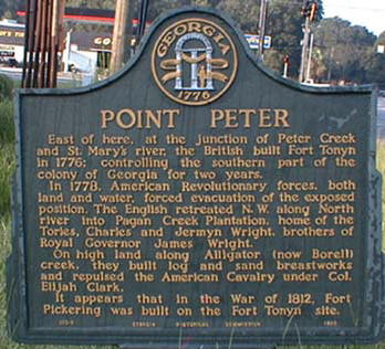 of Georgia were extended from the Altamaha (now the southern boundary of Glynn County) to the St. Marys River (the current southern boundary of Camden). In 1765, four parishes were laid off between the Altamaha and St. Marys Rivers. These were St. Davids, St. Patricks, St. Marys and St. Thomas. The Parish of Camden, named for
Charles Pratt, Earl of Camden in England, was then formed from the St. Marys and St. Thomas parishes. At first, the community of St. Patrick was the County Seat of Camden. Later, the county seat was moved further south to the little town of St. Marys. Back then, Camden was larger, encompassing much of Charlton County, a bit of Brantley County, and part of Wayne County. Now, Camden extends north to Glynn County, south to the Georgia/Florida border of
the St. Marys River, east to the Atlantic Ocean and west to Charlton and Wayne counties.
of Georgia were extended from the Altamaha (now the southern boundary of Glynn County) to the St. Marys River (the current southern boundary of Camden). In 1765, four parishes were laid off between the Altamaha and St. Marys Rivers. These were St. Davids, St. Patricks, St. Marys and St. Thomas. The Parish of Camden, named for
Charles Pratt, Earl of Camden in England, was then formed from the St. Marys and St. Thomas parishes. At first, the community of St. Patrick was the County Seat of Camden. Later, the county seat was moved further south to the little town of St. Marys. Back then, Camden was larger, encompassing much of Charlton County, a bit of Brantley County, and part of Wayne County. Now, Camden extends north to Glynn County, south to the Georgia/Florida border of
the St. Marys River, east to the Atlantic Ocean and west to Charlton and Wayne counties.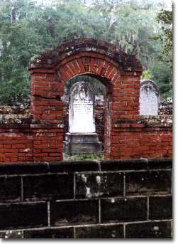 a
fort on their land. The brothers built this fort, which was on the St. Marys
River, in order to protect their land during the war. It is believed the
fort was where Scrubby Bluff is today. The fort was named Wright's Fort. Wright's Fort became a rendezvous for the loyalists and outlaws not only
from Georgia but also from North Florida. These outlaws called themselves the
"Florida Rangers" and they robbed many south Georgians; they would store their
loot in Wright's Fort. Captain John Baker marched from Savannah in order to
take care of this nest of outlaws. He failed; so did Major-General
Robert Howe, commander of the American army in the Southern States. Retreating
British soldiers finally burned it down in 1778. The Americans rebuilt it
when they invaded East Florida, and then burned it down to prevent it
falling into enemy hands. The remains were finally discovered in 1975.
a
fort on their land. The brothers built this fort, which was on the St. Marys
River, in order to protect their land during the war. It is believed the
fort was where Scrubby Bluff is today. The fort was named Wright's Fort. Wright's Fort became a rendezvous for the loyalists and outlaws not only
from Georgia but also from North Florida. These outlaws called themselves the
"Florida Rangers" and they robbed many south Georgians; they would store their
loot in Wright's Fort. Captain John Baker marched from Savannah in order to
take care of this nest of outlaws. He failed; so did Major-General
Robert Howe, commander of the American army in the Southern States. Retreating
British soldiers finally burned it down in 1778. The Americans rebuilt it
when they invaded East Florida, and then burned it down to prevent it
falling into enemy hands. The remains were finally discovered in 1975.