![]()
1911 Ballard Map of Glynn County
|
Page 1-- Pages 1-4
can be read under
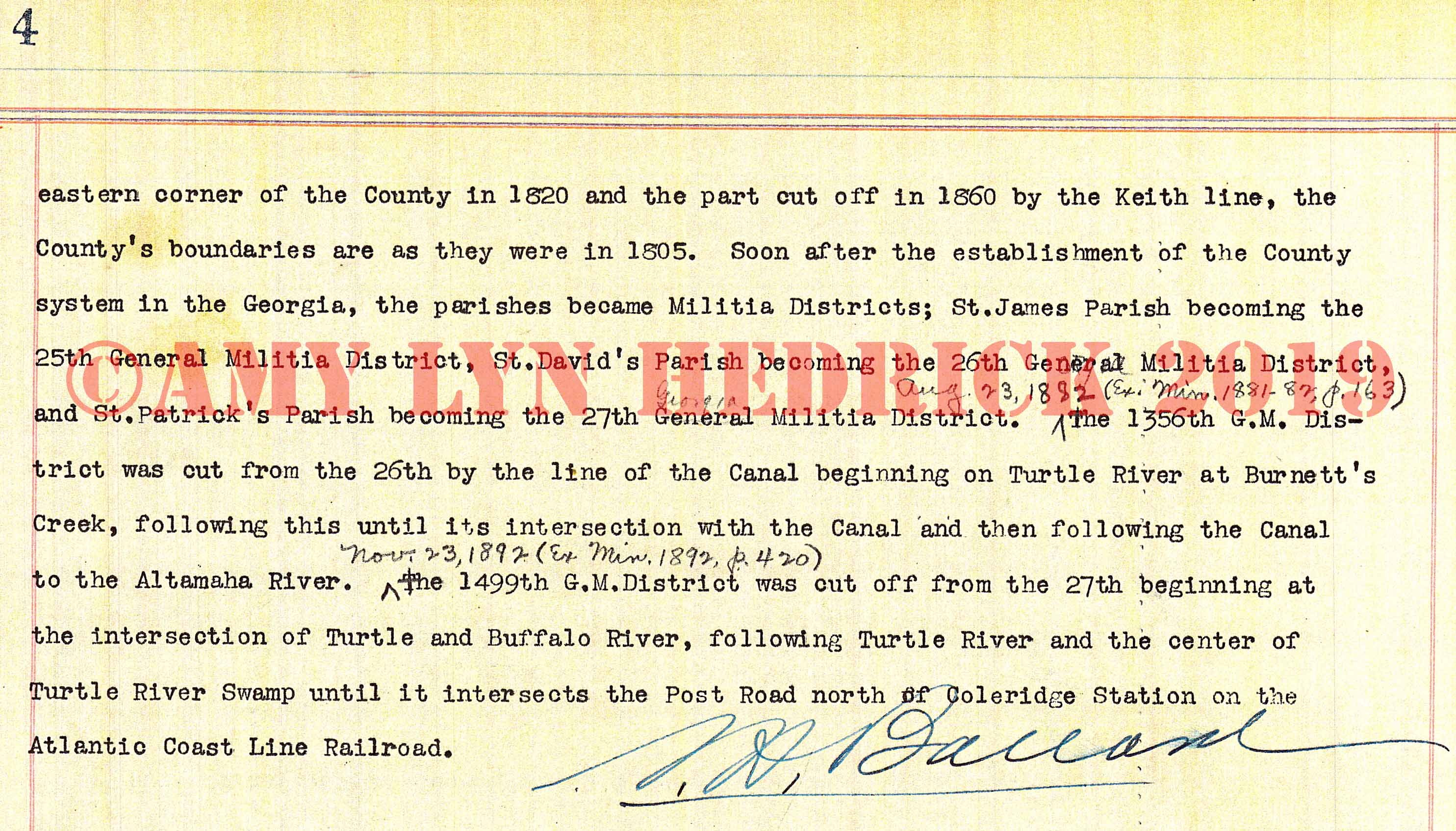
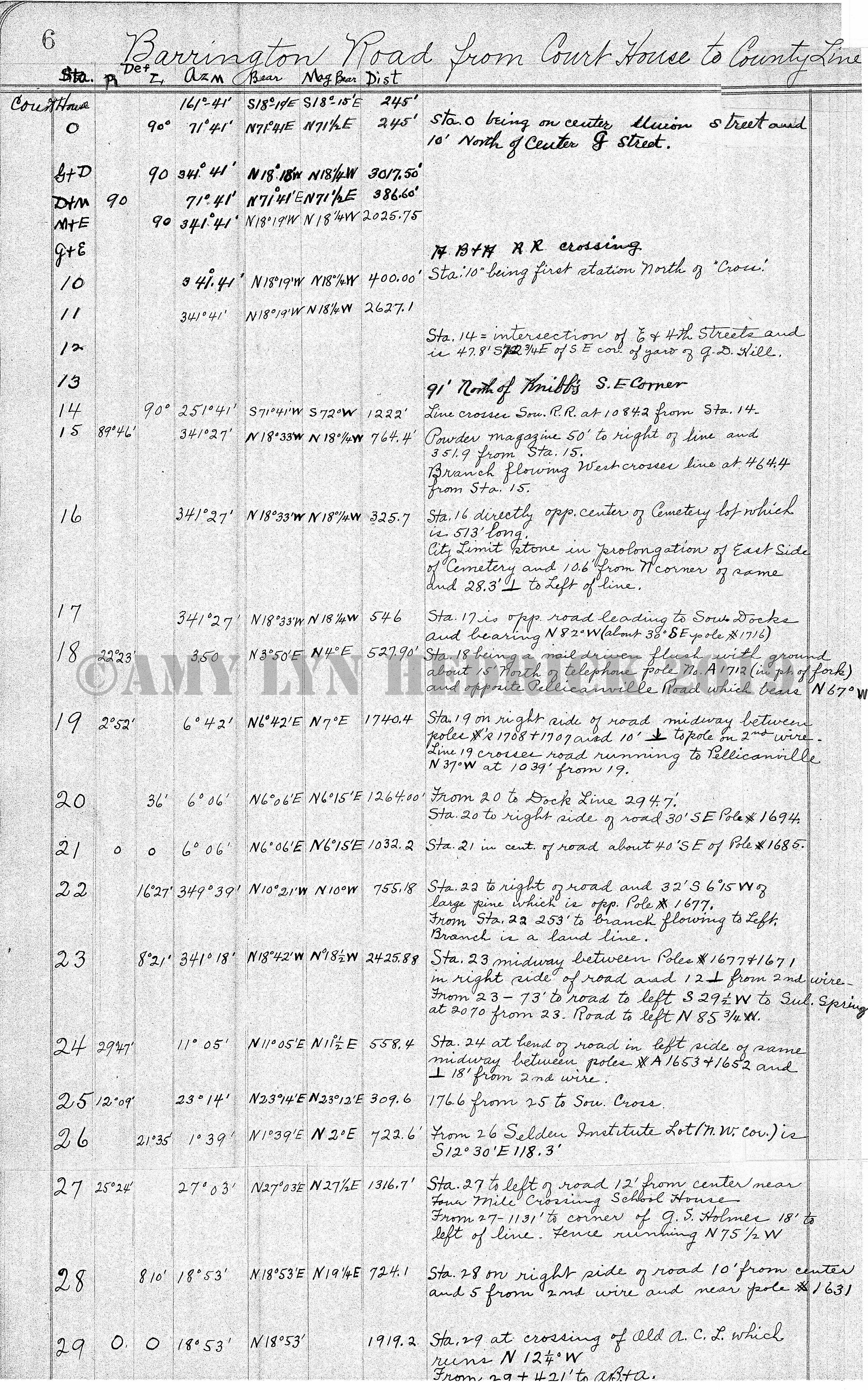
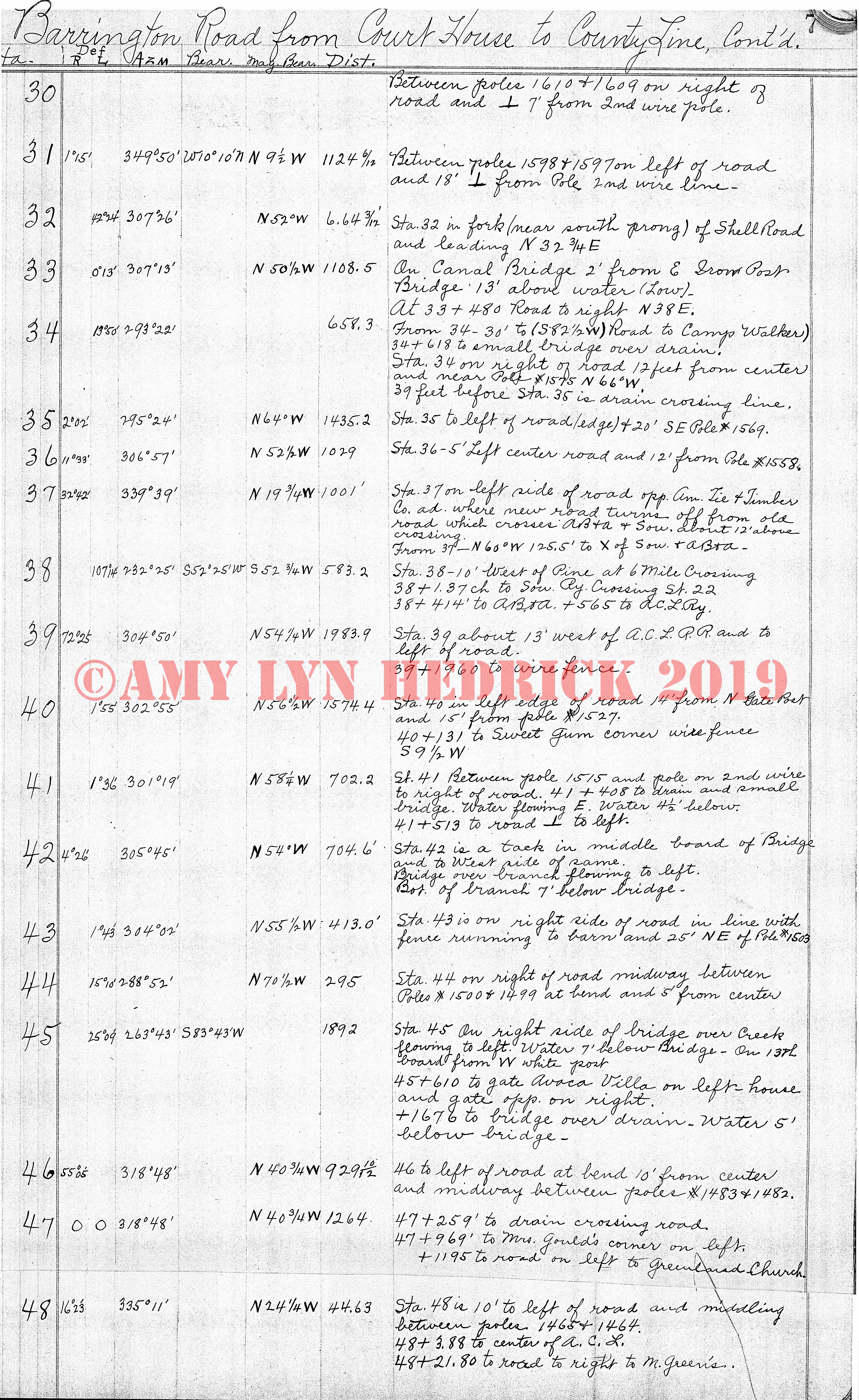
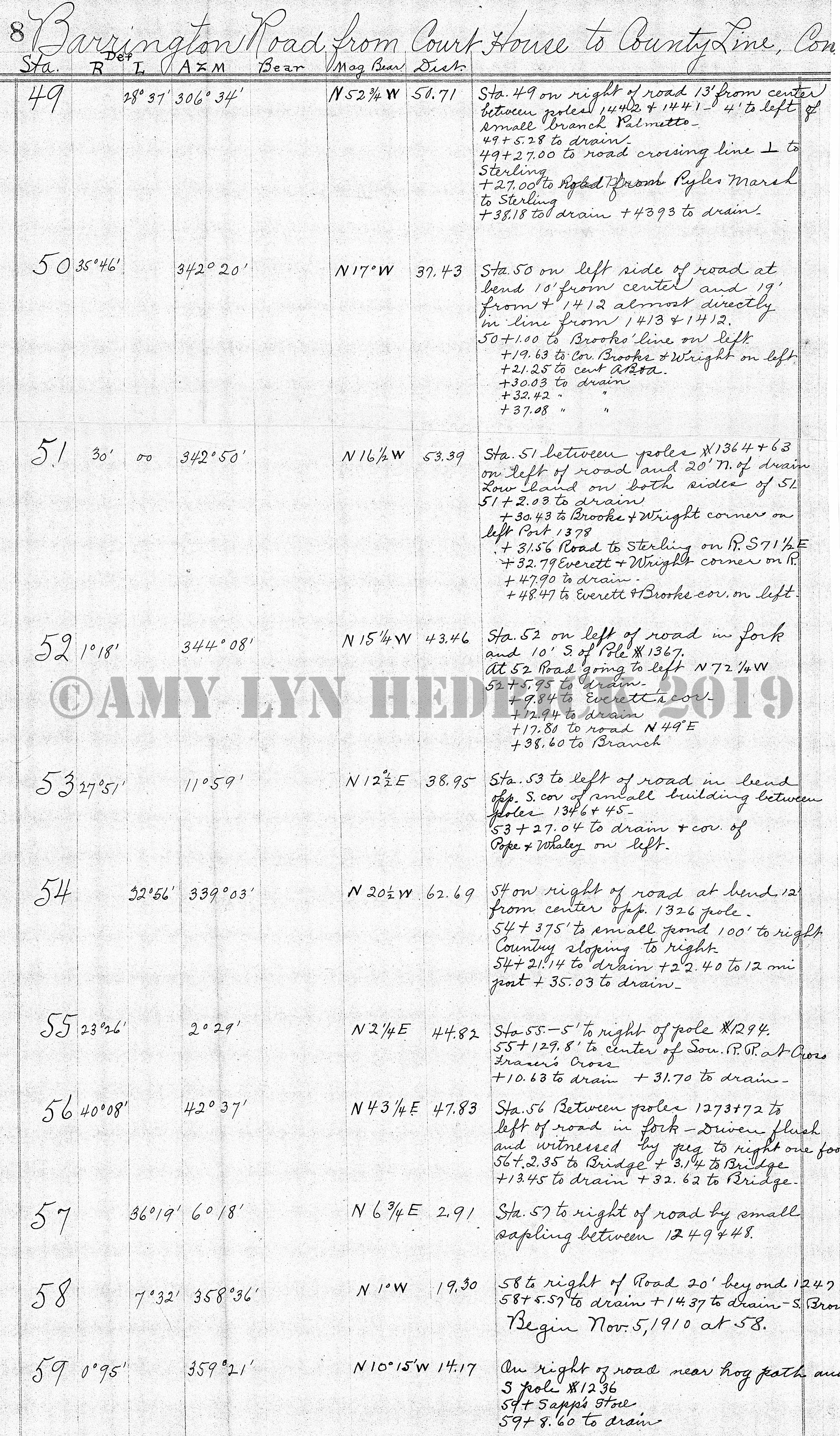
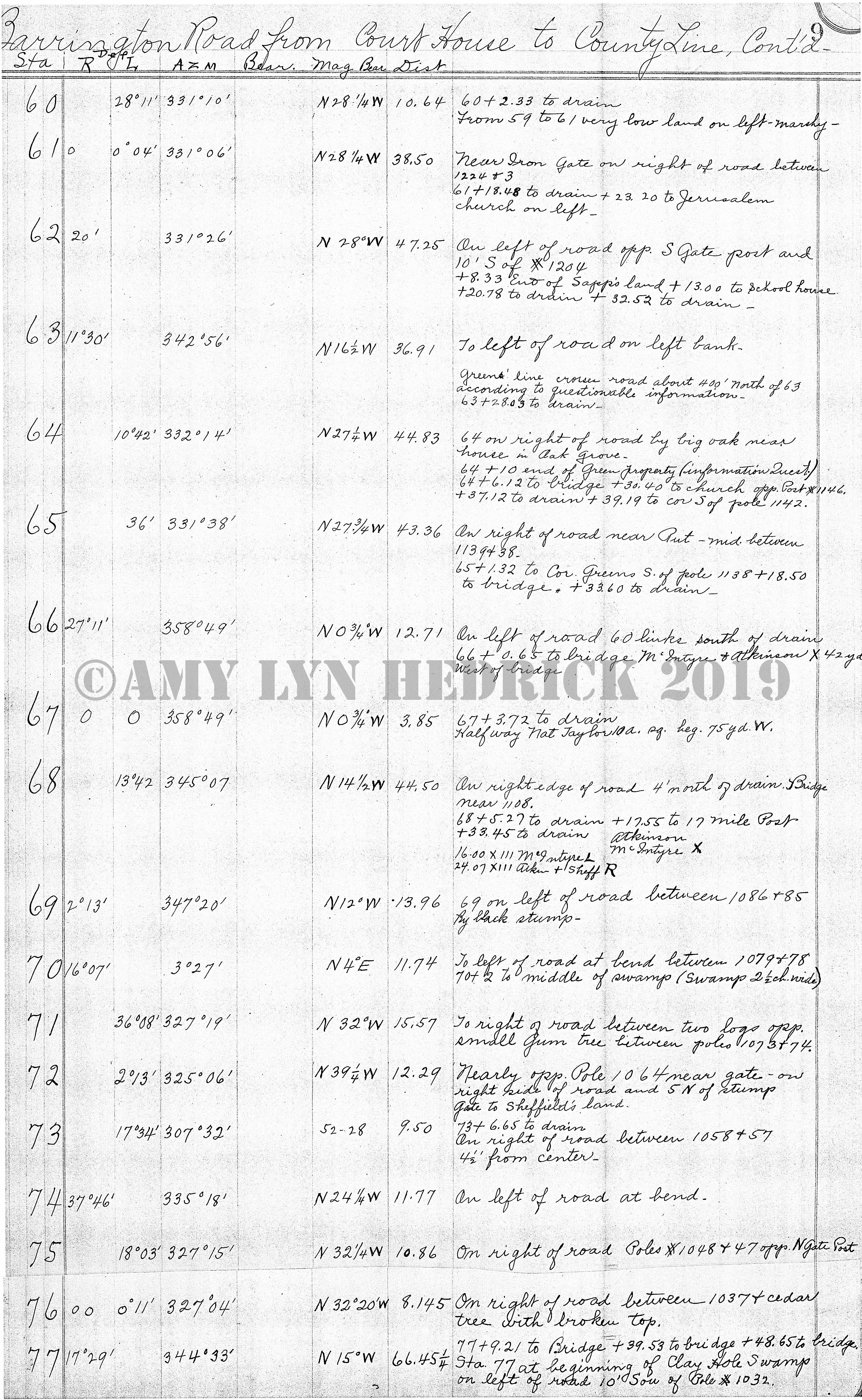
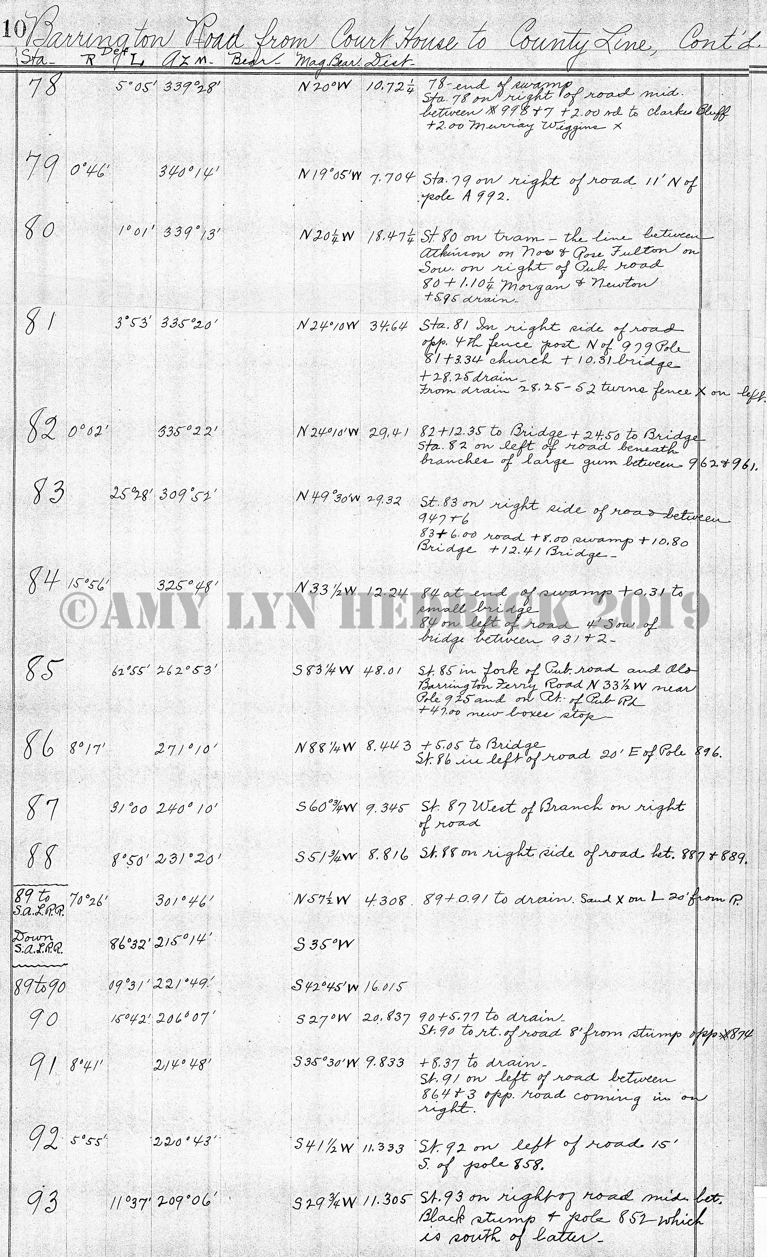
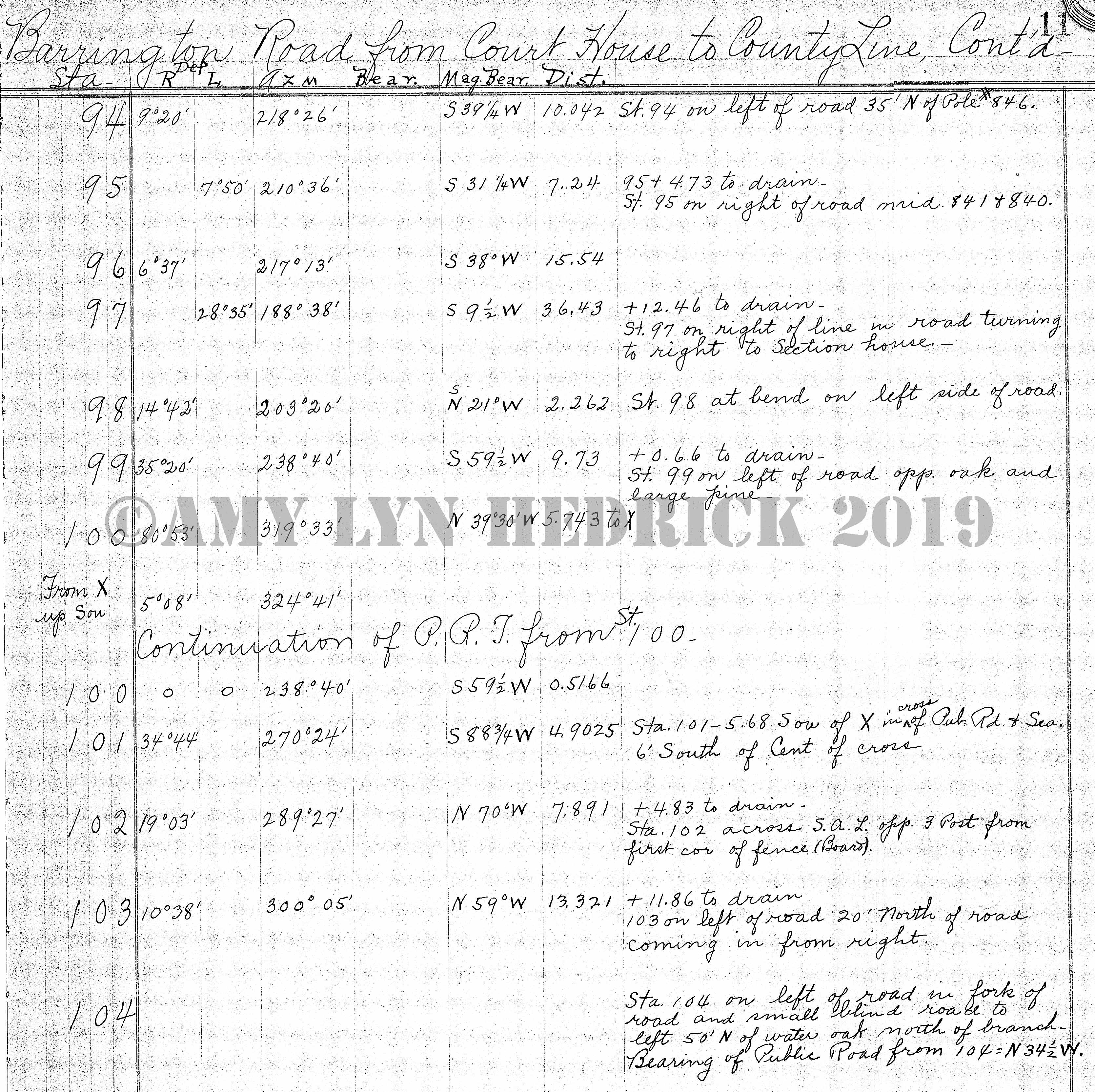
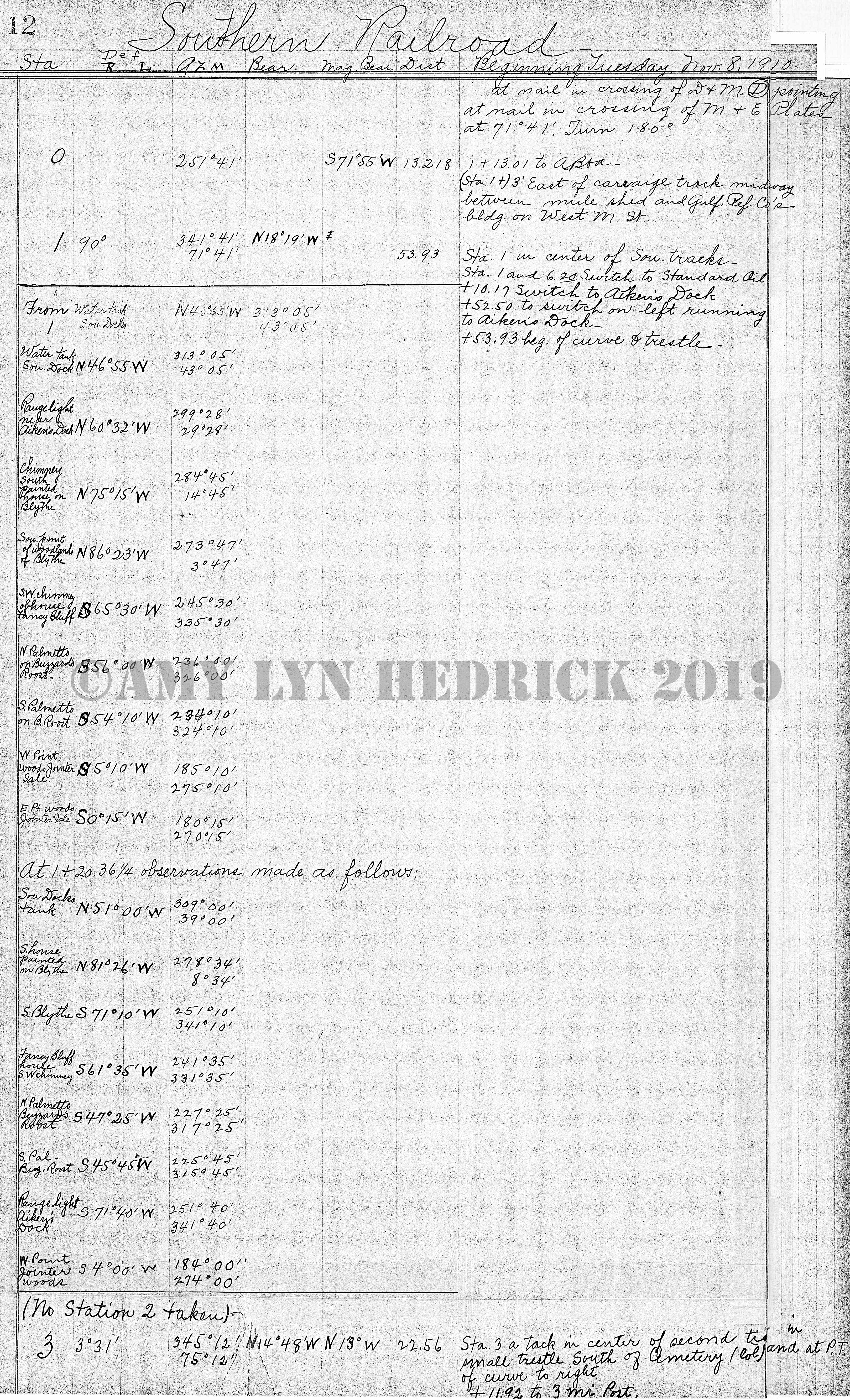
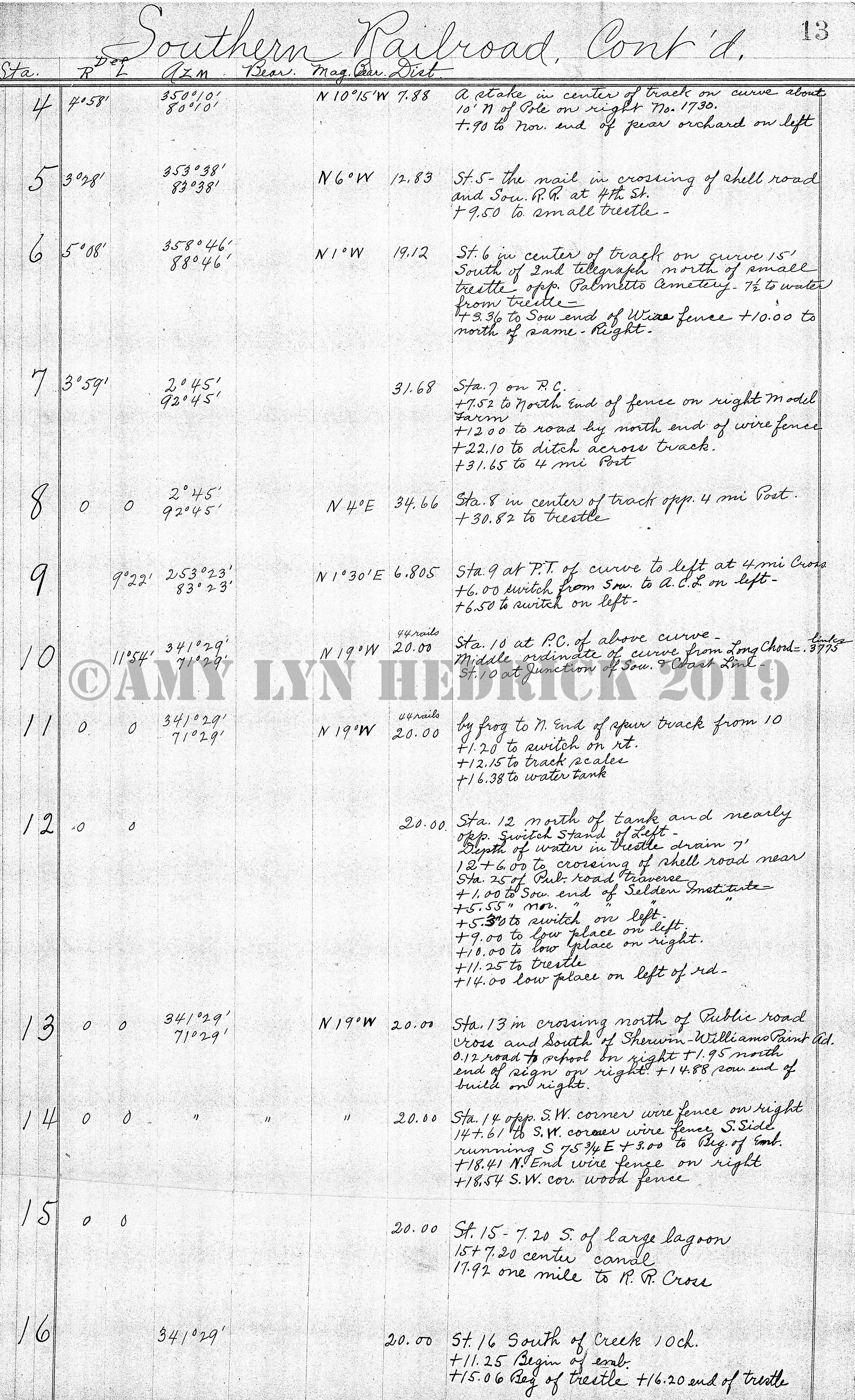
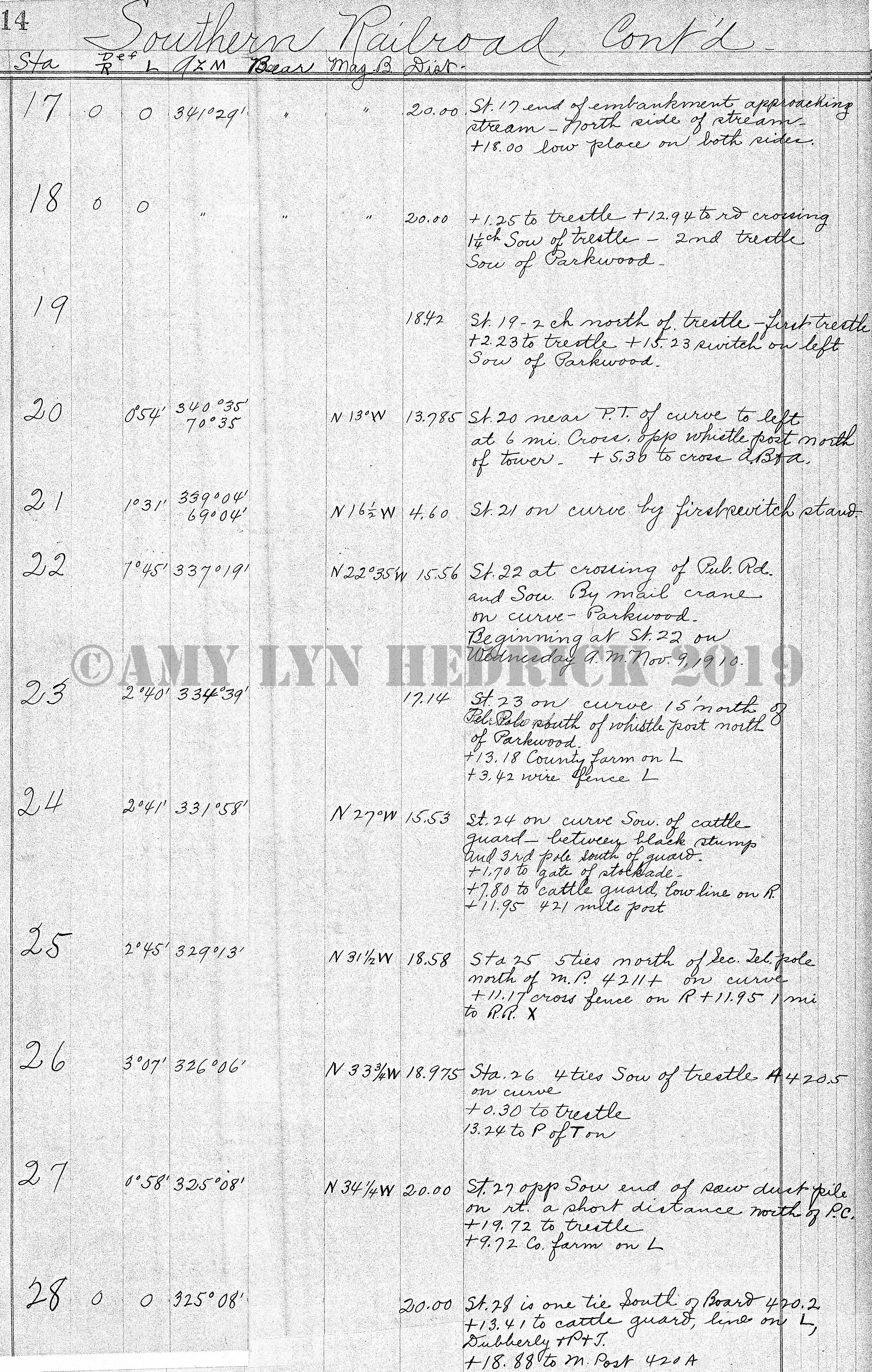
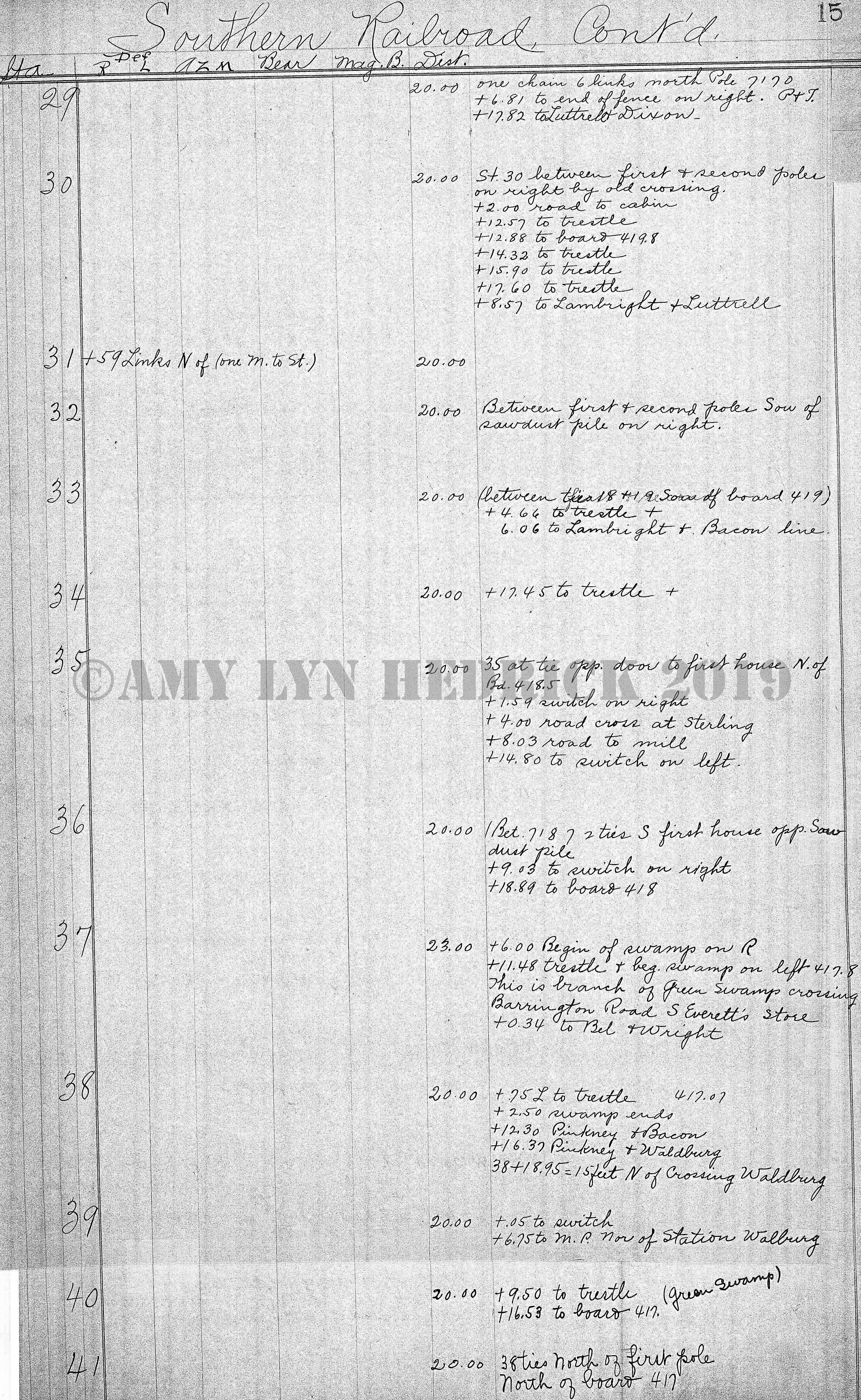
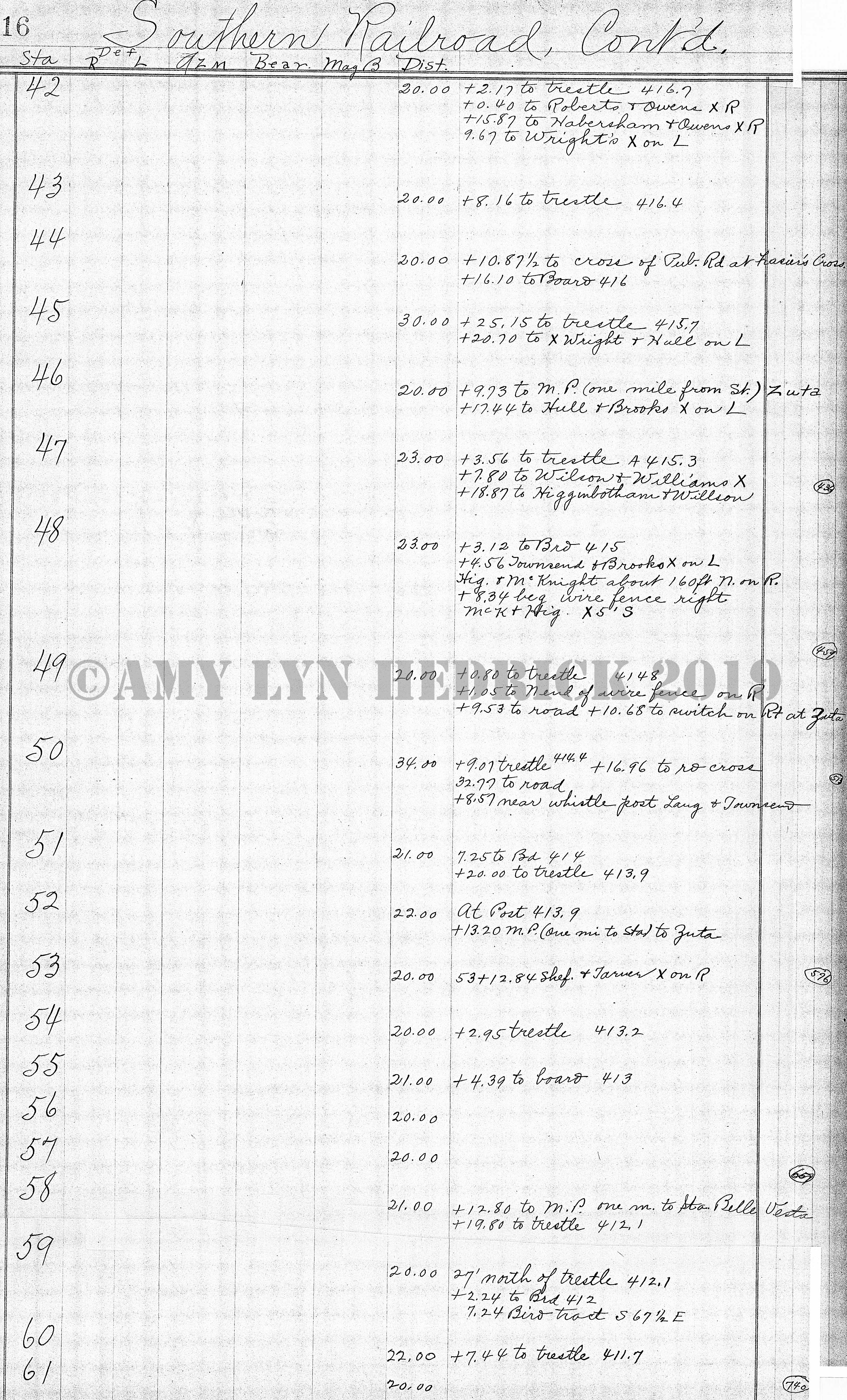
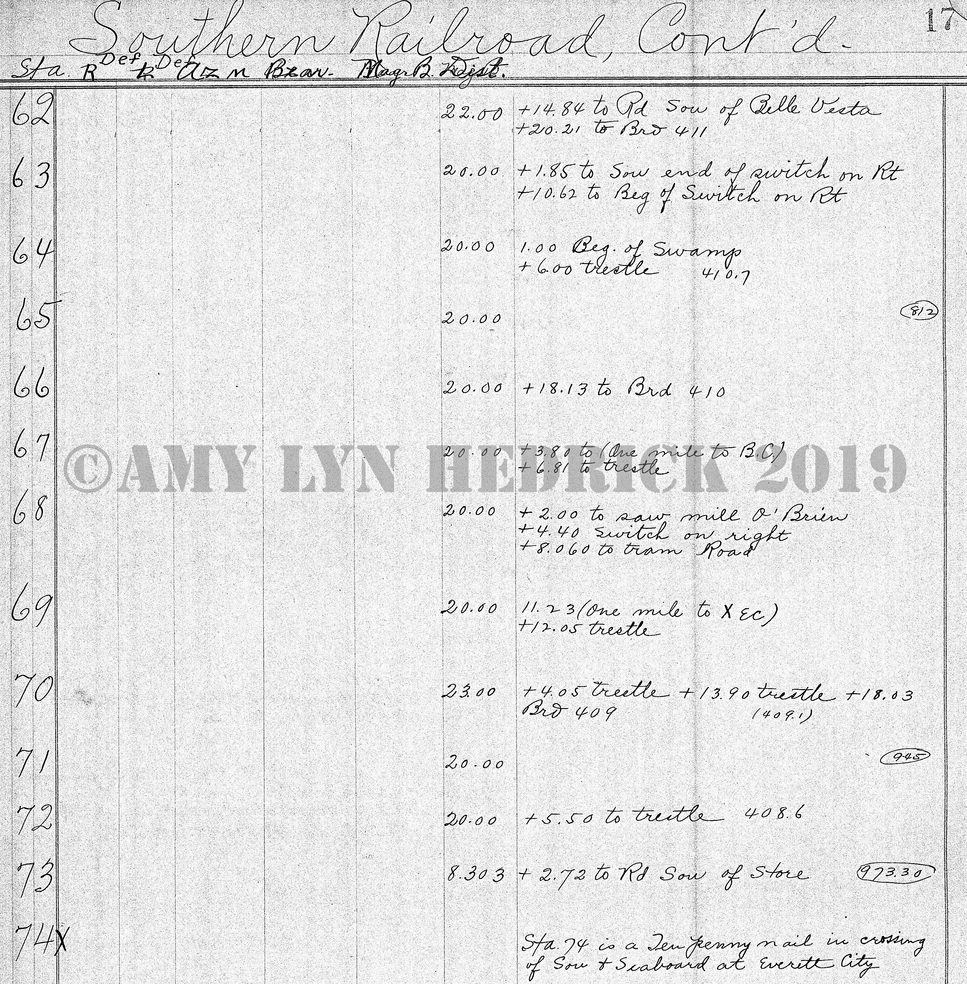
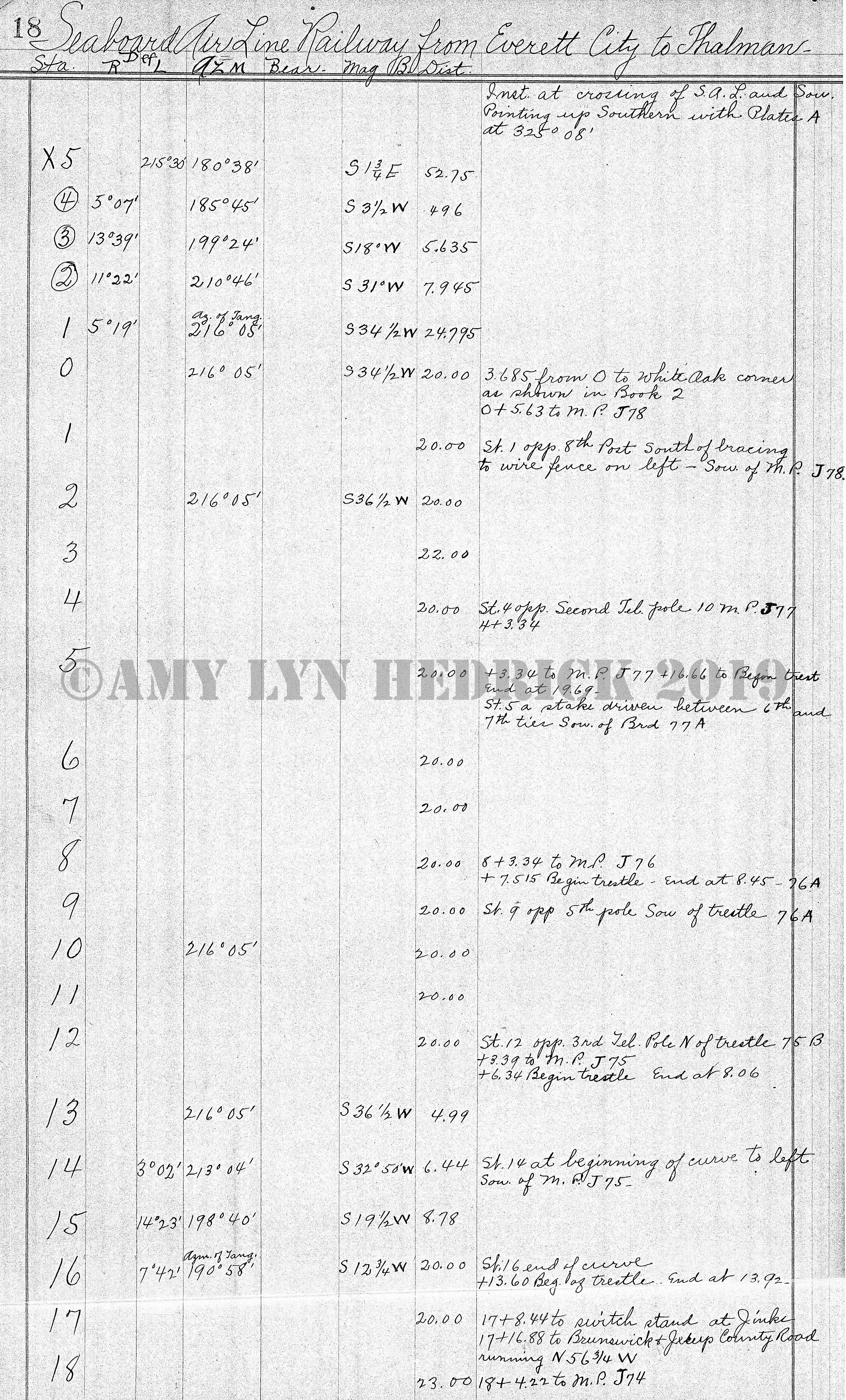
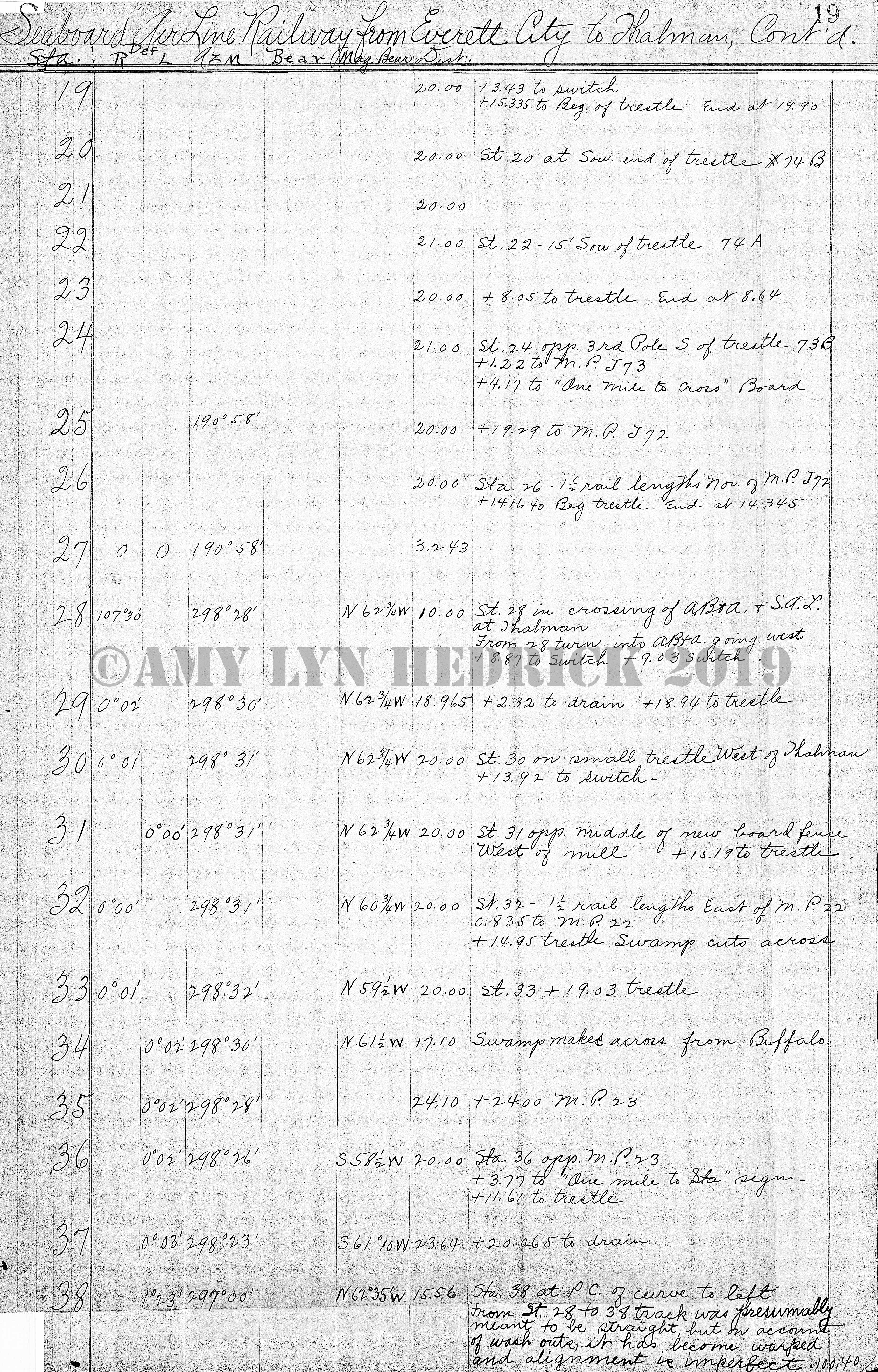
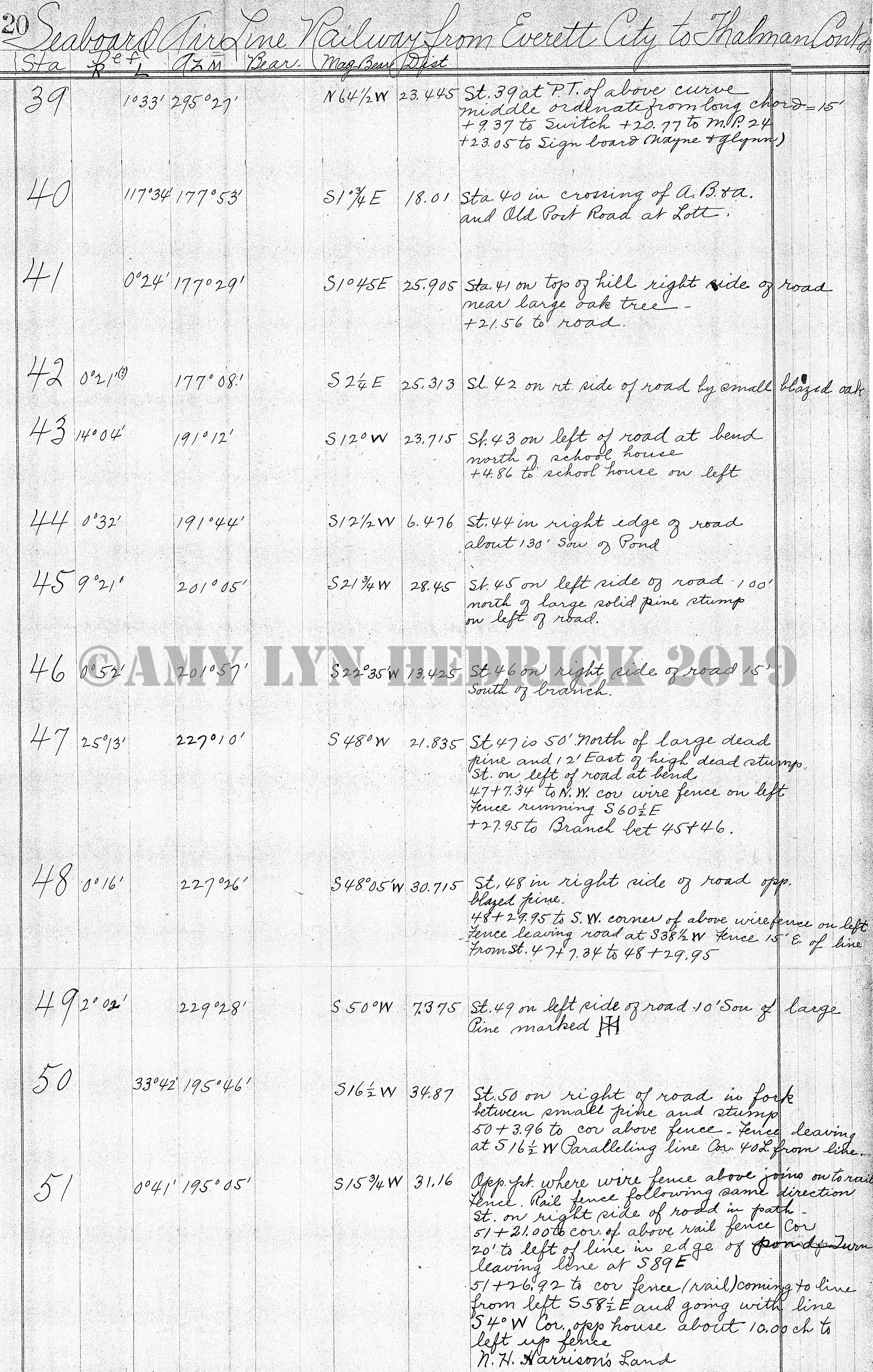
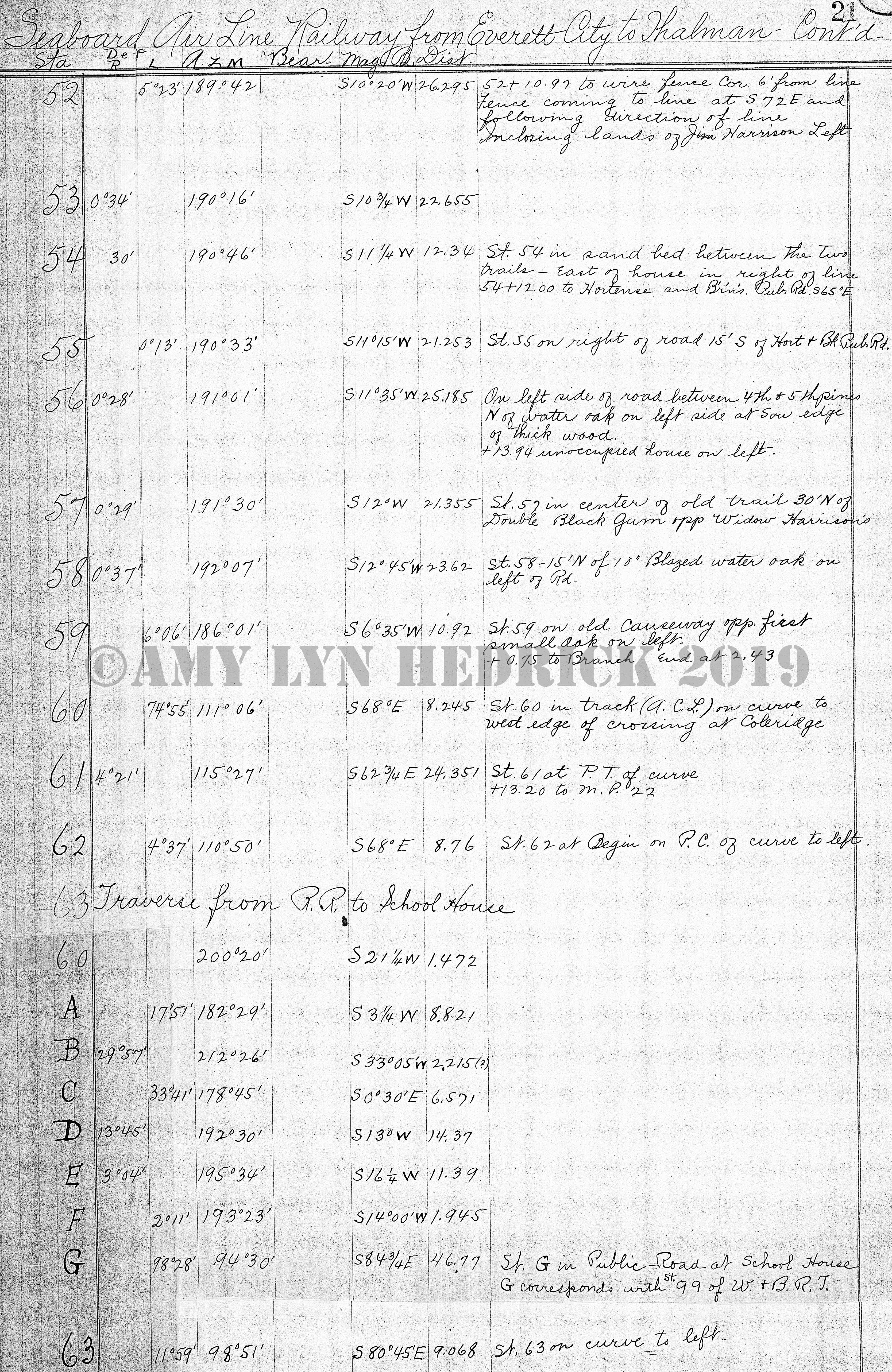
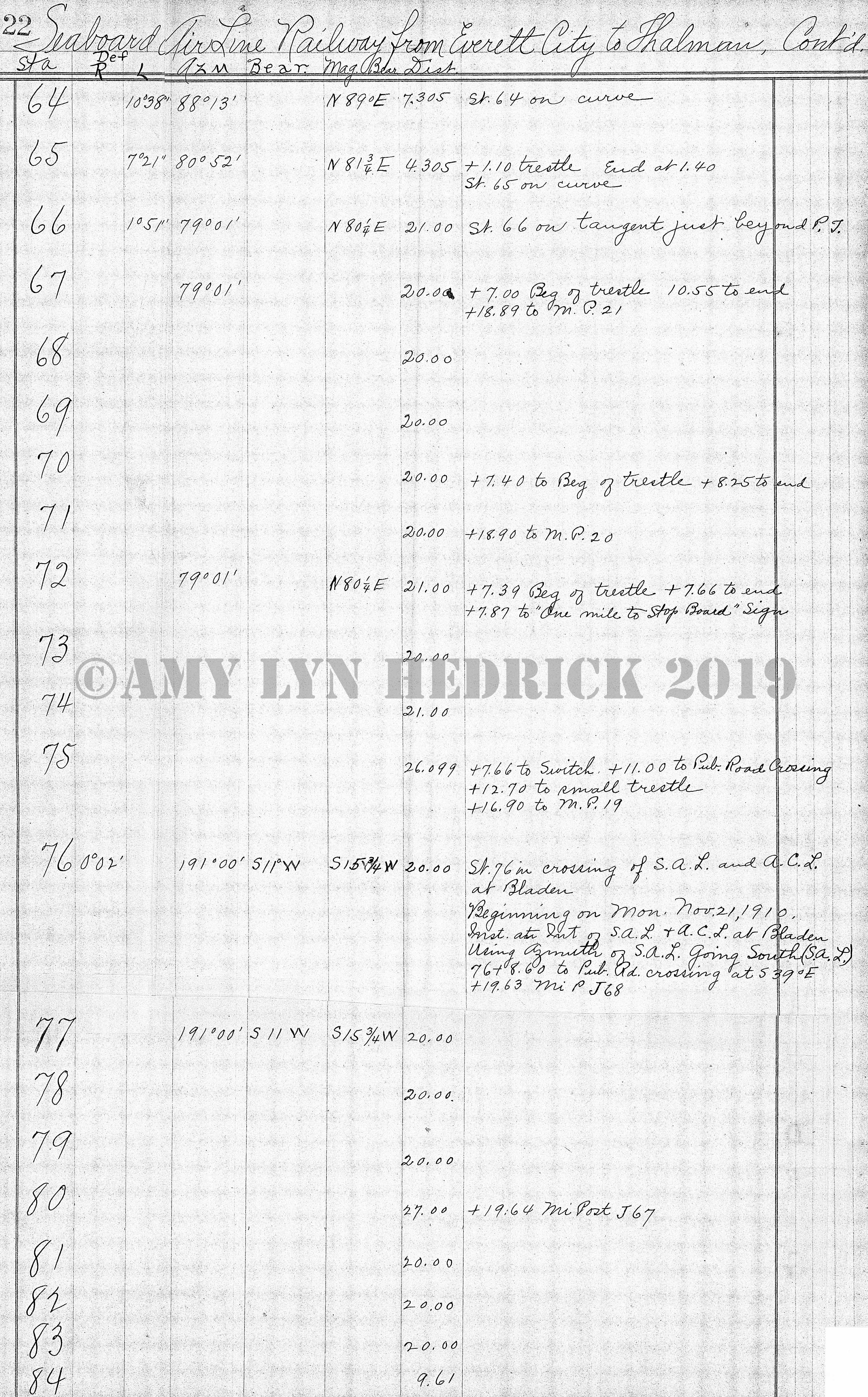
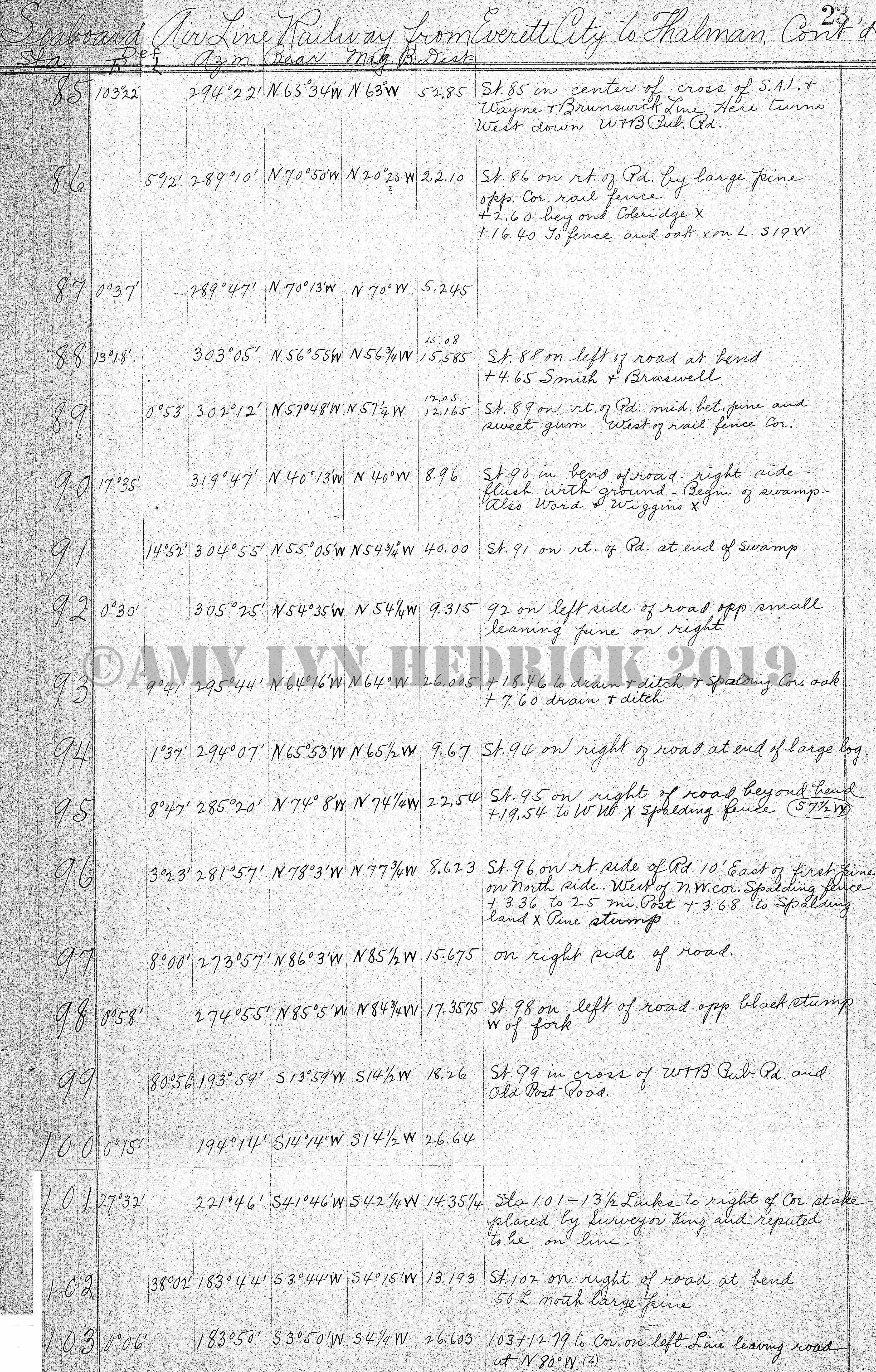
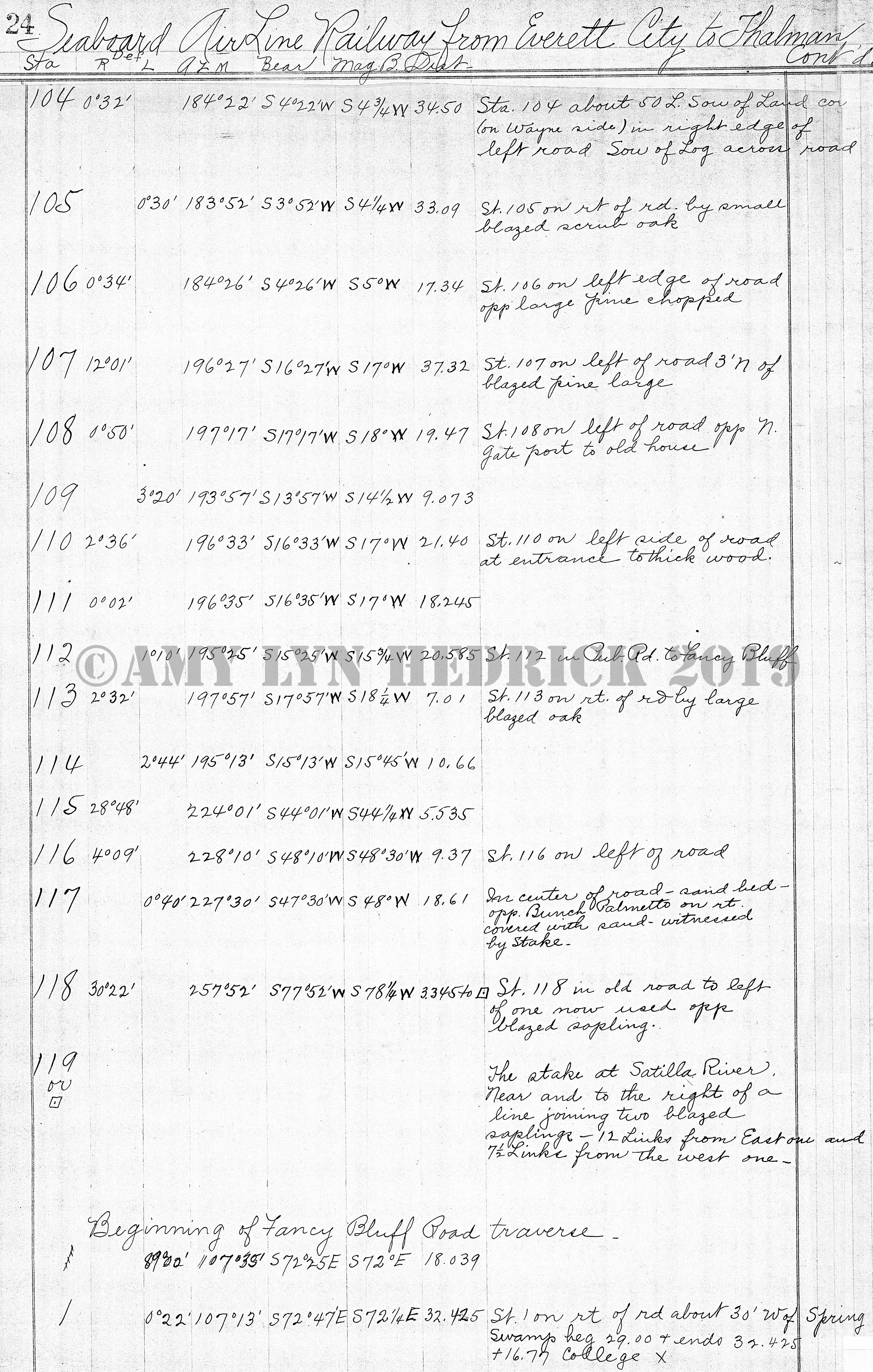
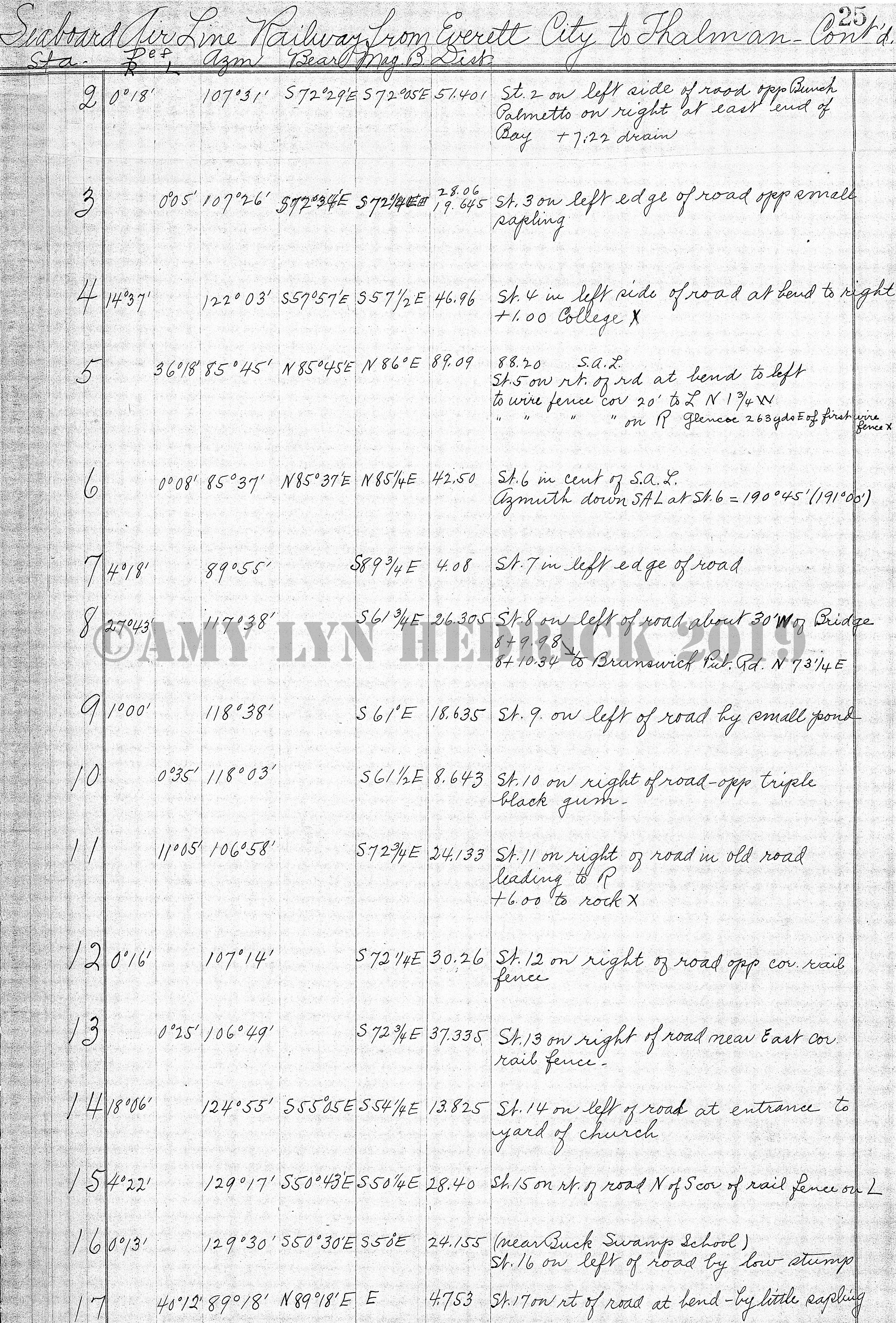
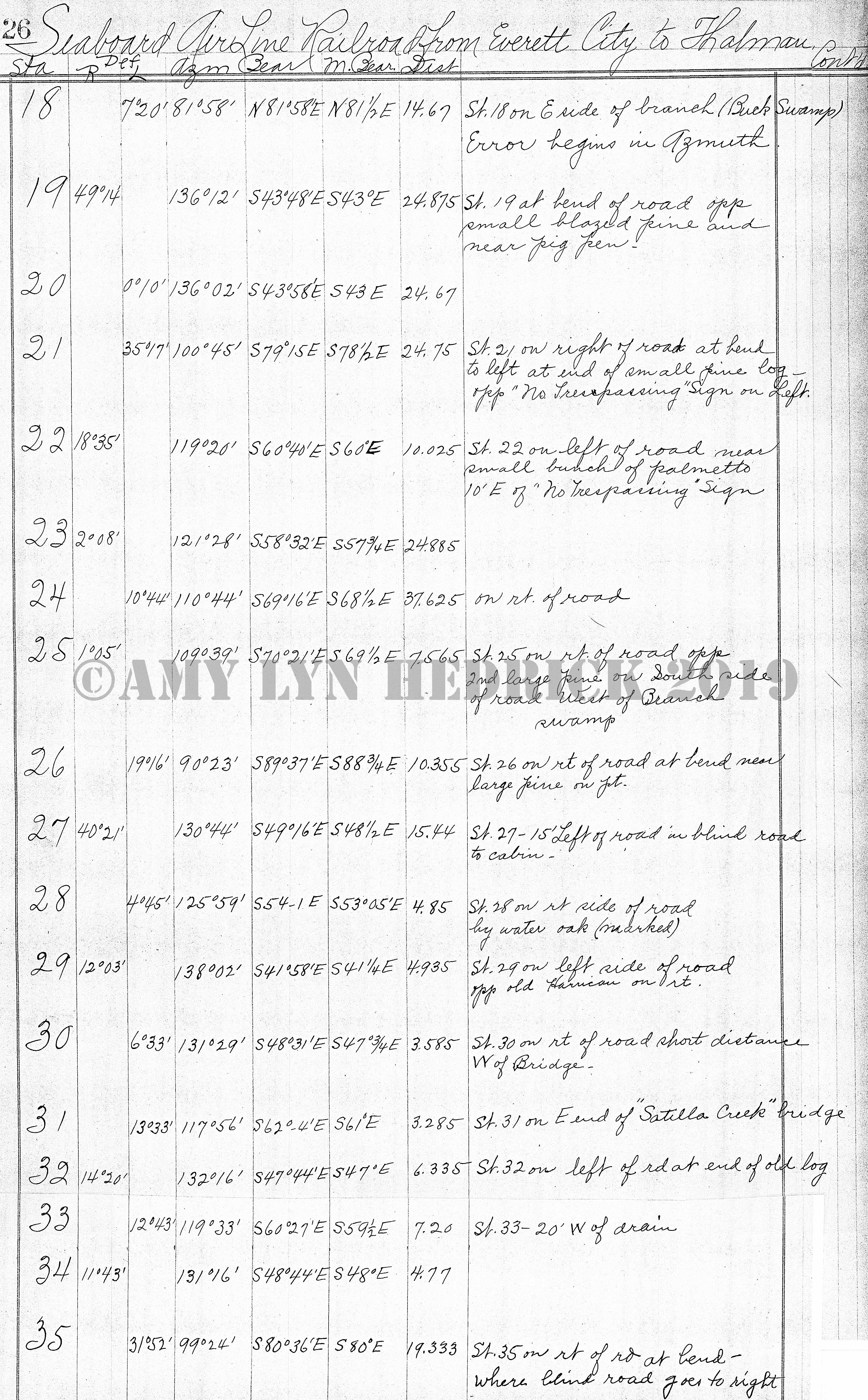
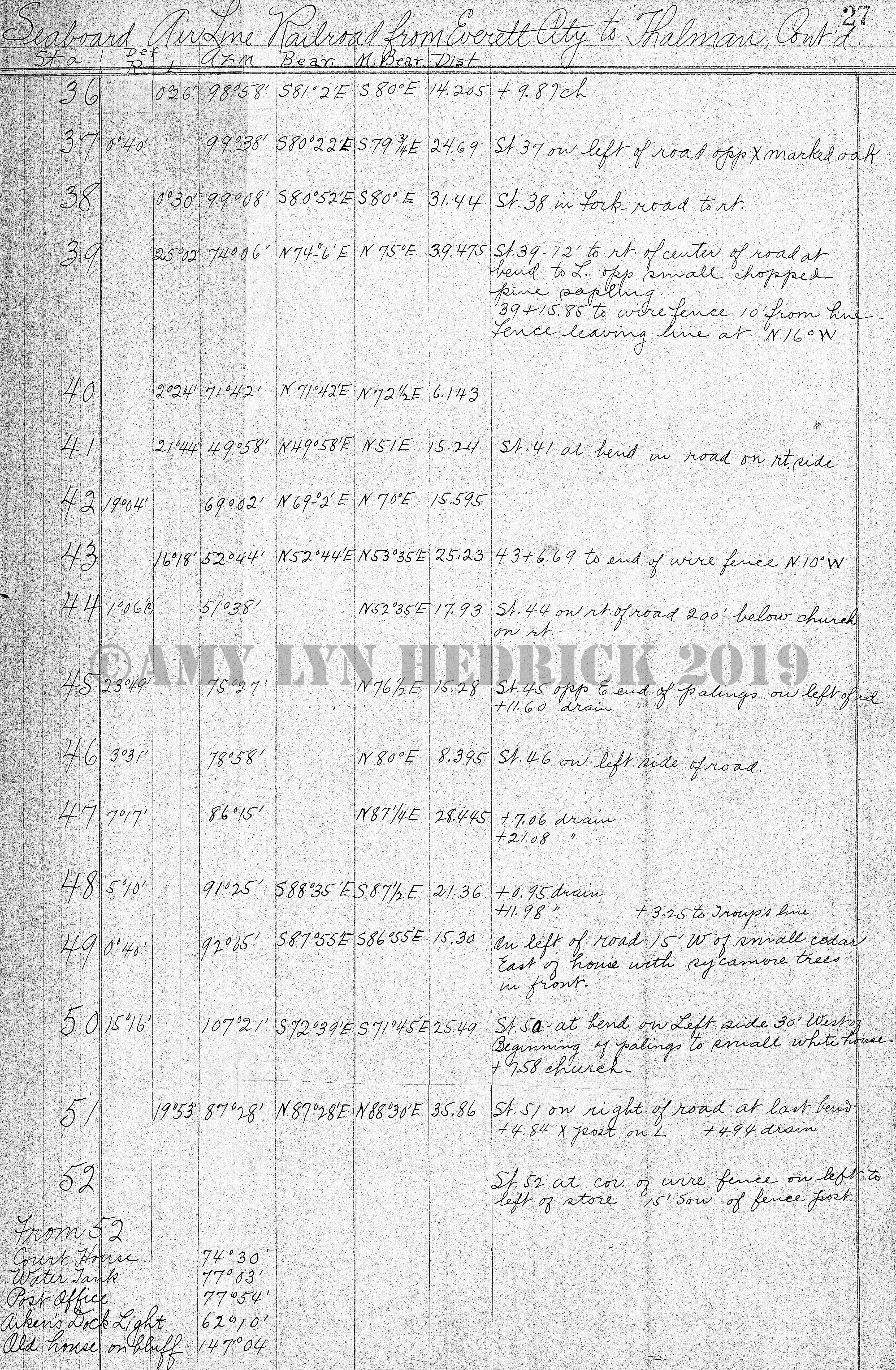
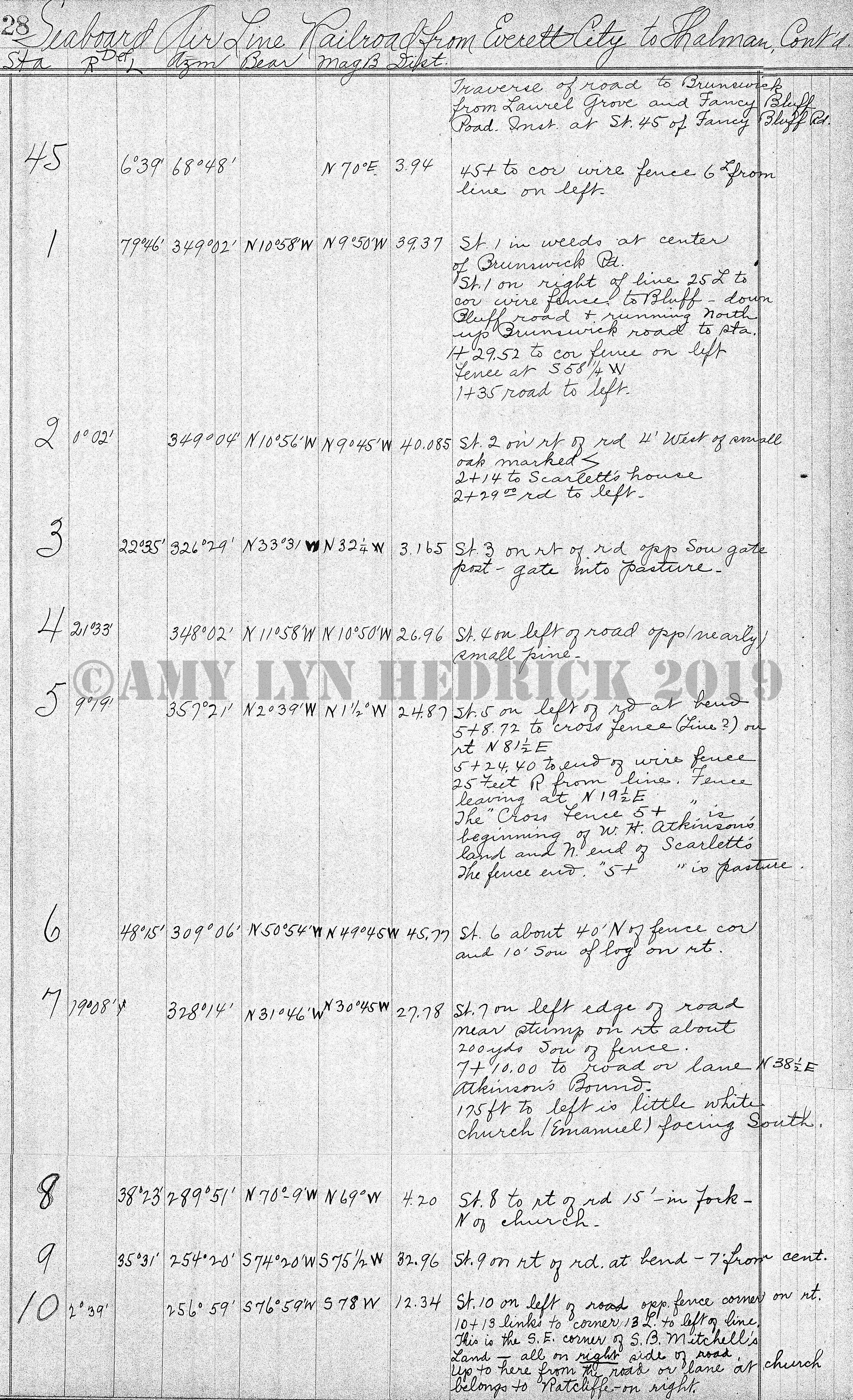
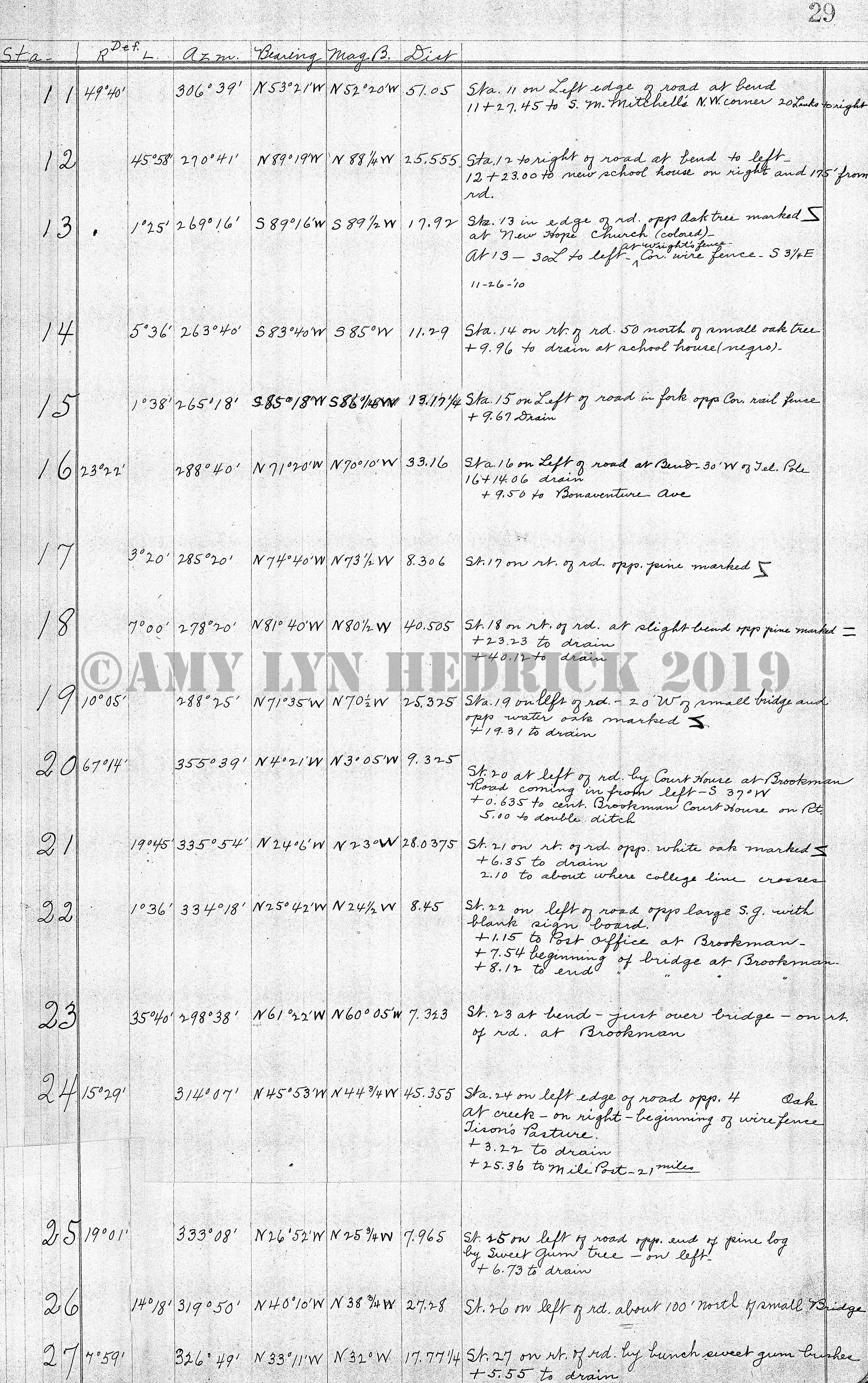
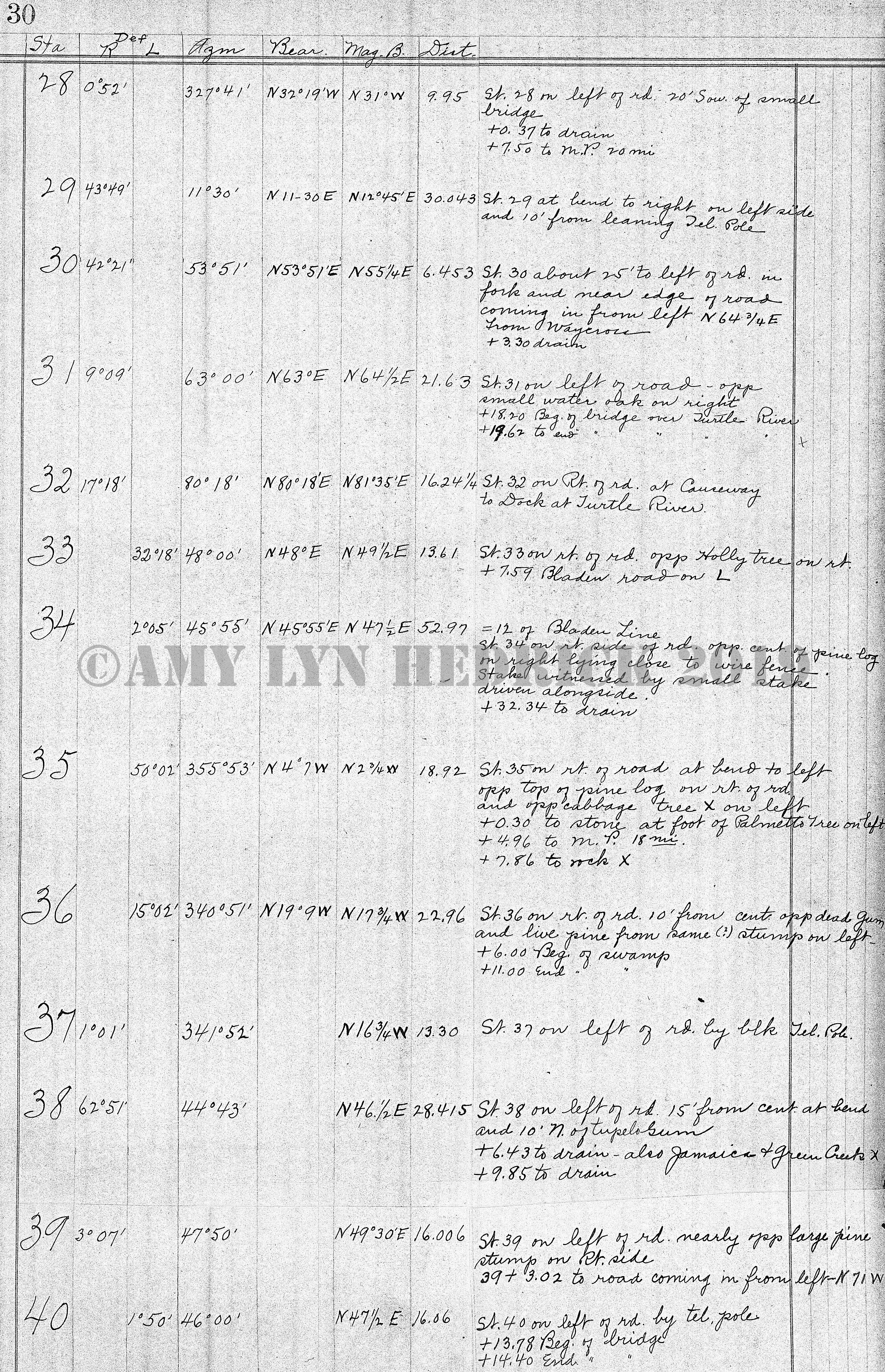
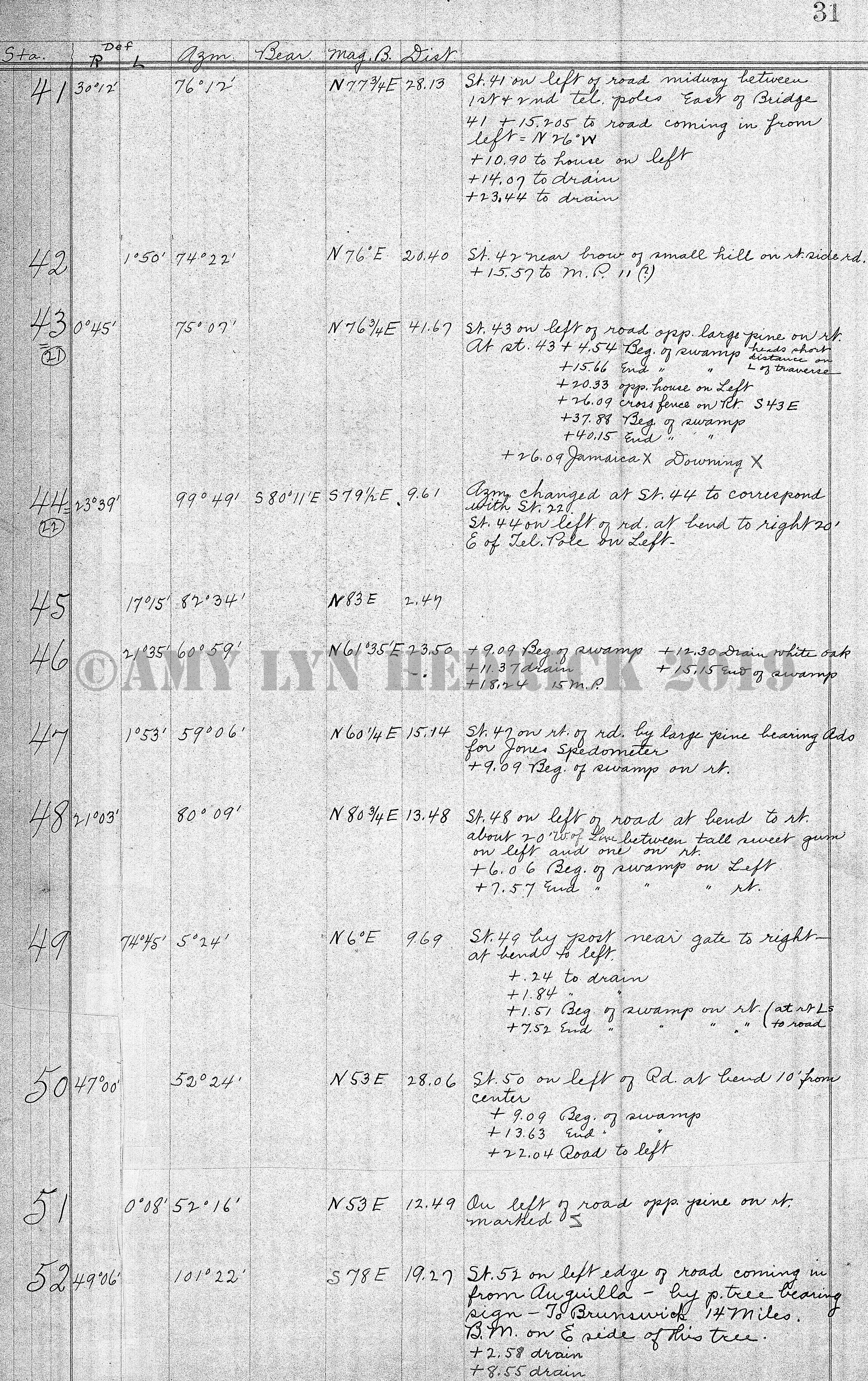
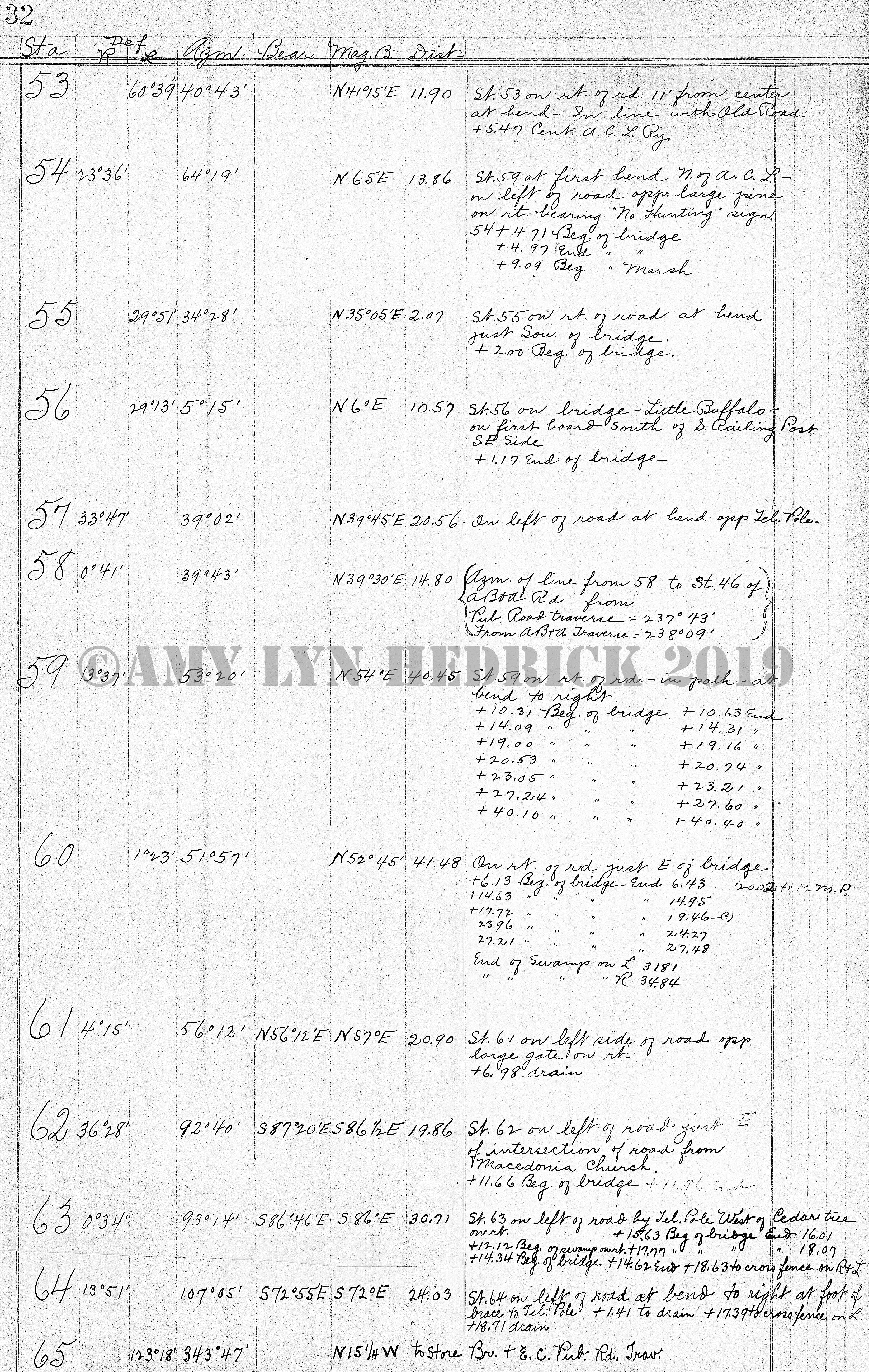
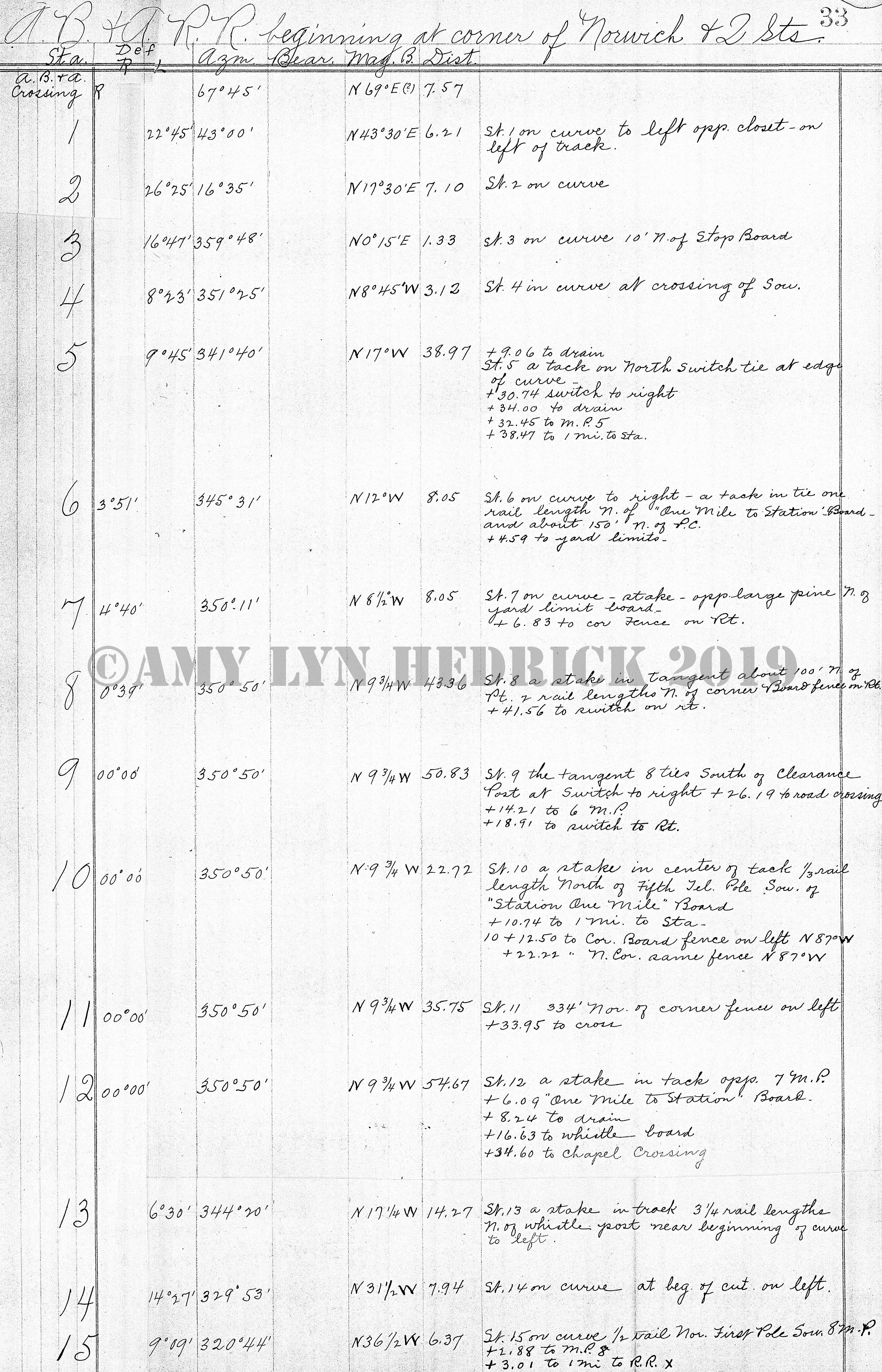
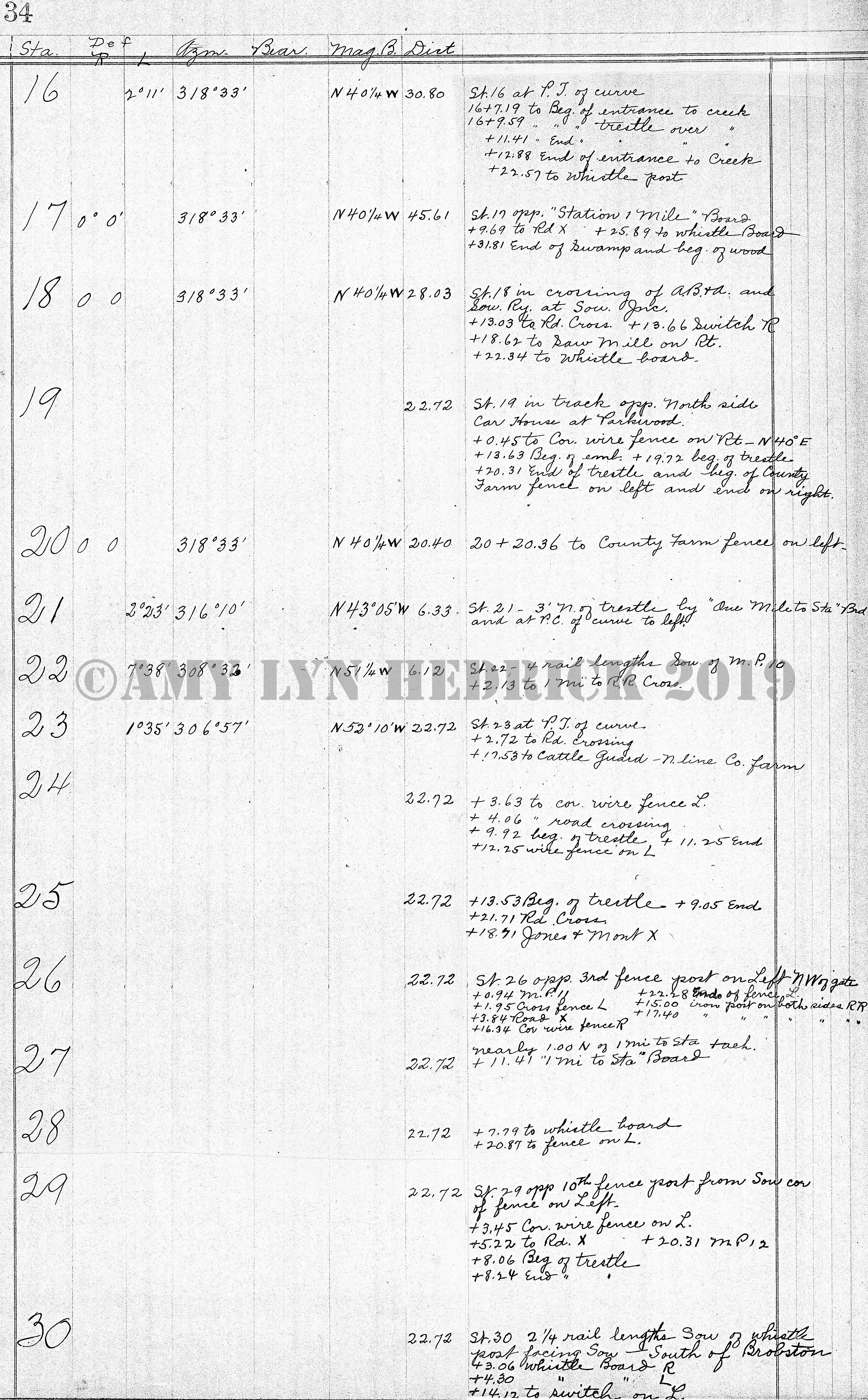
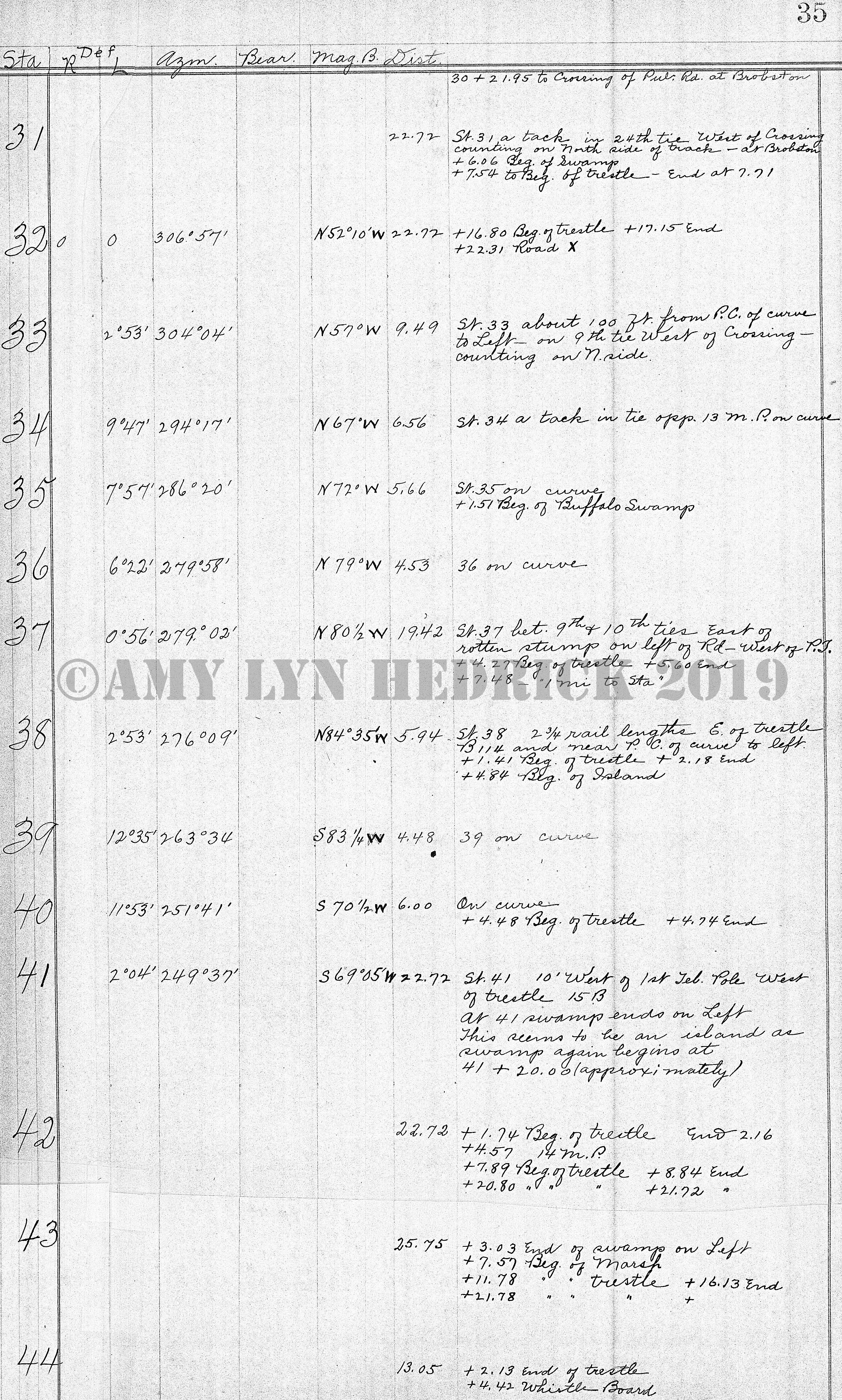
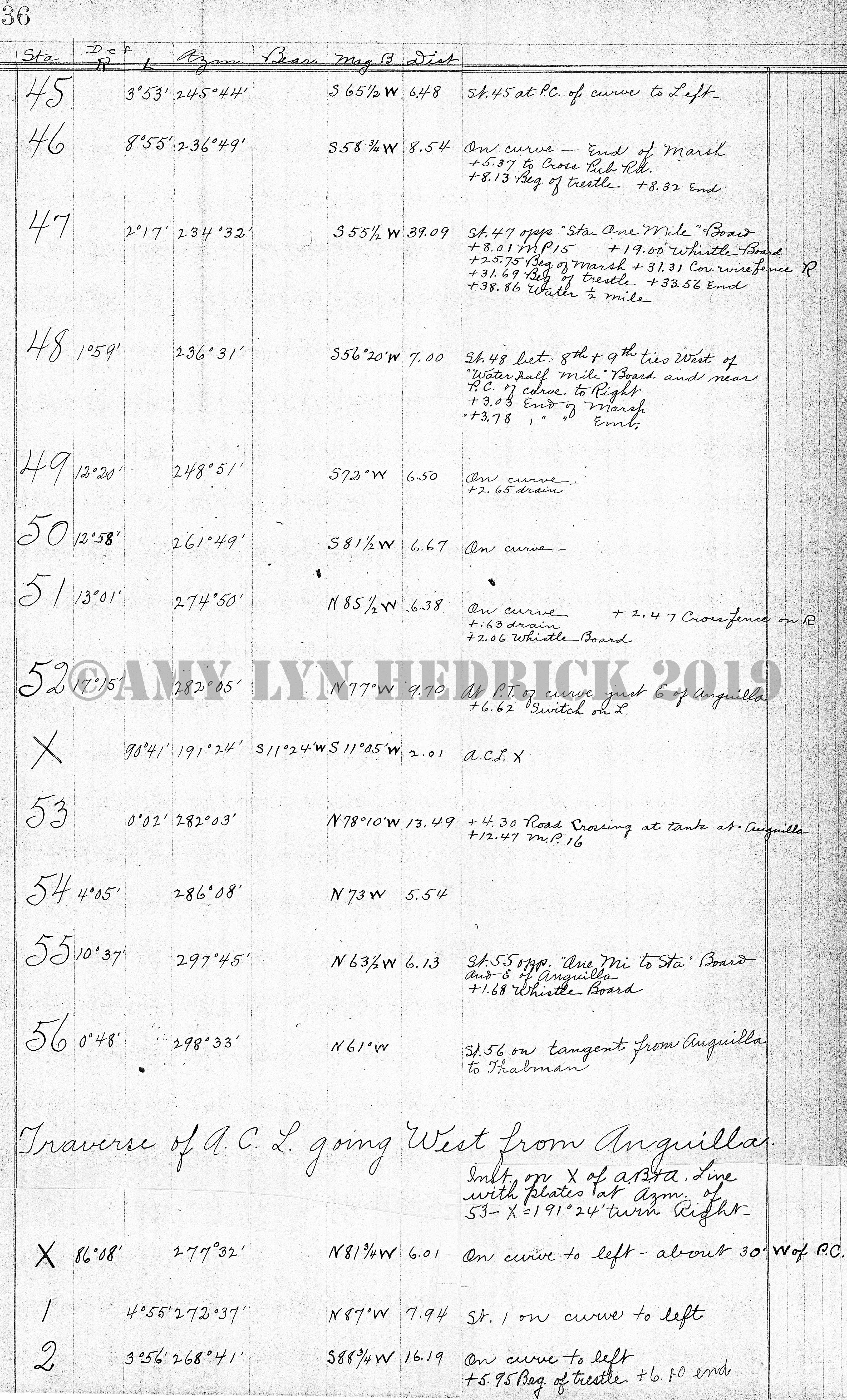
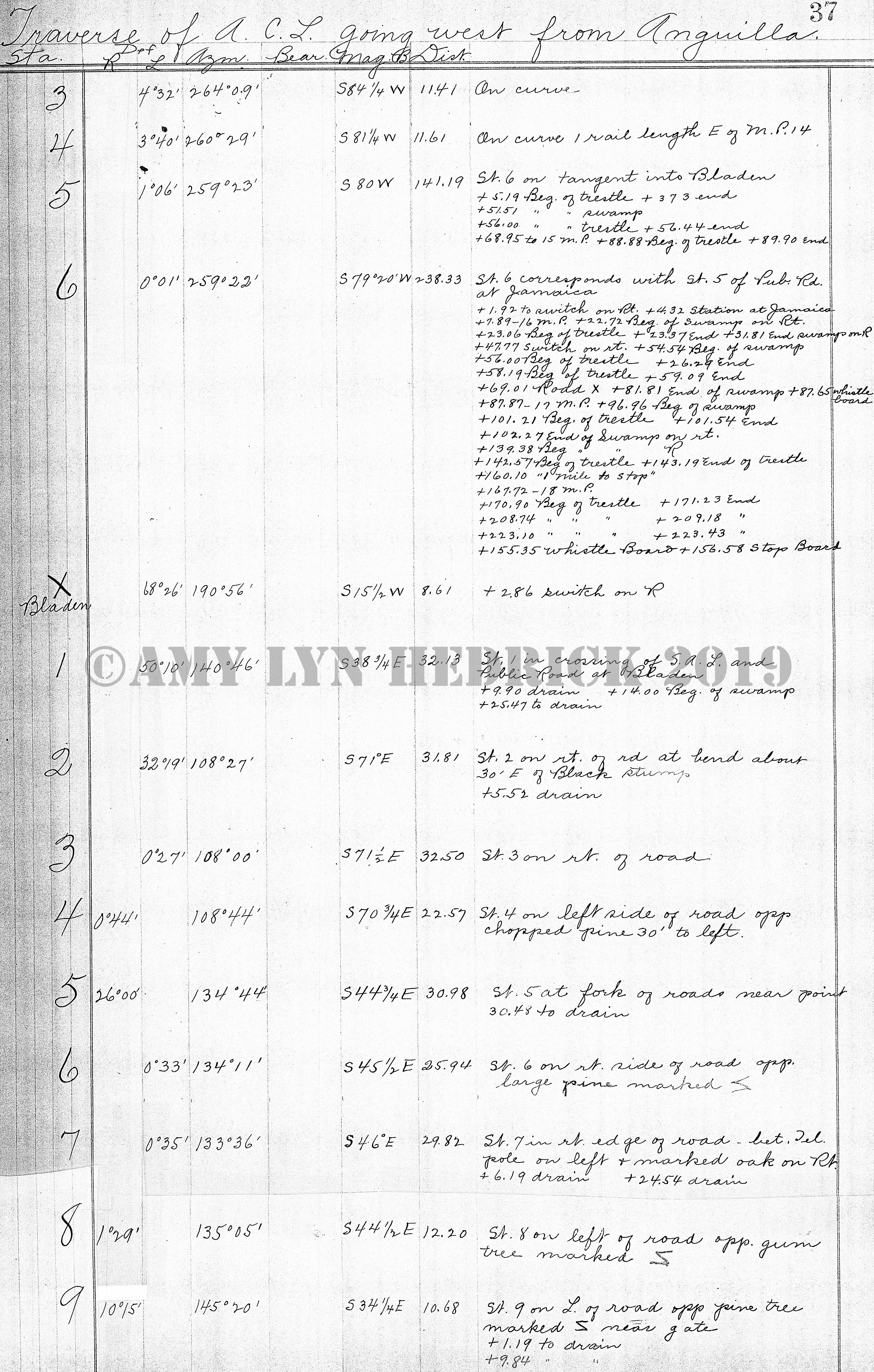
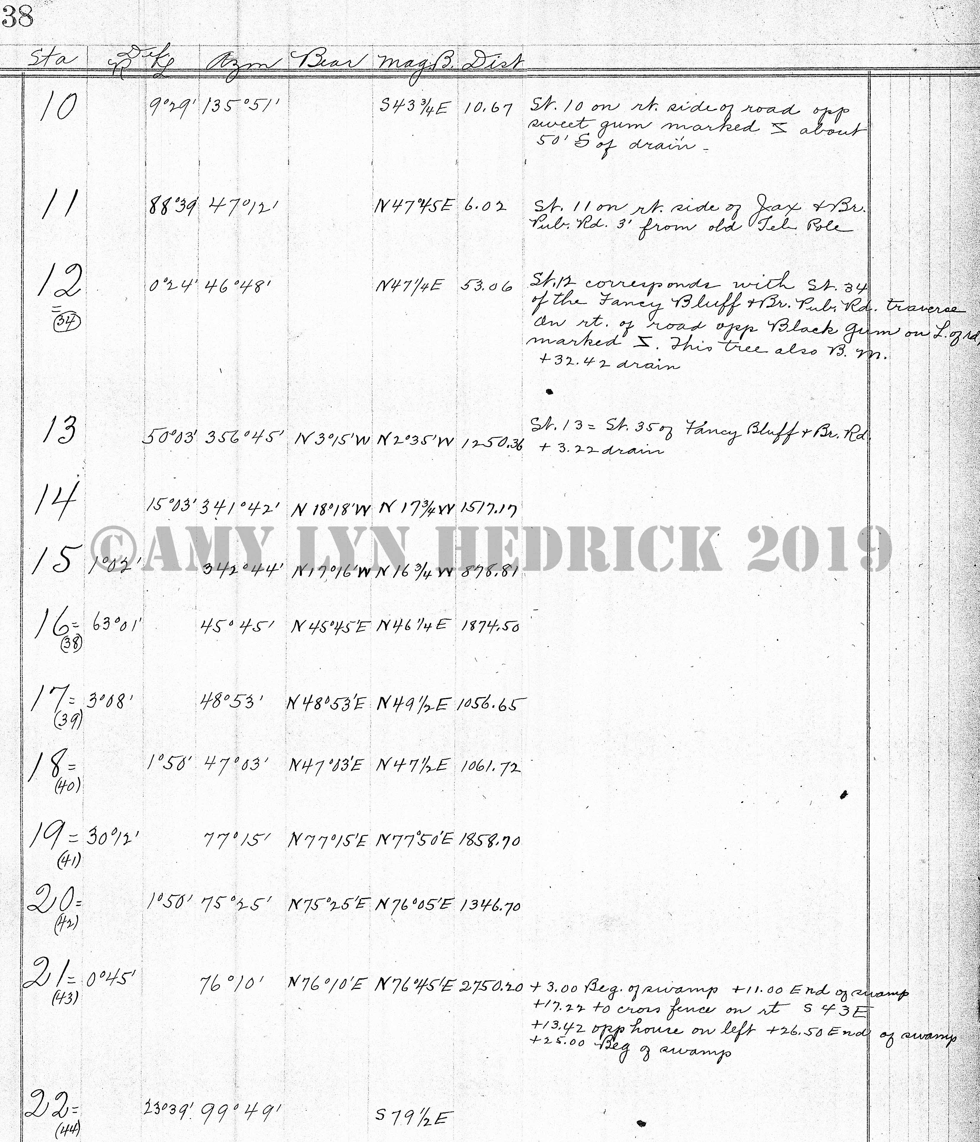
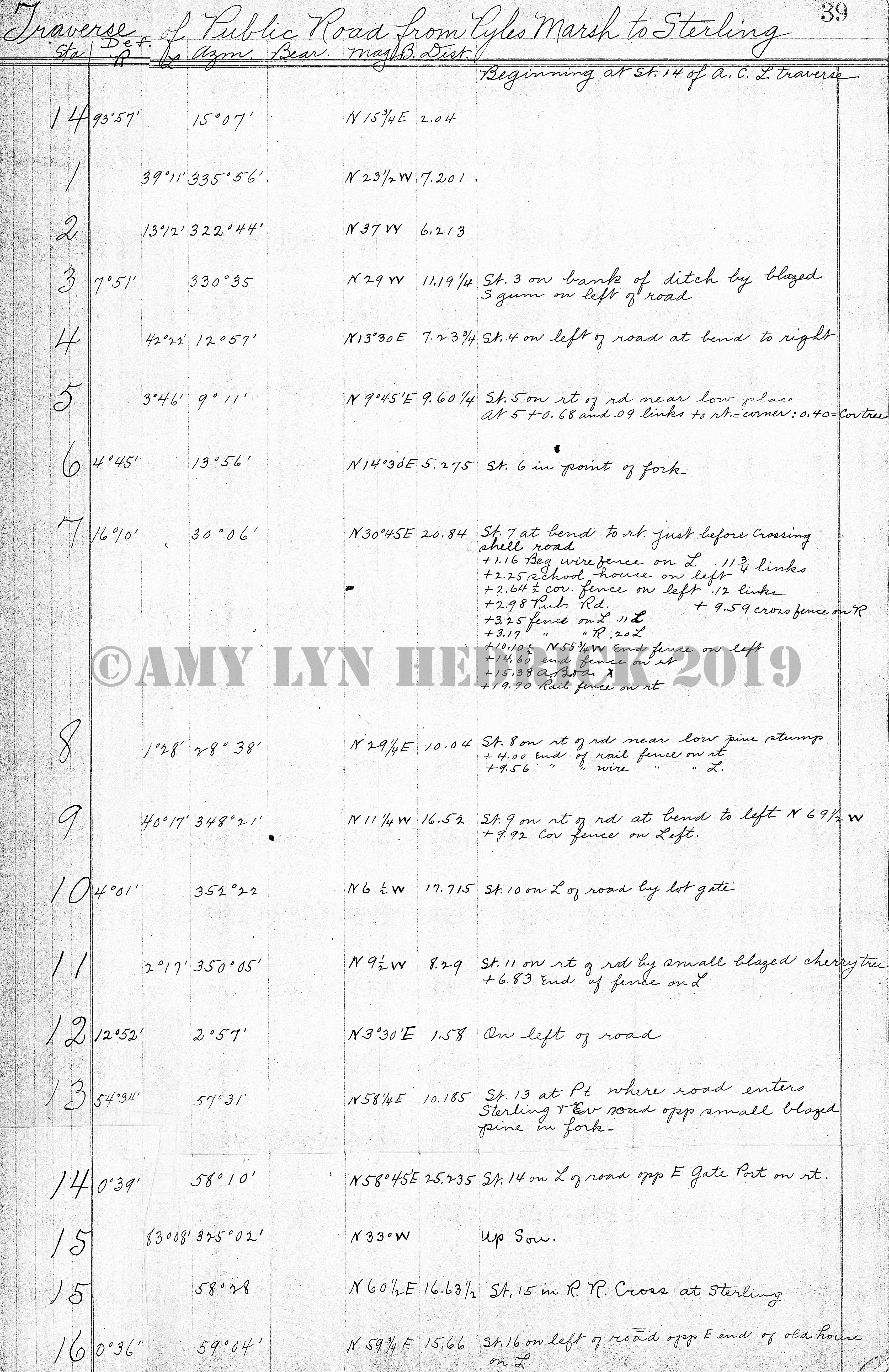
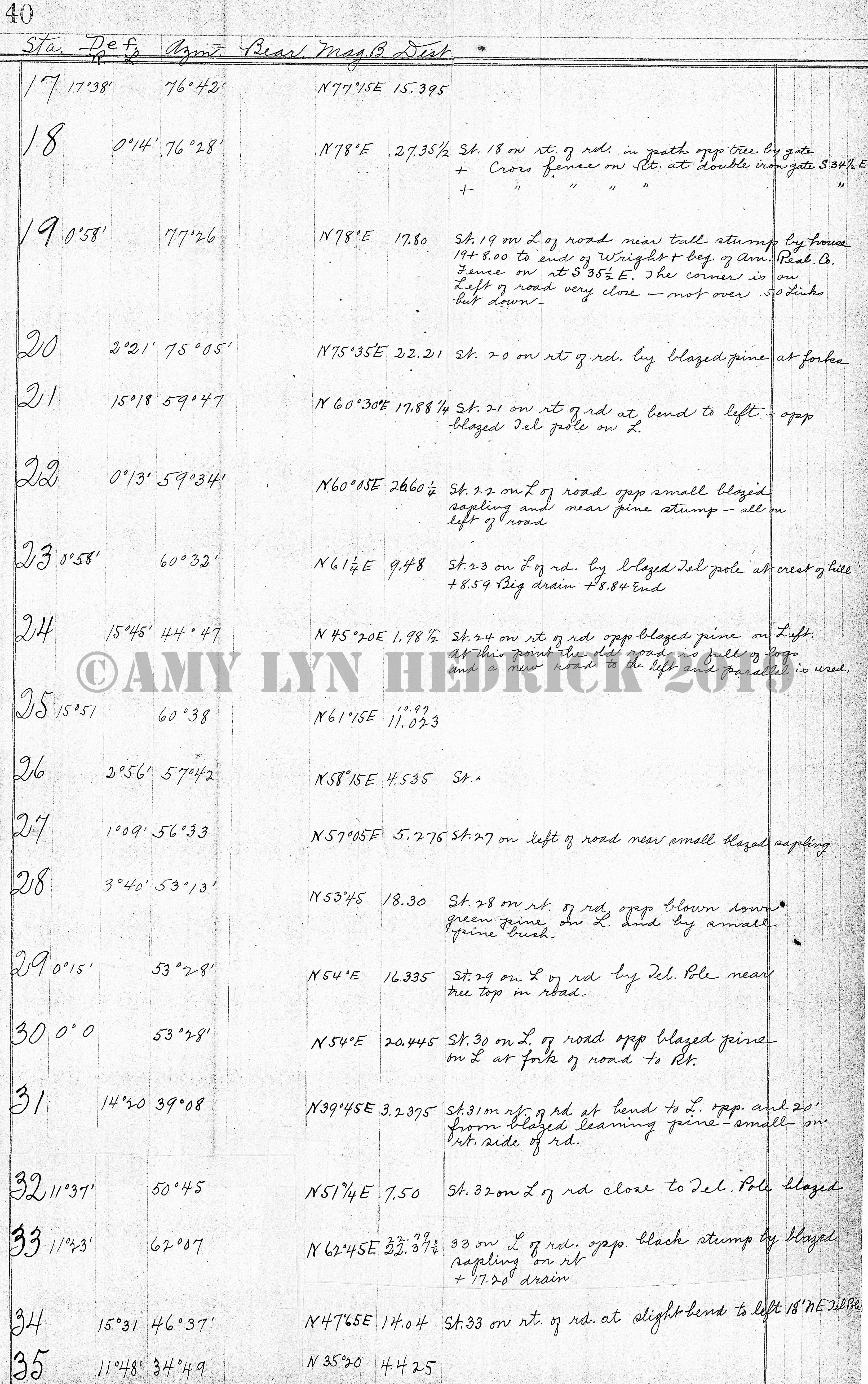
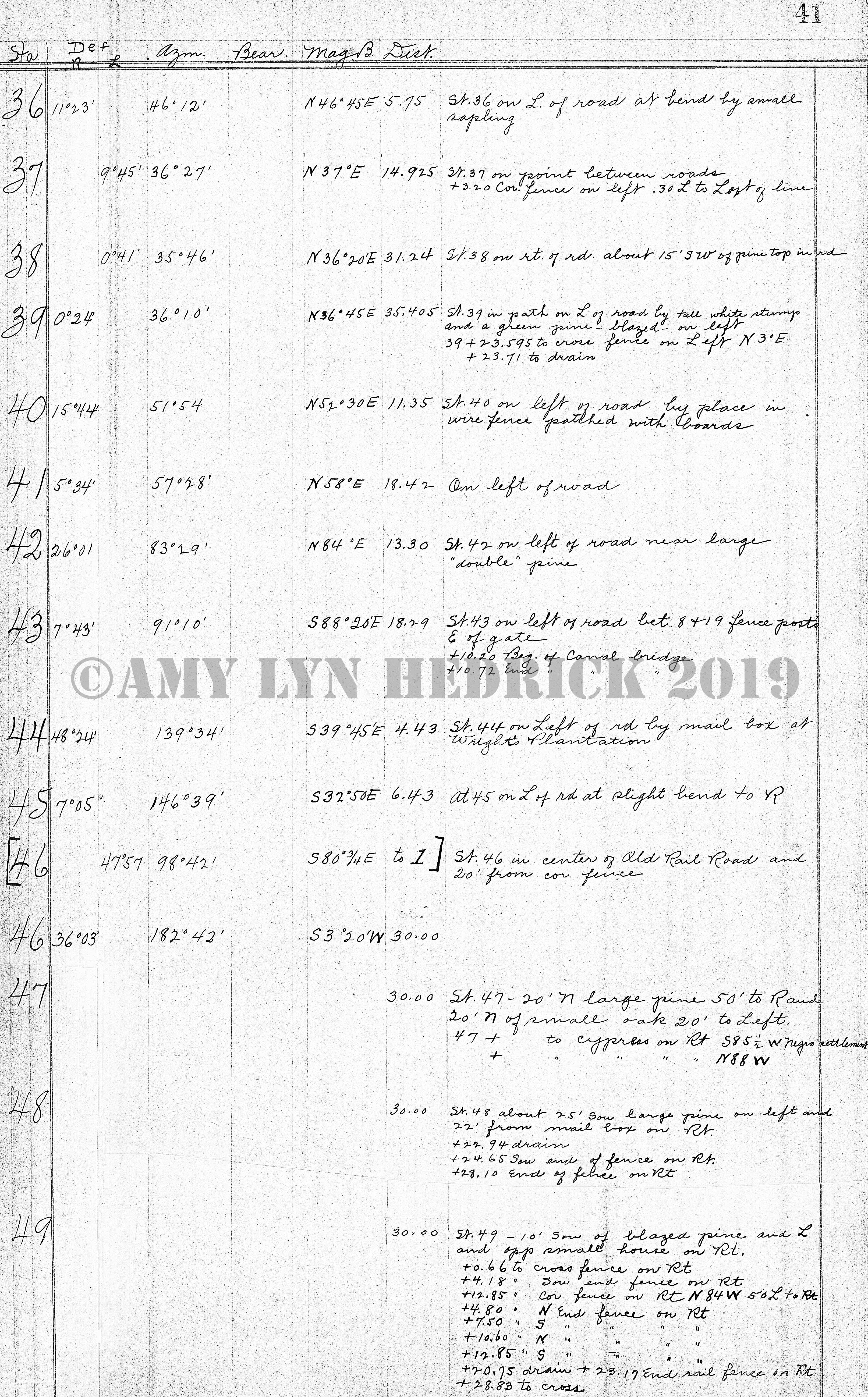
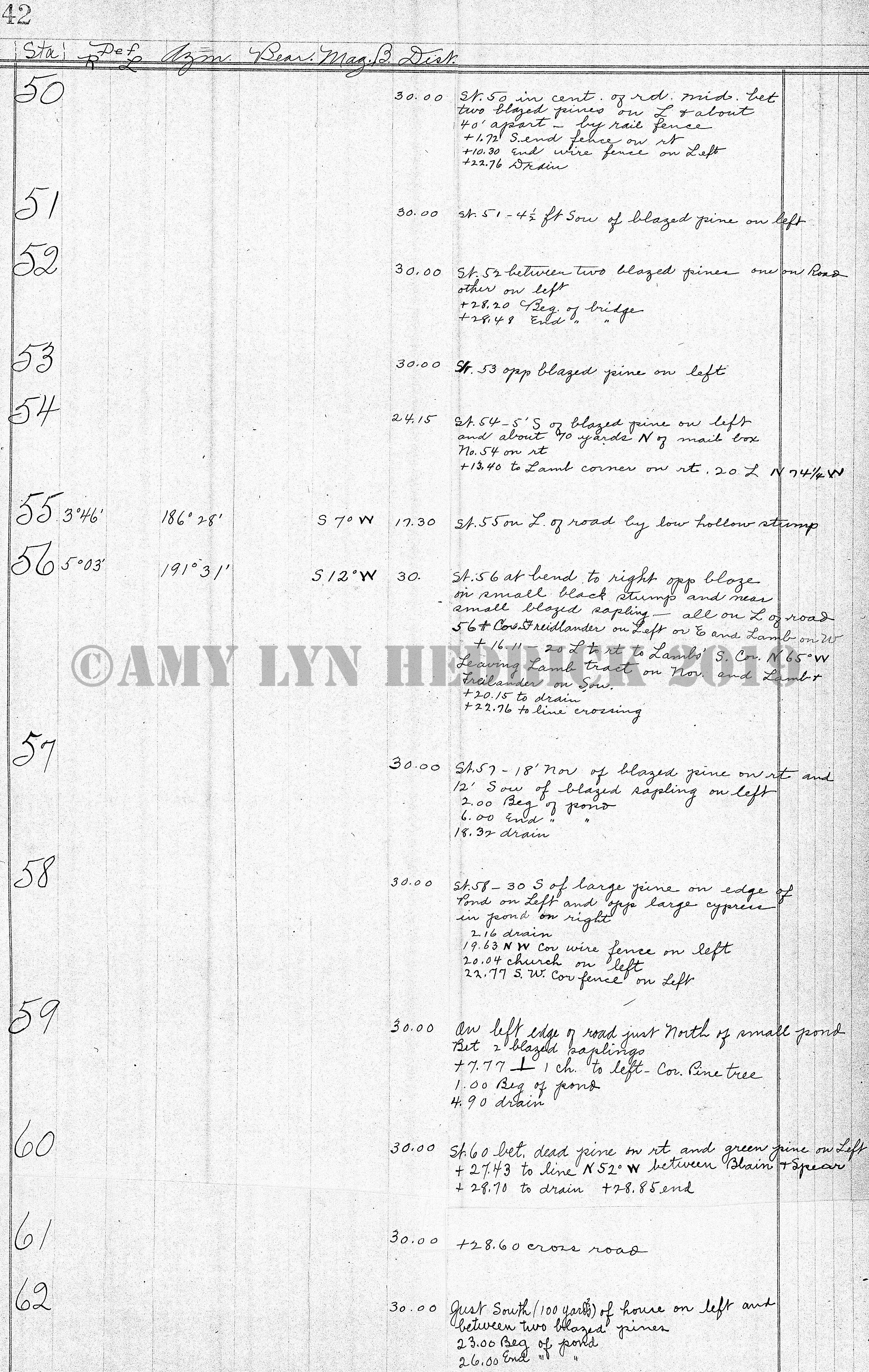
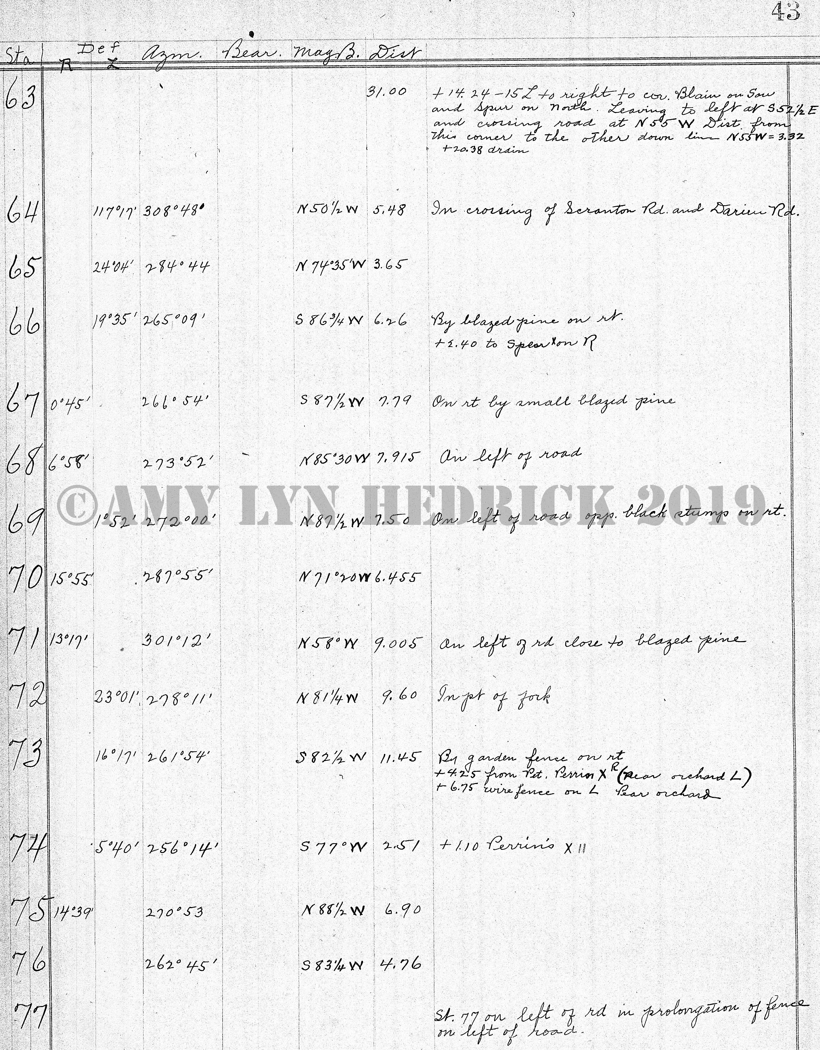
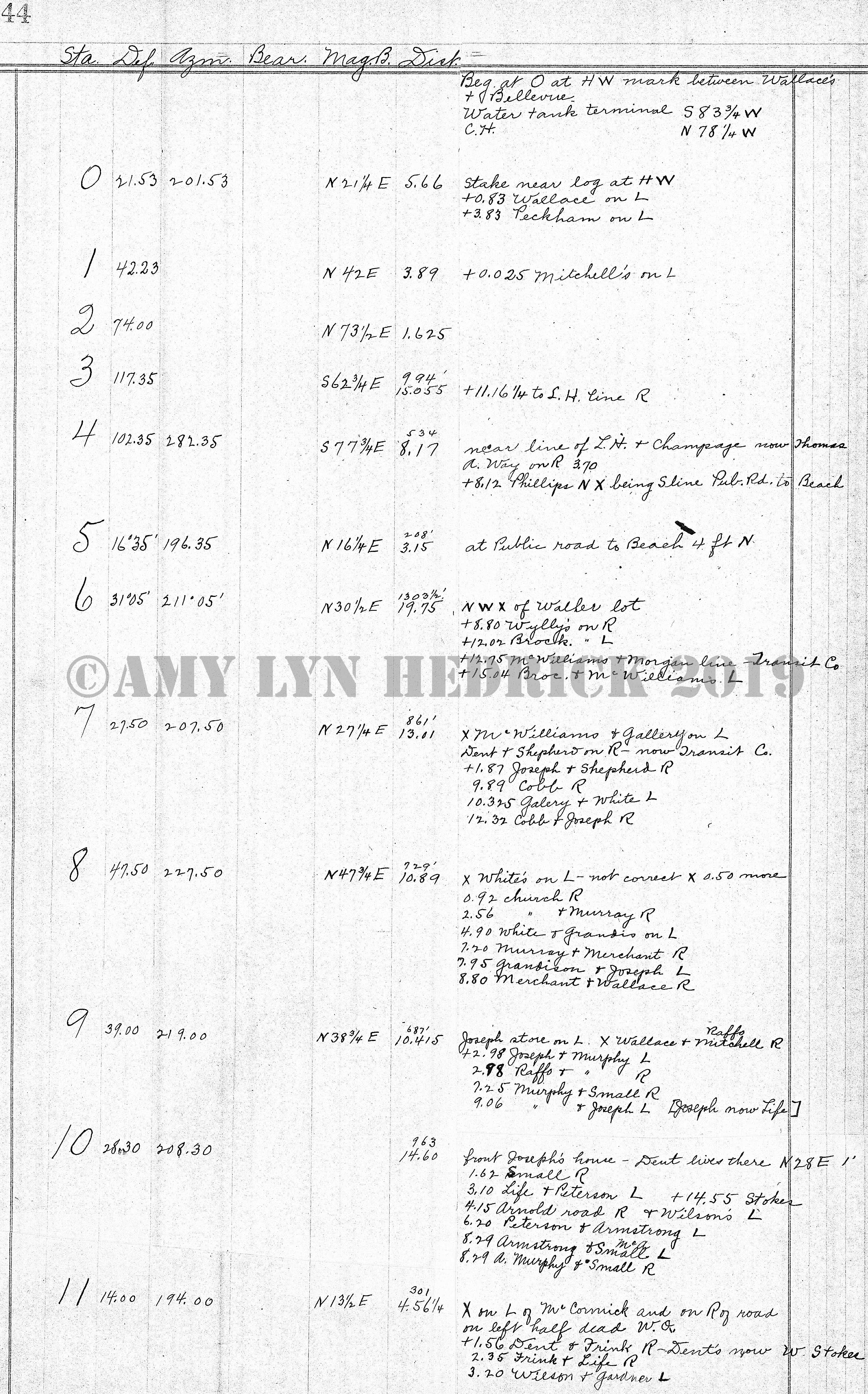
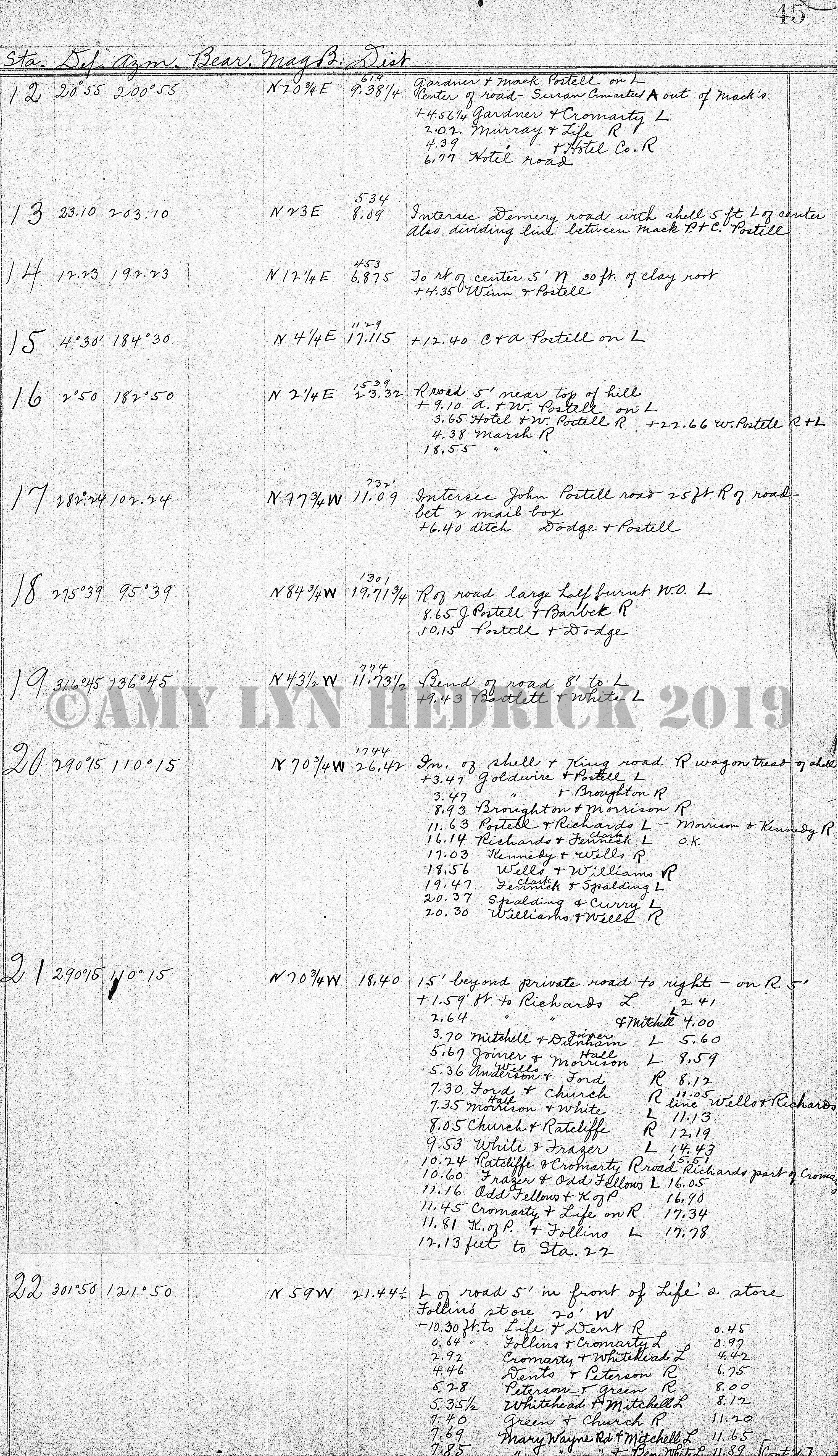
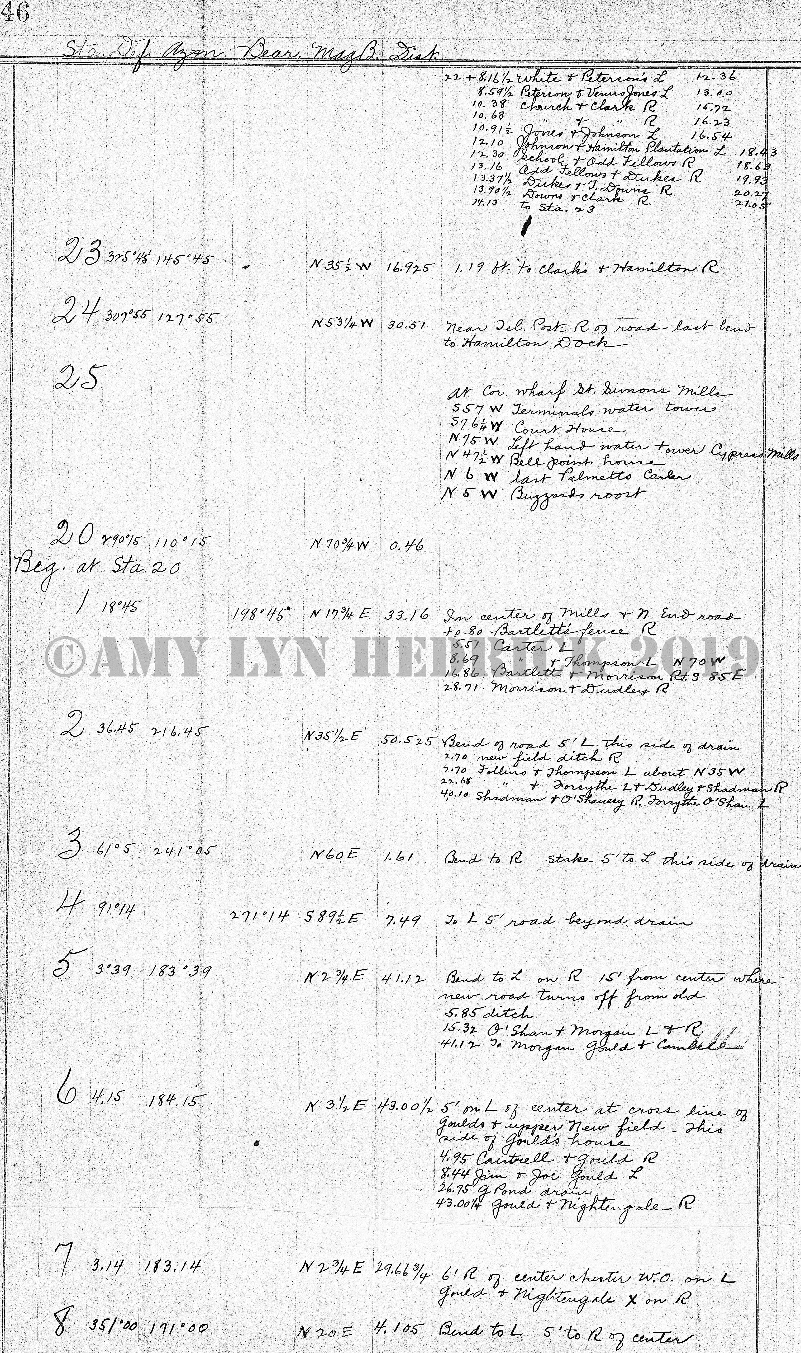
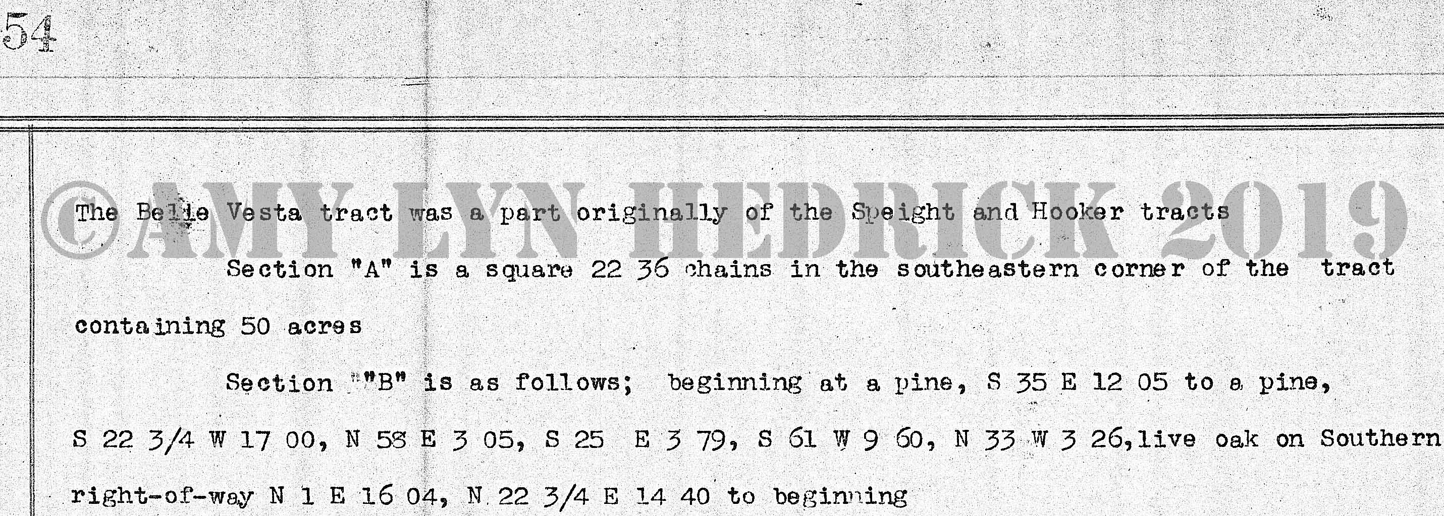
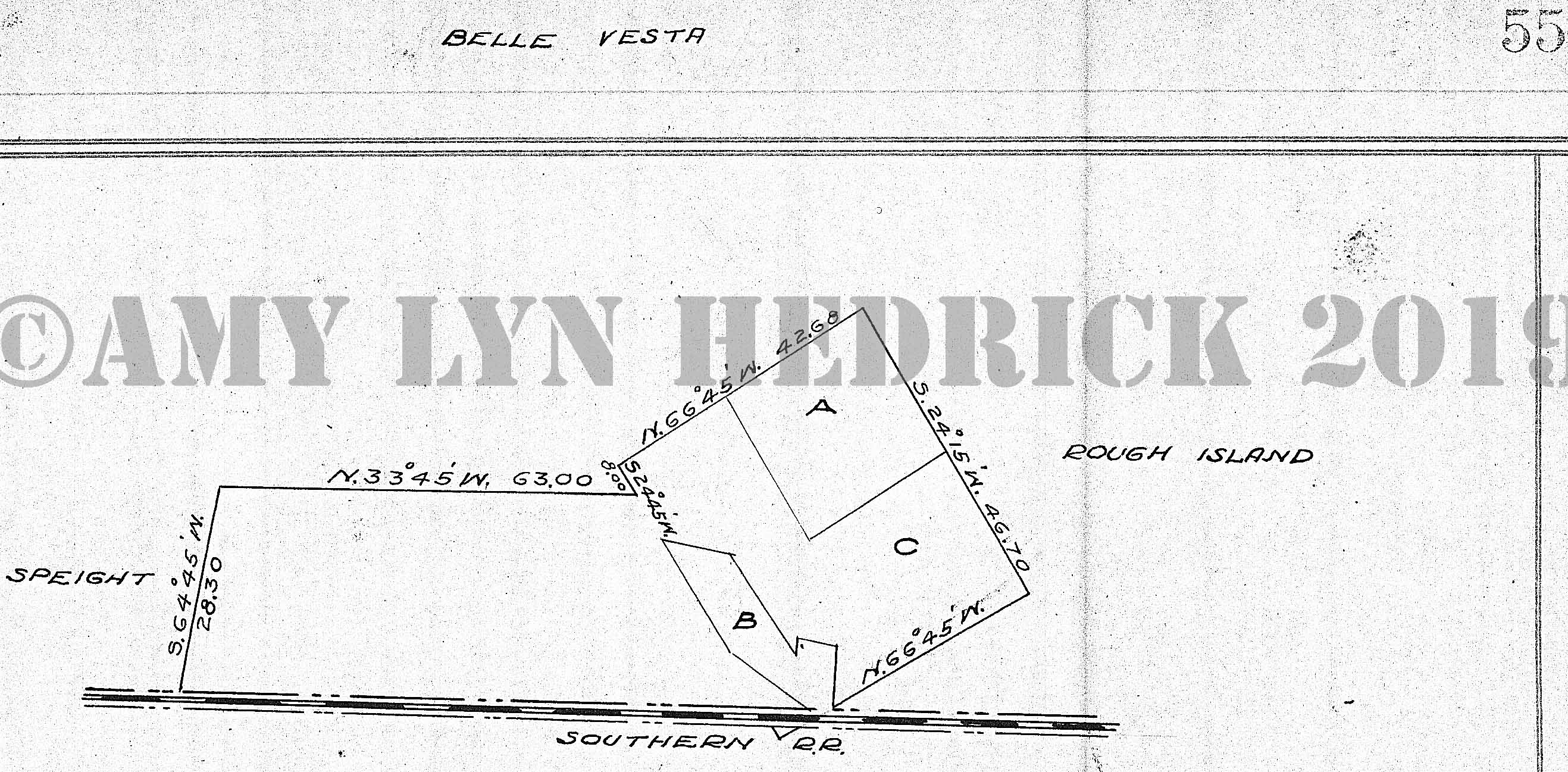
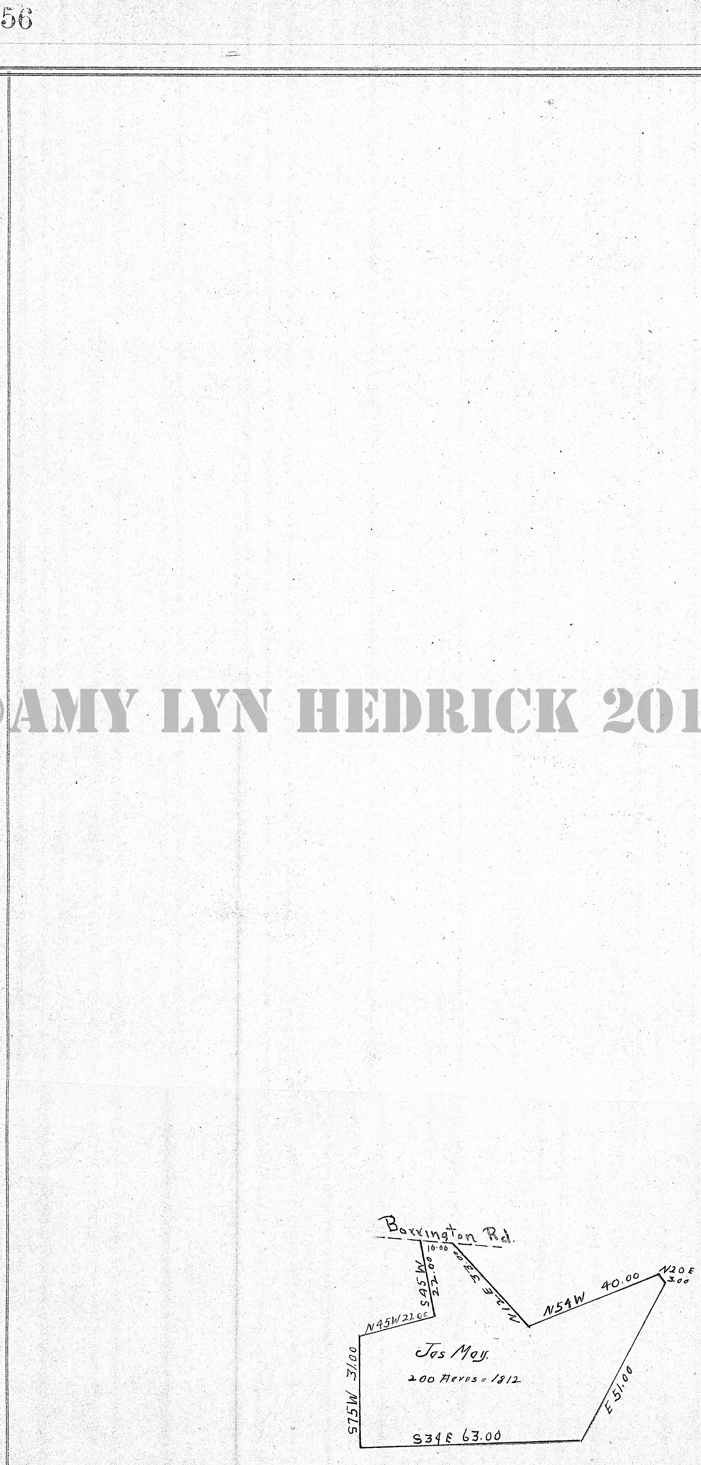
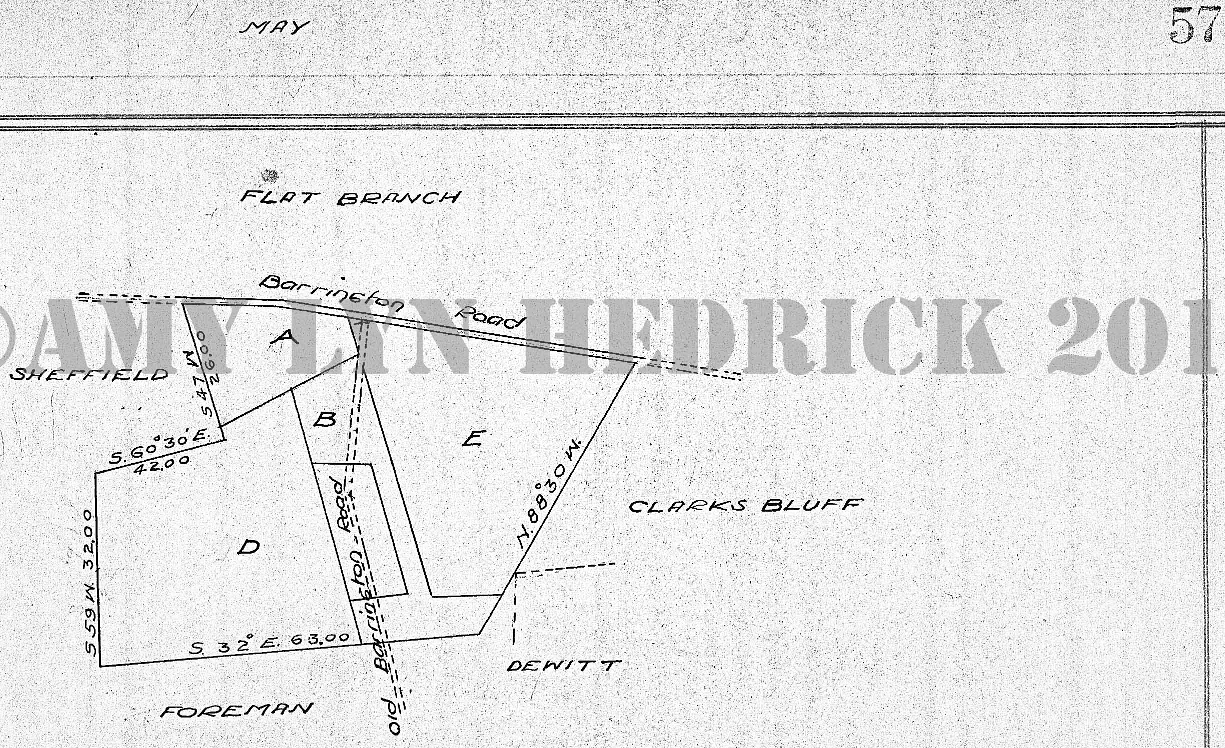
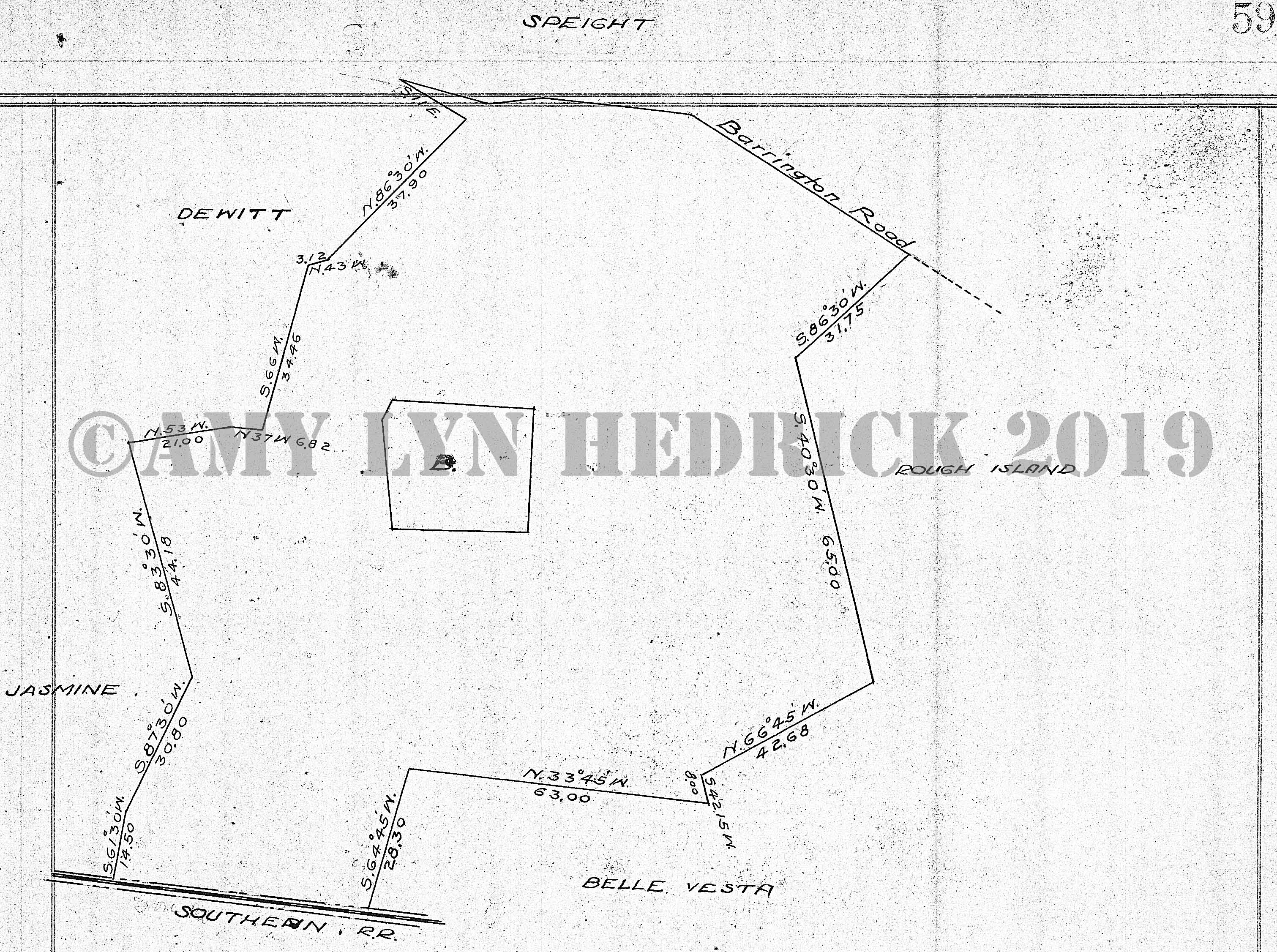
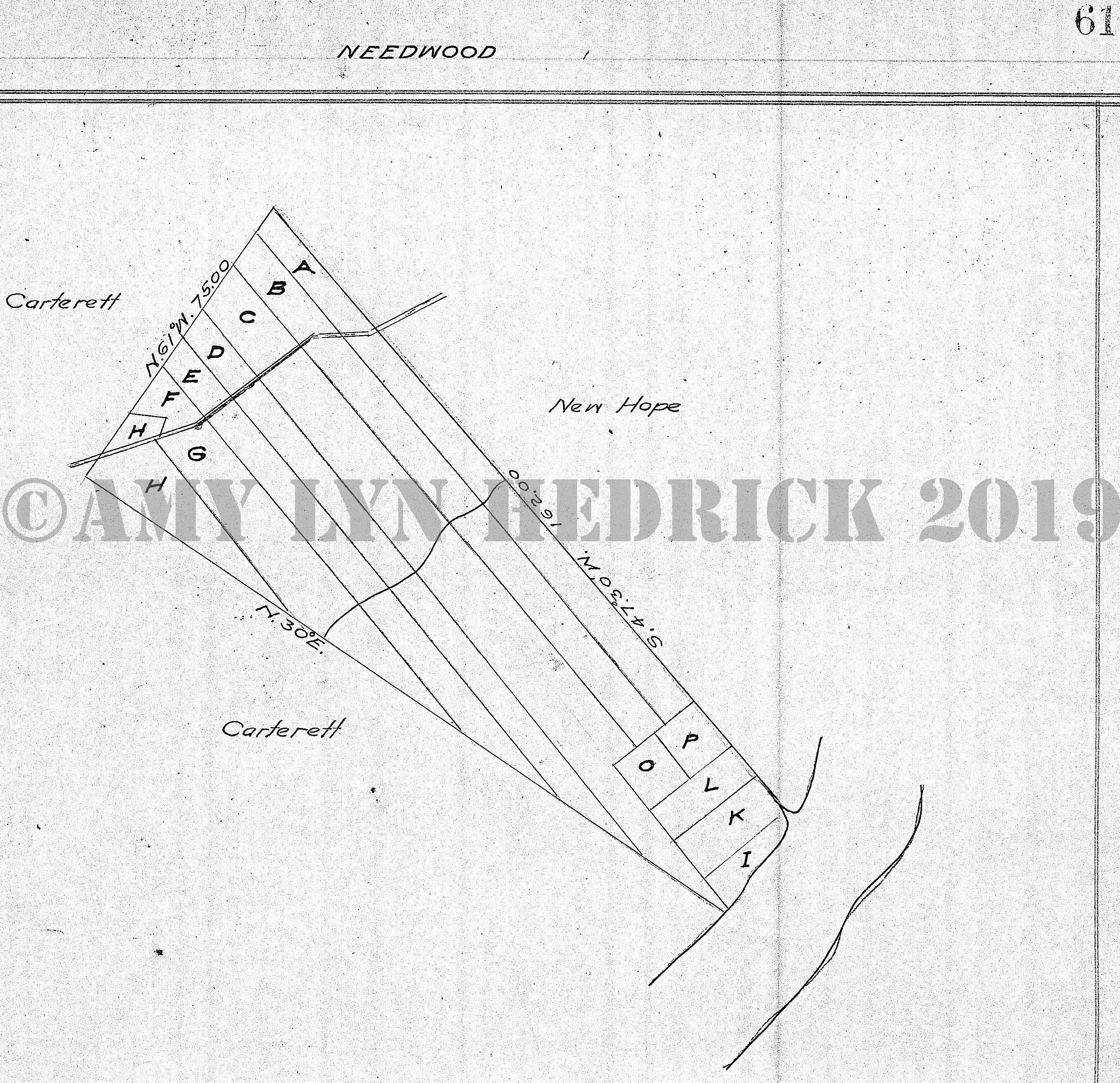
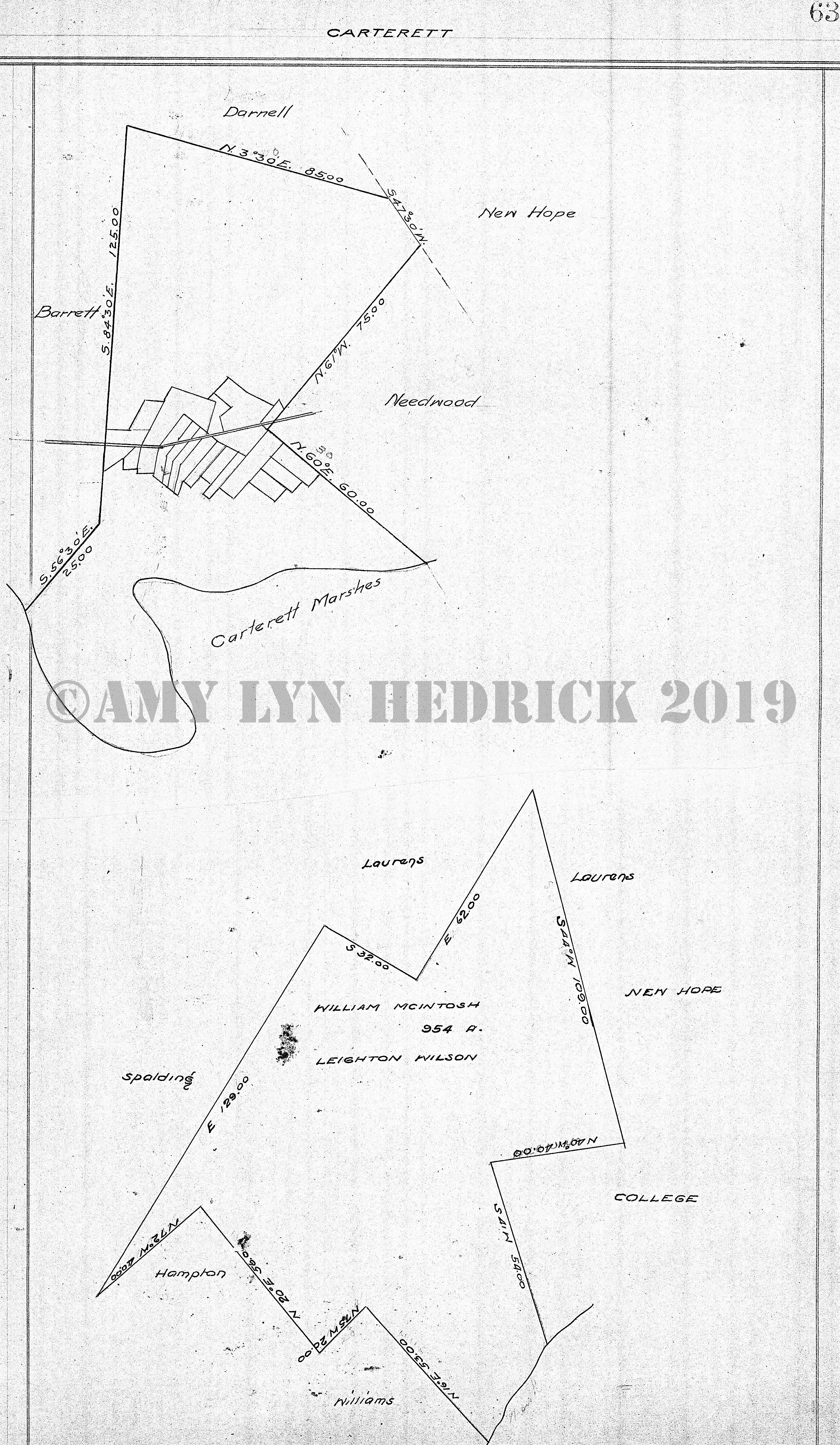
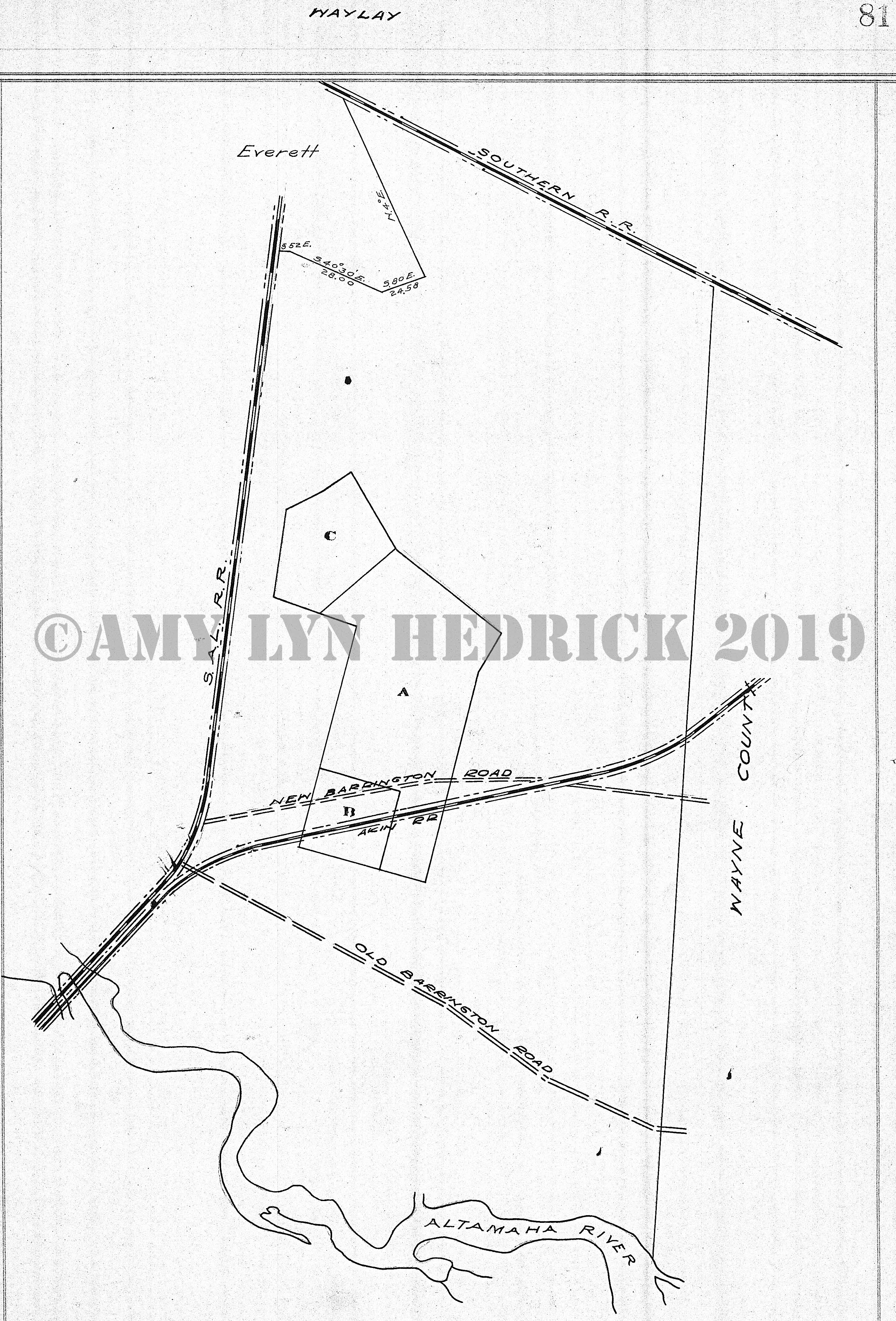
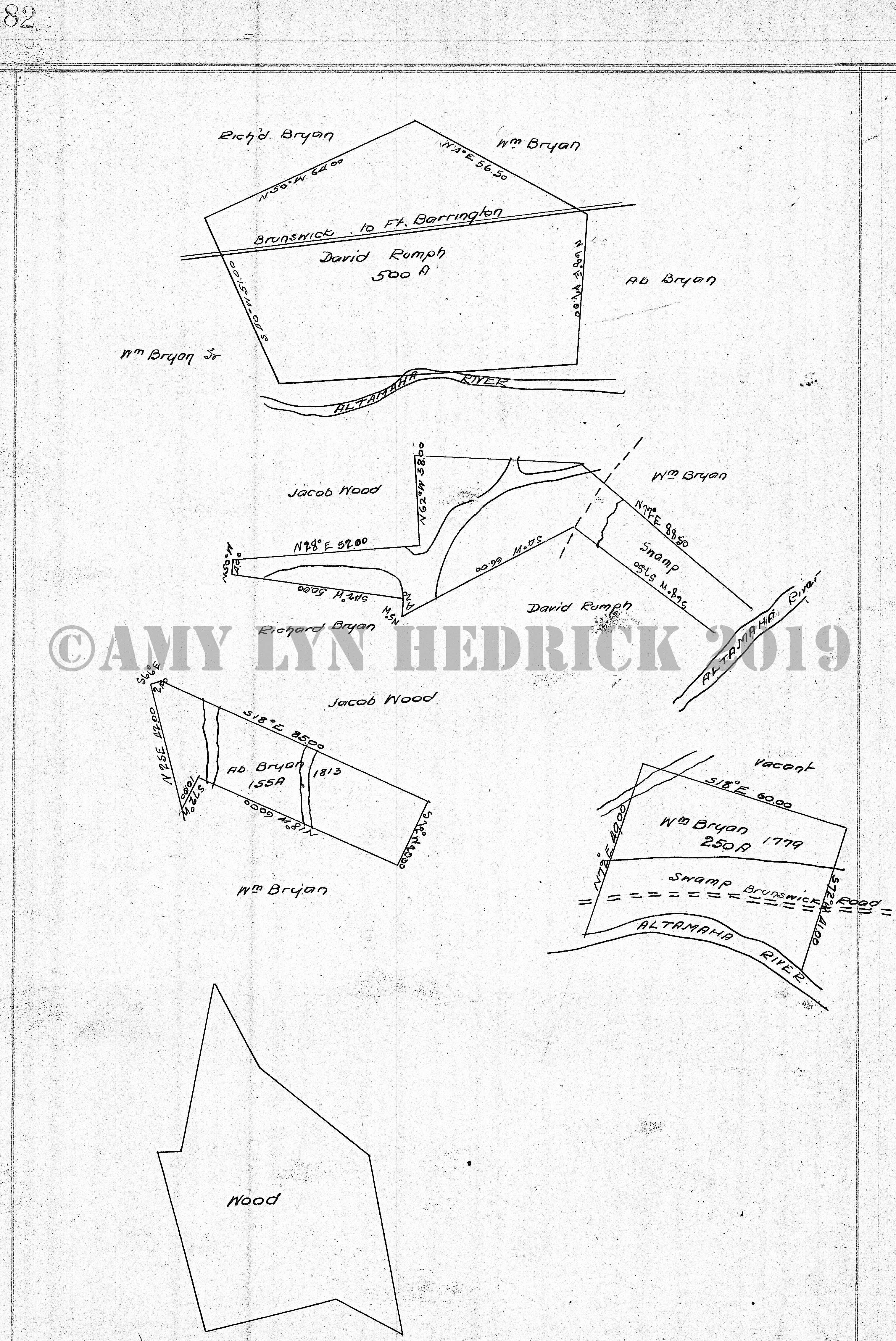
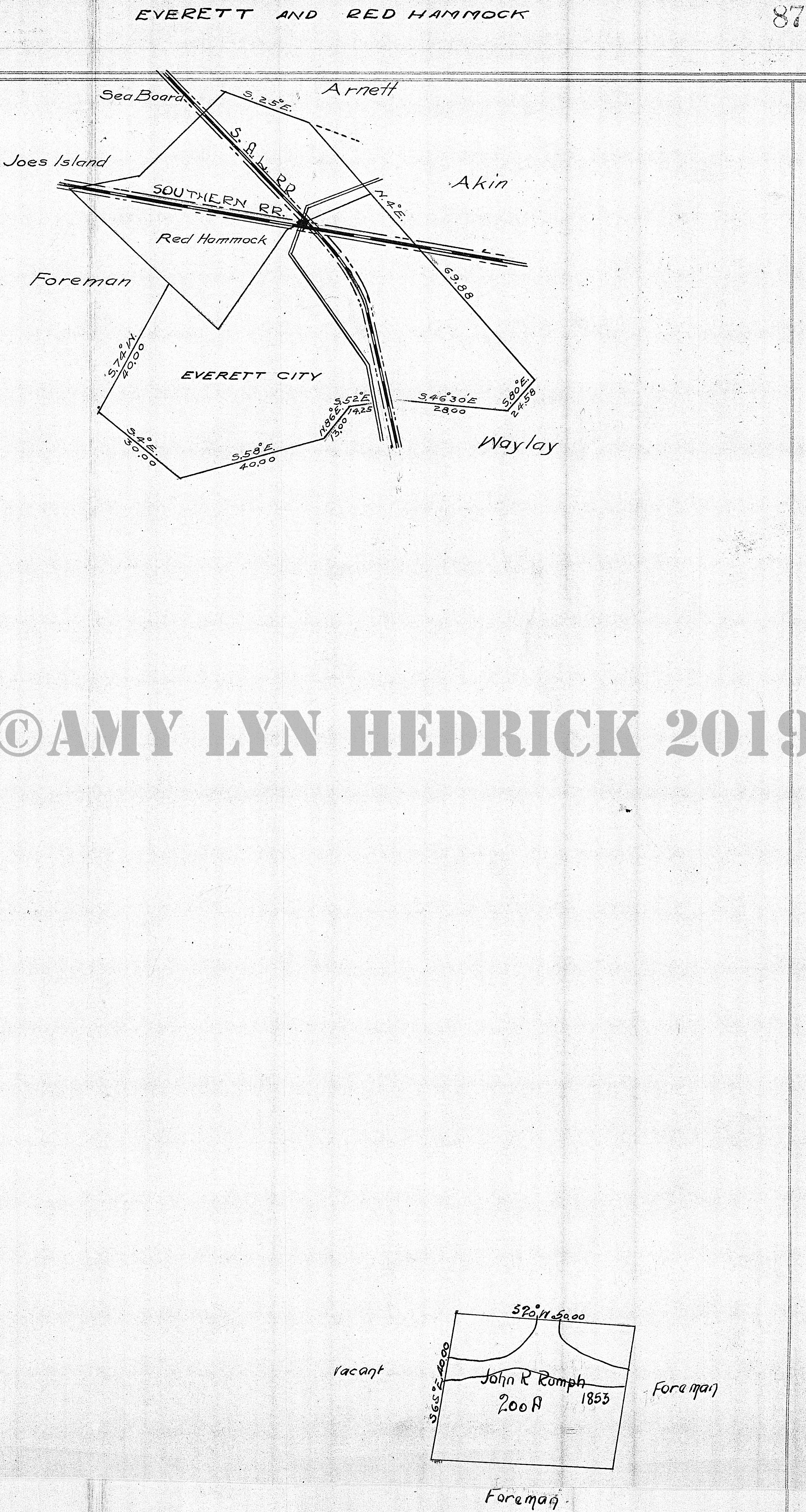
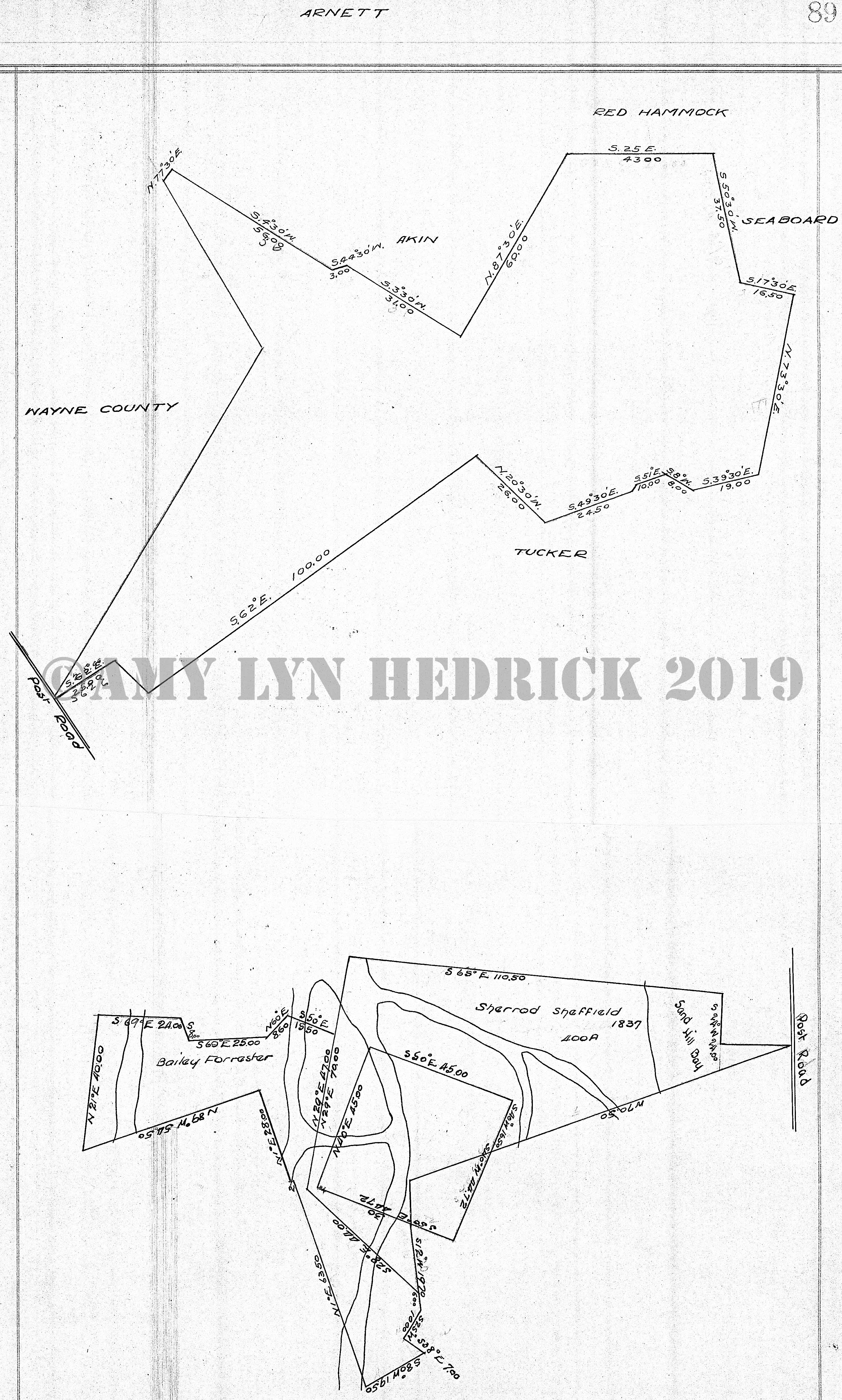
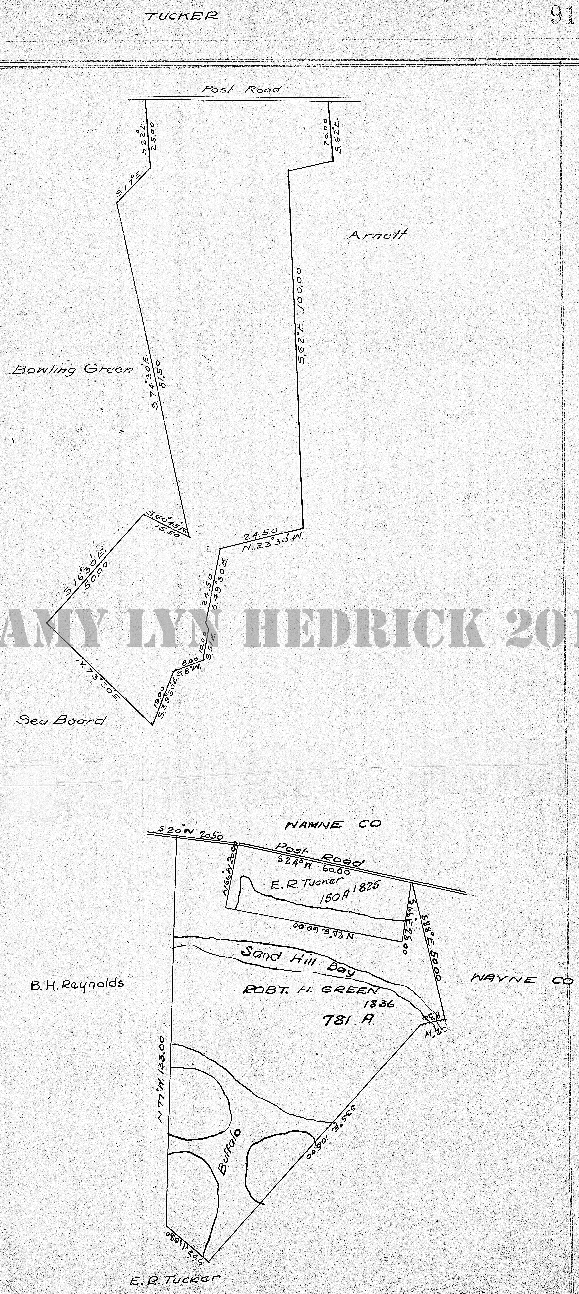
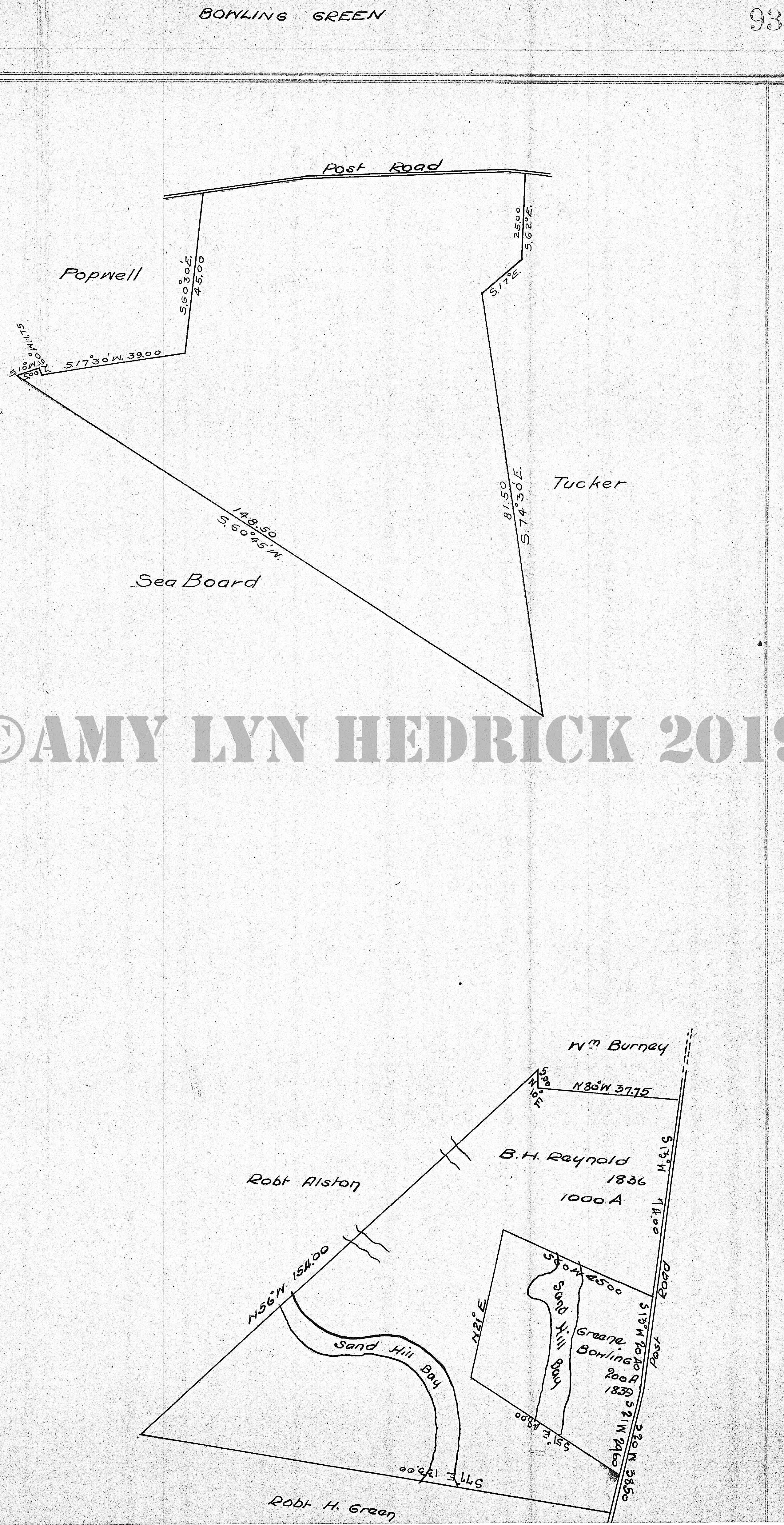
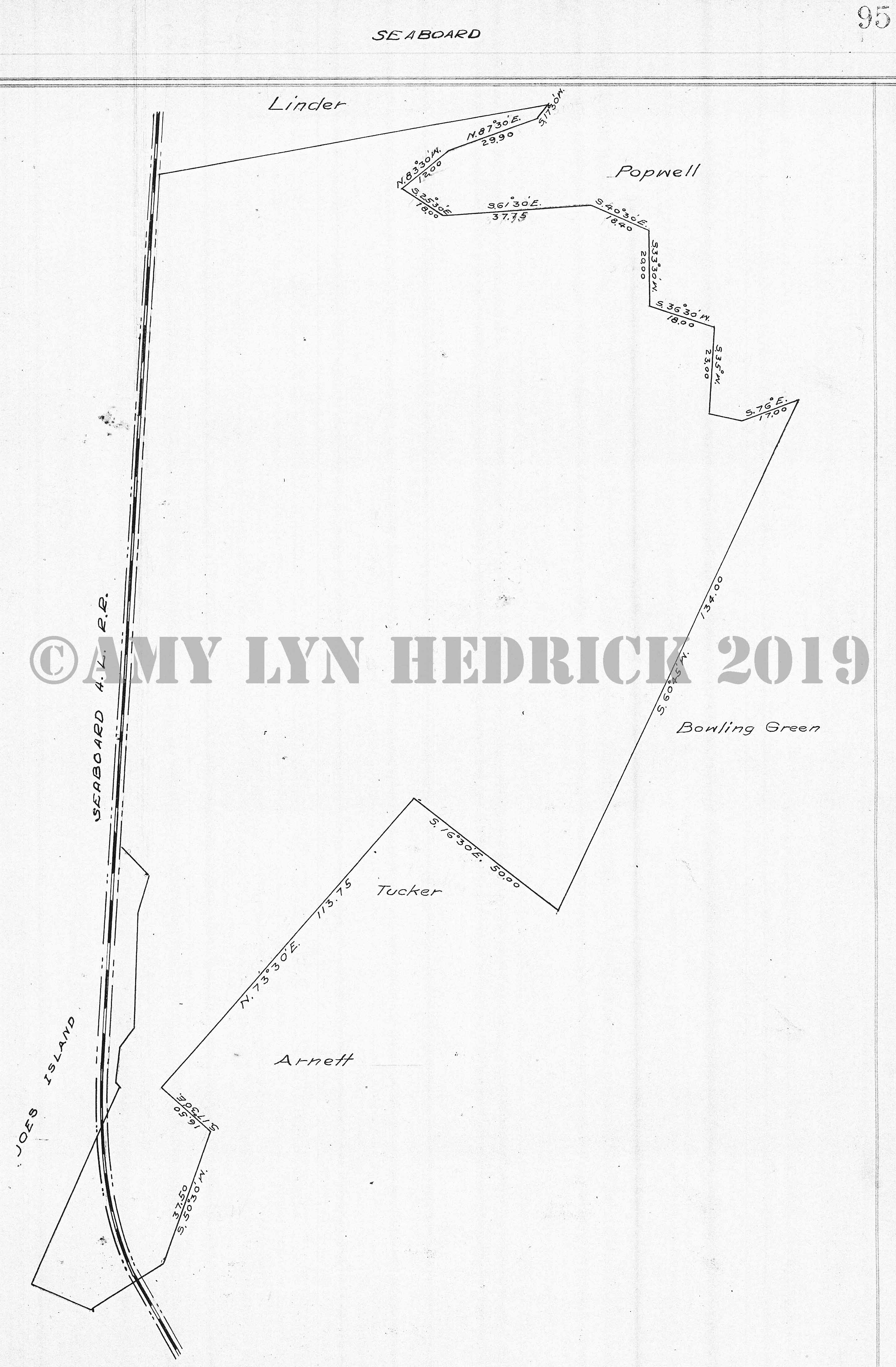
Ballard's biography Page 2 Page 3 Page 4 Page 5 Page 6 -- from this page to page 46 is all of the measurements taken from stake to stake around the whole county Page 7 Page 8 Page 9 Page 10 Page 11 Page 12 Page 13 Page 14 Page 15 Page 16 Page 17 Page 18 Page 19 Page 20 Page 21 Page 22 Page 23 Page 24 Page 25 Page 26 Page 27 Page 28 Page 29 Page 30 Page 31 Page 32 Page 33 Page 34 Page 35 Page 36 Page 37 Page 38 Page 39 Page 40 Page 41 Page 42 Page 43 Page 44 Page 45 Page 46 Page 47 Page 48 -- "No Title" also: Pleasant I. Williams (1836), James D. Jarrett (1836), Jacob Woodall (1836), Hudson, John G. Bell, R. Grant, J.W. Couper, Wm. D. Jarrett, Doctor Perry, John Burnett Jr., instersected by road to Grant Ferry, O'Cannon, Jno. Burnett, S.M. Burnett Page 49 -- "Bacon" also: Perry, Grant Ferry Road, Southern railroad, Canal, Helviston, Lemon, Canal, Darnell, New Hope, Petersville, Barnwell Page 50 -- "No Title" measurement & descriptions of the following lands and those on pgs. 51 & 52: Doctor Perry (1795), W.A. Jarrett (1836), vacant, intersected by Reedy Branch, Gigniliatt, Burnett, Jarrett, Couper, DuPree, James H. Couper (1836), N.S. (not surveyed?), Grant, DuPree, N.S. Page 51 -- "Perry & Couper" Southern railroad, Grant Ferry Road, DuPree, Pritchard Page 52 -- "Continued from pg. 50" measurements & descriptions of the various tracts mentioned from pg. 50 to 52 also: Isaac M. Rowls, Loyal Cowls (1836), Lewis Bond (1836), G.G. Holcombe, James Bivens (1836), Nath. B. Juhans (1836), James Wood (1836), Michael Harvey (1836), Charles Smith (1836), William Houston, Dart, intersected by Cowpen Creek, vacant land, Altamaha River, James May, Murray, Forrester, Gigntiat (Gignilliat?) Page 53 -- "Hooker" also: Honey Gall, Altamaha River, Clarks Bluff, Speight, intersected by Barrington Road, Purvis, Vivian Page 54 -- "No Title" Information & measurements about Belle Vesta; originally part of the Speight & Hooker tracts Page 55 -- "Belle Vesta" also: Speight, Southern railroad, Rough Island Page 56 -- "No Title" also: James May (1812), Barrington Road Page 57 -- "May" also: Flat Branch, Barrington Road, Sheffield, Foreman, Old Barrington Road intersects, Dewitt, Clarks Bluff Page 58 Page 59 -- "Speight" also: Dewitt, Jasmine, Southern railroad, Belle Vesta, Rought Island, Barrington Road Page 60 Page 61 -- "Needwood" also: Carterett on two sides, New Hope Page 62 Page 63 -- "Caterett" also: Darnell, Barrett, Carterett Marshes, Needwood, New Hope, William McIntosh/Leighton Wilson, Laurens, Spalding, Hampton, Williams, College, New Hope, Laurens |
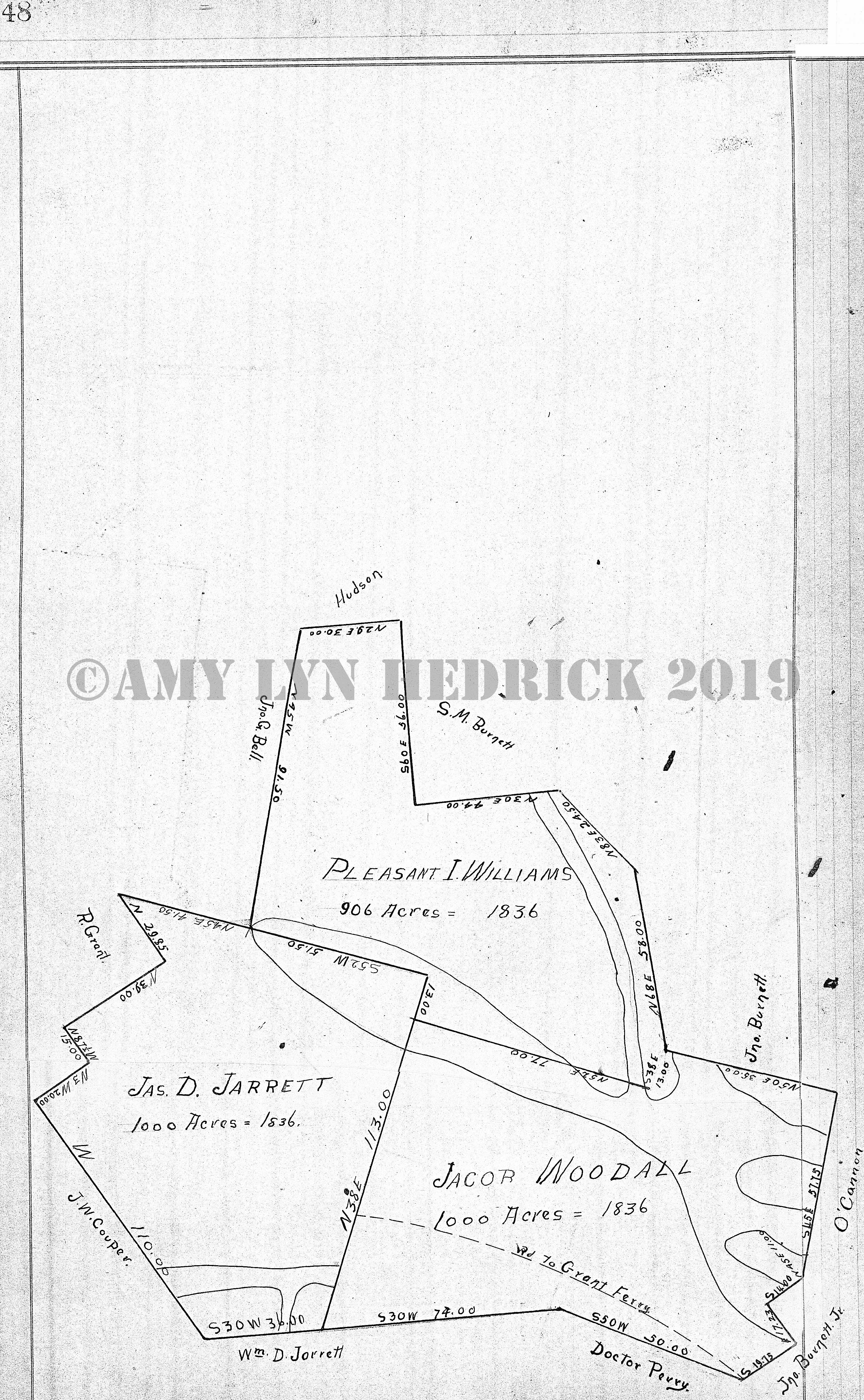
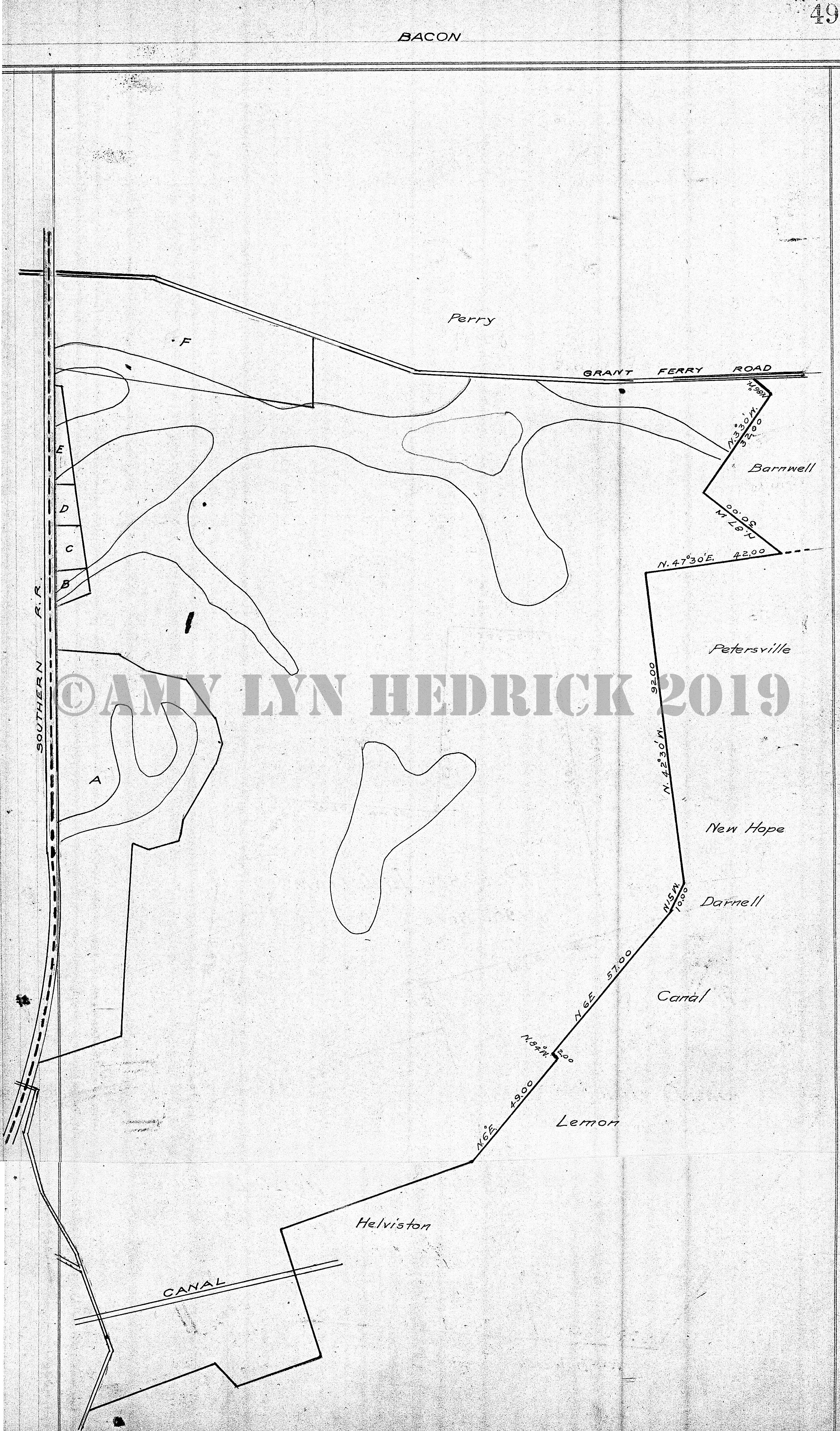
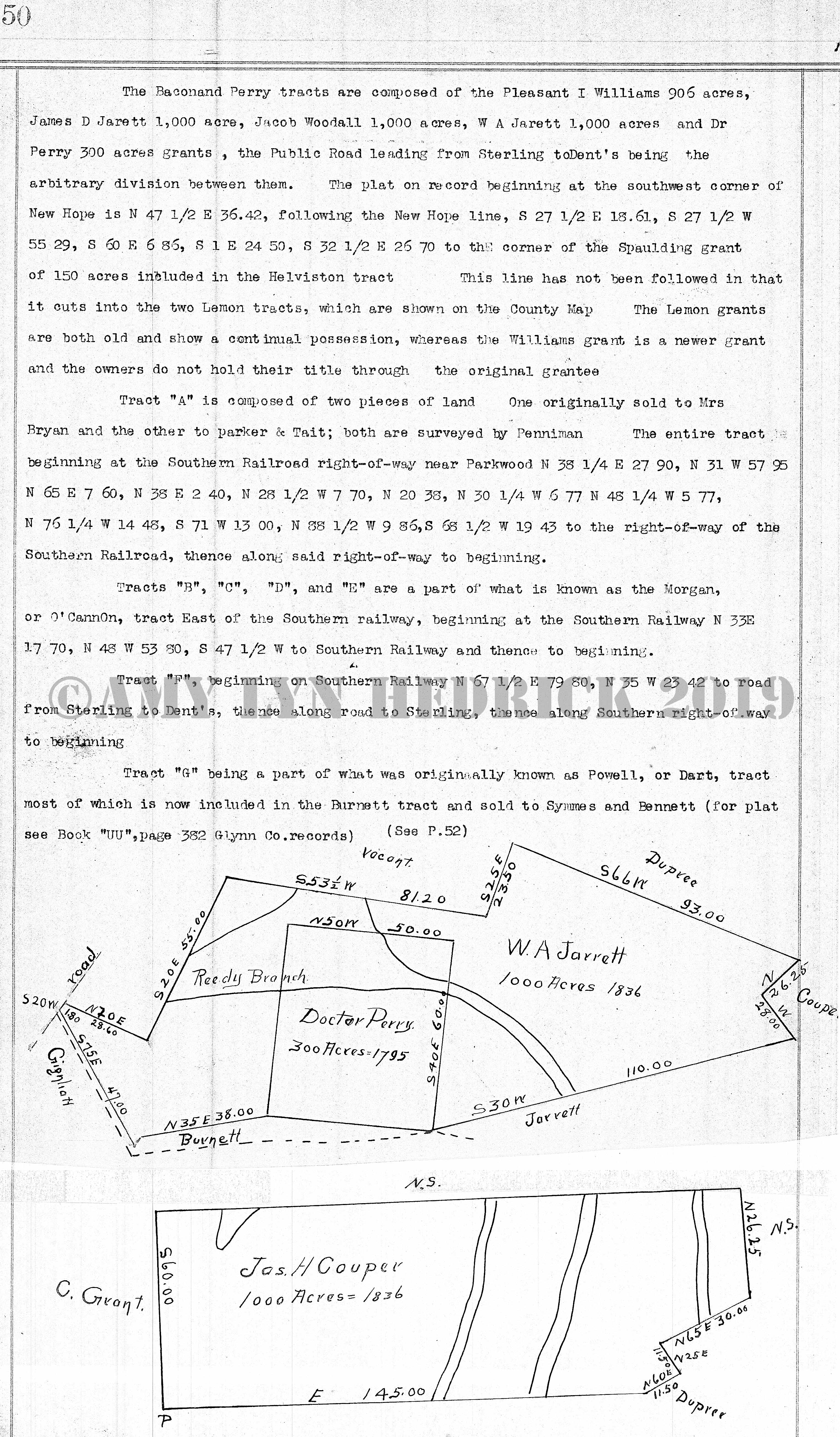
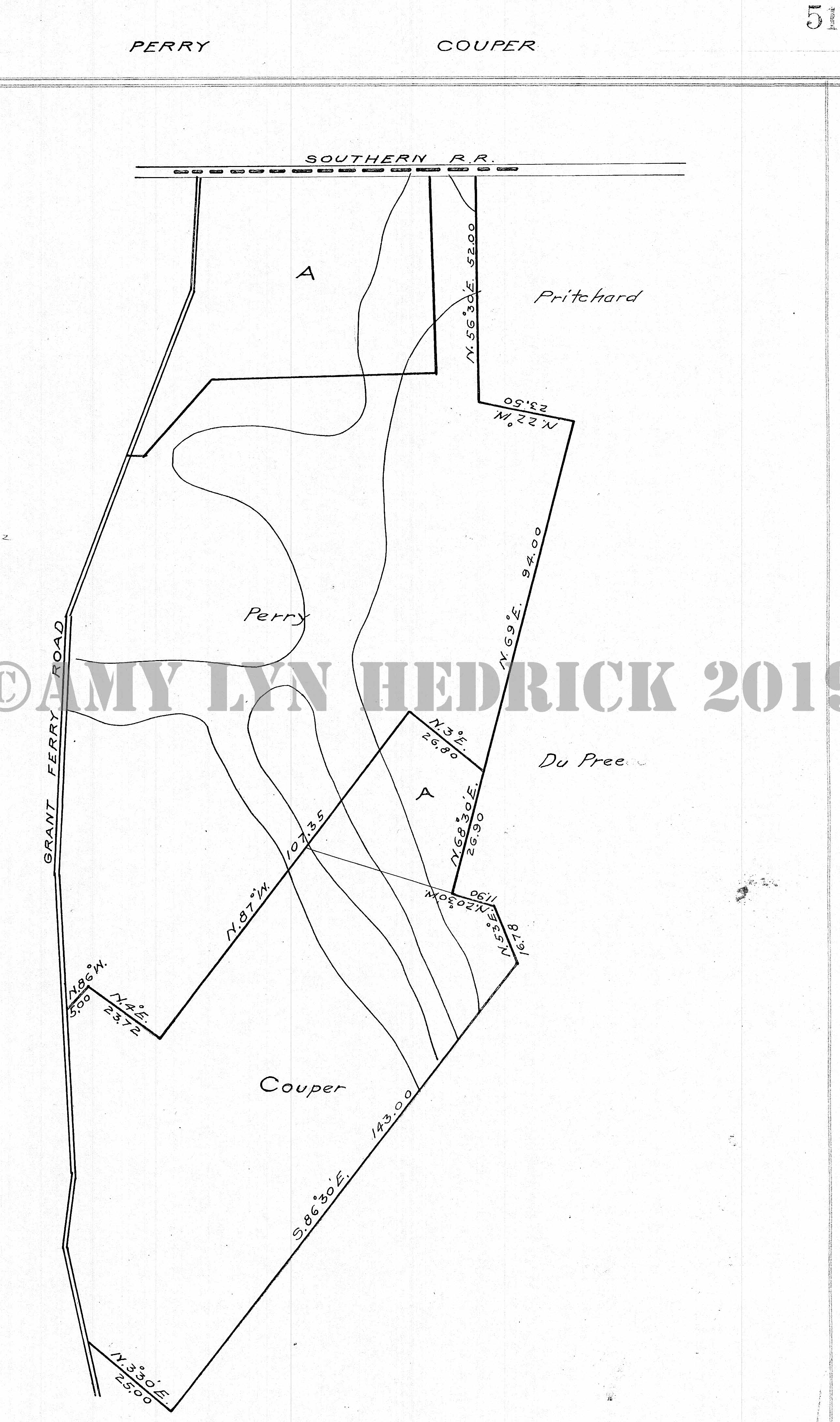
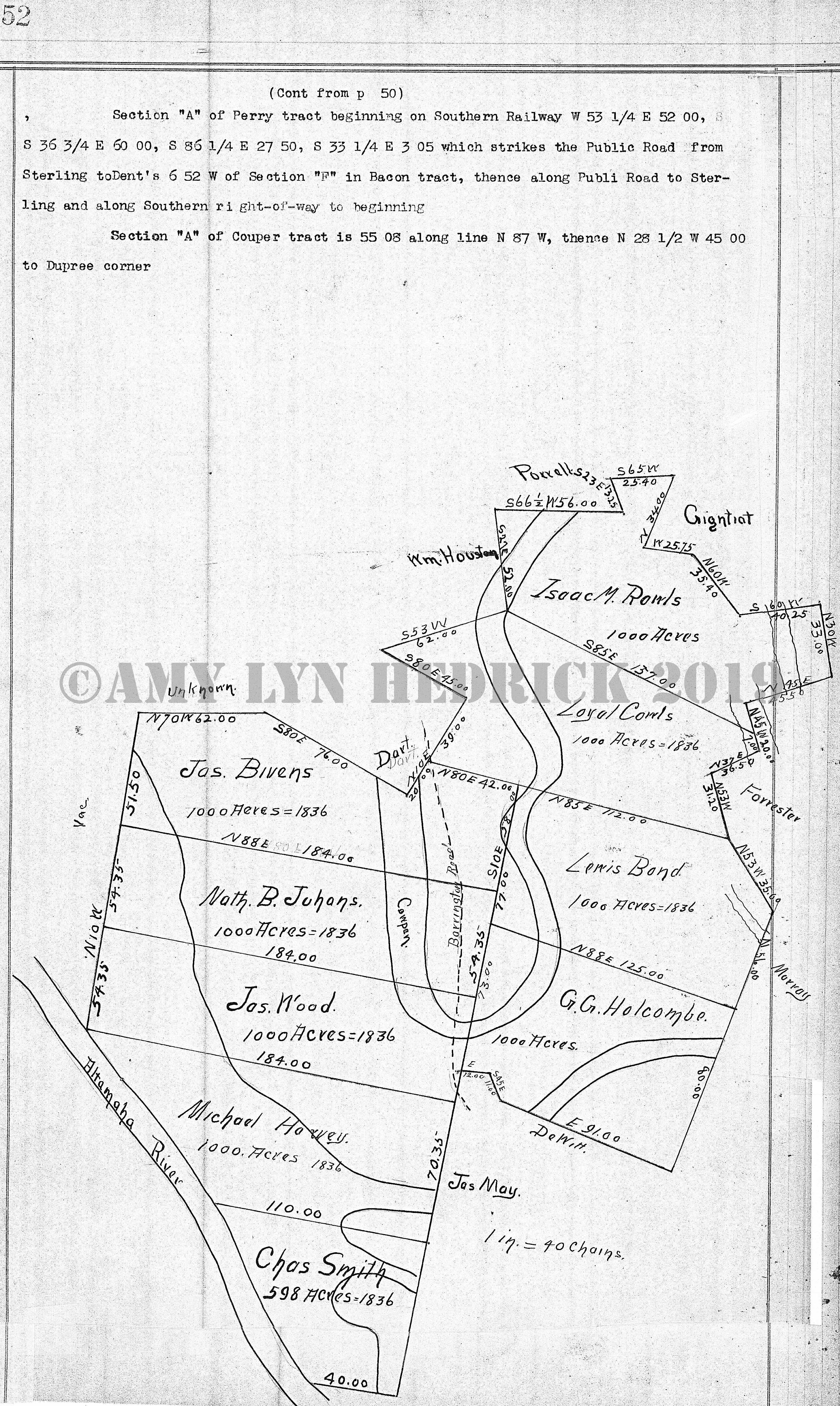
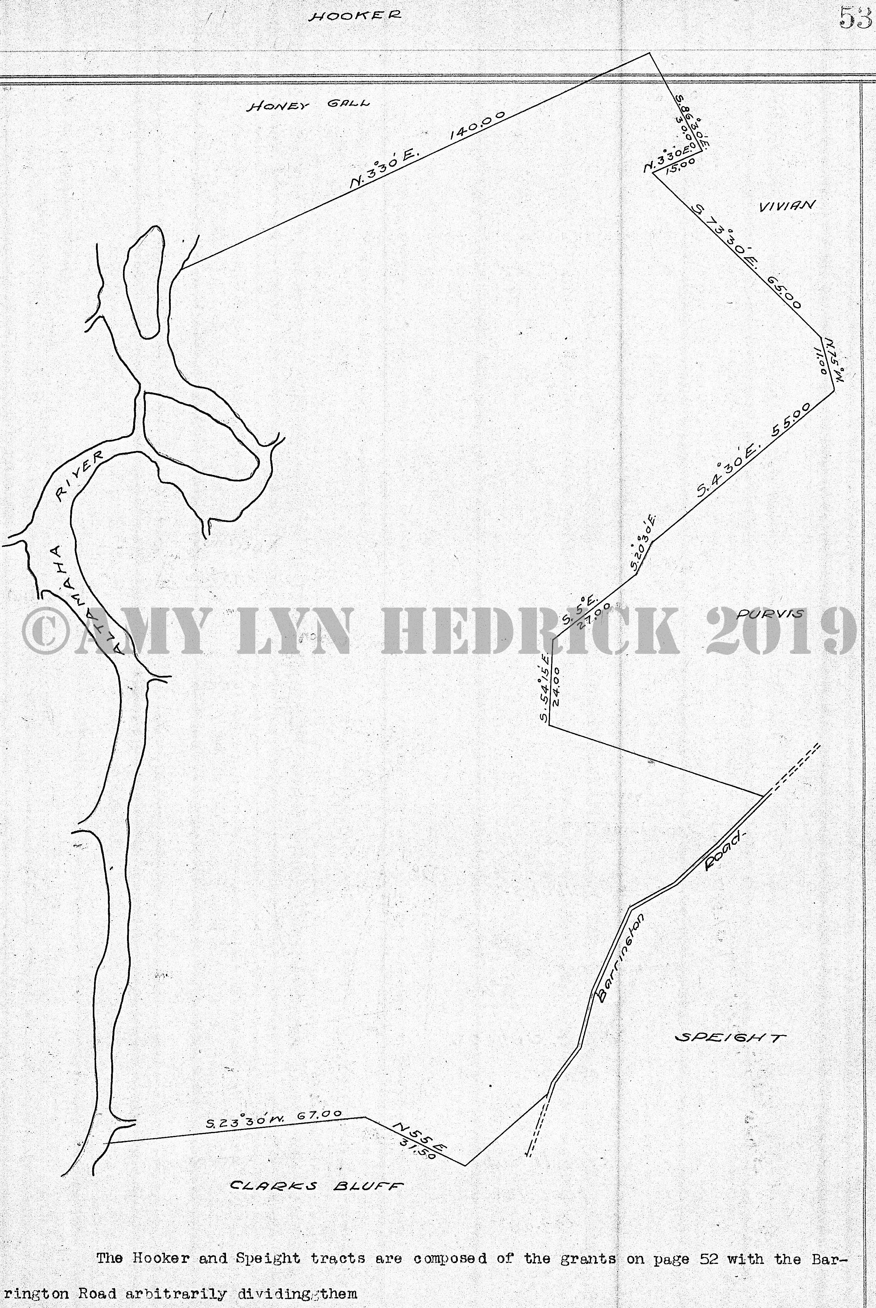
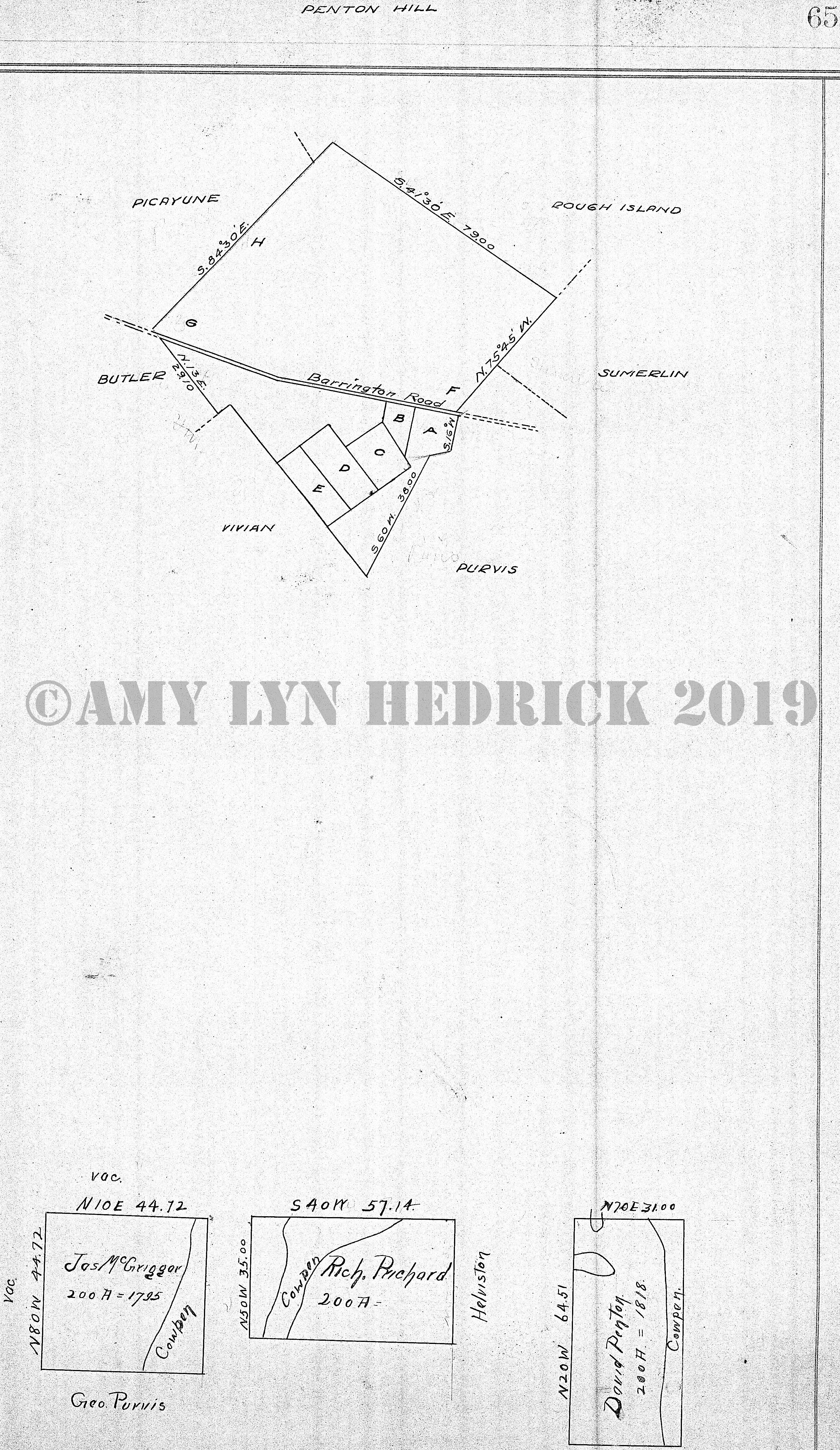
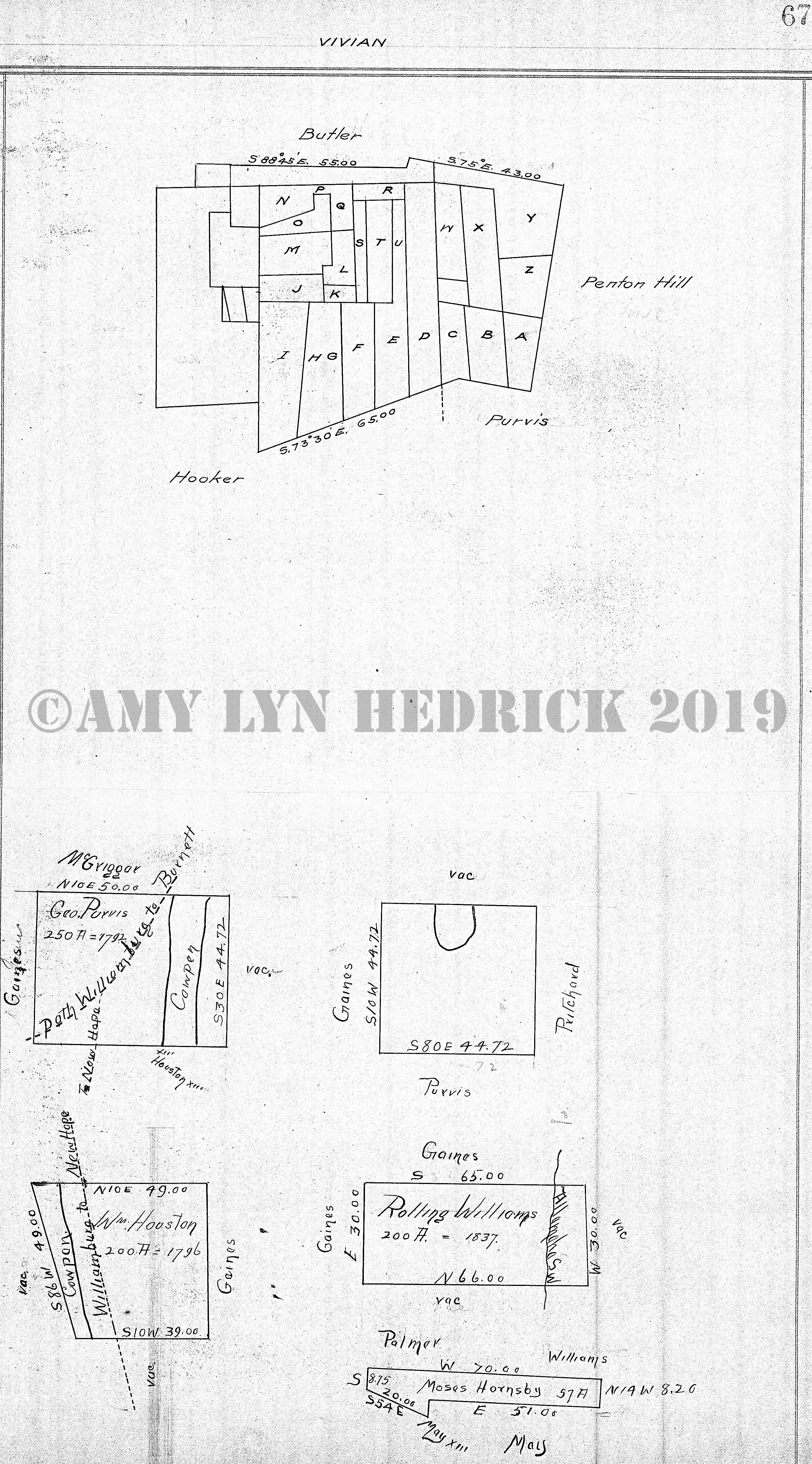
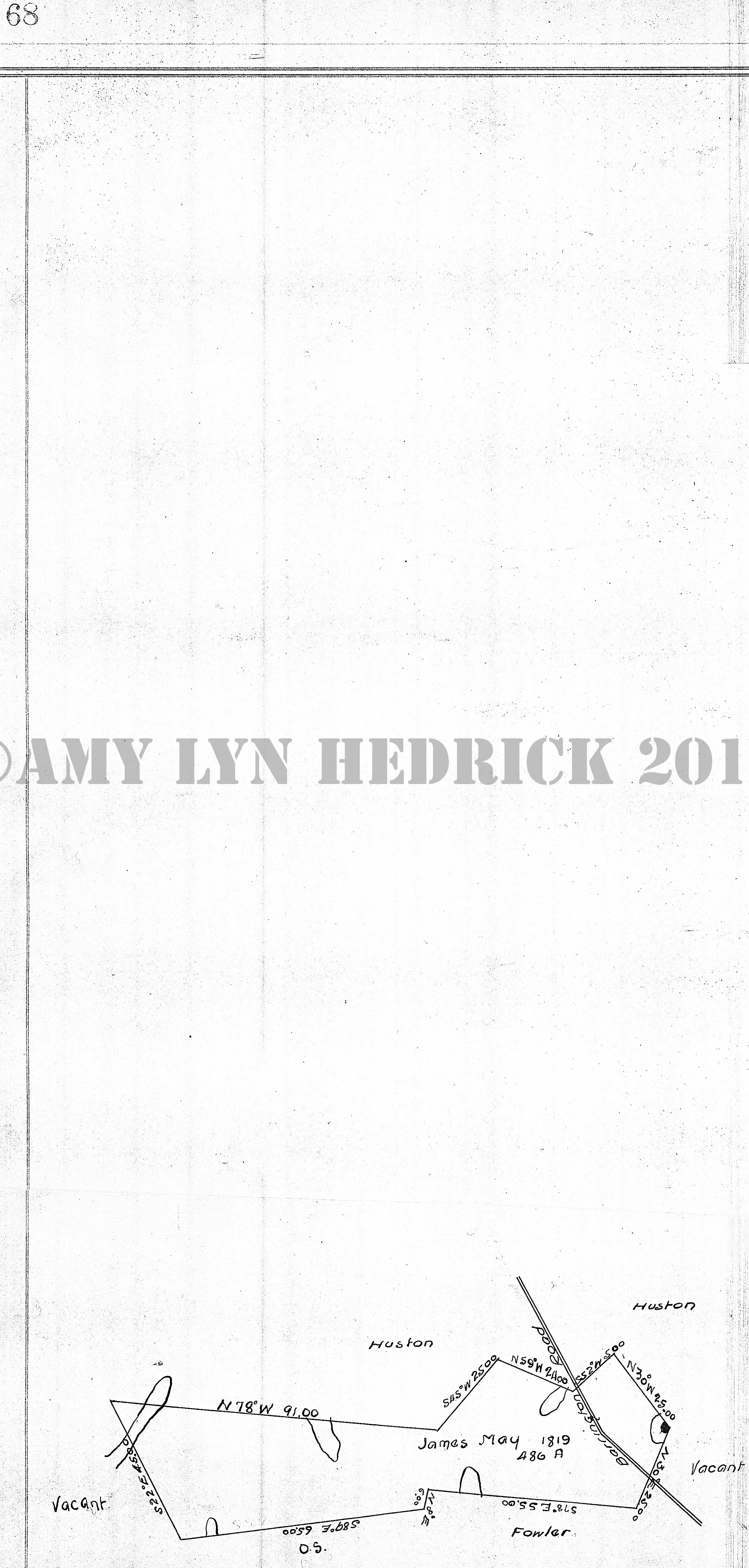
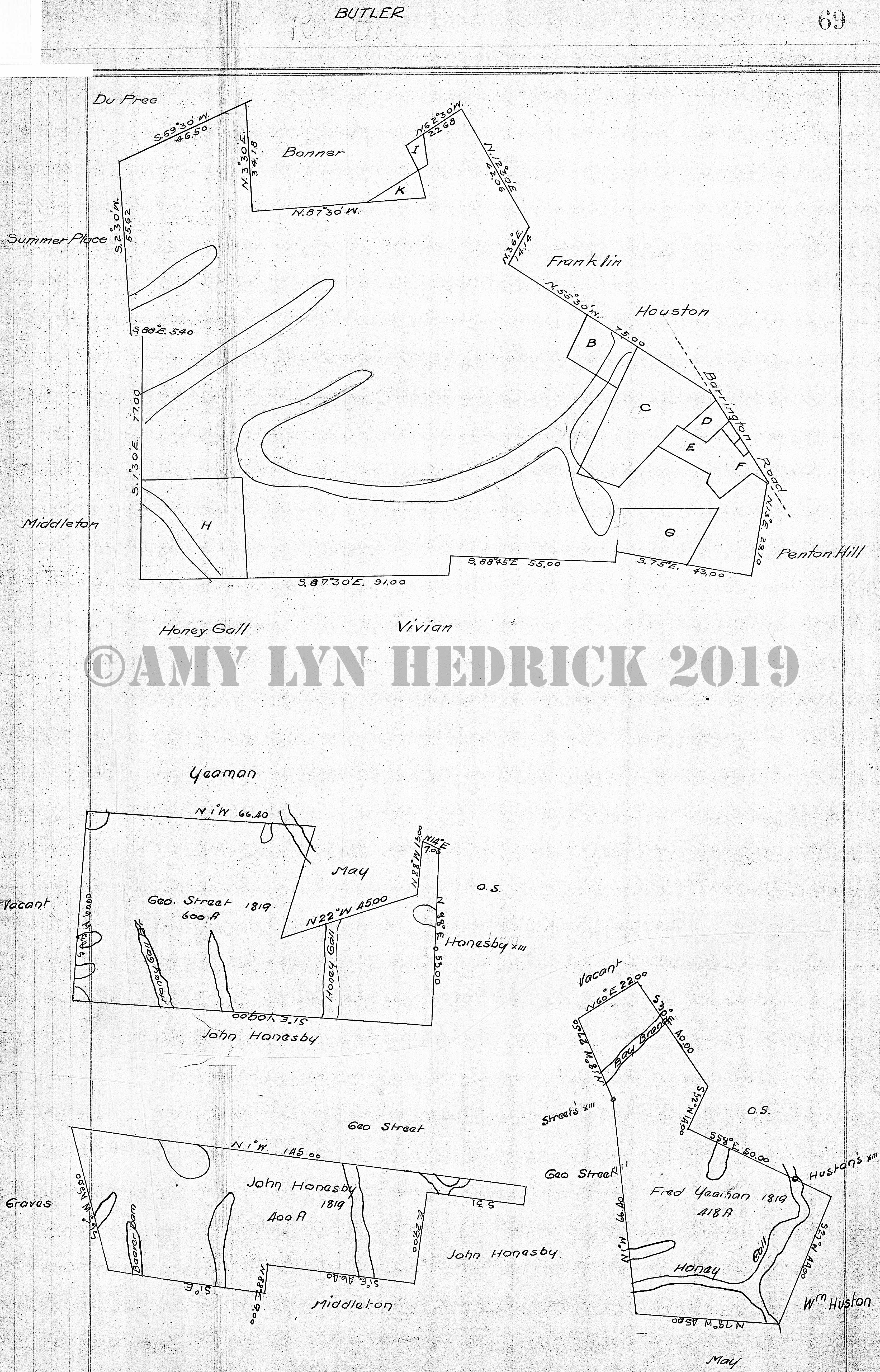
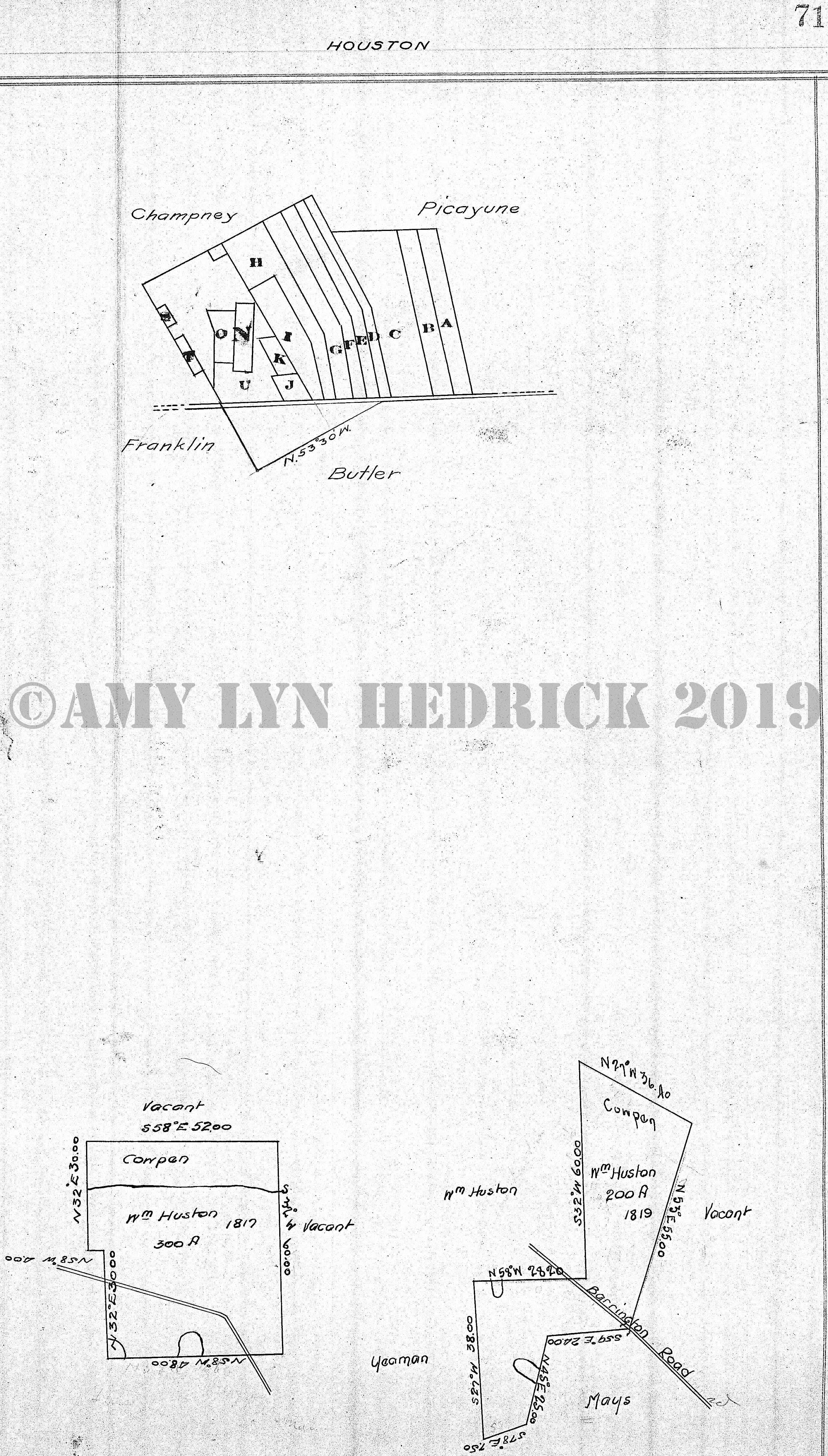
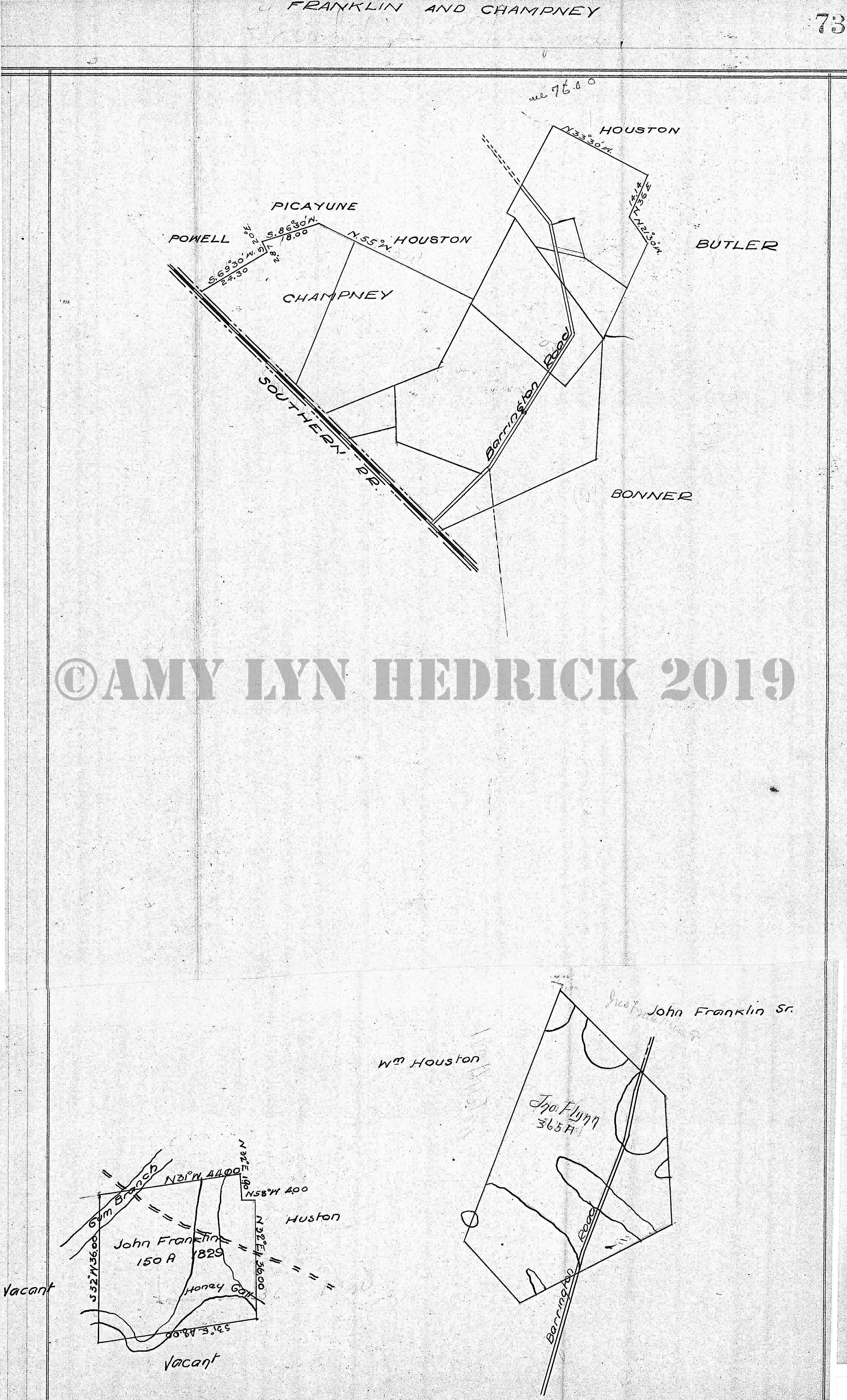
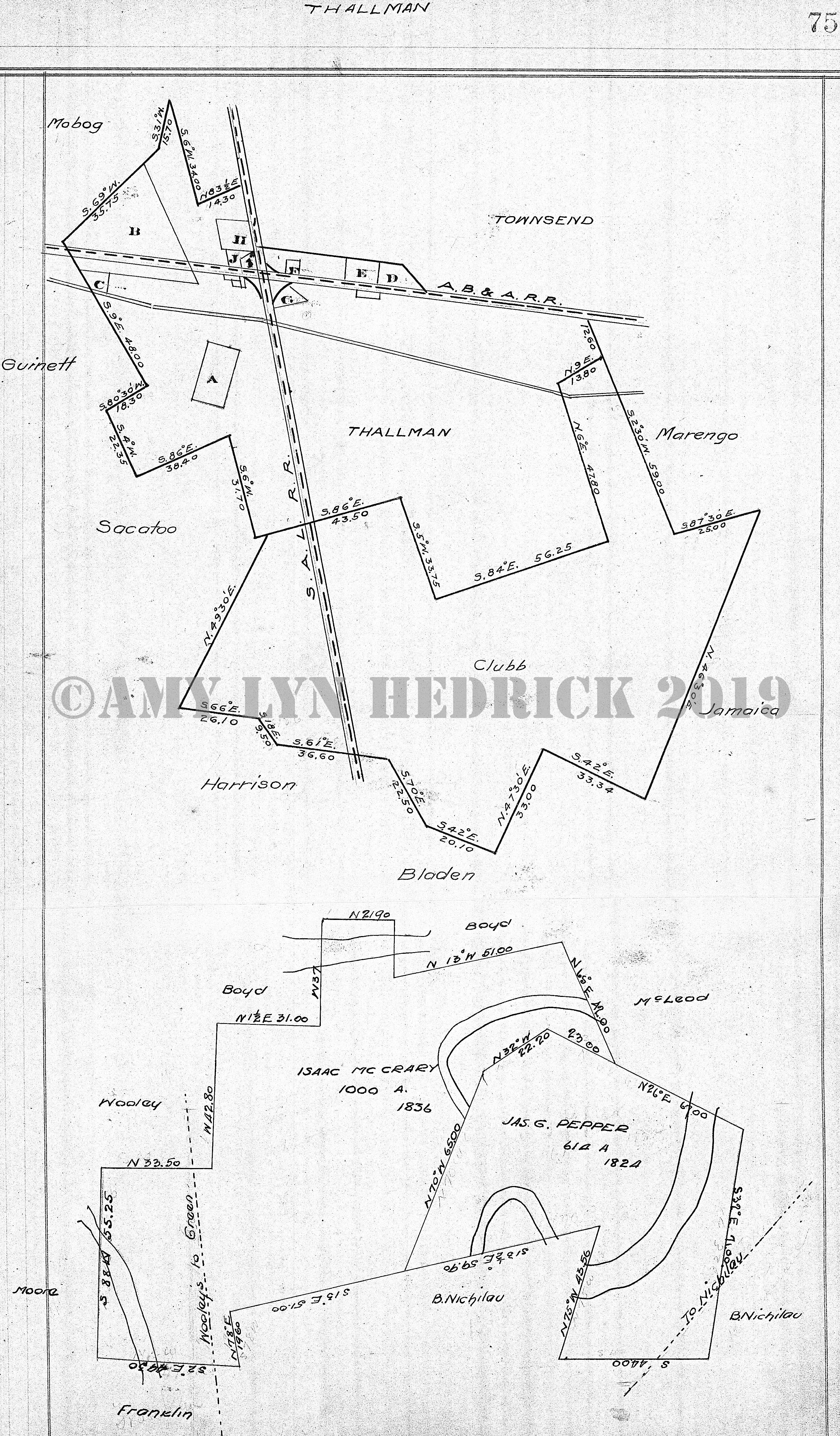
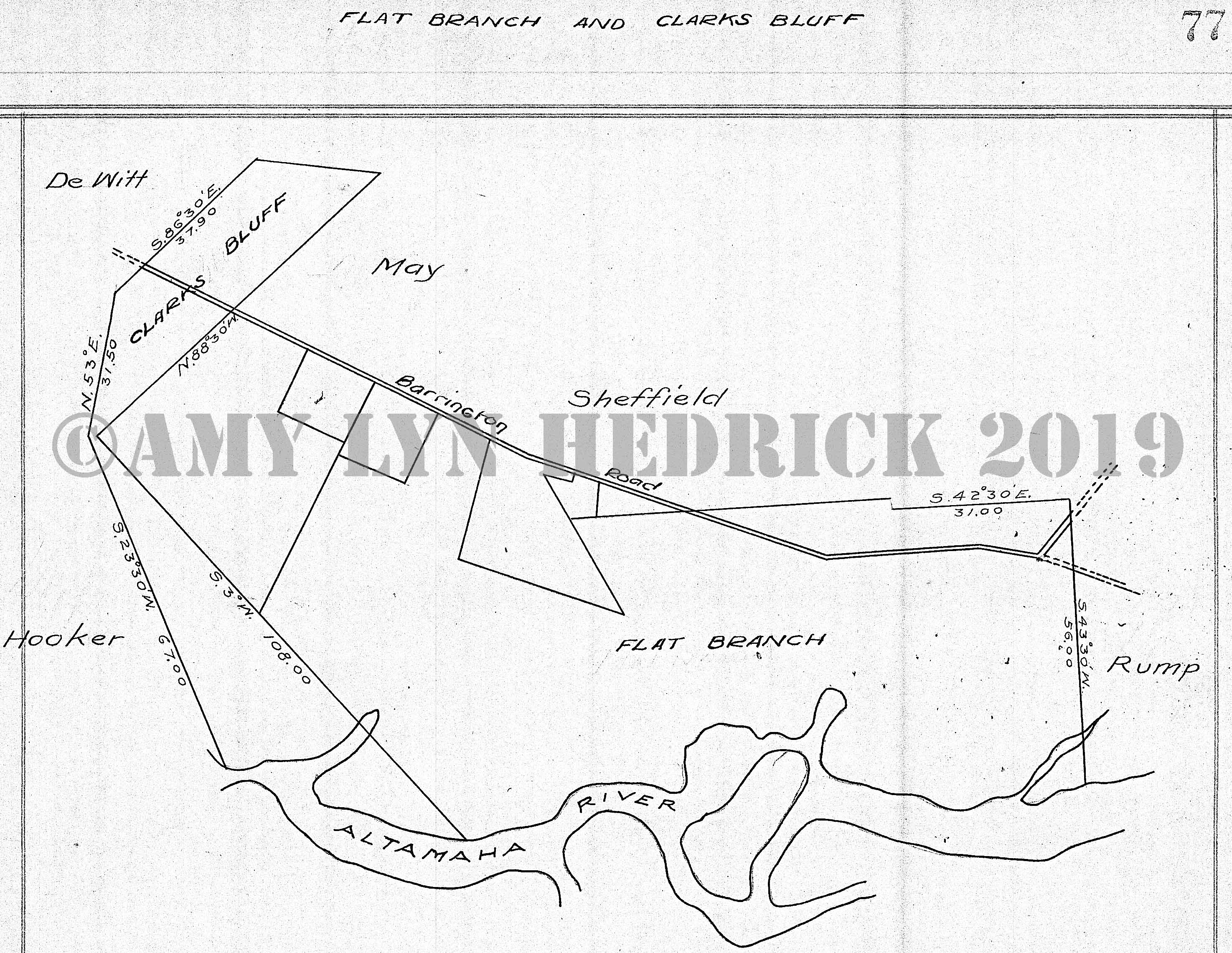
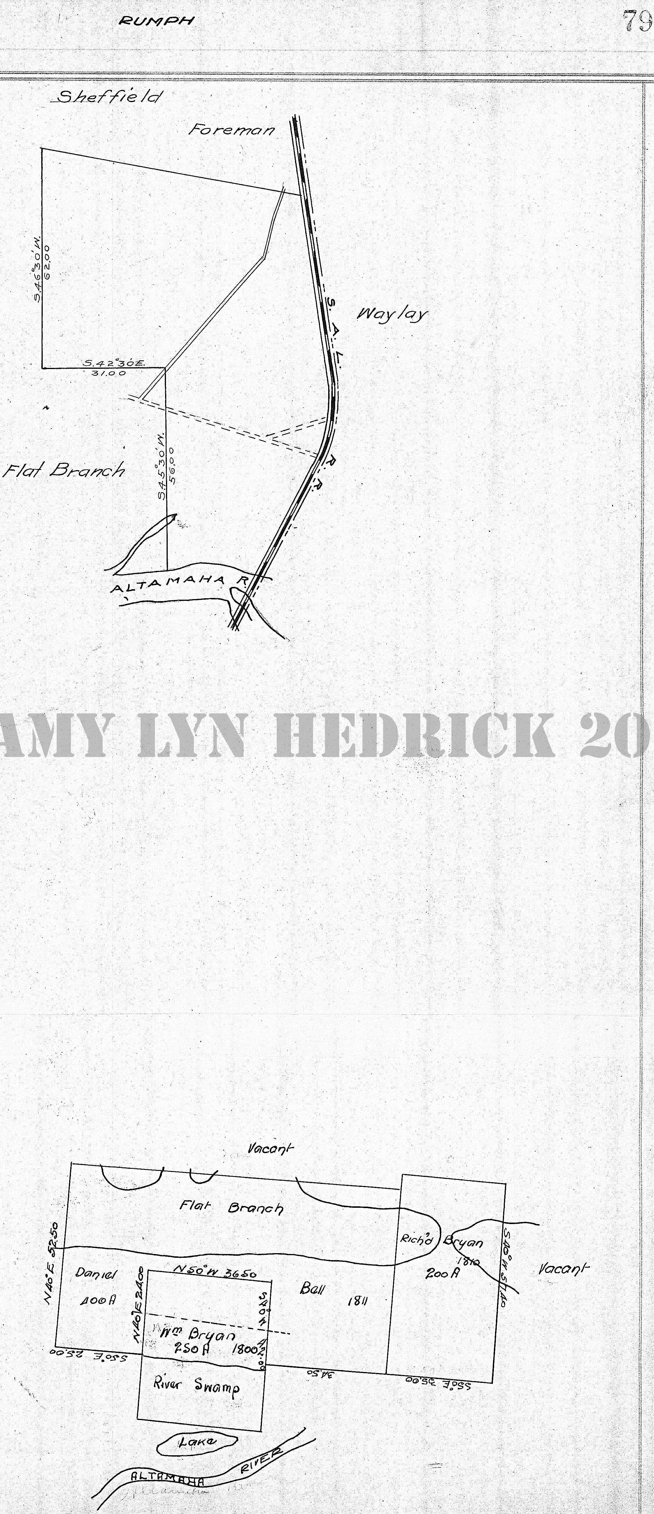
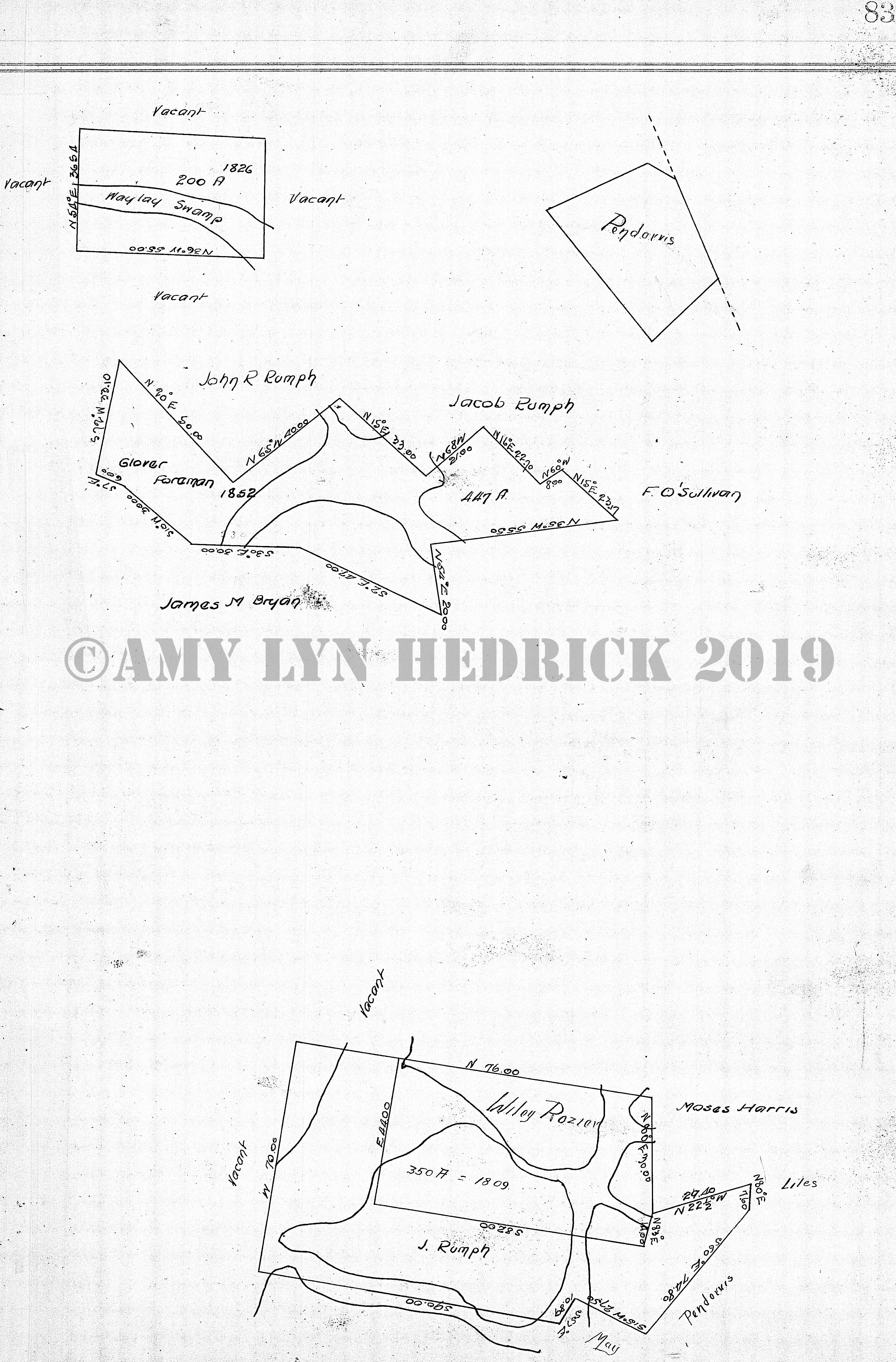
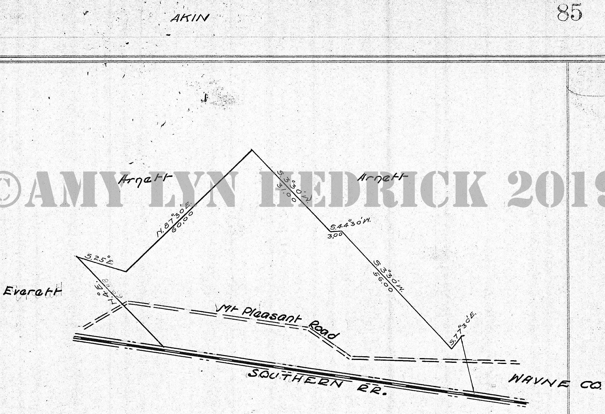
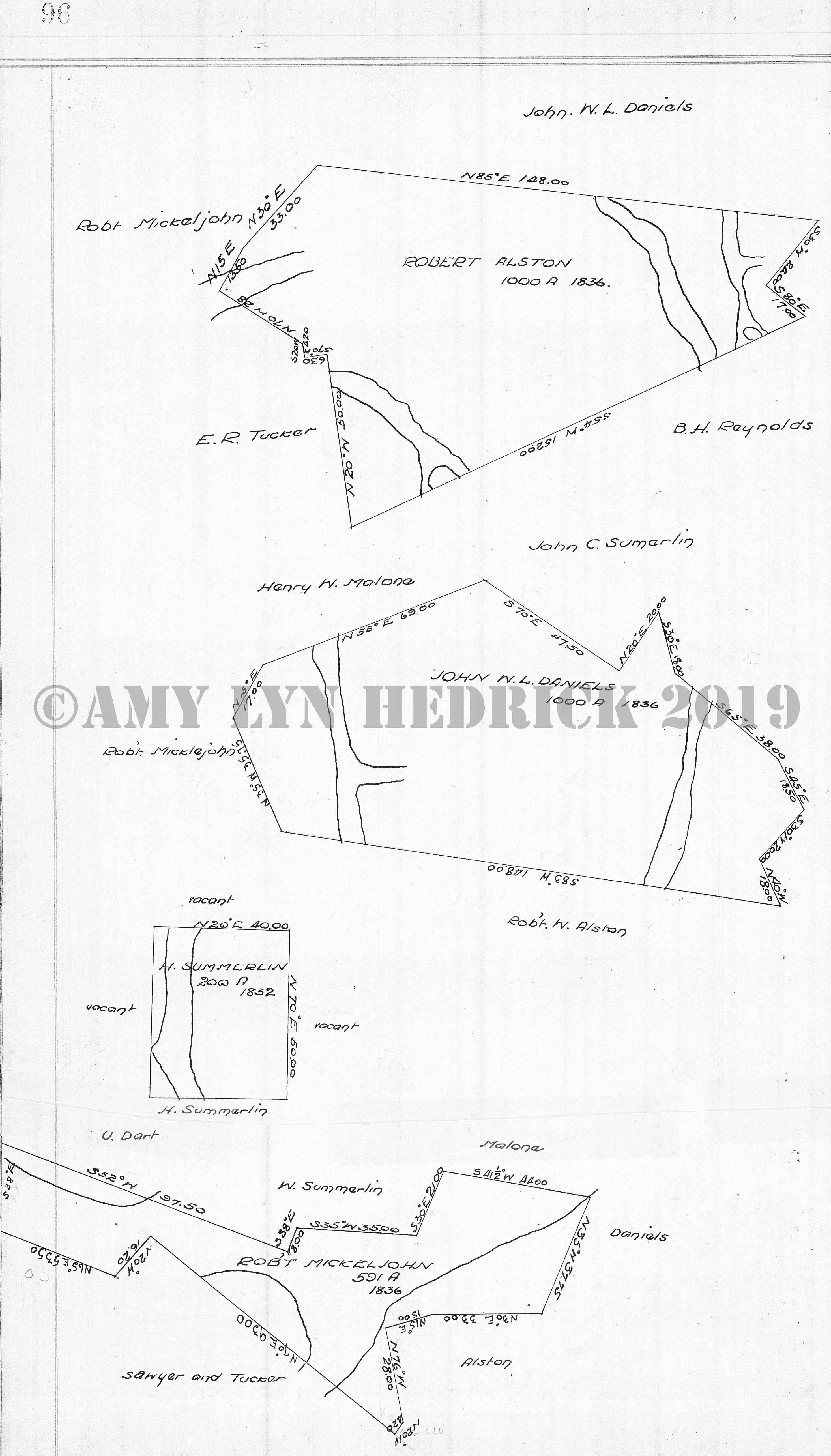
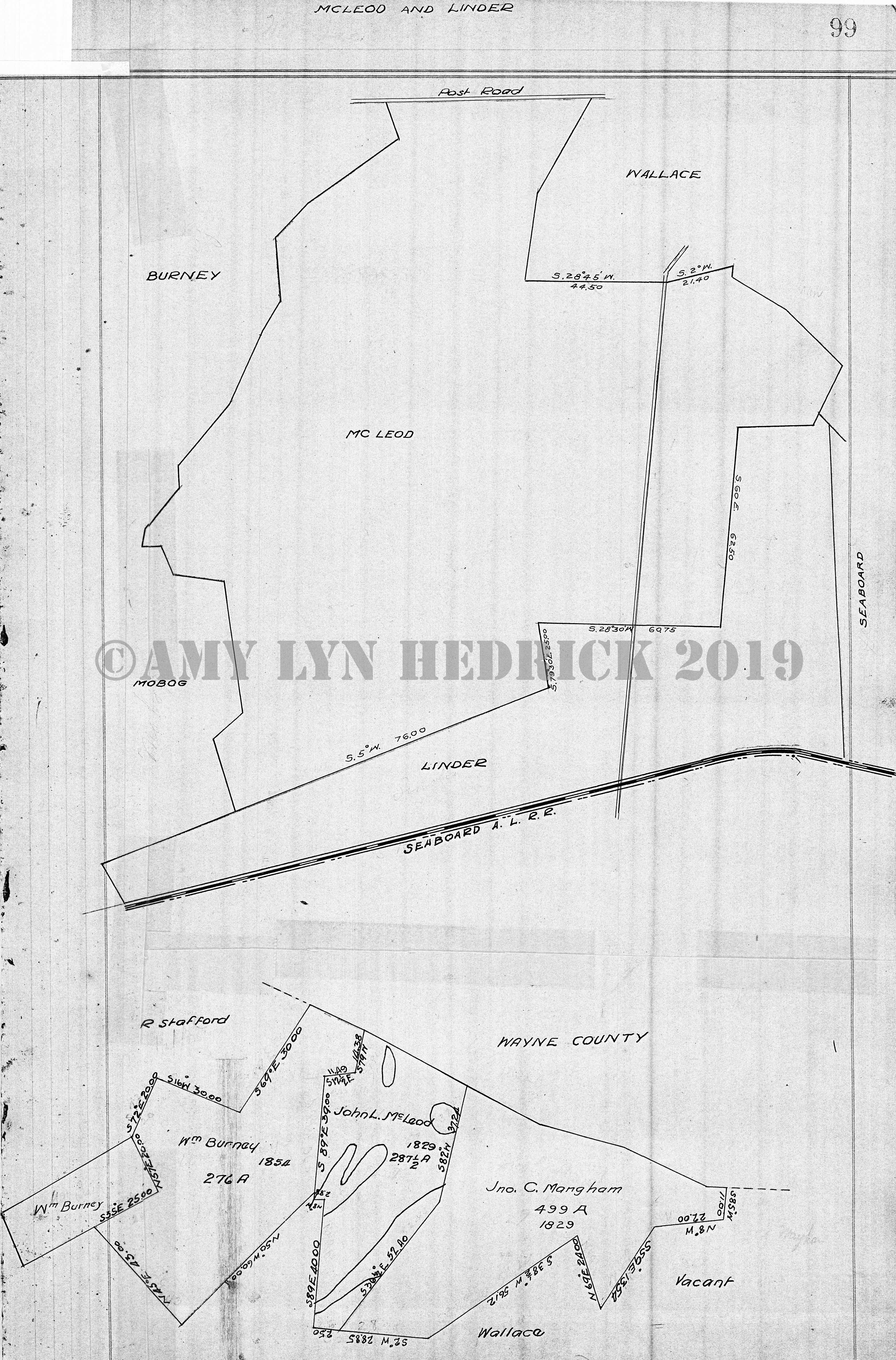
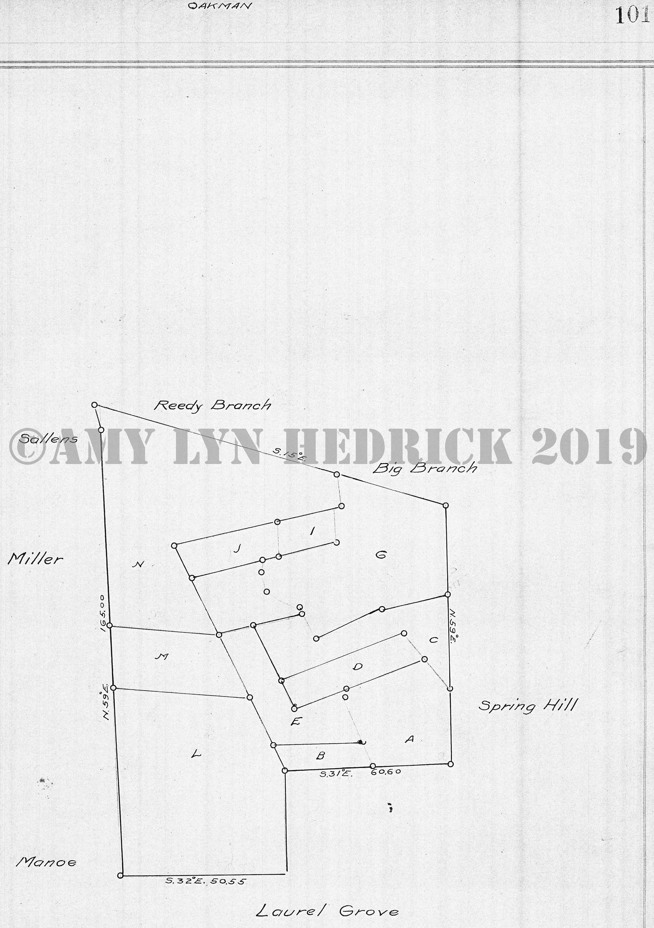
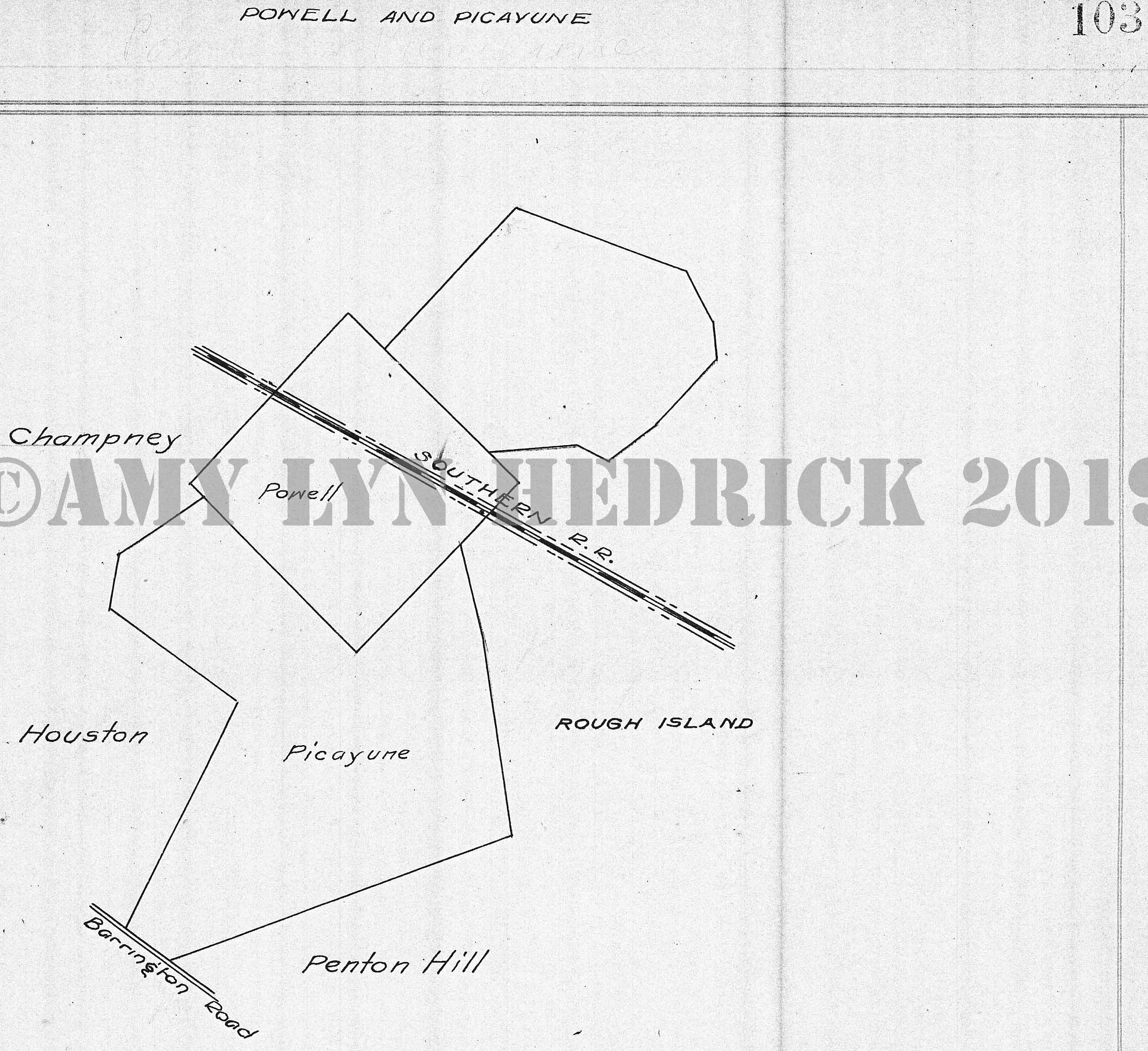
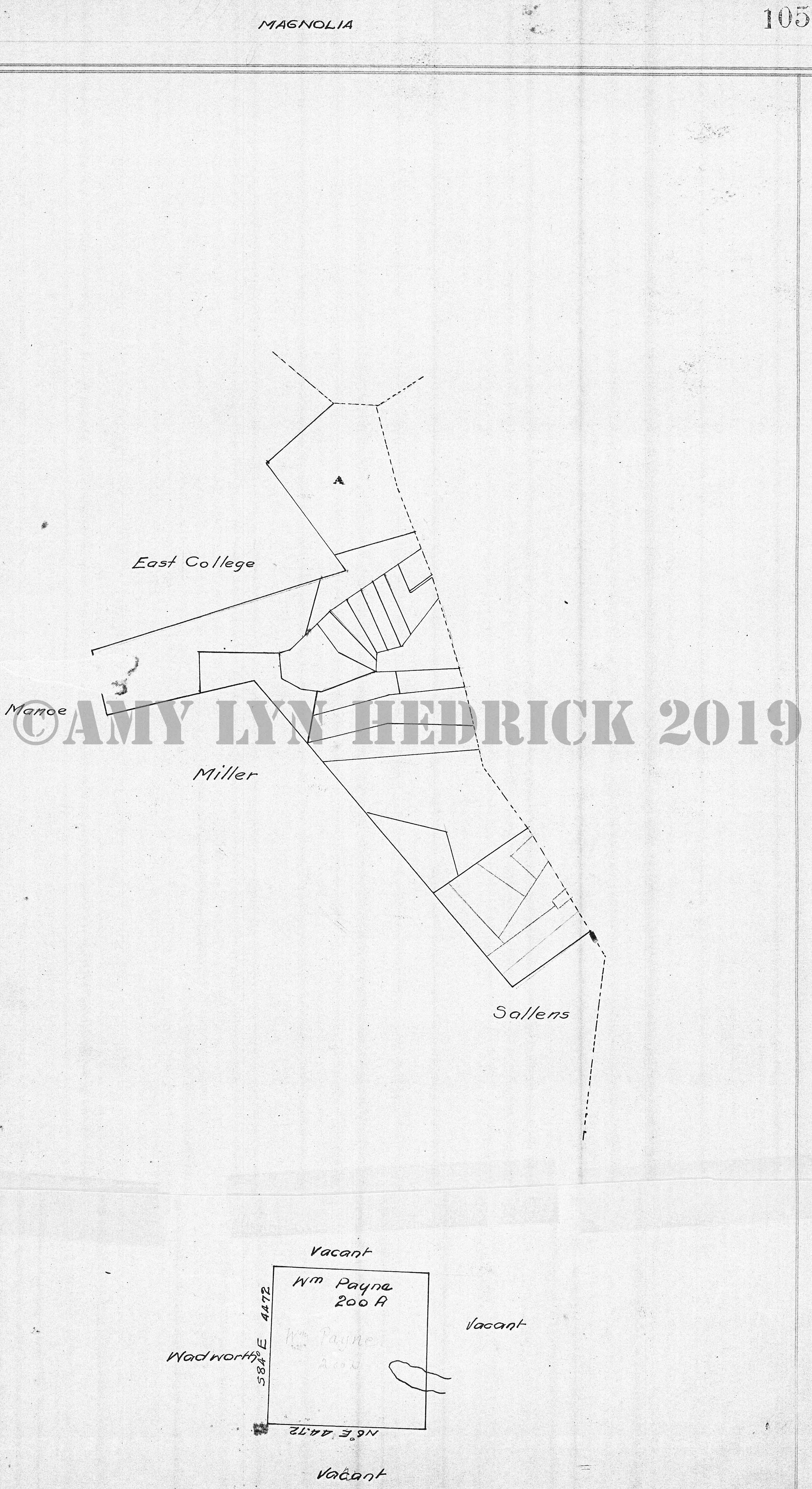
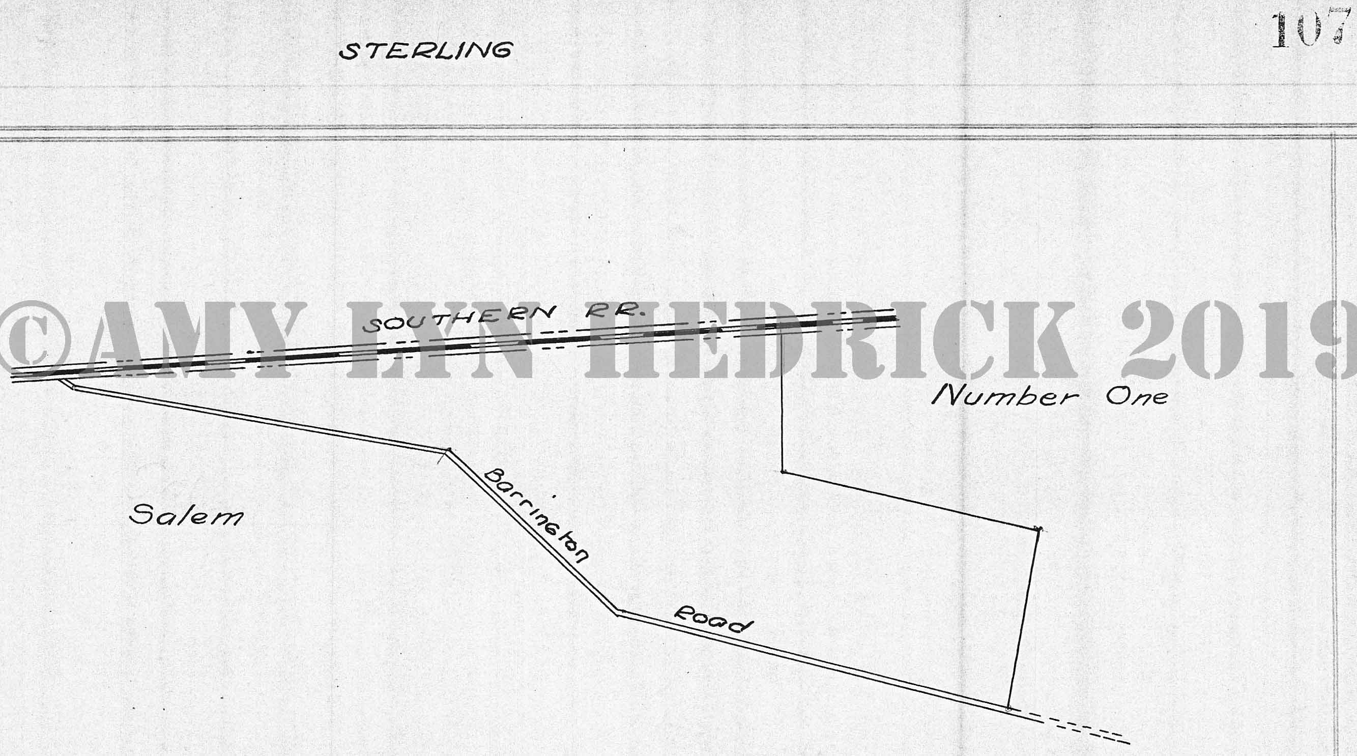
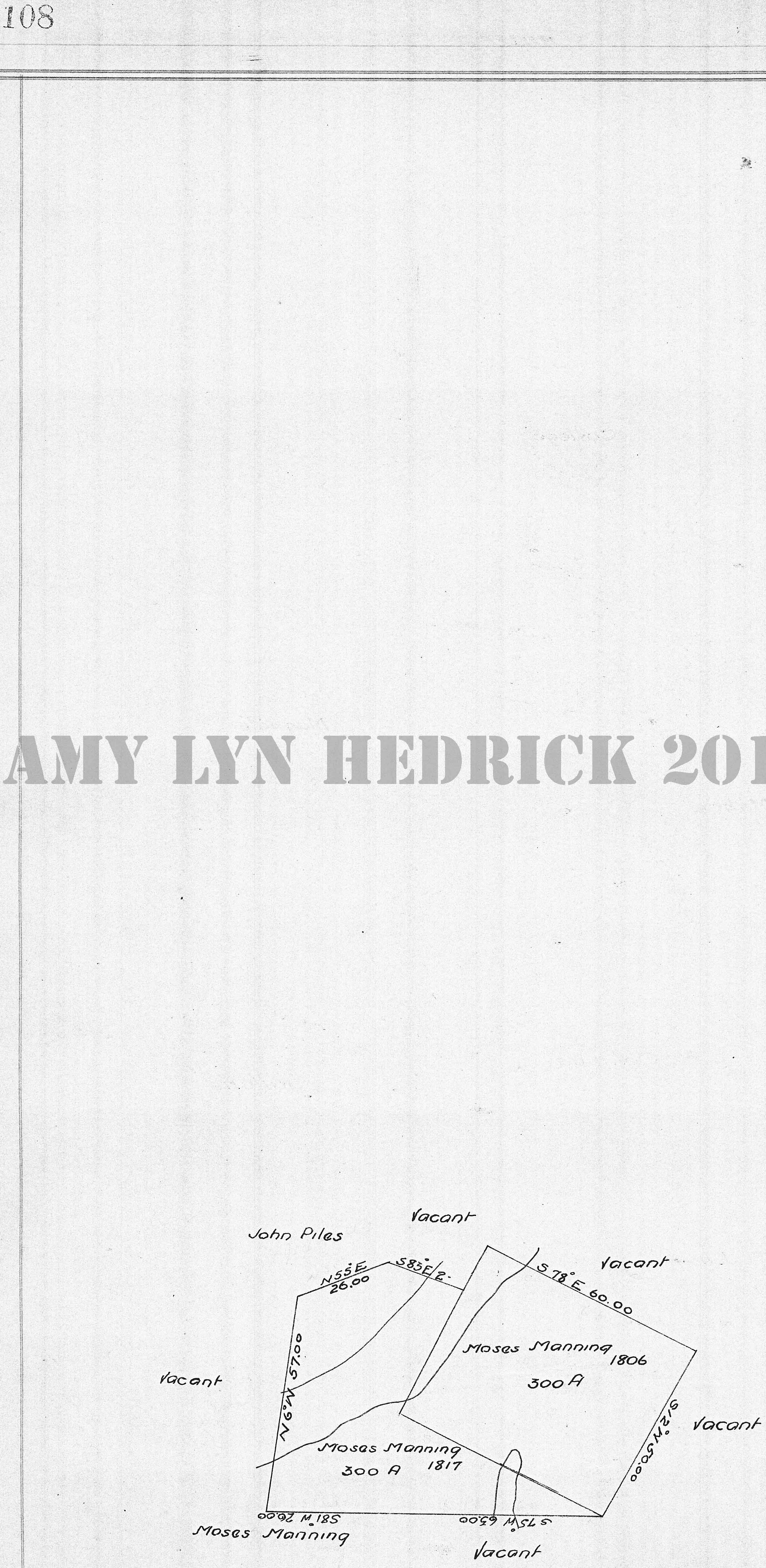
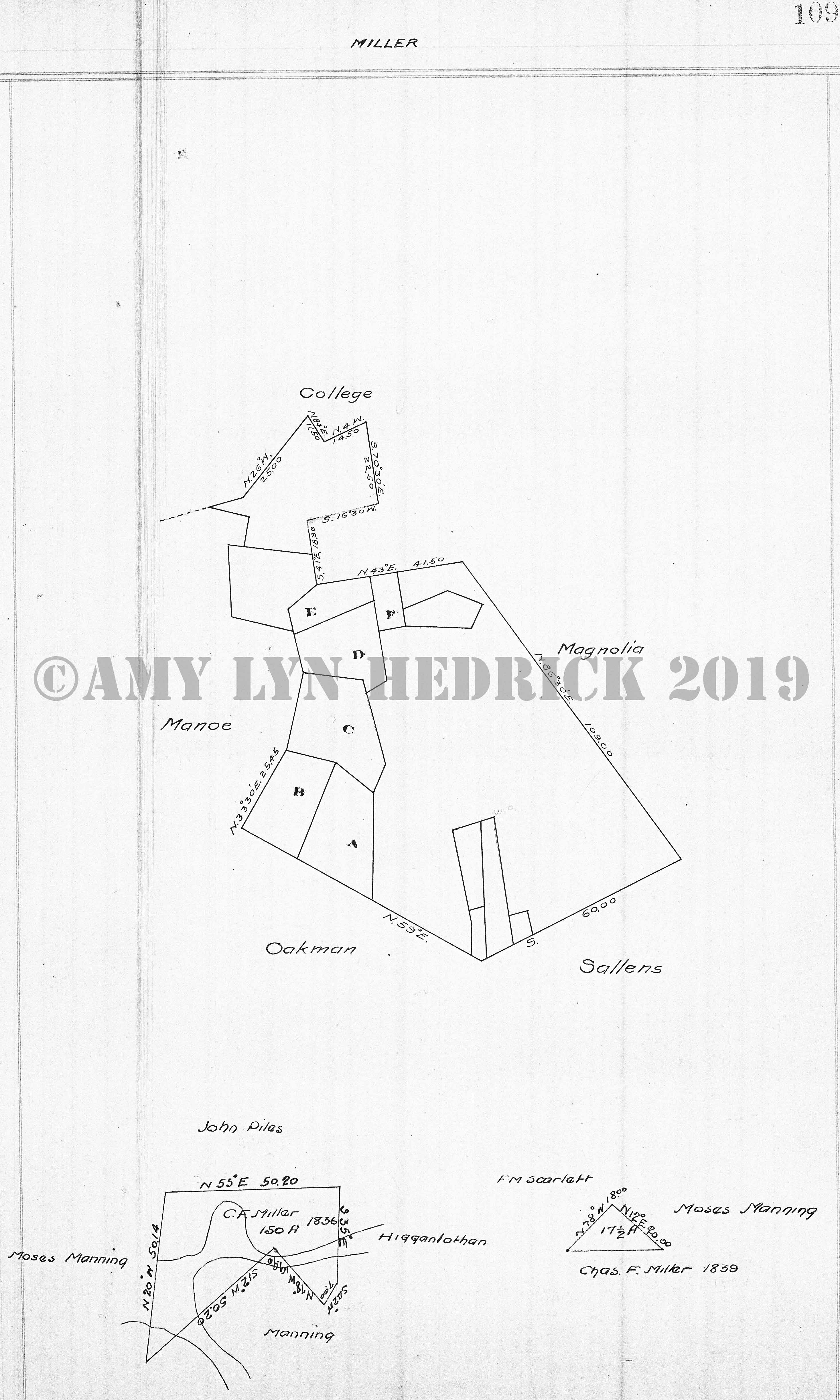
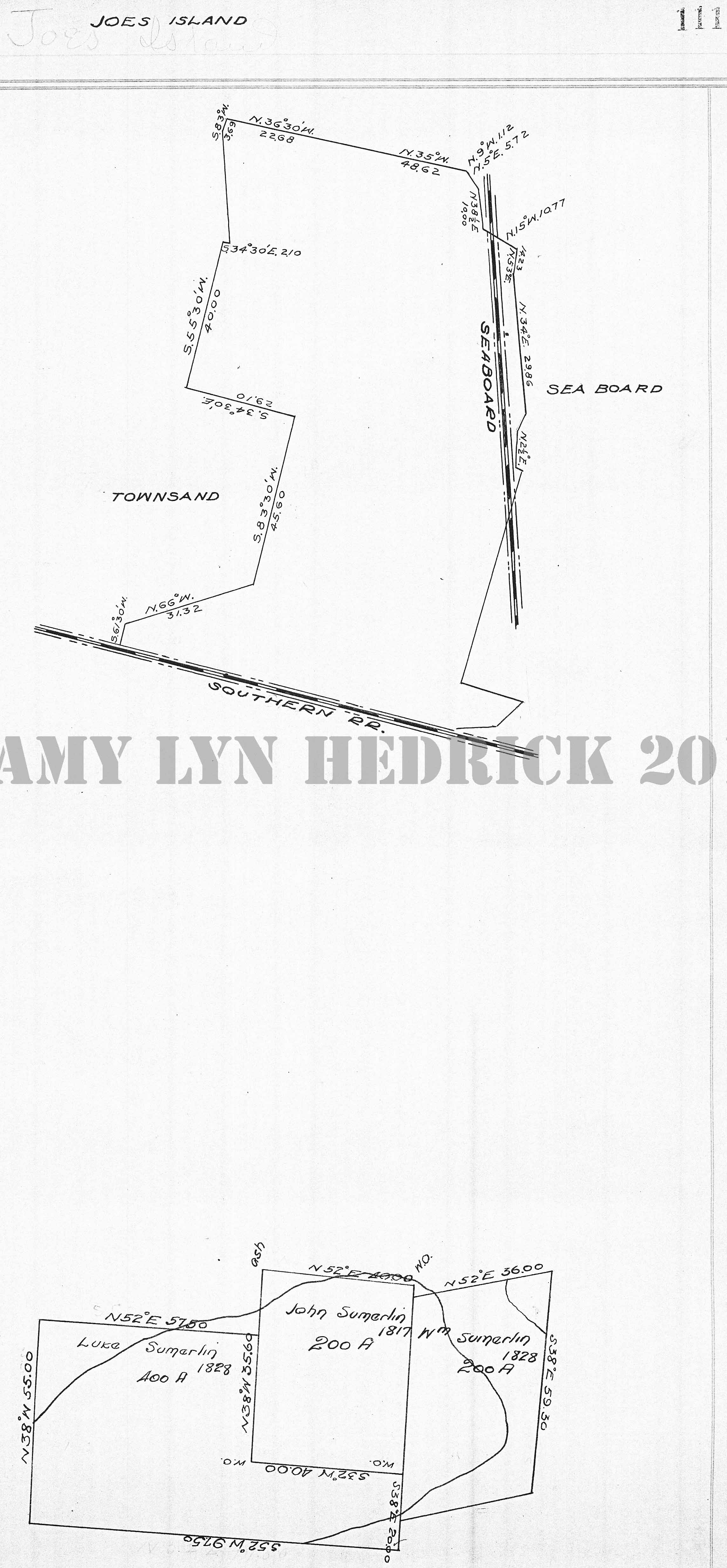
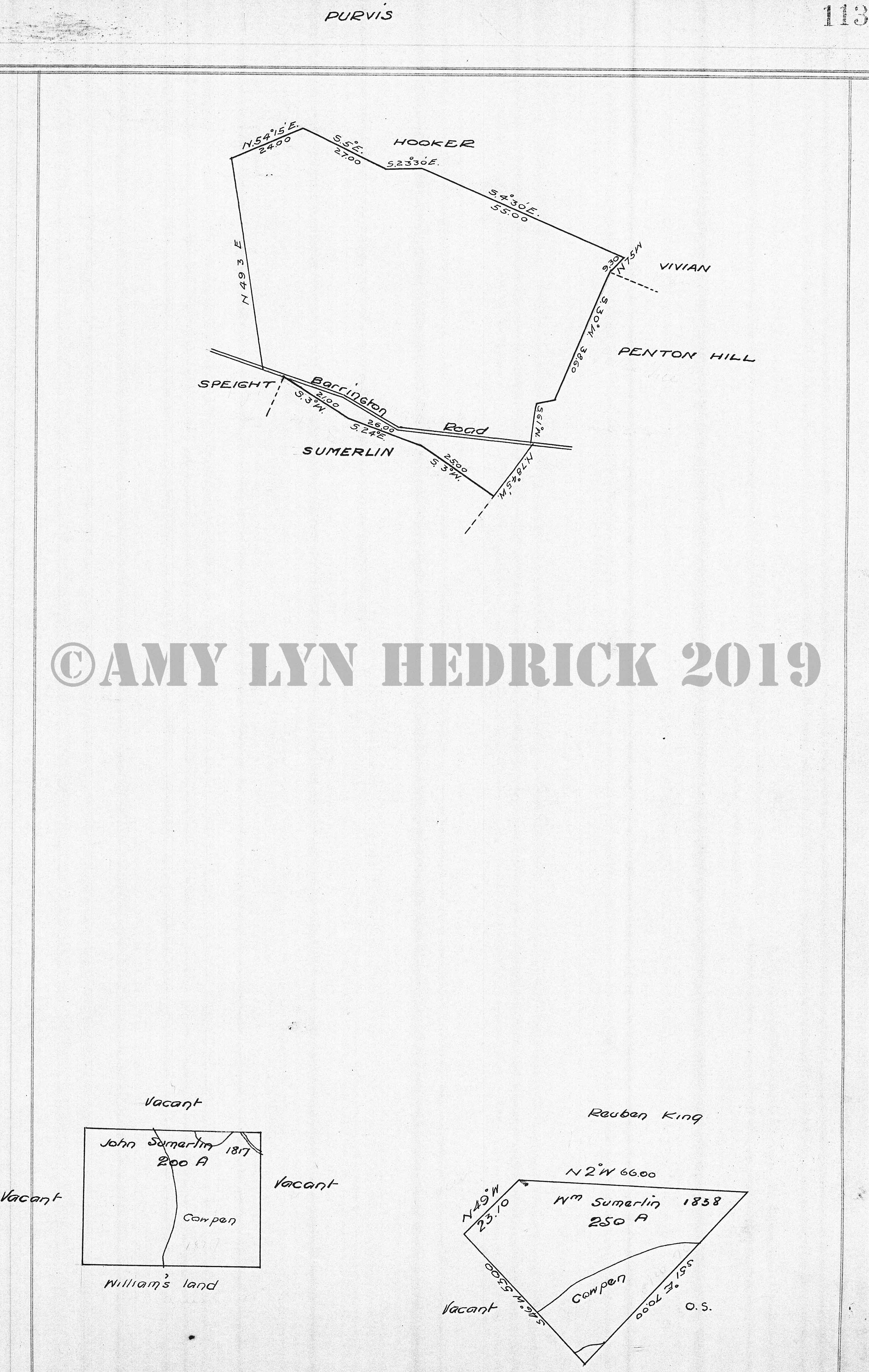
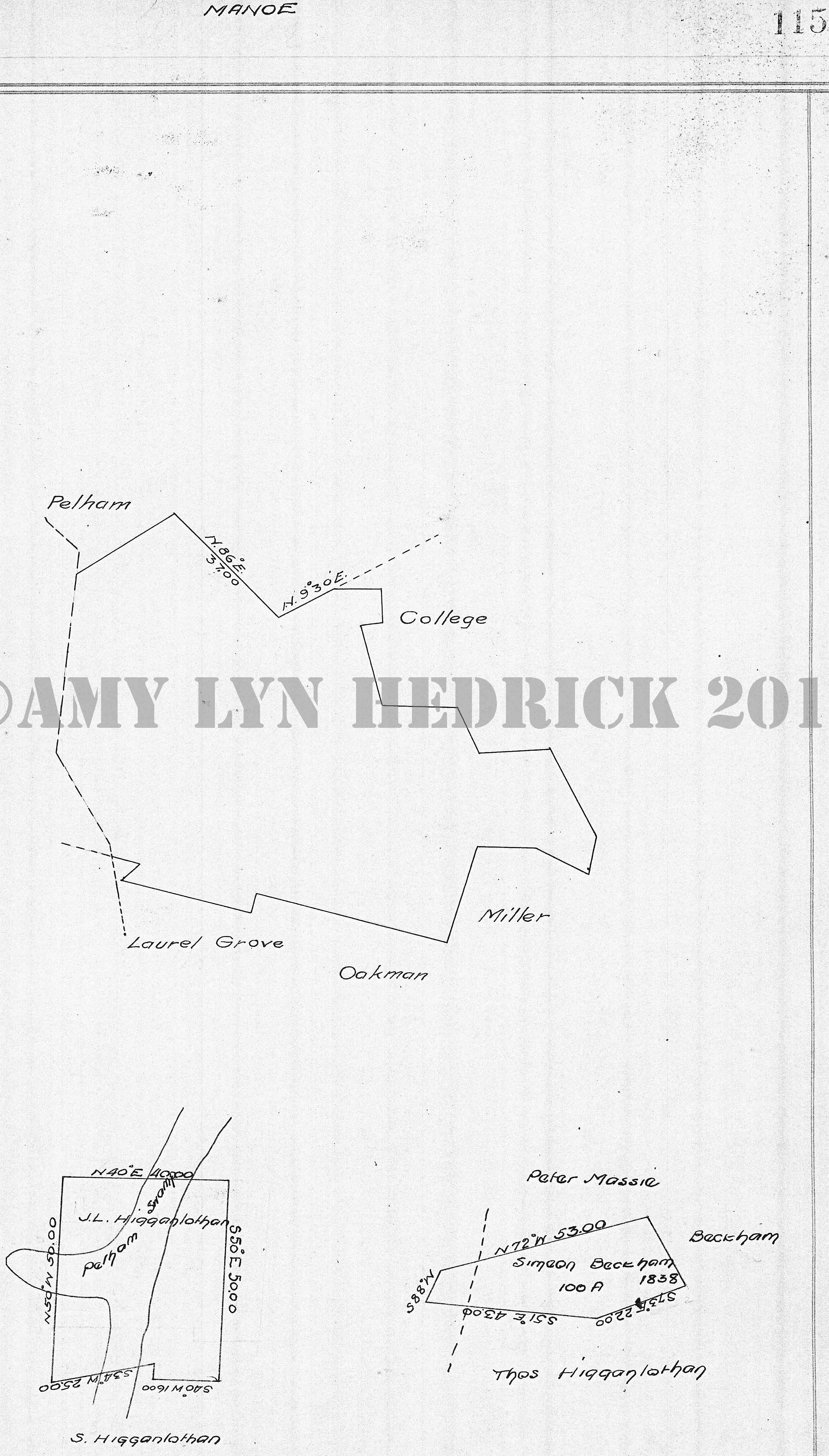
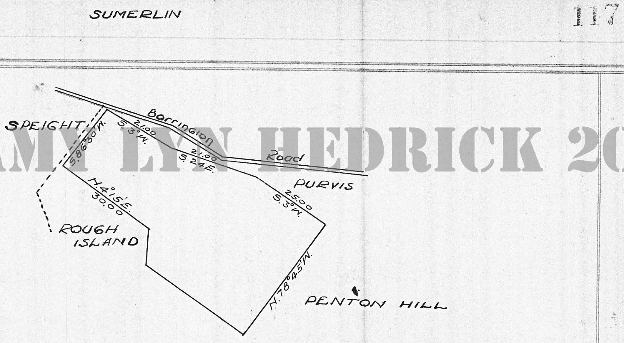
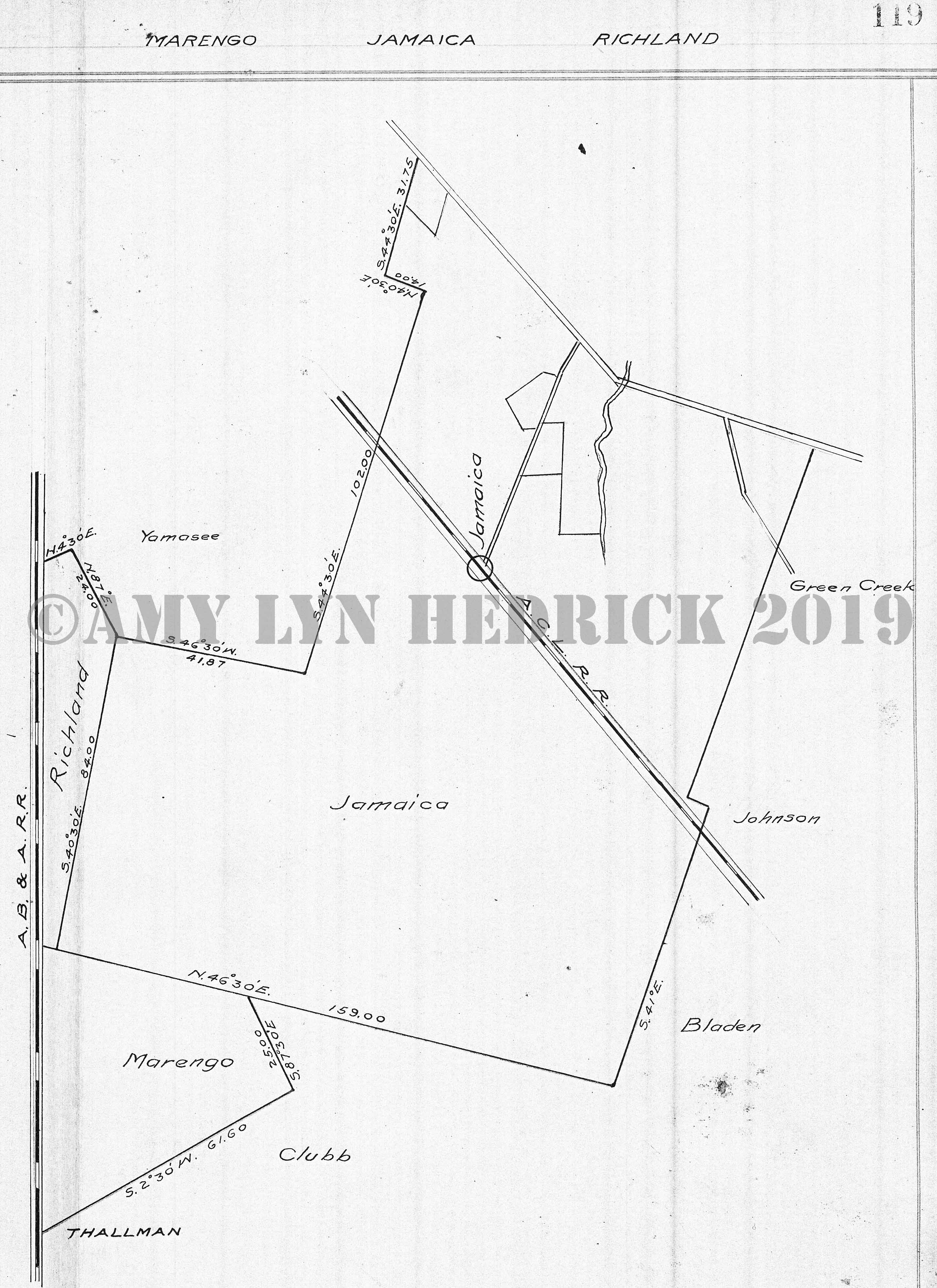
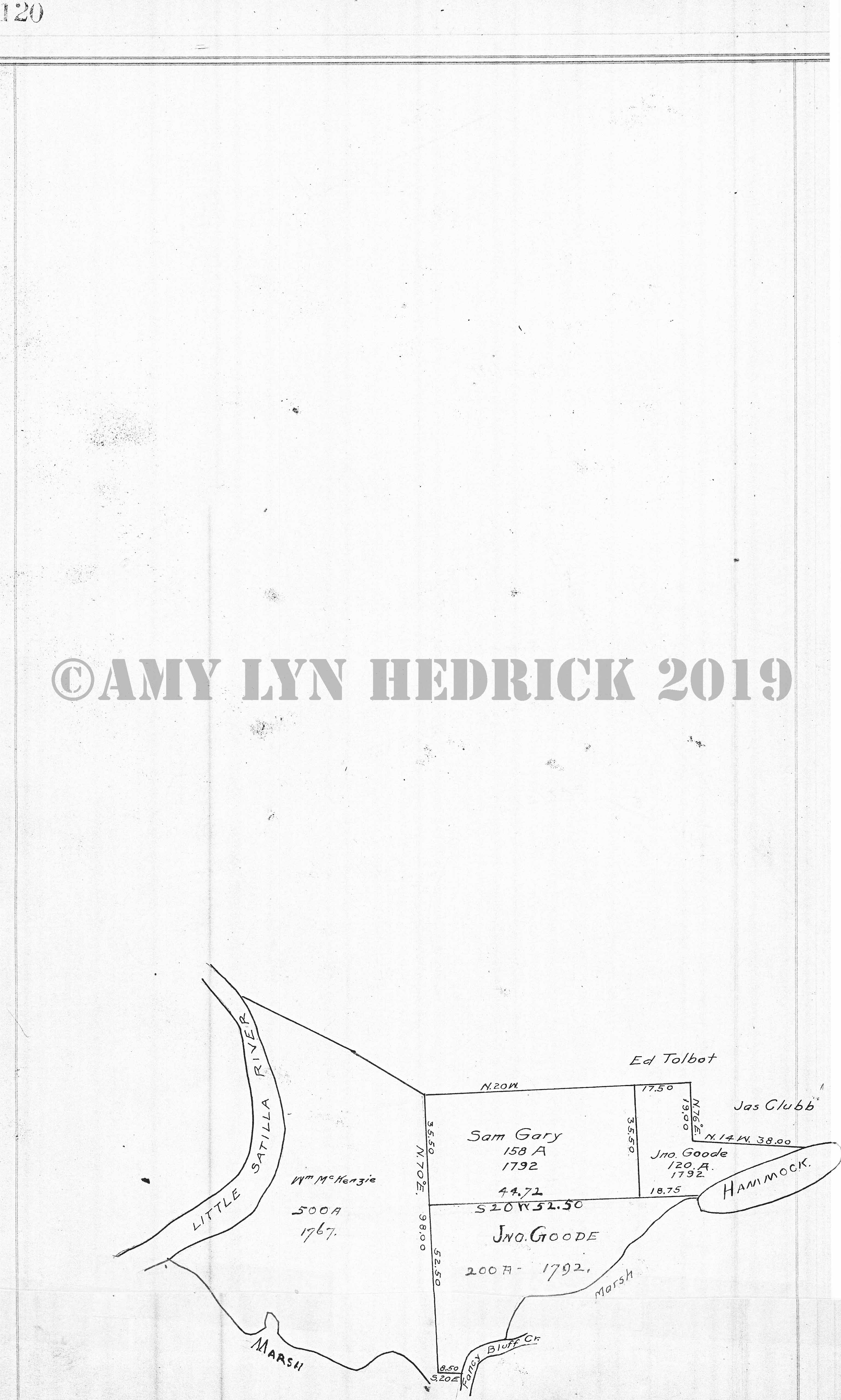
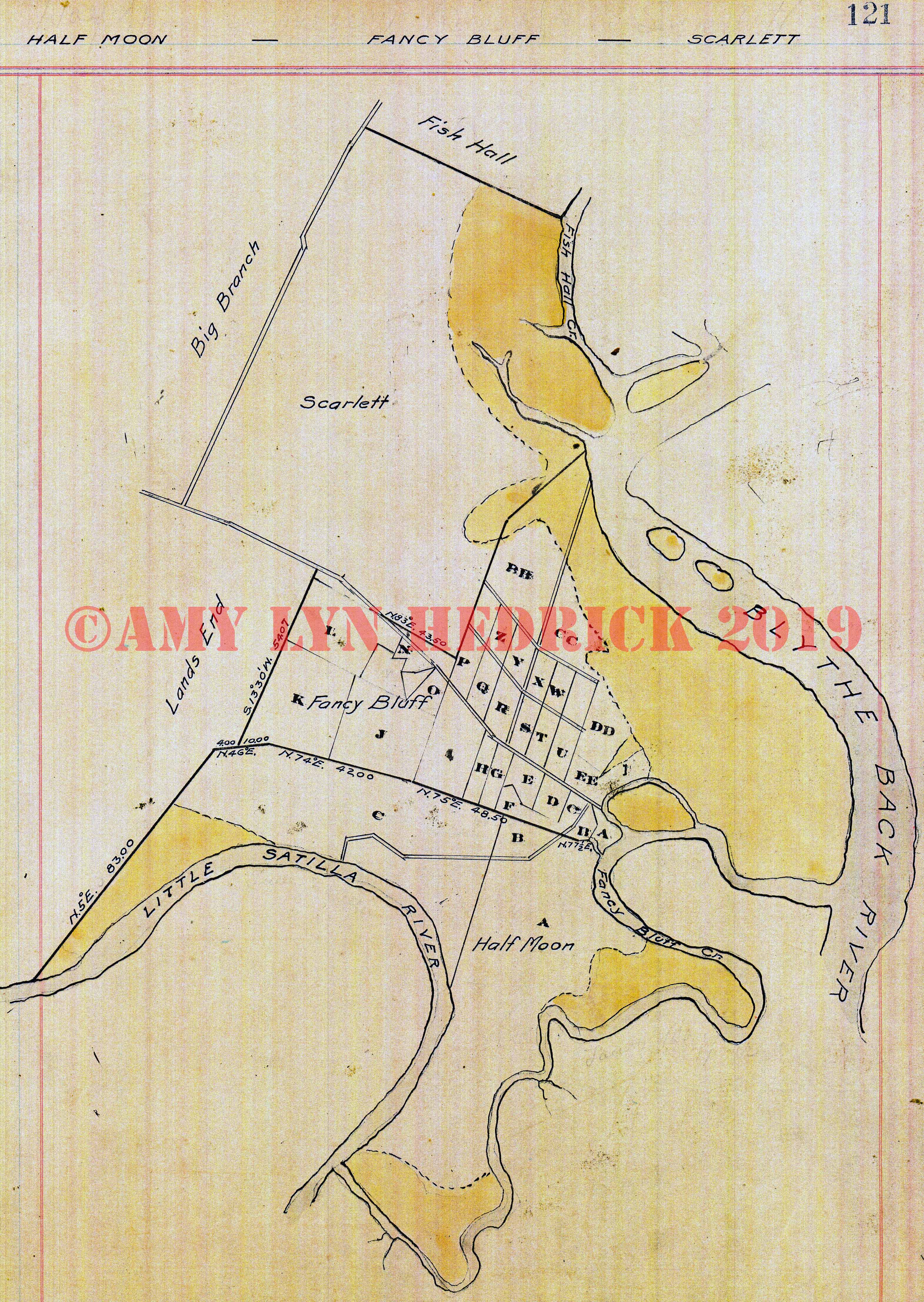
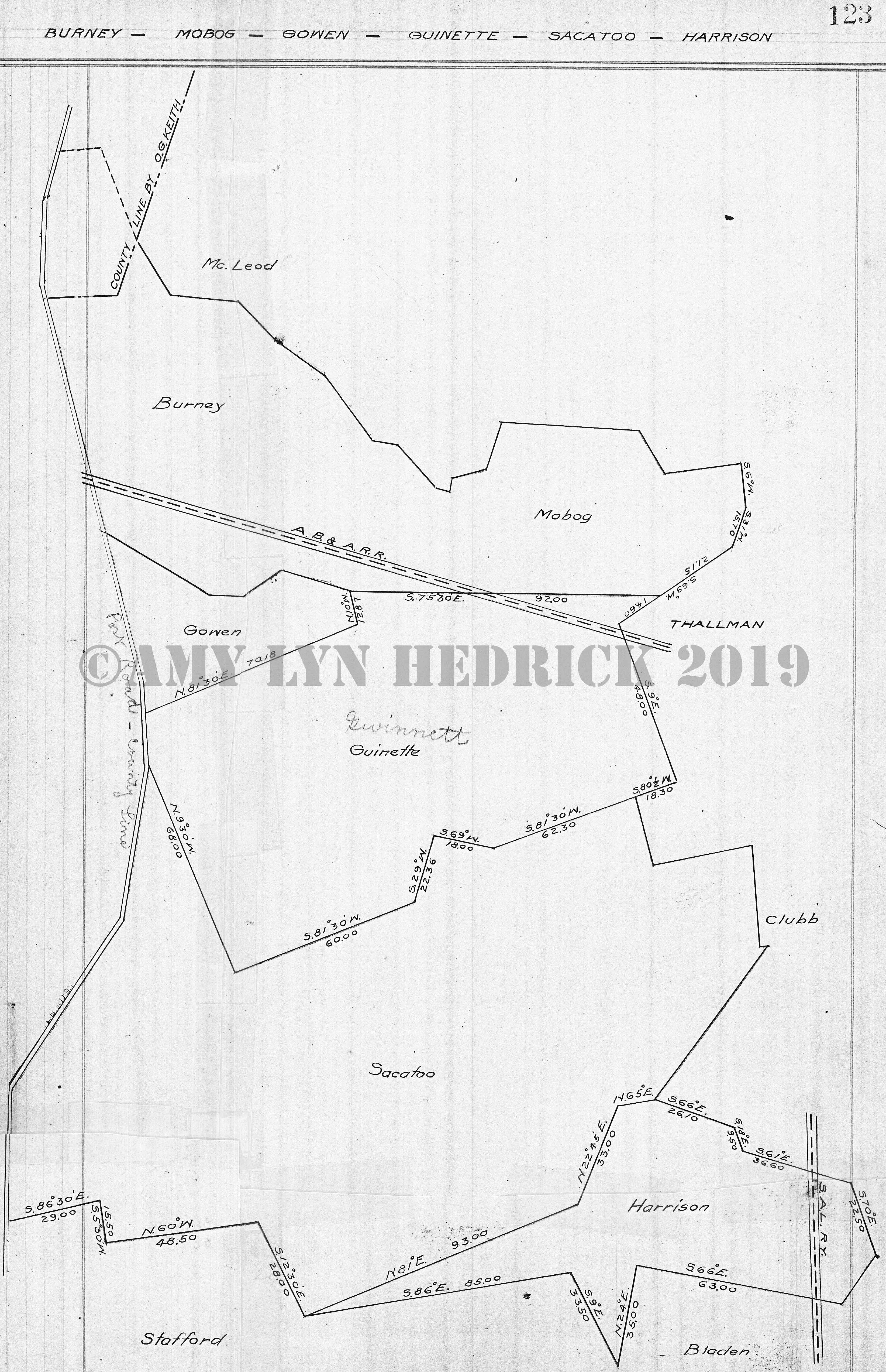
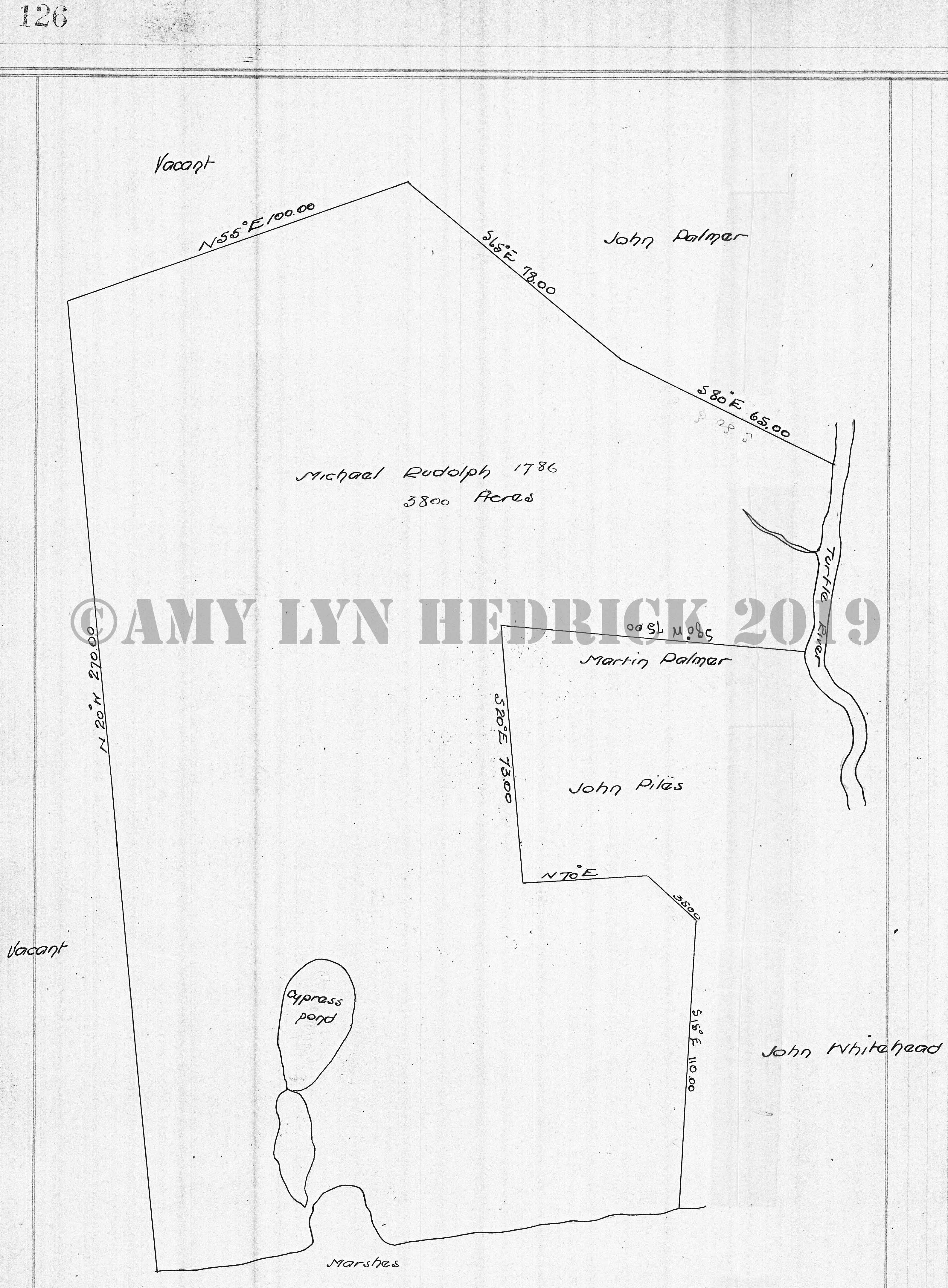
Page 64 Page 65 -- "Penton Hill" also: Picayune, Butler, Vivian, Purvis, Sumerlin, Rough Island, intersected by Barrington Road, Jas. McGriggor (1795), vacant on two sides, Geo. Purvis, Rich. Prichard, nothing listed on 3 sides, Helviston, David Penton (1818), nothing listed on surrounding sides Page 66 Page 67 -- "Vivian" also: Butler, Hooker, Purvis, Penton Hill, Geo. Purvis (1792), McGrigger, Gaines, Houston XIII, vacant, intersected by road to New Hope & Path Williamburg to Burnett, not named, vacant, Gaines, Purvis, Pritchard, Wm. Houston (1796), vacant on two sides, Gaines, intersected by path Williamburg to New Hope, Rolling Williams (1837), Gaines on two sides, vacant on two sides, Moses Hornsby, Palmer, May XIII, May, Williams Page 68 -- "No Title" also: James May (1819), Huston, vacant, O.S. (not sure what that means), Fowler, vacant, Huston, intersected by Barrington Road Page 69 -- "Butler" also: Du Pree, Summer Place, Middleton, Honey Gall, Vivian, Penton Hill, Barrington Road, Houston, Franklin, Bonner, Geo. Street (1819), Yeoman, John Honesby, Honesby XIII, O.S. (not sure what this means), May, John Honesby (1819), George Street, Middleton, Jone Honesby, Fred Yeoman (1819), Vacant, Street's XIII, Geo. Street, May, Wm. Huston, Huston's XIII, O.S. (not sure what that means) Page 70 Page 71 -- "Houston" also: Champney, Franklin, Butler, Picayune, Wm. Huston (1817), vacant on two sides, crossed by Cowpen, Wm. Huston (1819), Wm. Huston, Yeoman, Mays, vacant land, intersected by Barrington Road Page 72 Page 73 -- "Franklin & Champney" also: Picayune, Powell, Southern railroad, Bonner, Butler, Houston, intersected by Barrington Road, John Franklin (1829), intersected by Gum Branch & Honey Gall, vacant on two sides, Huston, Jno. Flynn, Wm. Houston, crossed by Barrington Road, John Franklin, Sr. Page 74 Page 75 -- "Thallman" also: Clubb, Mabog, Guinett (Gwinnett), Sacatoo, Harrison, Bladen, Jamaica, Marengo, Townsend, intersected by AB&A and SAL railroad, Isaac McCrary (1836), Jas. G. Pepper (1824), Boyd, Wooley, Moore, Franklin, B. Nichilau (Nicolau), B. Nicolau, McLeod, Boyd, intersected by a road "Wooley's to Green" and "To Nocolau's" Page 76 Page 77 -- "Flat Branch & lark's Bluff" also: DeWitt, Hooker, Altamaha River, Rump (as spelled), Sheffield, May, intersected by Barrington Road Page 78 Page 79 -- "Rumph" also: Foreman, Sheffield, Flat Branch, Altamaha River, SAL railroad, Waylay, Daniel Bell (1811), Rich'd Bryan (1810), Flat Branch, Vacant land on two sides, insert of Wm. Bryan (1800), River Swamp Page 80 Page 81 -- "Waylay" also: Everett, SAL railroad, New Barrington Road intersecting land w/Akin railroad, Old Barrington Road, Wayne County Page 82 -- "No Title" also: David Rumph, intersection by Brunswick to Ft Barrington Road, Rich'd Bryan, Wm. Bryan, Sr., Altamaha River, Ab Bryan, Wm. Bryan, no name, Jacob Wood, Richard Bryan, David Rumph, Altamaha River, Wm. Bryan, Ab Bryan (1813), Jacob Wood, Wm. Bryan, Wm. Bryan (1779), Vacant, Altamaha River, intersected Brunswick Road, Wood, Page 83 -- "No Title" also: square with 1826, vacant on all sides, intersected by Waylay Swamp, Pendarvis, Glover Foreman (1852), John R. Rumph, James M. Bryan, F. O'Sullivan, Jacob Rumph Page 84 Page 85 -- "Akin" Arnett, Everett, Southern railroad, Wayne County, Arnett, intersected by Mt. Pleasant Road Page 86 Page 87 -- "Everett & Red Hammock" also: Sea Board, Joe's Island, Foreman, Waylay, Akin, Arnett, intersected with SAL & Southern railroad, John R. Rumph (1853), vacant, Foreman on two sides Page 88 Page 89 -- "Arnett" also: Akin, Wayne County, Post Road, Tucker, Seaboard, Red Hammock, Bailey Forrester, Sherrod Sheffield (1837), only border Post Road Page 90 Page 91 -- "Tucker" also: Post Road, Bowling Green, Sea Board, Arnett, Robt. H. Green (1836) w/a square inside that says E.R. Tucker (1825), Wayne County boarder Post Road, B.H. Reynolds, E.R. Tucker, Wayne County Page 92 Page 93 -- "Bowling Green" also: Post Road, Popwell, Sea Board, Tucker, B.H. Reynold (1836) w/a square inside that says "Greene Bowling" and Sand Hill Bay, Wm. Burney, Robt. Alston, Robt. H. Green, Post Road Page 94 Page 95 -- "Seaboard" also: Linder, Seaboard AL railroad, Joe's Island, Arnett, Tucker, Bowling Green, Popwell Page 96 -- "No Title" also: Robert Alston (1836), John W.L. Daniels, Robt. Mickeljohn, E.R. Tucker, B.H. Reynolds, John W.L. Daniels (1836), Henry W. Malone, Robt. Micklejohn, Robt. W. Alston, John C. Sumerlin, H. Summerlin (1852), vacant on 3 sides, H. Summerlin, Robt. Mickeljohn (1836), W. Summerlin, U. Dart, Sawyer & Tucker, Alston, Daniels, Malone Page 97 Page 98 Page 99 -- "McLeod & Linder" also: Post Road, Burney, Mobog, Seaboard AL railroad, Seaboard lands, Wallace, Wm. Burney (1854), John L. McLeod (1829), Jno C. Mangham (1829), R. Stafford, Wallace, vacant, Wayne County Page 100 Page 101 -- "Oakman" also: Reedy Branch, Miller, Manoe, Laurel Grove, Spring Hill, Big Branch Page 102 Page 103 -- "Powell & Picayune" also: Southern railroad, Champney, Houston, Barrington Road, Penton Hill, Rough Island Page 104 Page 105 -- "Magnolia" also: East College, Miller, Sallens, Wm. Payne, vacant on 3 sides, Woodworth Page 106 Page 107 -- "Sterling" also: Southern railroad, Salem, Barrington Road, Number One Page 108 -- "No Title" also: Moses Manning (1817), Moses Manning (1806), vacant, John Piles, vacant, Moses Manning, vacant on all other sides Page 109 -- "Miller" also: College, Manoe, Oakman, Sallens, Magnolia, C.F. Miller (1836), John Piles, Moses Manning, Manning, Higinbotham Chas. F. Miller (1839), F.M. Scarlett, Moses Manning Page 110 Page 111 -- "Joe's Island" also: Townsend, Southern railroad, Sea Board line, Luke Sumerlin (1828), John Sumerlin (1817), Wm. Sumerlin (1828) Page 112 Page 113 -- "Purvis" also: Hooker, Speight, Sumerlin, Penton Hill, Vivian, intersected by Barrington Road, John Sumerlin (1817), vacant on 3 sides, William's land, Wm. Sumerlin (1838), Reuben King, vacant, O.S. (not sure what this means) Page 114 Page 115 -- "Manoe" also: Pelham, Laurel Grove, Oakman, Miller, College, J.L. Higginbotham, intersected by Pelham Swamp, S. Higginbotham, Simeon Beckham (1838), Peter Massie, Thos. Higginbotham, Beckham Page 116 Page 117 -- "Sumerlin" also: Speight, Rough Island, Penton Hill, Purvis, Barrington Road Page 118 Page 119 -- "Marengo, Jamaica, Richland" also: Yamasee, AB&A railroad, Thallman, Clubb, Bladen, Johnson, Green Creek, intersected by ACL railroad Page 120 -- "No Title" also: Wm. McKenzie (1767), Sam Gary (1792), Jno. Goode (1792), John Goode (1792), Ed Tolbot, Little Satilla River, marshes, James Clubb Page 121 -- "Half Moon, Fancy Bluff, Scarlett" also: Fish Hall, Big Branch, Lands End, Little Satilla, Fancy Bluff Creek, Blythe Back River, Fish Hall Creek Page 122 Page 123 -- "Burney, Mobog, Gowen, Guinette (Gwinnett), Sacatoo, Harrison" also: McLeod, Wayne County line as Post Road, Stafford, Bladen, SAL railroad, Clubb, Thallman, AB&A railroad intersects part of the property Page 124 Page 125 Page 126 -- "No Name" also: Michael Rudolph (1786), vacant on two sides, marshes, John Whitehead, John Piles, Martin Palmer, Turtle River, John Palmer |
For now, I have
links to the images of the book; eventually, I will type in the subject
matter on each page so you won't have to click every single image to
find something. Many pages were blank in the book, I have still listed those pages here, they are just not hyperlinked to any image for obvious reasons. I have listed all the lands pictured on the pages by underlining the owner's name and also listing what surrounded their plat running counter-clockwise around the plat. It's a bit confusing, but, just remember, the underlined names are the plats pictured on that particular page. The years in parentheses is presumably an original grant date for that particular plat owner. Some names were grossly misspelled, one in particular that I corrected throughout was Higganlothan which was obviously Higginbotham and Townsand which should be Townsend. Other names that I know are misspelled I left as written. The 1911 Ballard Map book is located in Superior Court, Glynn County Georgia and was scanned by the Glynn County GIS office, however, they have yet to get it online for public access and have therefore allowed me to put it online in the interim. Thanks to Superior Court Clerk, Ronald Adams, I have been provided a copy of the GIS scans to put online so that the public has access to the book which is no longer in circulation at the courthouse. Further thanks to Andrew Strickland for providing the file and Marilyn Proper for running through the file and showing me how it works. Yes, it sounds "bad" that this book is not in circulation, however, the book is in a very delicate condition and the less handling the better; until a professional archivist can save it from complete destruction. In the meantime, the GIS office scanned the book in the best way they could. Many pages had to be Xeroxed in sections, taped back together, and then scanned because the book could not be taken apart in order to clean the pages and scan them properly. Other pages were already falling out of the book and could be scanned in their original format. Thus, you will see the majority of the pages here are in black and white while some are in color. Also, to save space, pages that only had data covering less than the whole page, have been cropped down to a smaller size instead of leaving them at their full page size. 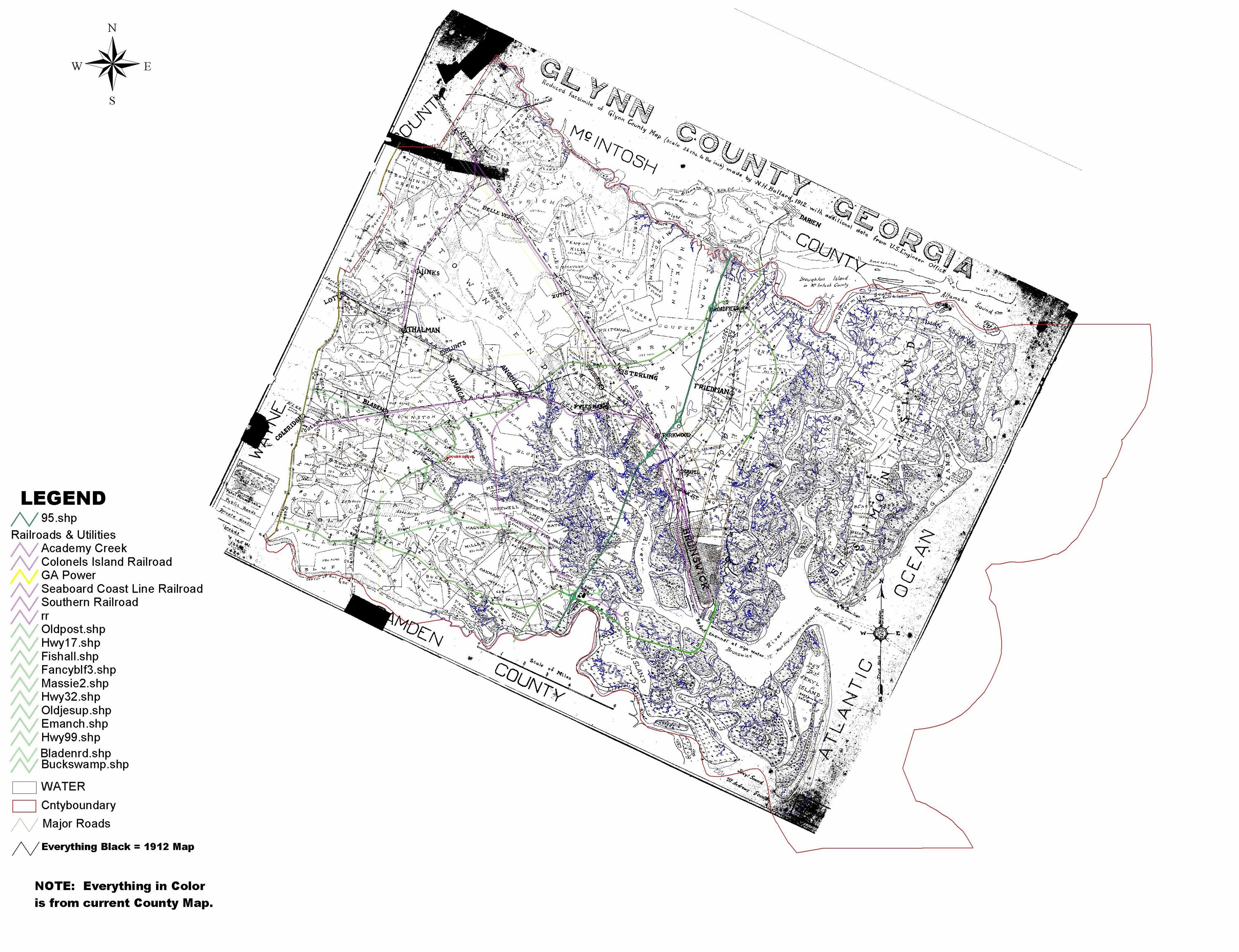 At
one point someone took all of the plats in this book and put them
together in one giant county map. Then, later, a GIS agent,
Chrissy McGranaham-Chapman, overlaid this map with current
highways. Keep in mind, this couldn't be done to scale, therefore, the
highways are layered in an approximation to the property locations
today. At
one point someone took all of the plats in this book and put them
together in one giant county map. Then, later, a GIS agent,
Chrissy McGranaham-Chapman, overlaid this map with current
highways. Keep in mind, this couldn't be done to scale, therefore, the
highways are layered in an approximation to the property locations
today.To read more about Nathaniel Hawyard Ballard, the surveyor and creator of this map, click here. In order to get the pages online, I had to reformat them into smaller files; therefore, if you want an original copy of a page, please email me directly and we will work out a way to get a copy delivered. |
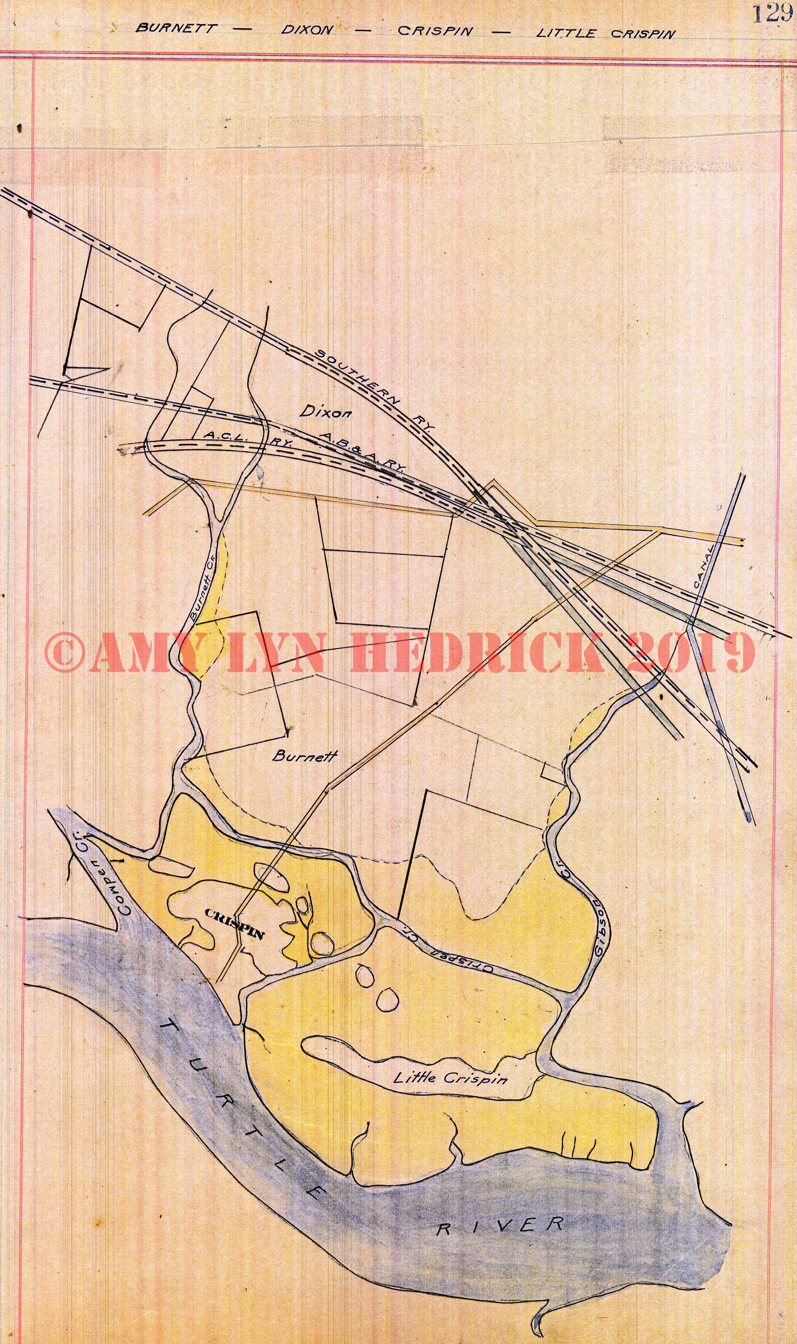
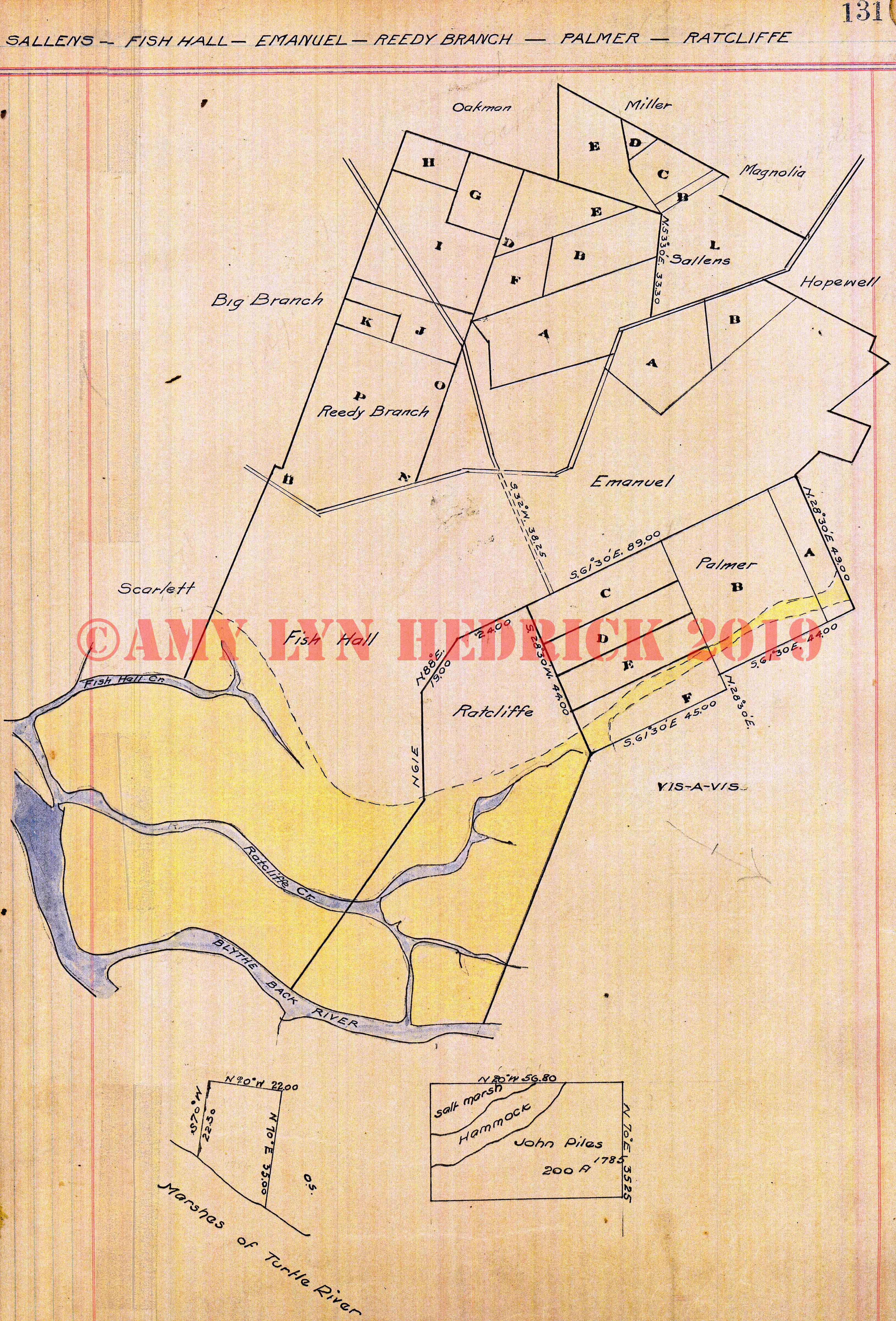
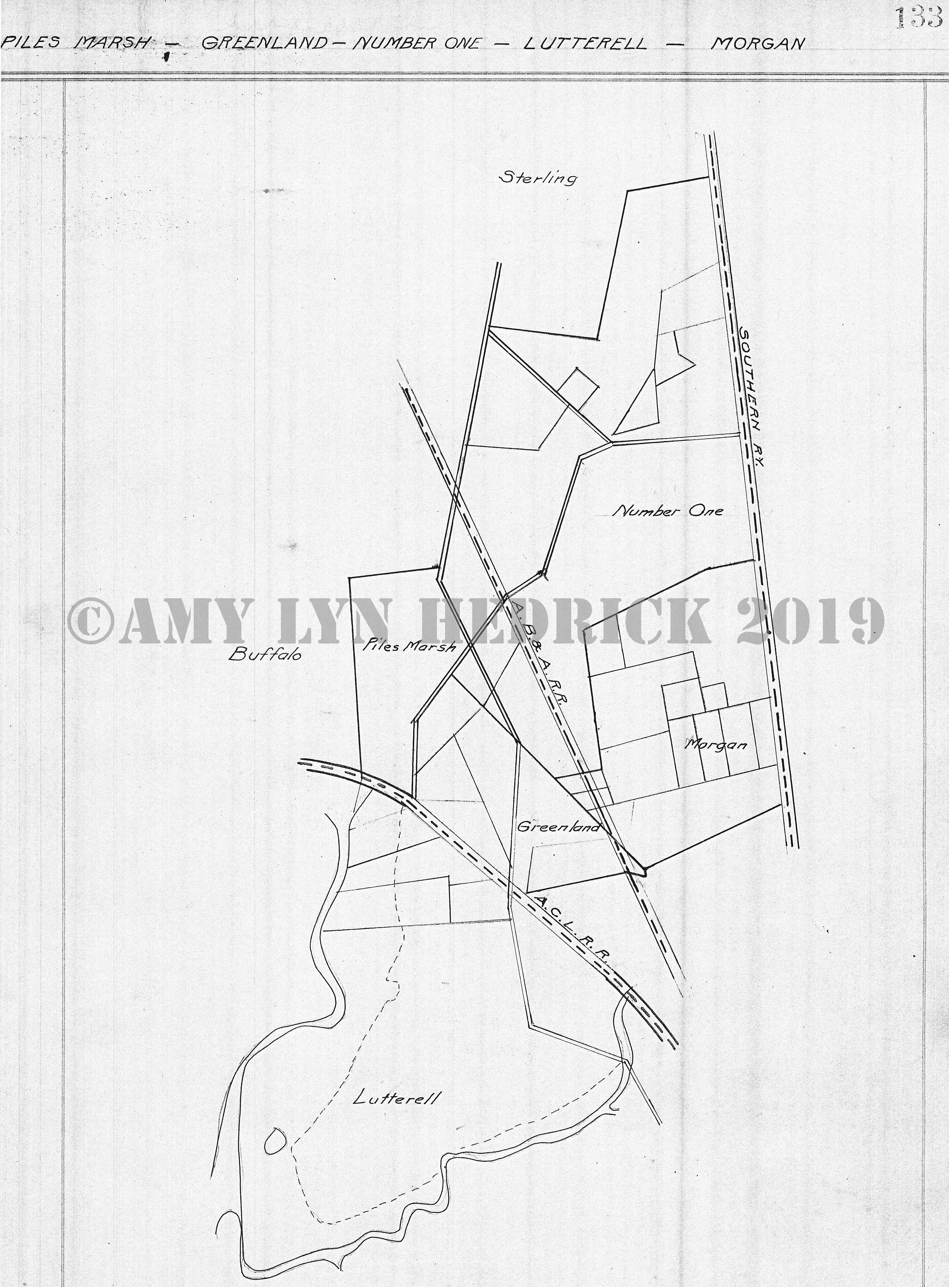
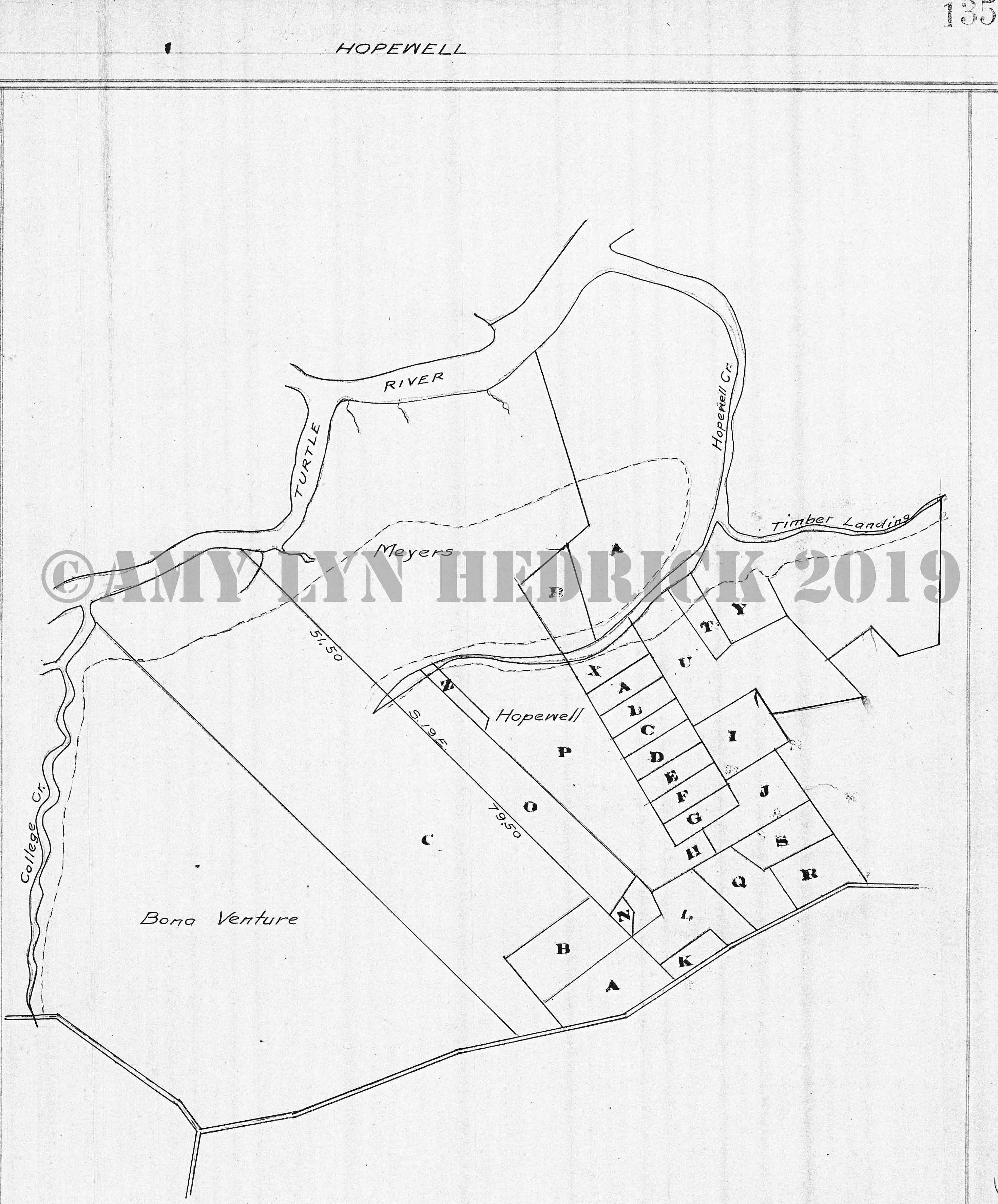
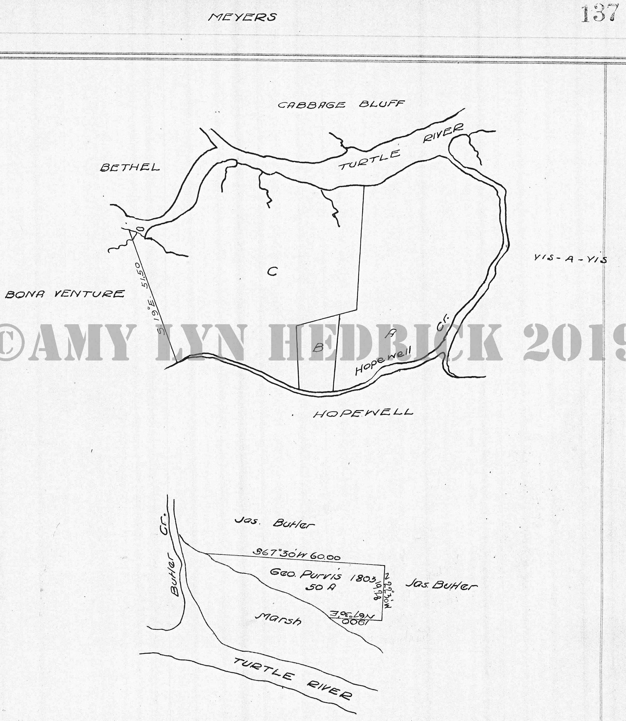
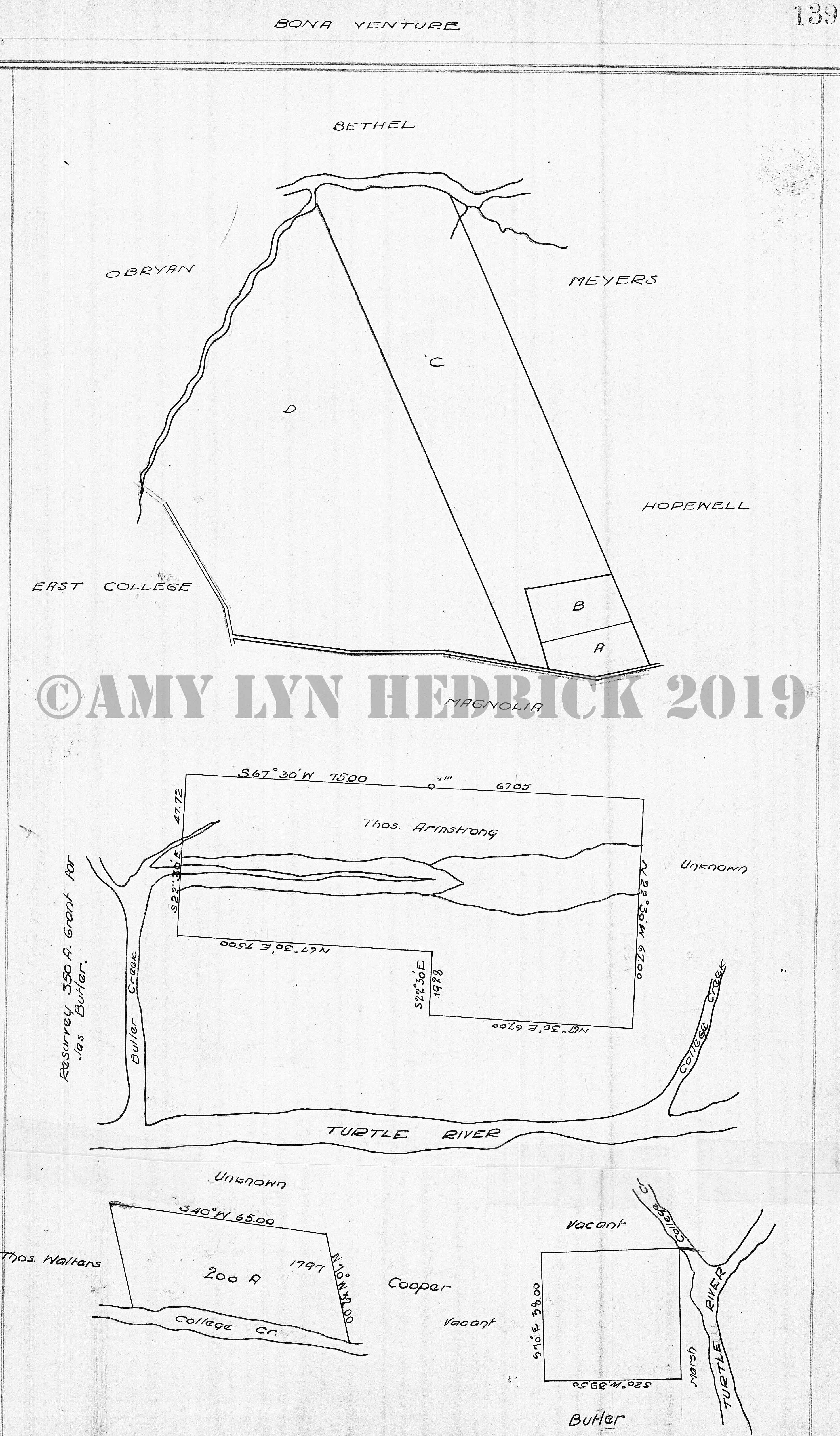
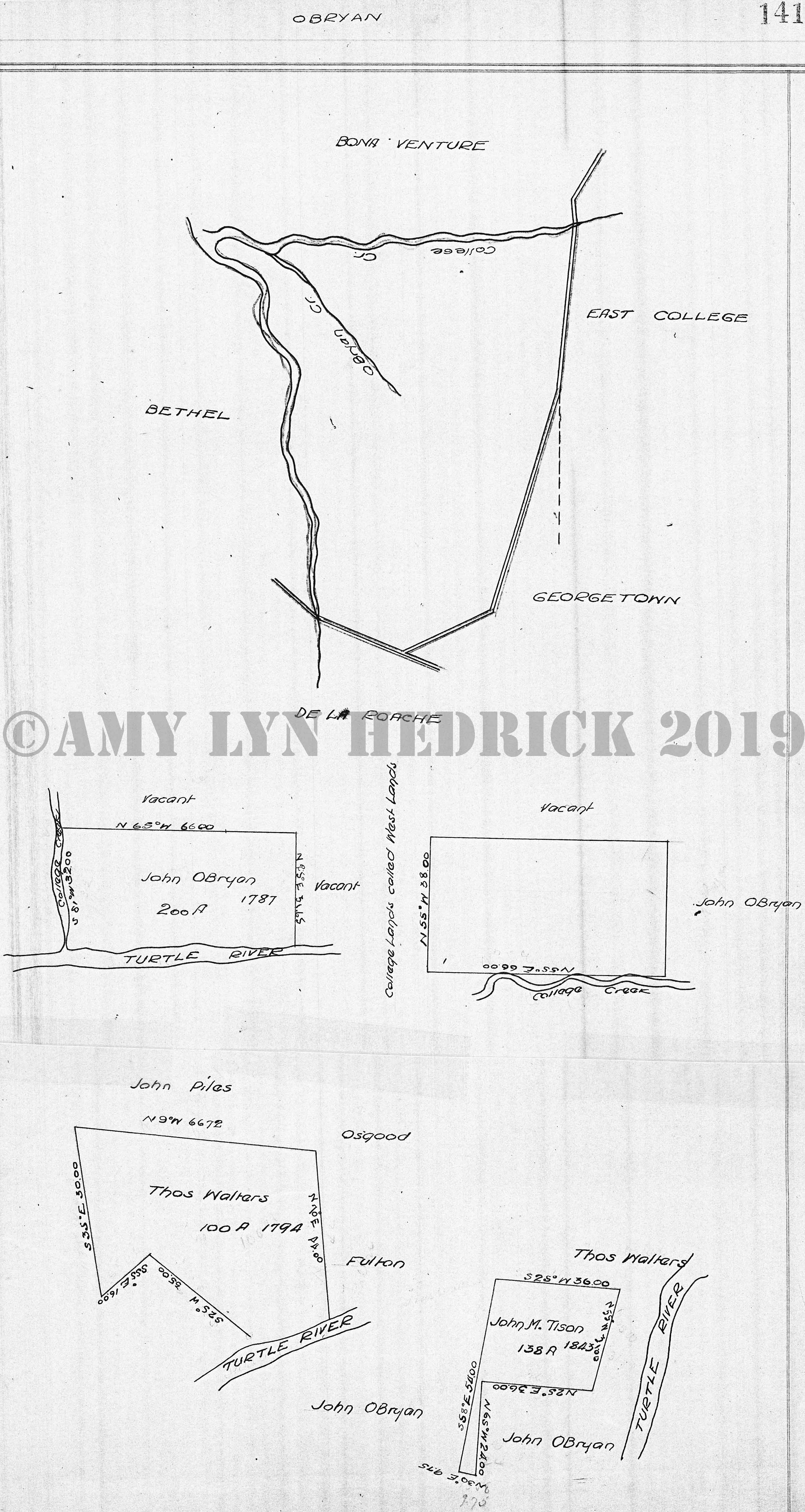
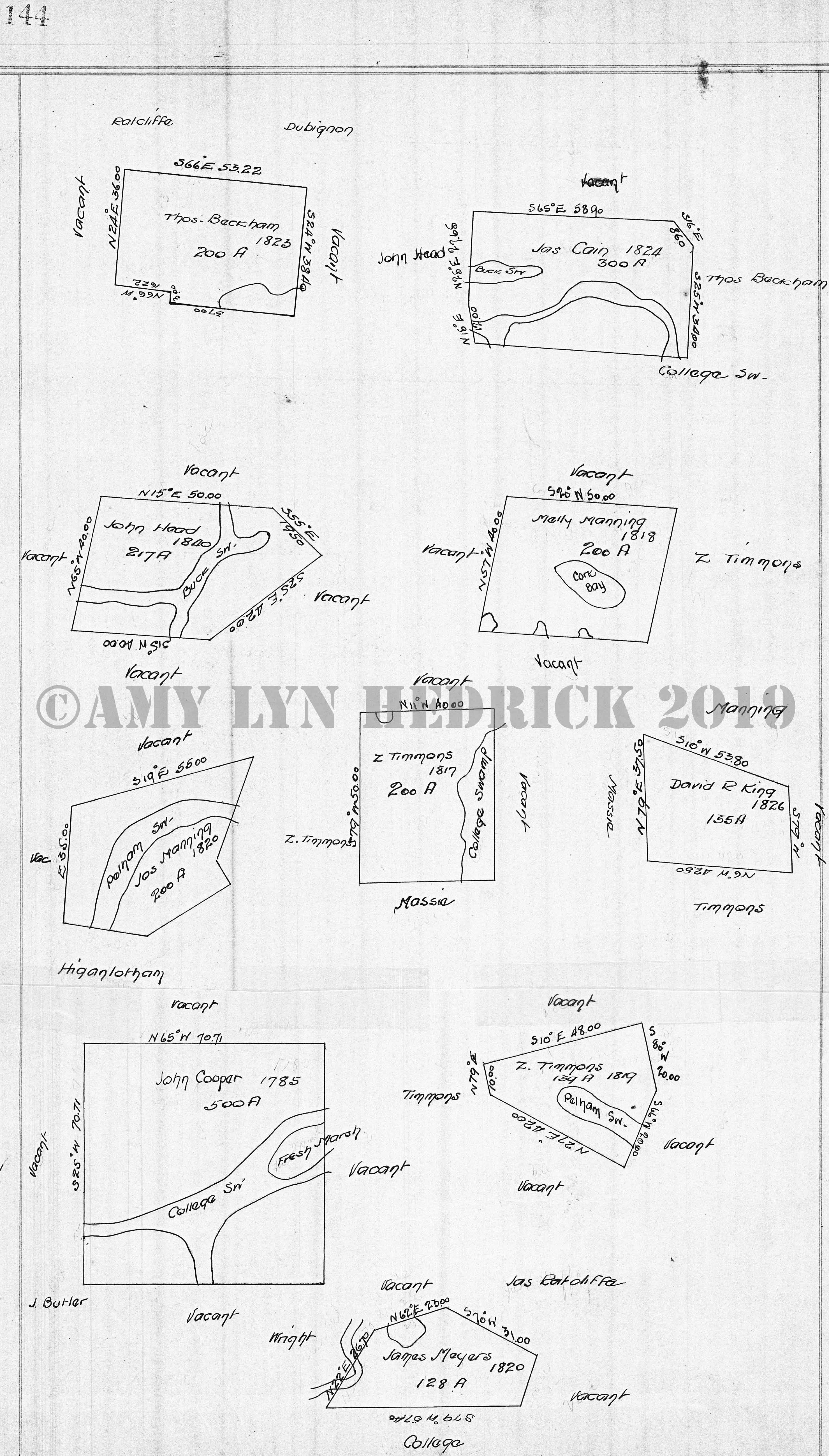
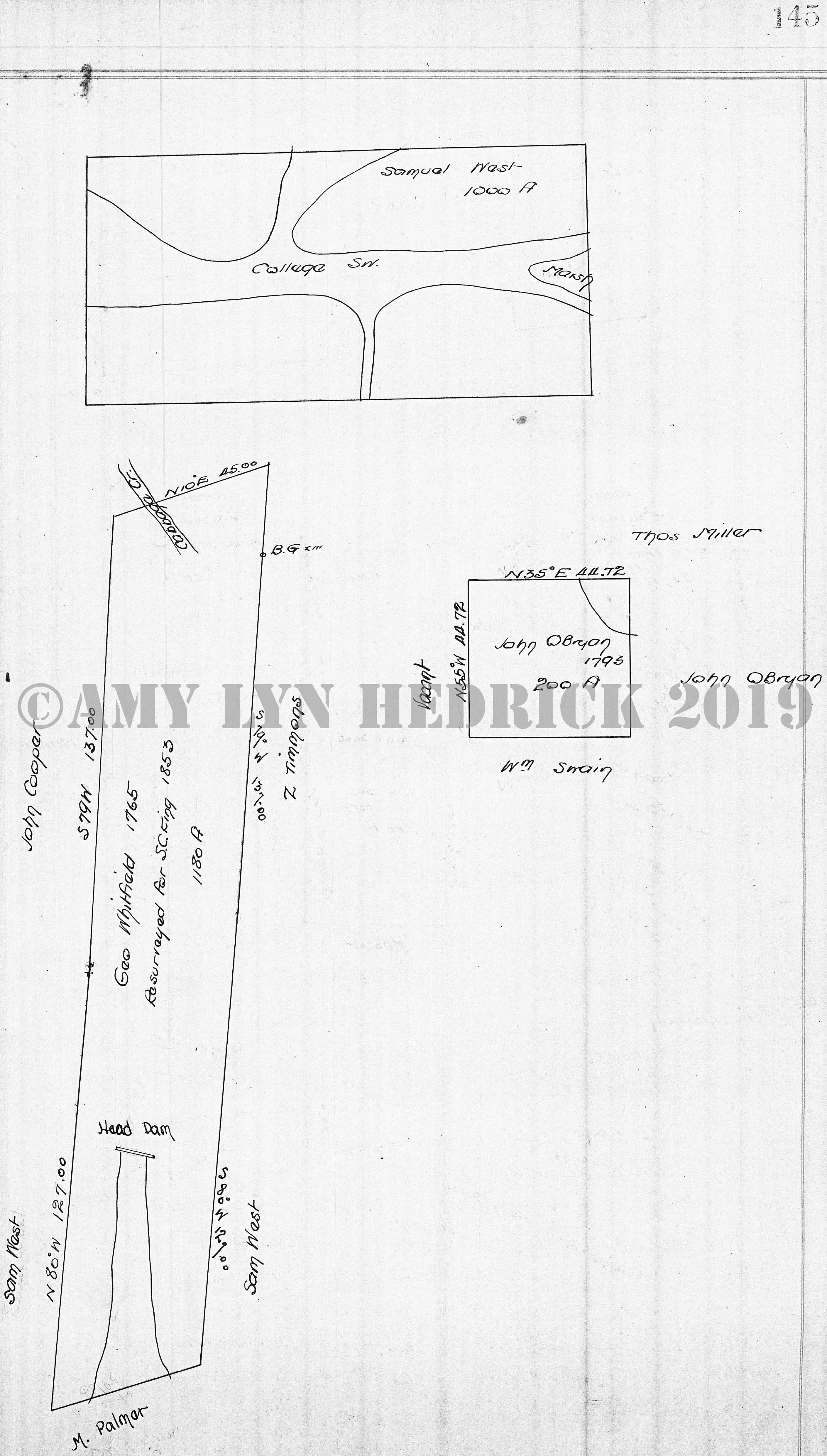
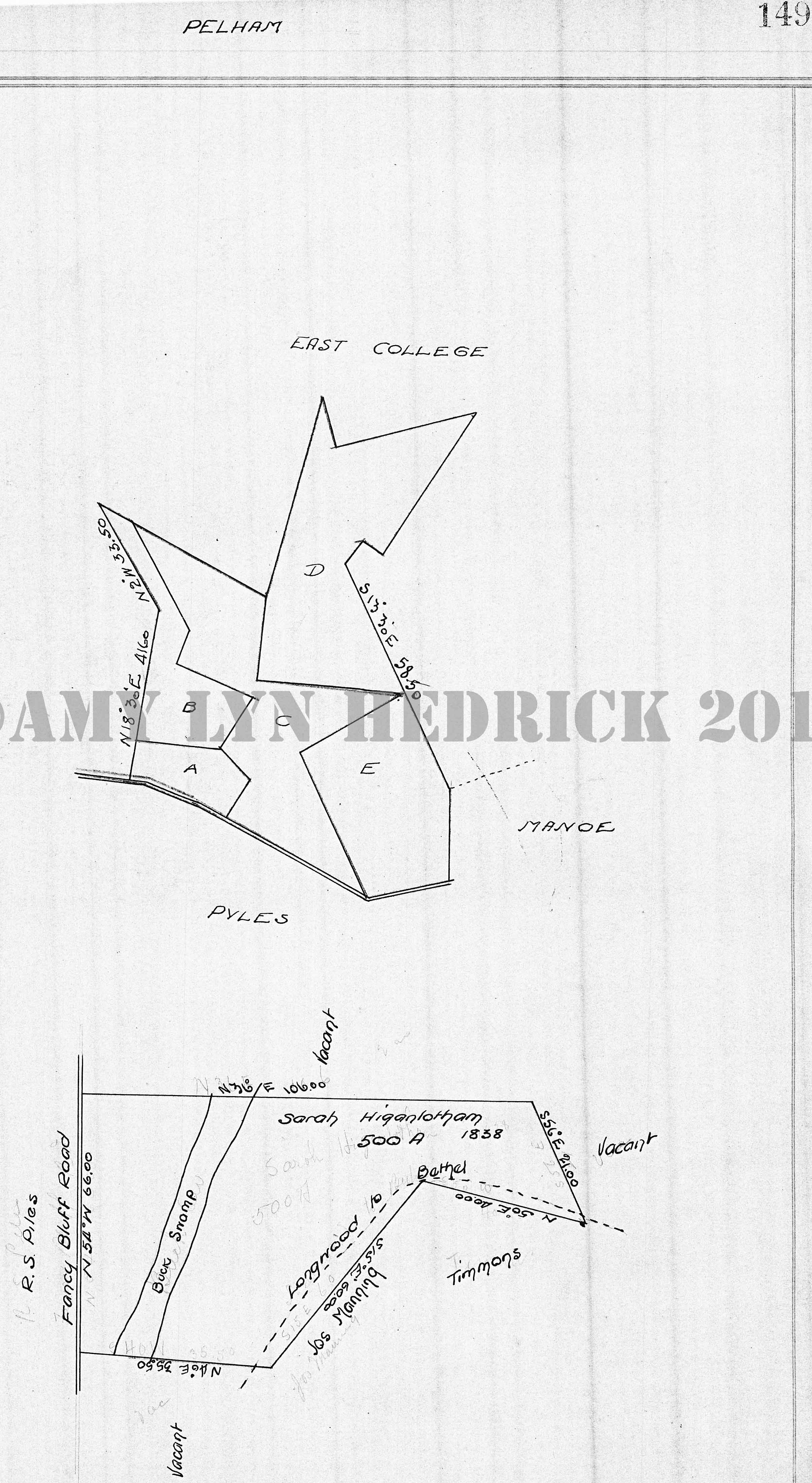
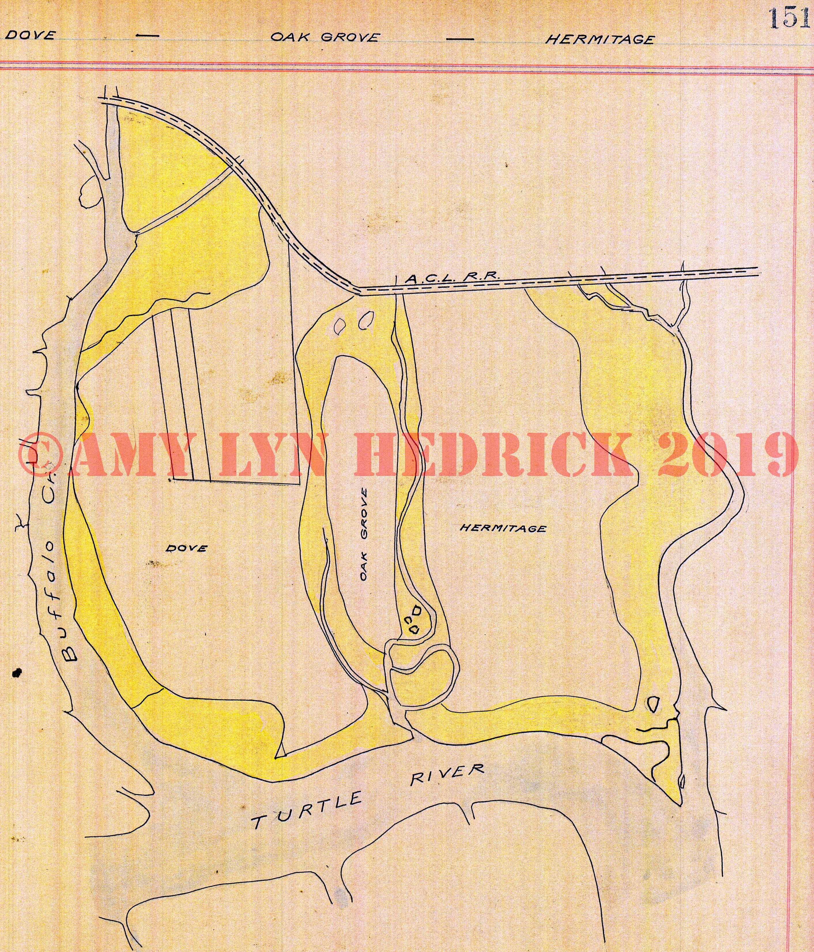
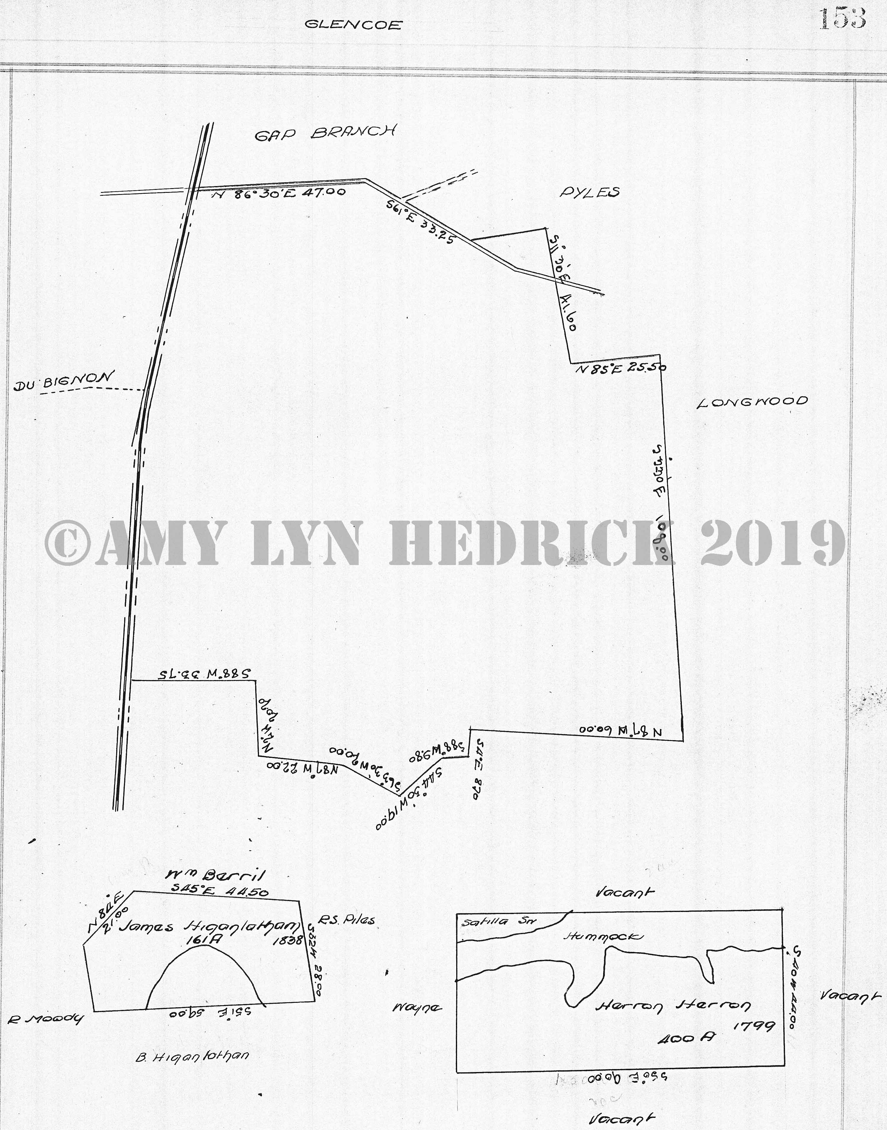
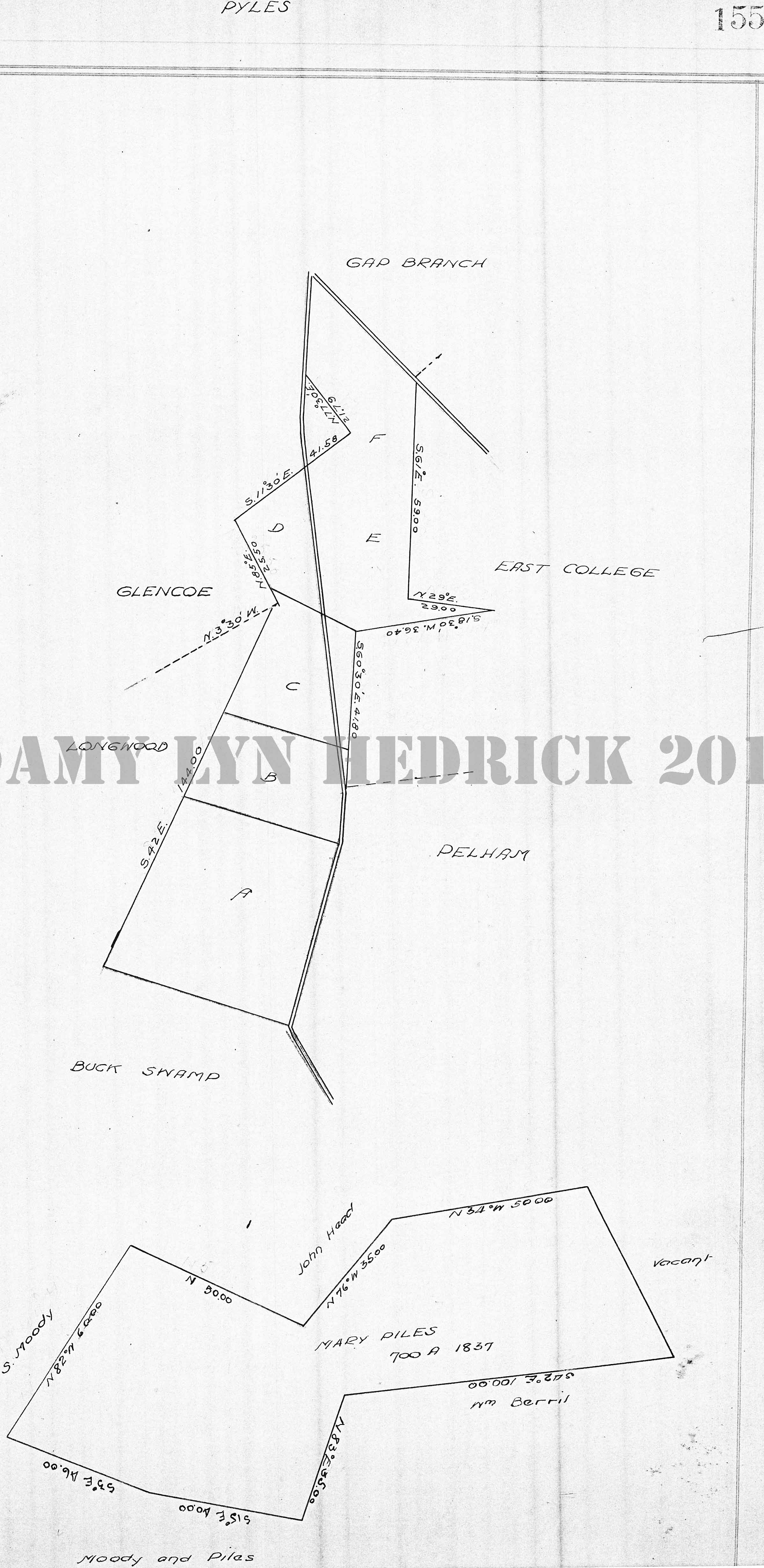
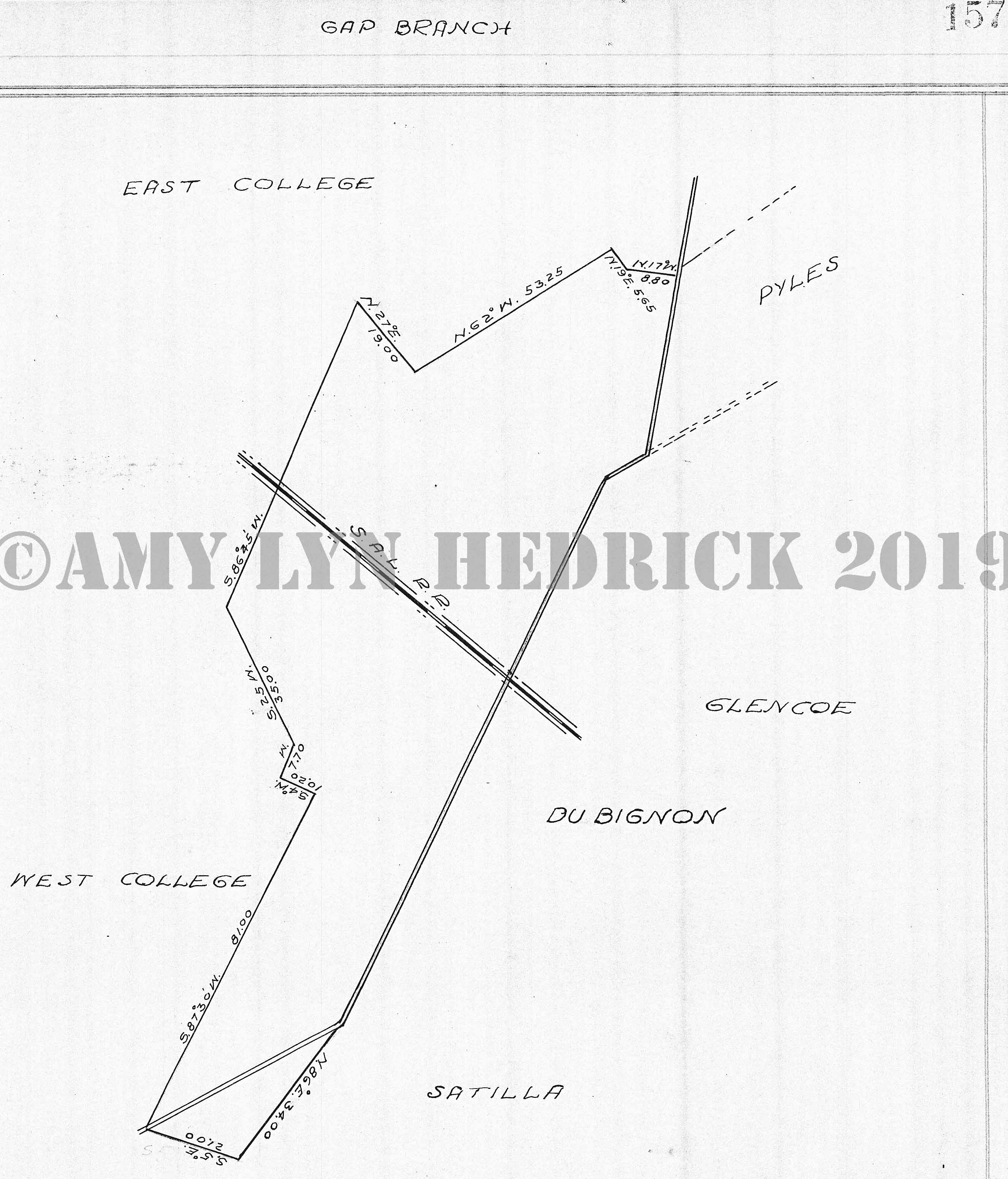
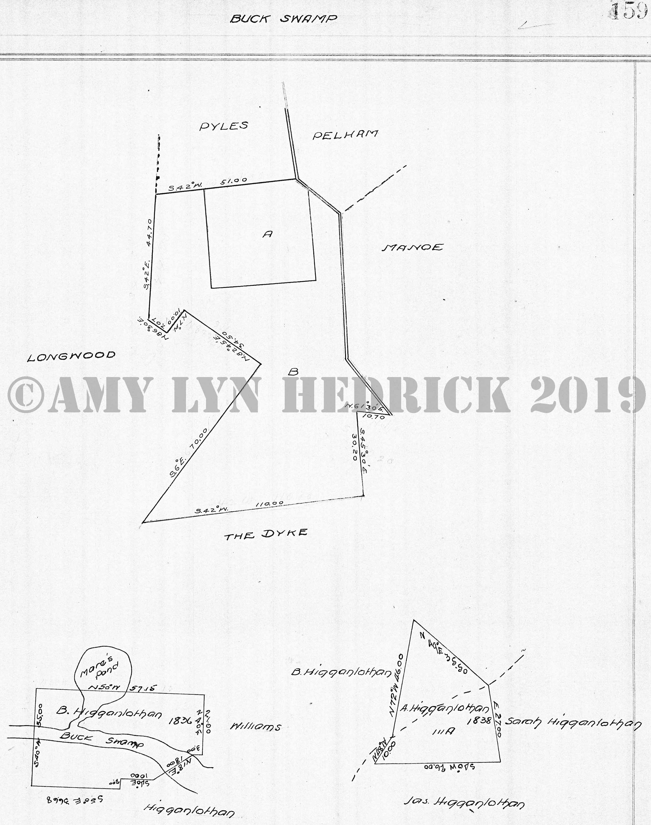
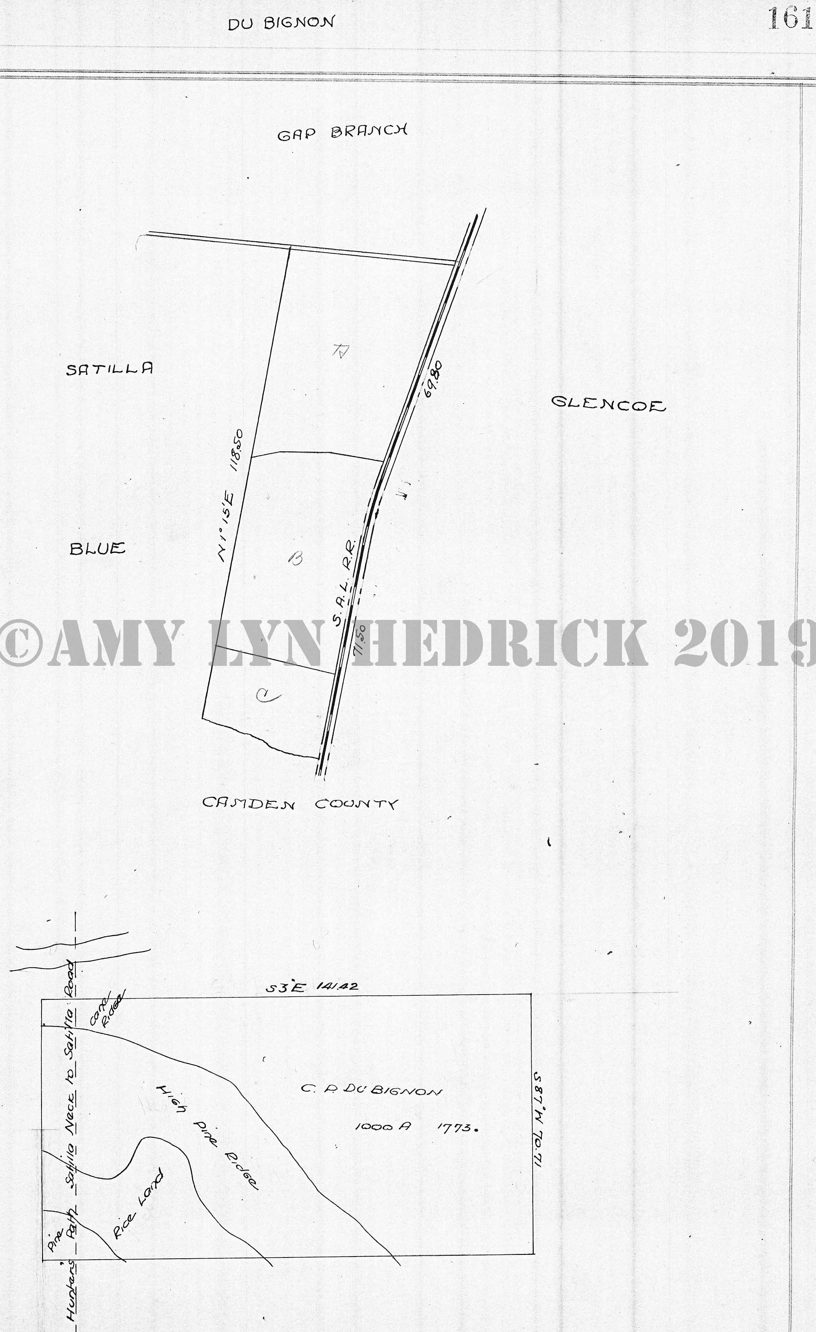
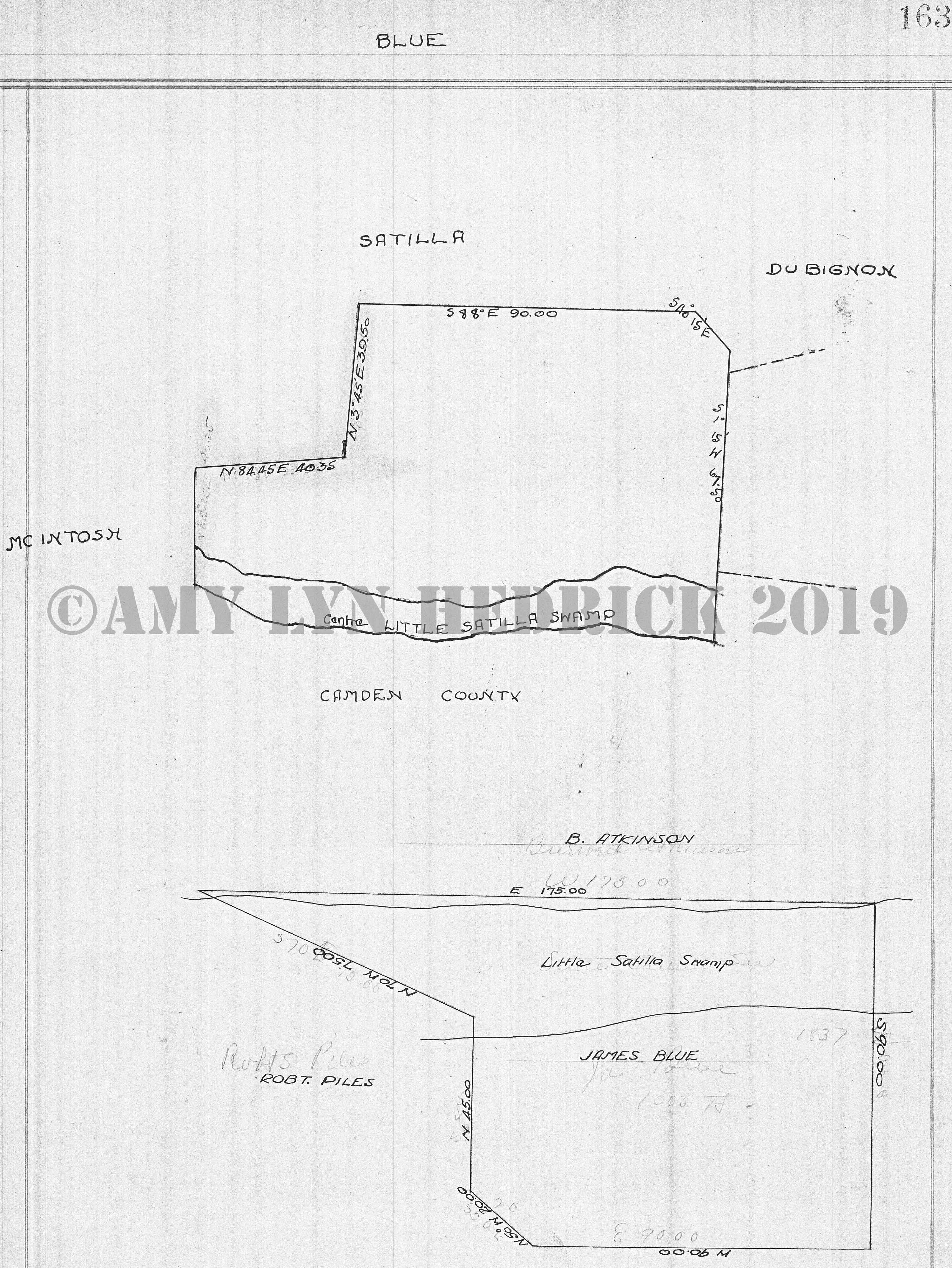
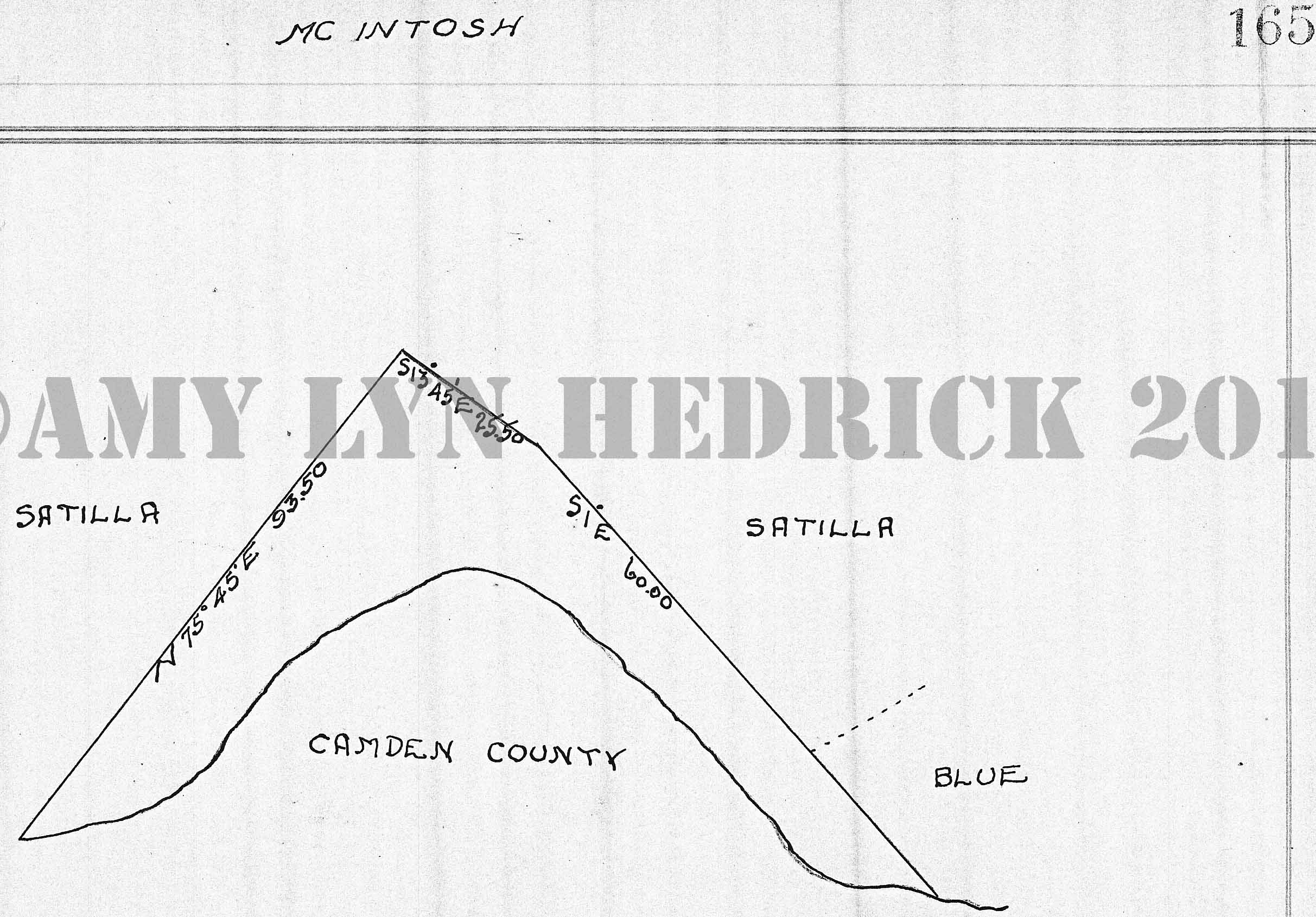
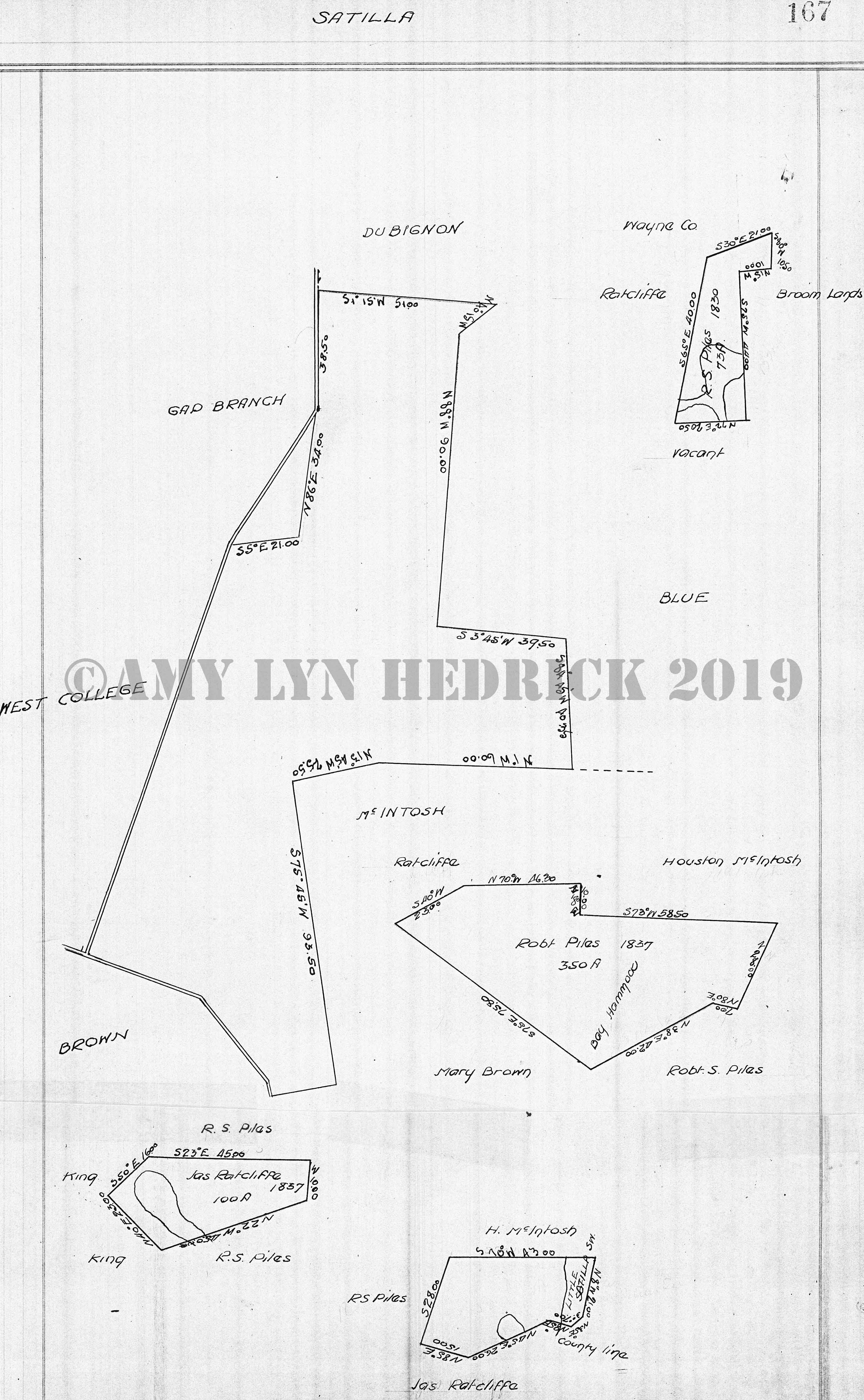
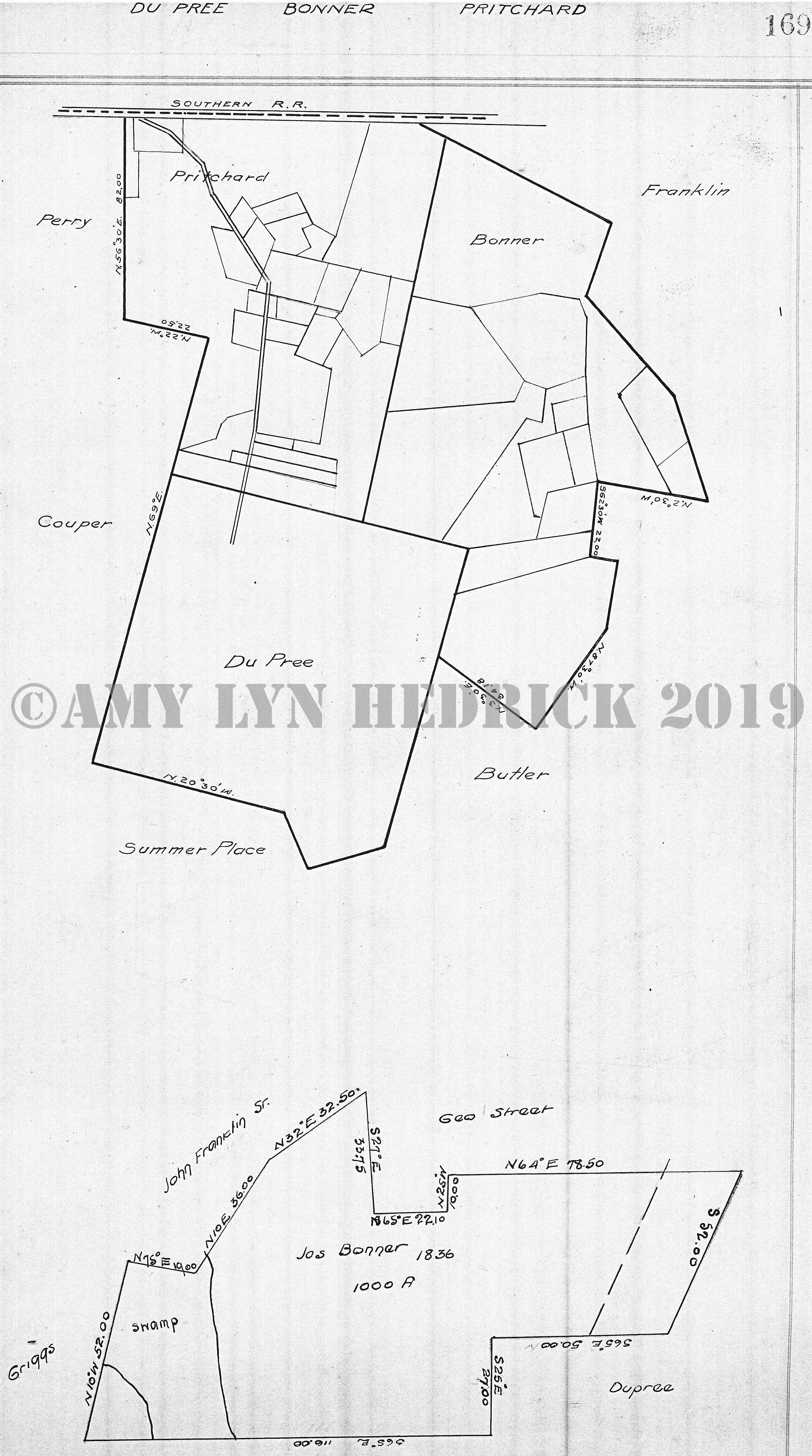
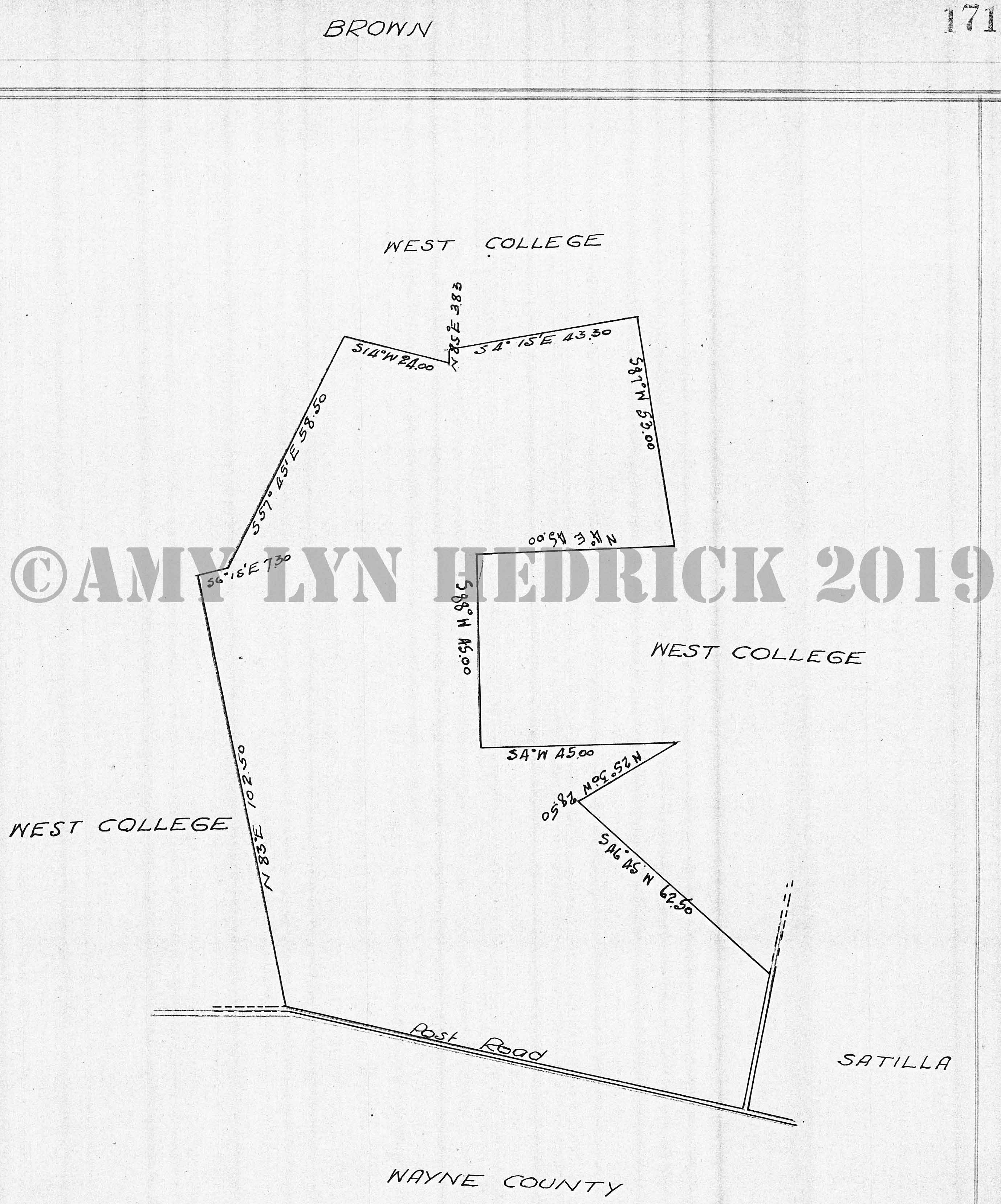
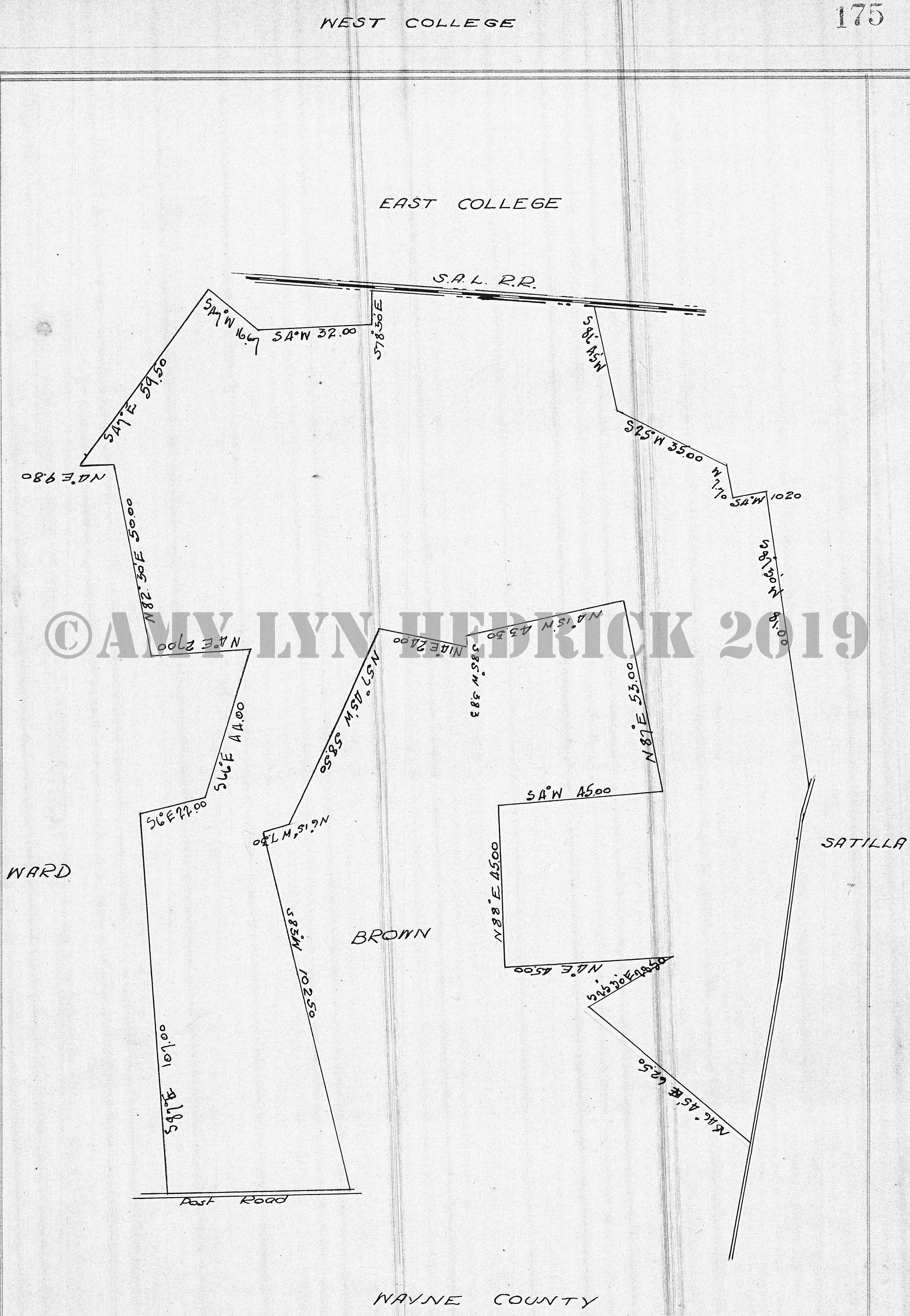
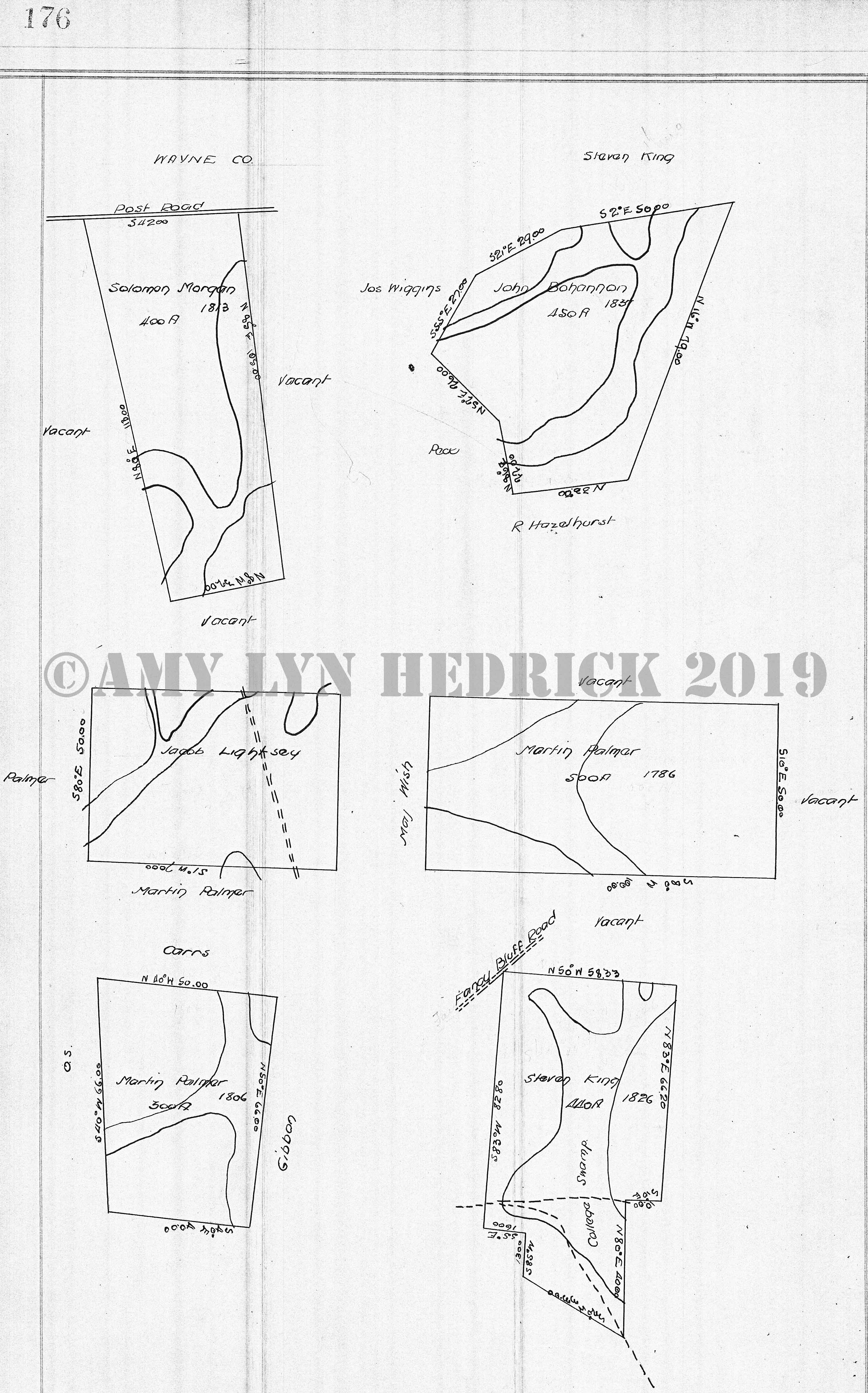
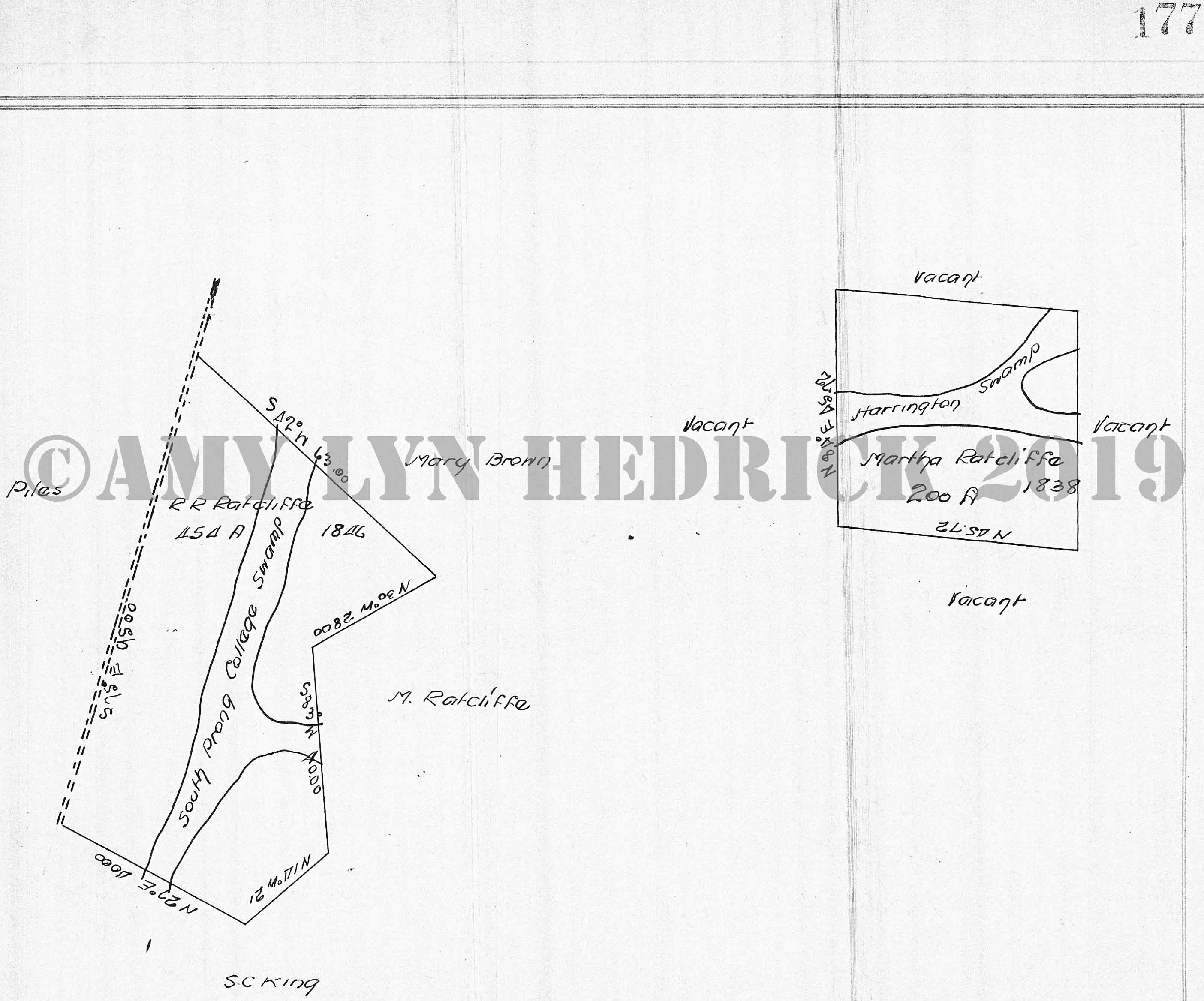
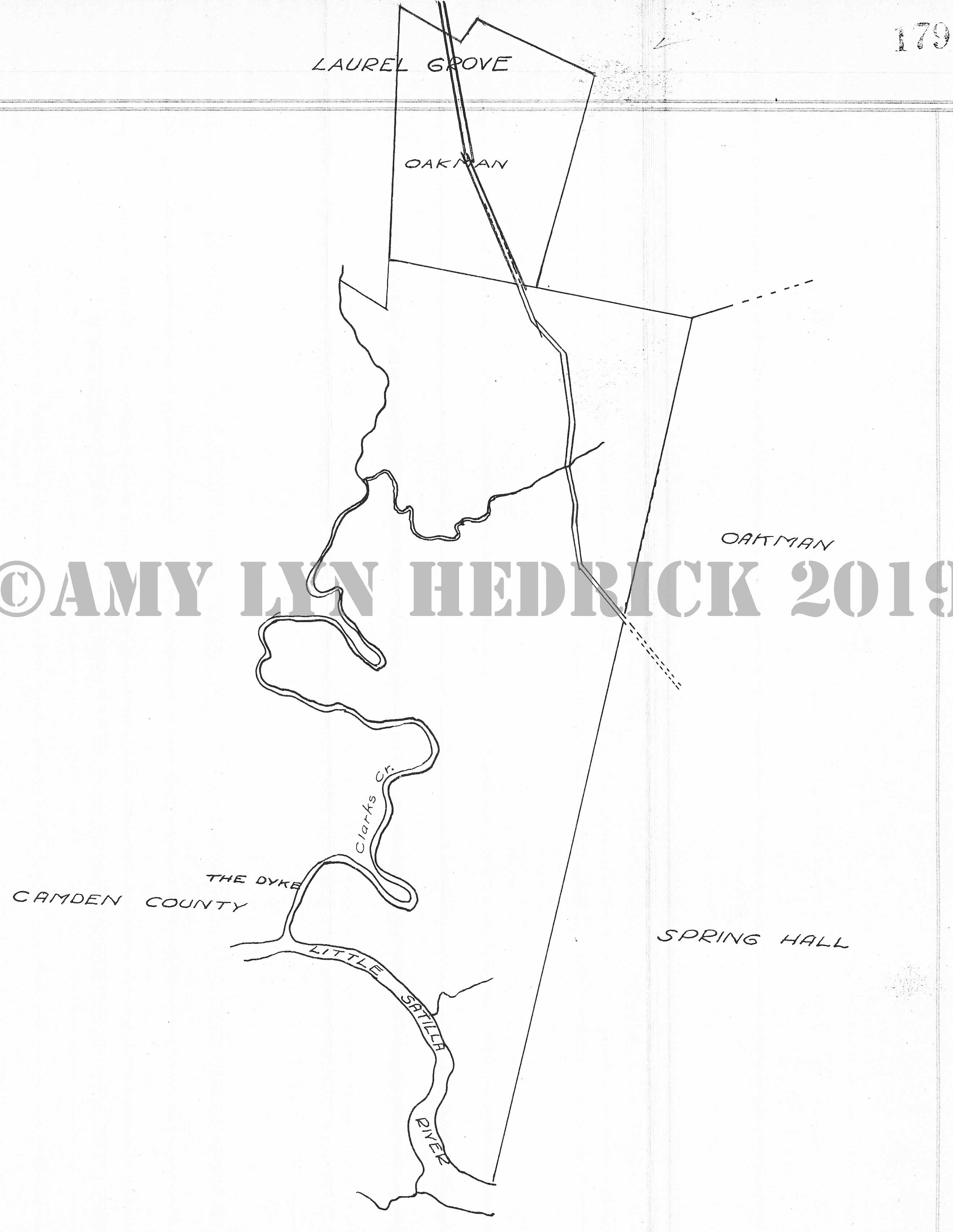
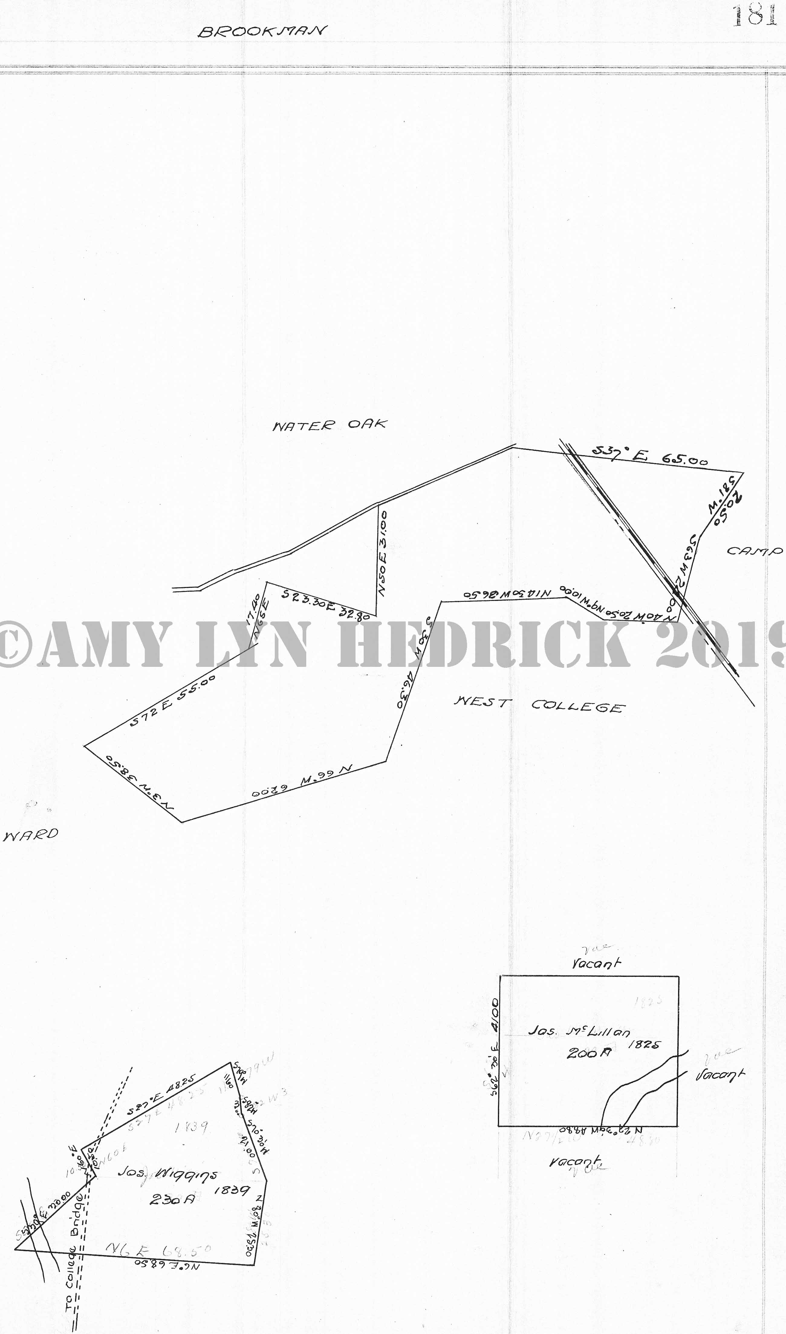
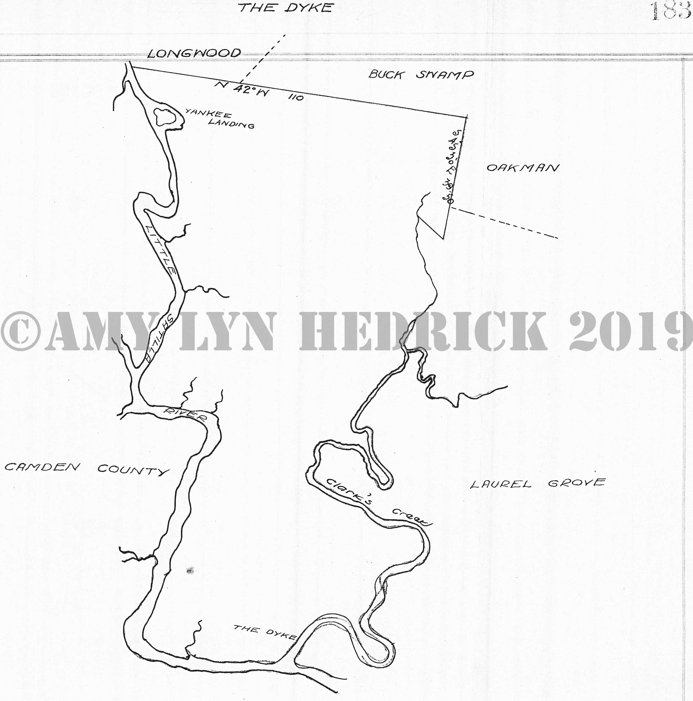
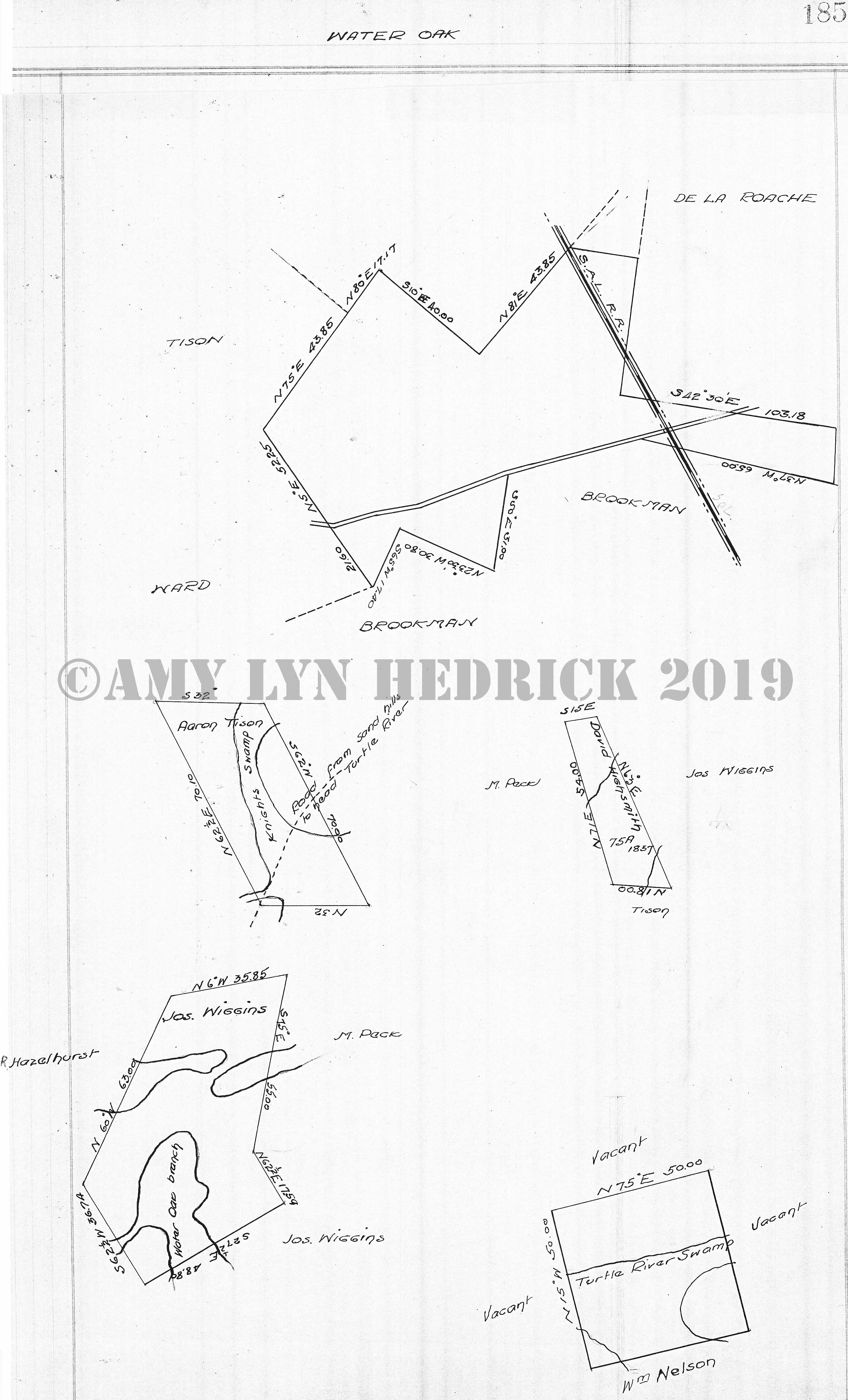
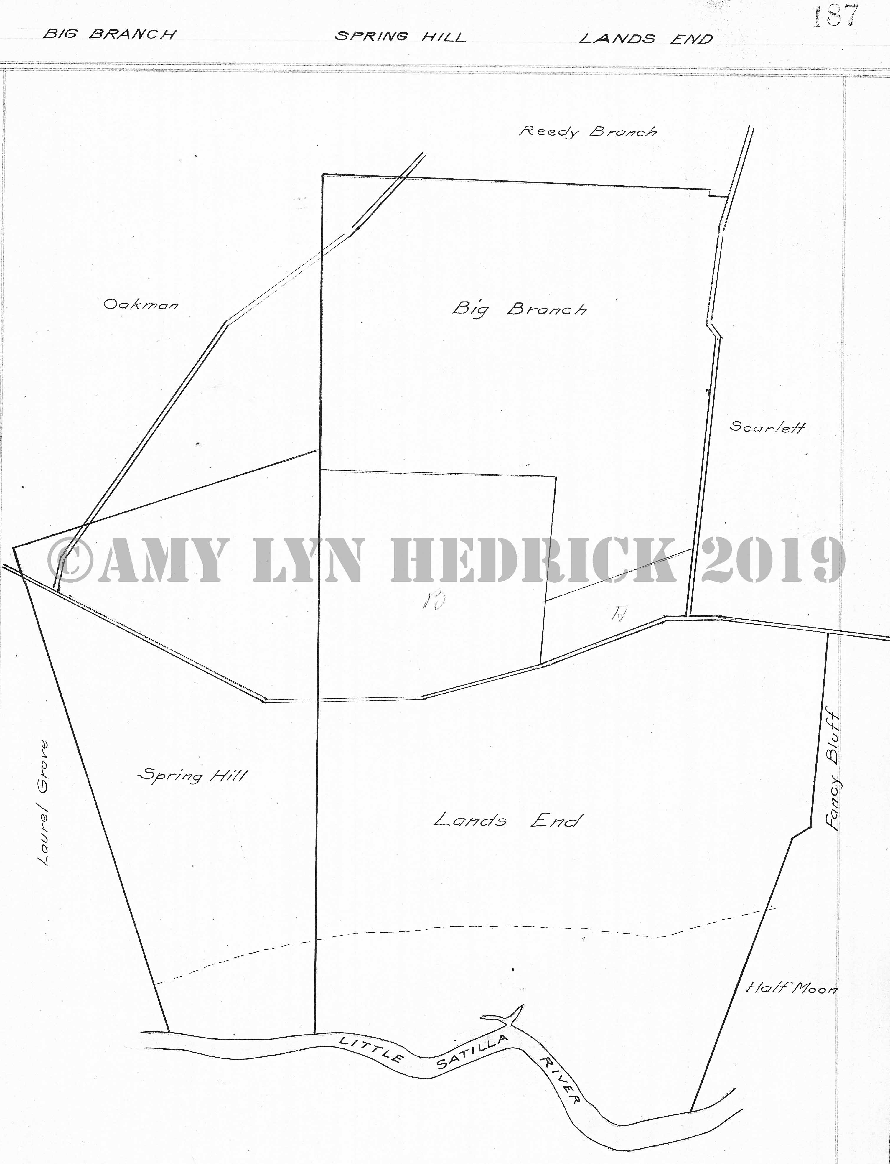
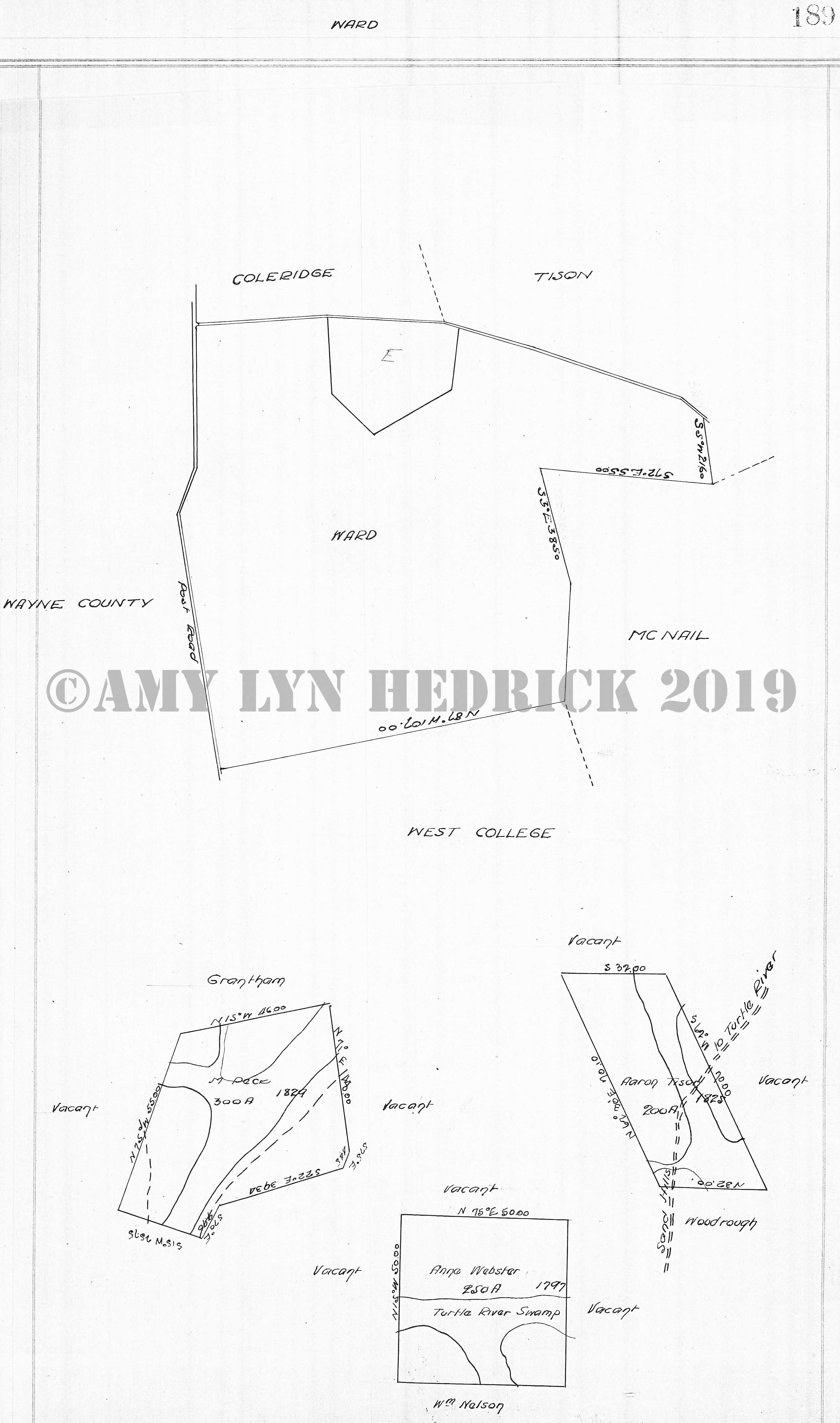
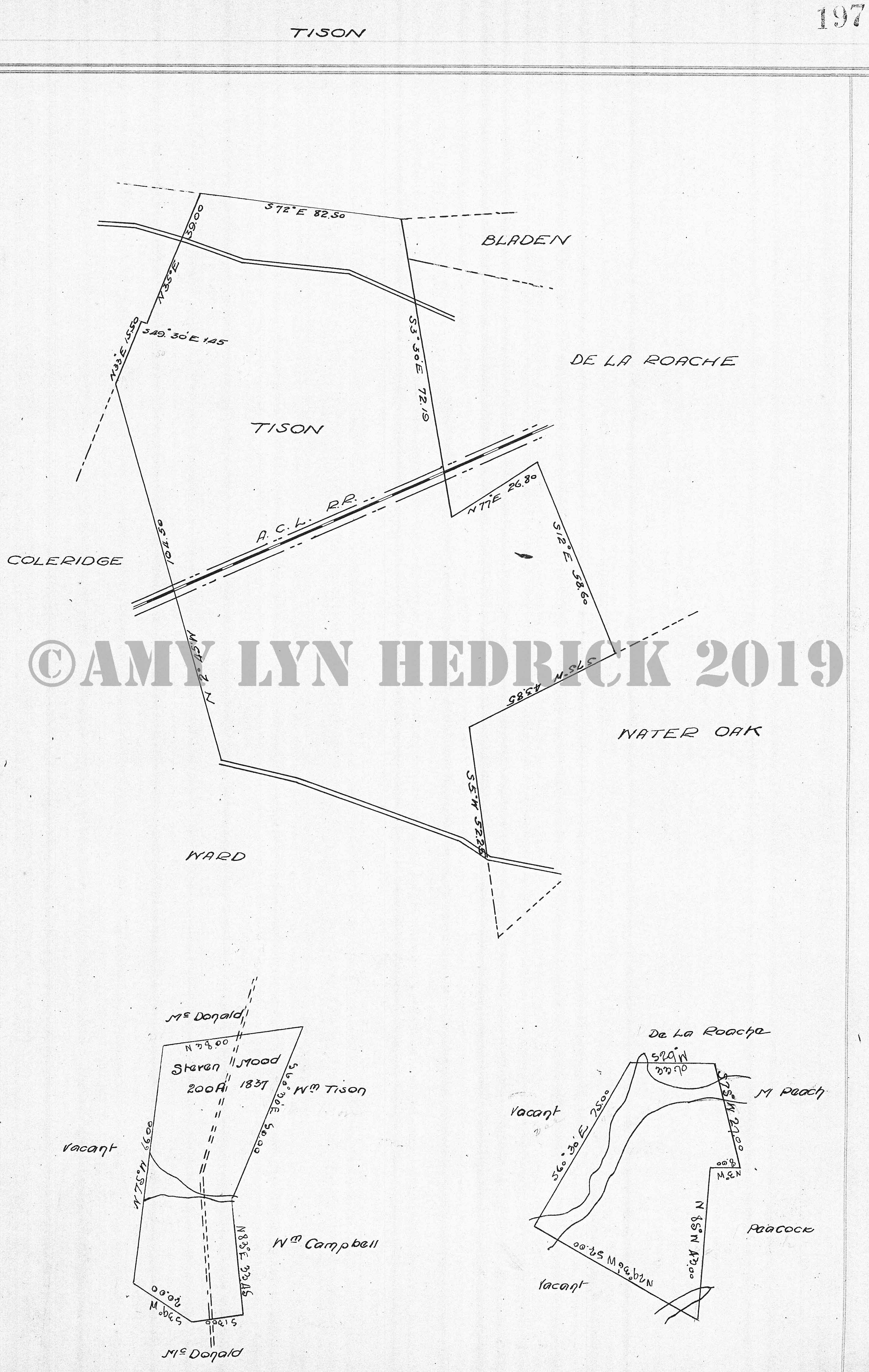
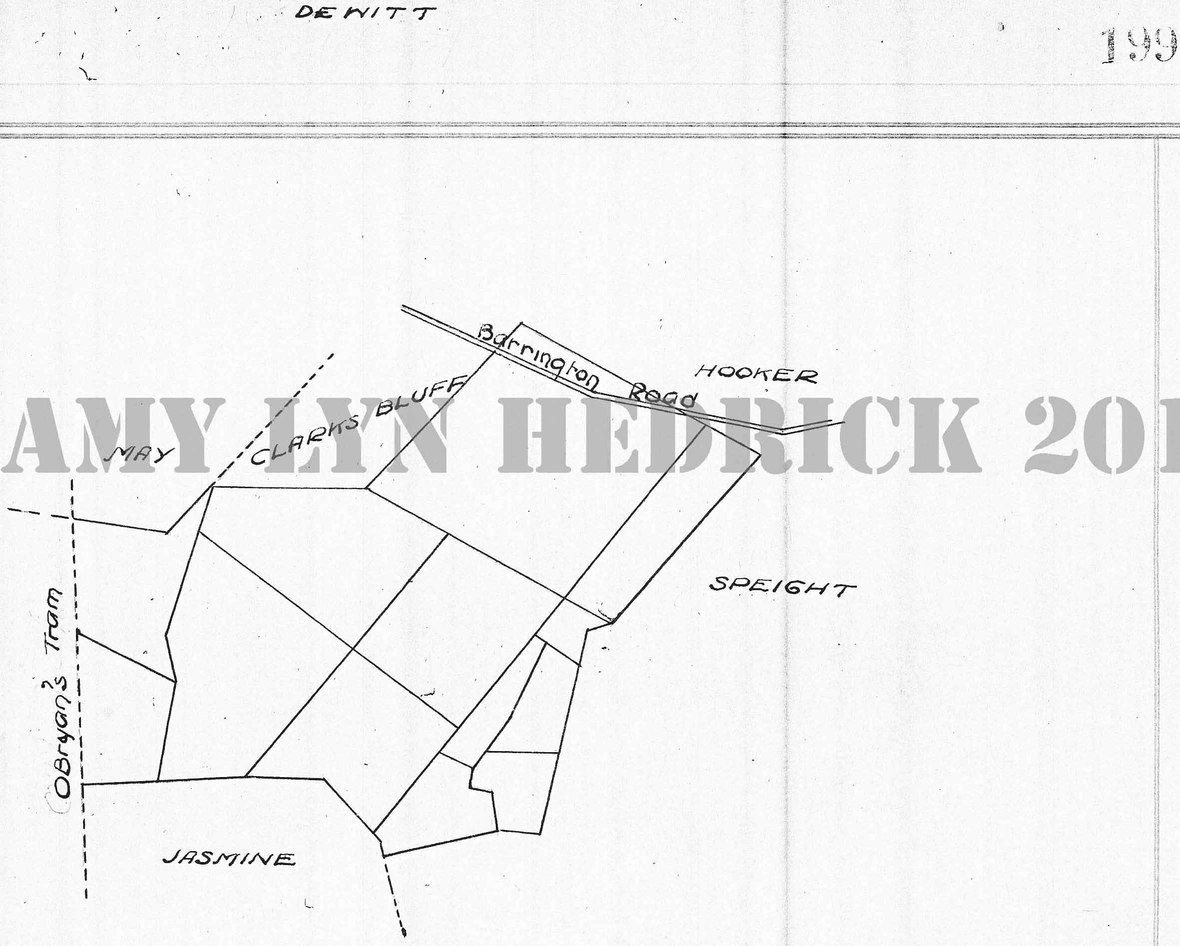
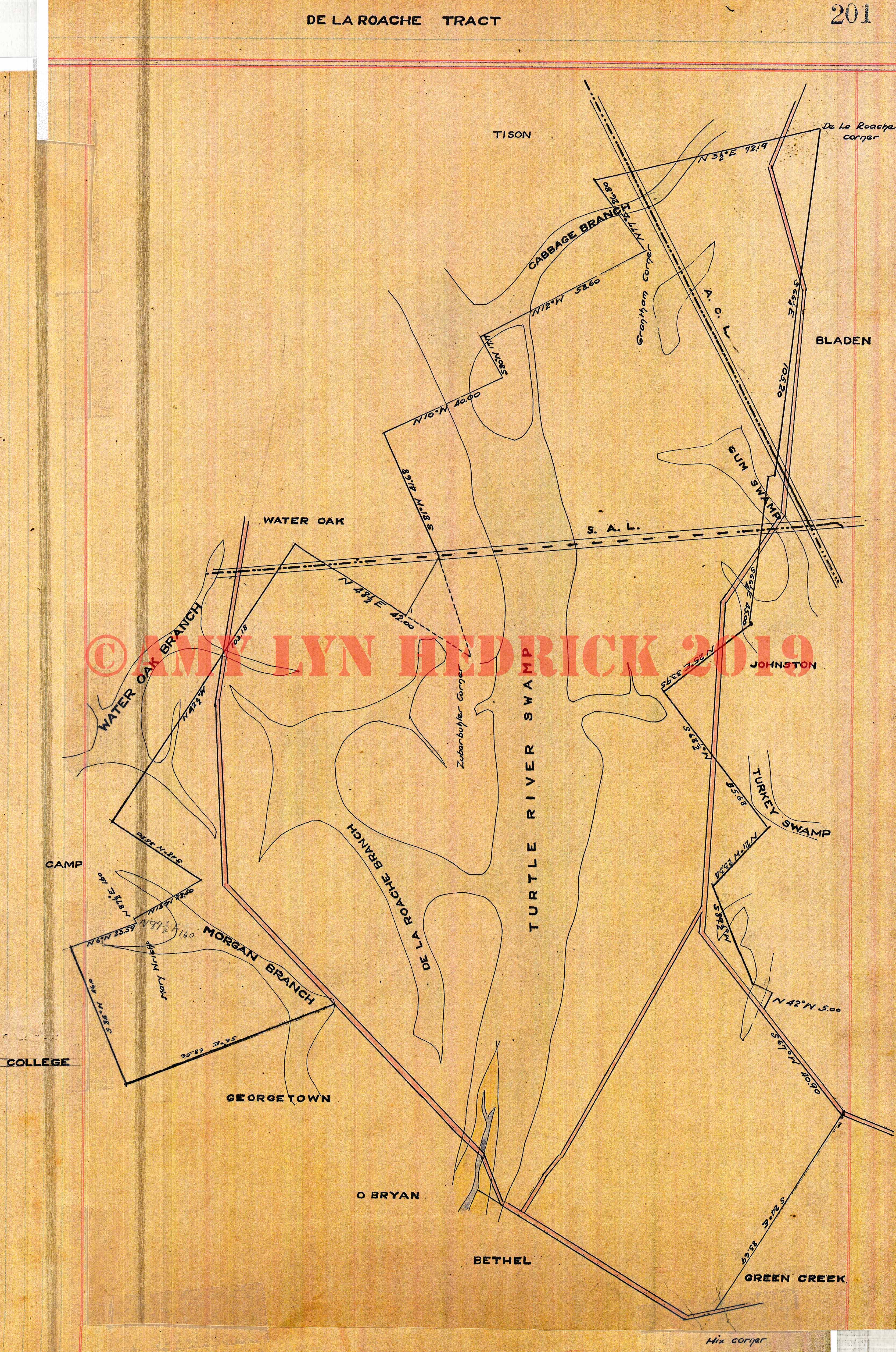
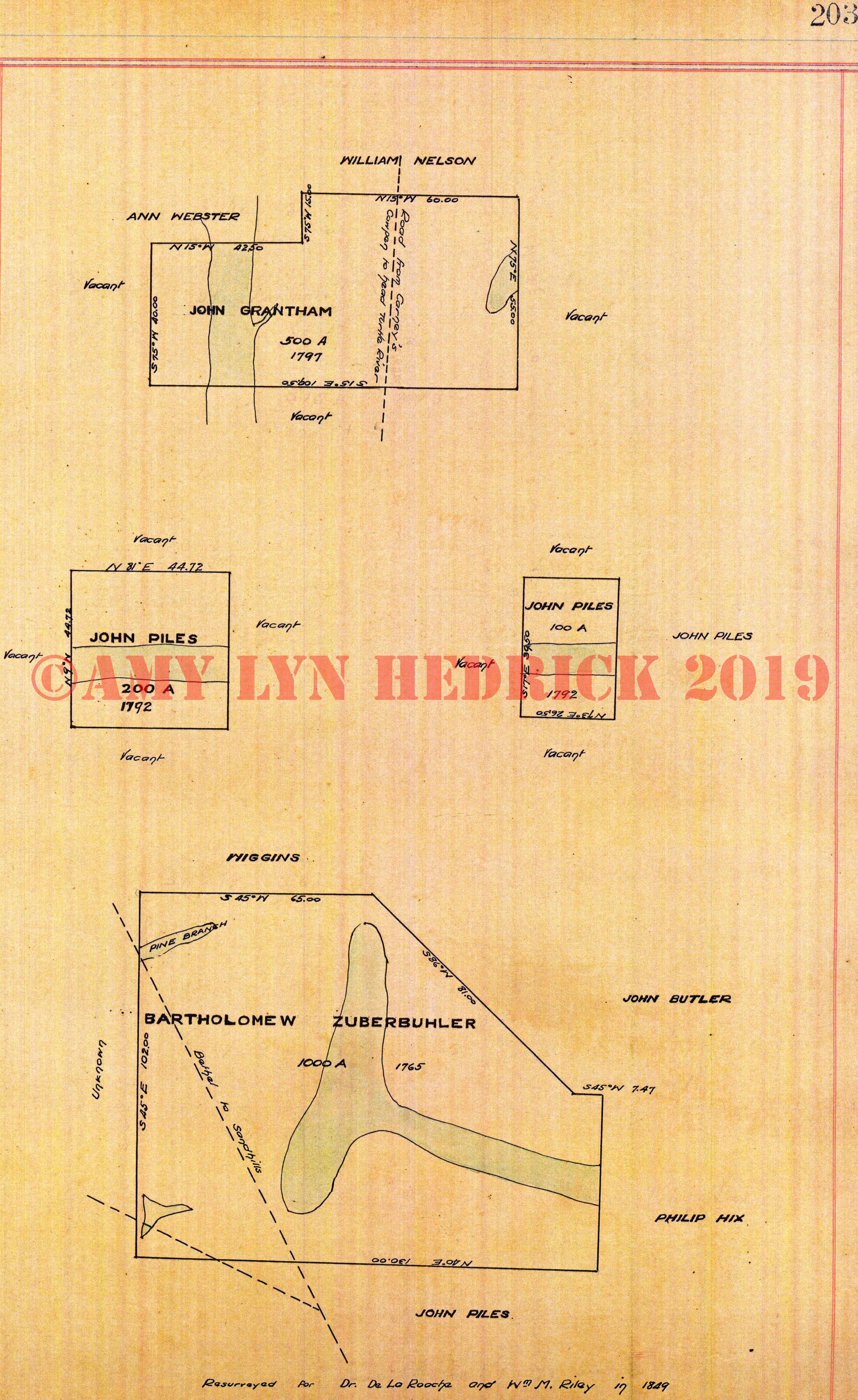
Page 127 Page 128 Page 129 -- "Burnett, Dixon, Crispin, Little Crispin" also: Southern & AB&A railroads, the canal Page 130 Page 131 -- "Sallens, Fish Hall, Emanuel, Reedy Branch, Palmer, Ratcliffe" also: Oakman, Big Branch, Scarlett, Vis-A-Vis, Hopewell, Magnolia, Miller, not named, John Piles (1785), bordered by marshes of Turtle River Page 132 Page 133 -- "Piles Marsh, Greenland, Number One, Lutterell, Morgan" also: Sterling, Buffalo, ACL, ABA, & Southern railroads Page 134 Page 135 -- "Hopwell" also: Meyers (Myers?), Bonaventure, Turtle River & Hopewell Creek enter property and Timber Landing Page 136 Page 137 -- "Meyers (Myers?)" also: Cabbage Bluff, Bethel, Bona Venture, Hopewell, Vis-A-Vis, Geo. Purvis (1803), Jas. Butler on two sides Page 138 Page 139 -- "Bona Venture" also: Bethel, O'Bryan, East College, Hopewell, Meyers (Myers?), Thos. Armstrong, surrounded by Butler Creek & Turtle River, unknown, plot not named, unknown, Thos. Walters, Cooper, plot not named, vacant on two sides, Butler, marsh Page 140 Page 141 -- "O'Bryan" also: Bona Venture, Bethel, Georgetown, East College, John O'Bryan (1787), vacant on two sides, College Lands called West Lands, blank plot, John O'Bryan, vacant, Thos. Walters (1794), John Piles, Fulton, Osgood, John M. Tison (1843), Thos. Walters, John O'Bryan on two sides Page 142 Page 143 Page 144 -- "No Title" also: Thos. Beckham (1823), Ratcliffe, Vacant on two sides, duBignon, Jas. Cain (1824), vacant land, John Head, College SW, Thos. Beckham, John Head (1840), vacant on all sides, Melly Manning (1818), vacant on sides, Z. Timmons, Jos. Manning (1820), vacant on two sides, Z. Timmons (1817), vacant on two sides, Z. Timmons, Massie, David R. King (1827), Manning, Massie, Timmons, vacant on one side, John Cooper (Couper) (1785), vacant on all sides, J. Butler, Z. Timmons (1819), vacant on three sides, Timmons, James Meyers (Myers?) (1820), vacant, Wright, College, Jas. Ratcliffe Page 145 -- "No Title" also: Samuel West, Geo. Whitfield (1765) "resurveyed per S.C. King 1853", John Cooper (Couper?), Sam West, M. Palmer, Sam West, Head Dam comes into property, Z. Timmons, John O'Bryan (1796), Thos. Miller, vacant land, Wm. Swain, John O'Bryan Page 146 Page 147 -- "Georgetown" also: O'Bryan, De La Roache, Camp, East College Page 148 Page 149 -- "Pelham" also: East College, Pyles, Manoe, Sarah Higginbotham (1838), R.S. Piles & Fancy Bluff Road, vacant, Jos. Manning, Timmons, Vacant on two sides, Longwood to Bethel Page 150 Page 151 -- "Dove, Oak Grove, Hermitage" also: ACL railroad Page 152 Page 153 -- "Glencoe" also: Gap Branch, duBignon, Longwood, Pyles, James Higginbotham (1838), Wm. Berril, R. Moody, B. Higginbotham, R.S. Piles, plat titled Herron Herron (1799), surrounded on 3 sides by vacant, Wayne Page 154 Page 155 -- "Pyles" also: Gap Branch, Glencoe, Buck Swamp, Pelham, East College, Mary Piles (1837), John Hood, S. Moody, Moody & Piles, Wm. Berril, vacant land Page 156 Page 157 -- "Gap Branch" also: East College, West College, Satilla, duBignon, Glencoe, Pyles, SAL railroad Page 158 Page 159 -- "Buck Swamp" also: Pyles, Longwood, The Dyke, Manoe, Pelham, B. Higginbotham (1836), Higginbotham, Williams, A. Higginbotham (1838), B. Higginbotham, Jas. Higginbotham, Sarah Higginbotham Page 160 Page 161 -- "duBignon" also: Gap Branch, Stailla, blue, Camden Couty, Glencoe, SAL railroad, C.P. duBignon (1773 or 75), intersected by Hunter's Path Satilla Neck to Satilla Road Page 162 Page 163 -- "Blue" also: Satilla, McIntosh, Camden County, duBignon, James Blue, B. Atkinson, Robt. Piles Page 164 Page 165 -- "McIntosh" also: Satilla on two sides, Camden County, Blue Page 166 Page 167 -- "Satilla" also: duBignon, Gap Branch, West College, Brown, McIntosh, Blue, R.S. Piles (1830), Wayne County, Ratcliffe, vacant lands, Broom Lands, Robt. Piles (1837), Ratcliffe, Mary Brown, Robt. S. Piles, Houston McIntosh, Jas. Ratcliffe (1837 or 57), R.S. Piles, King on two sides, R.S. Piles, not named w/Little Satilla SW crossing through, H. McIntosh, R.S. Piles, Jas. Ratcliffe, county line Page 168 Page 169 -- "Du Pree, Bonner, Pritchard" also: Southern railroad, Perry, Couper, Summer Place, Butler, Franklin, Jos. Bonner (1836), John Franklin, Sr., Griggs, Dupree Page 170 Page 171 -- "Brown" also: West College on three sides, Wayne County line Post Road, Satilla Page 172 Page 173 -- "Dover Hall, Anguilla, Yamasee" also: ACL and AB&A railroad Page 174 Page 175 -- "West College" also: East College, Ward, Wayne County line Post Road, Brown, Satilla, SAL railroad Page 176 -- "No Title" also: Solomon Morgan (1813), Wayne County line Post Road, vacant on all sides, John Bohannon (1837), Steven King, Jos. Wiggins, peck, R. Hazelhurst, Jacob Lightsey, Palmer, Martin Palmer, Martin Palmer (1786), vacant on 3 sides, Maj. Wish, Martin Palmer (1806), Carrs, O.S. (not sure what this means), Gibson, Steven King (1826) intersected by Fancy Bluff Road and College Swamp Page 177 -- "No Title" also: R.R. Ratcliffe (1846), South Prong College Swamp, Piles, S.C. King, M. Ratcliffe, Mary Brown, Martha Ratcliffe (1838), vacant on all sides, Harrington Swamp Page 178 Page 179 -- "Laurel Grove" also: Oakman, The Dyke, Camden County line Little Satilla River, Spring Hall, Oakman Page 180 Page 181 -- "Brookman" also: Water Oak, Ward, West College, Camp, Jos. Wiggins (1839), Jos. McLillan (or James?) (1825) surrounded by vacant Page 182 Page 183 -- "The Dyke" also: Longwood, Yankee Landing, Camden County line Little Satilla River, Laurel Grove, Oakman, Buck Swamp Page 184 Page 185 --"Water Oak" also: Tison, Ward, Brookman, De La Roache, SAL railroad, Aaron Tison, road from Sand Hills to head of Turtle River, David Highsmith (1837 or 57), M. Peck, Tison, Jos. Wiggins, Jos. Wiggins, R. Hazelhurst, Jos. Wiggins, M. Peck, square with Turtle River Swamp, vacant on 3 sides, Wm. Nelson Page 186 Page 187 -- "Big Branch, Spring Hill, Lands End" also: Reedy Branch, Oakman, Laurel Grove, Half Moon, Fancy Bluff, Scarlett Page 188 Page 189 -- "Ward" also: Coleridge, Wayne County/Post Road, West College, McNail, Tison, M. Peck (1829), Grantham, vacant on two sides, Anne Webster (1797), vacant on 3 sides, Wm. Nelson, Aaron Tison (1825), vacant on two sides, Woodrough |
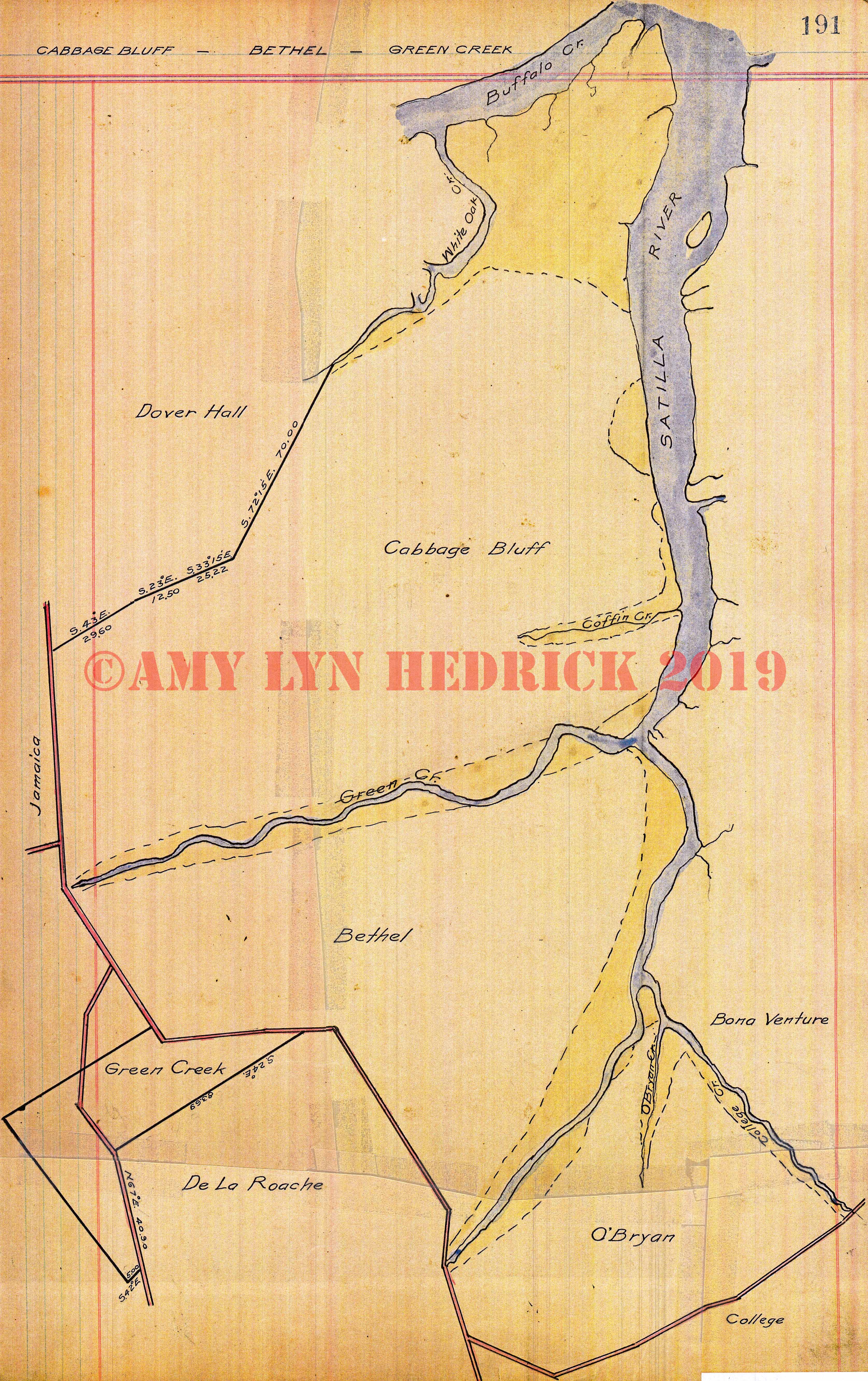
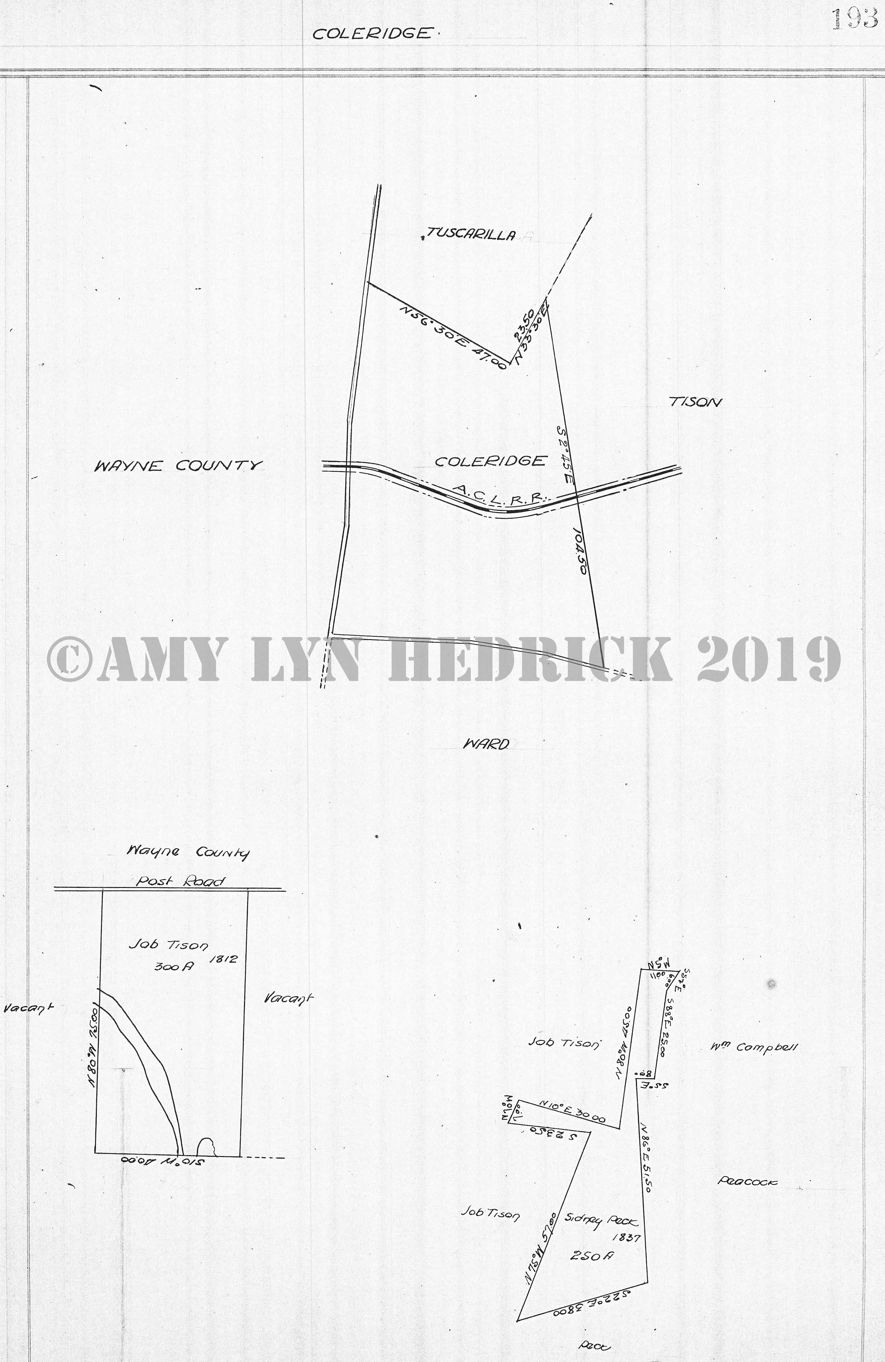
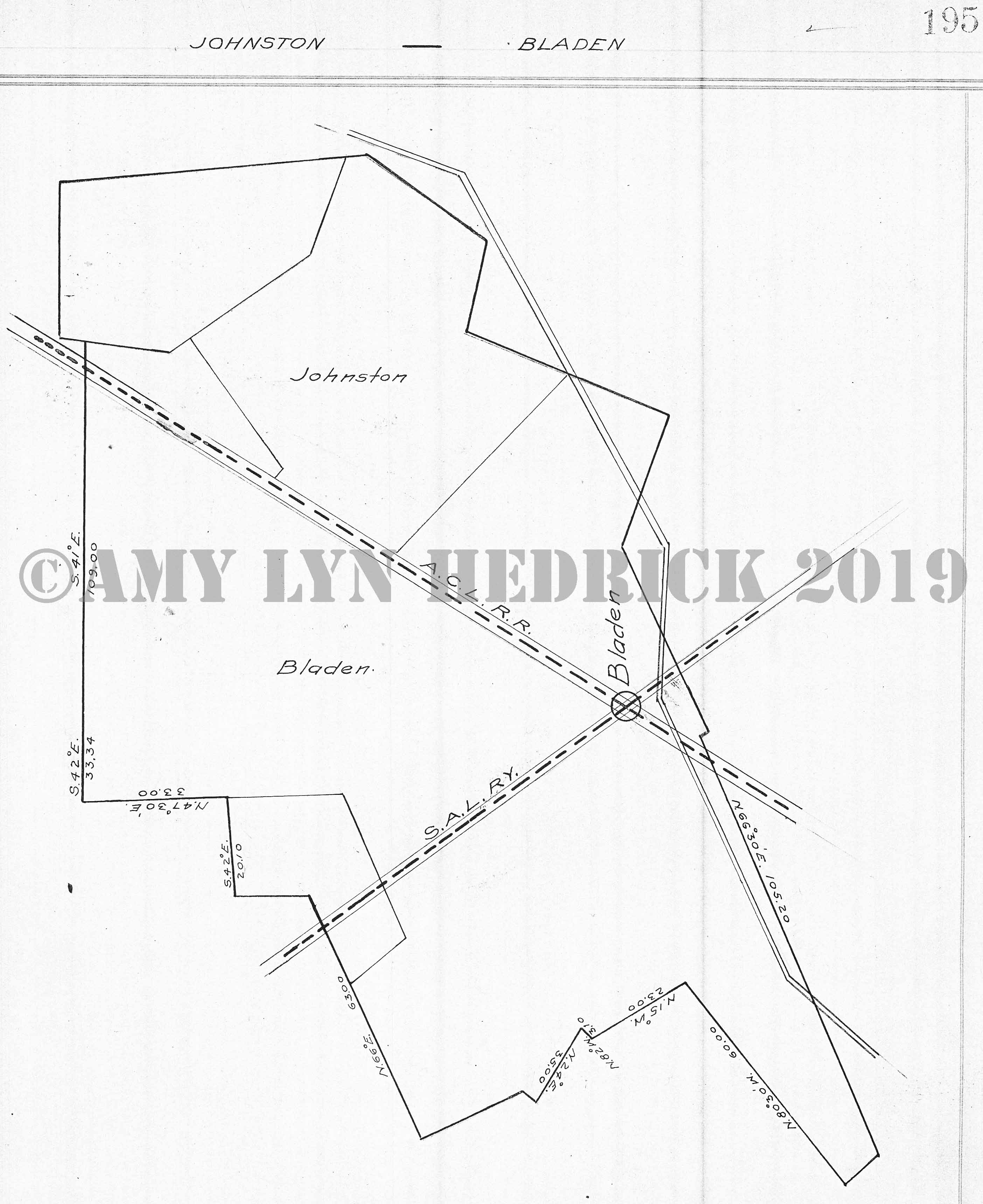
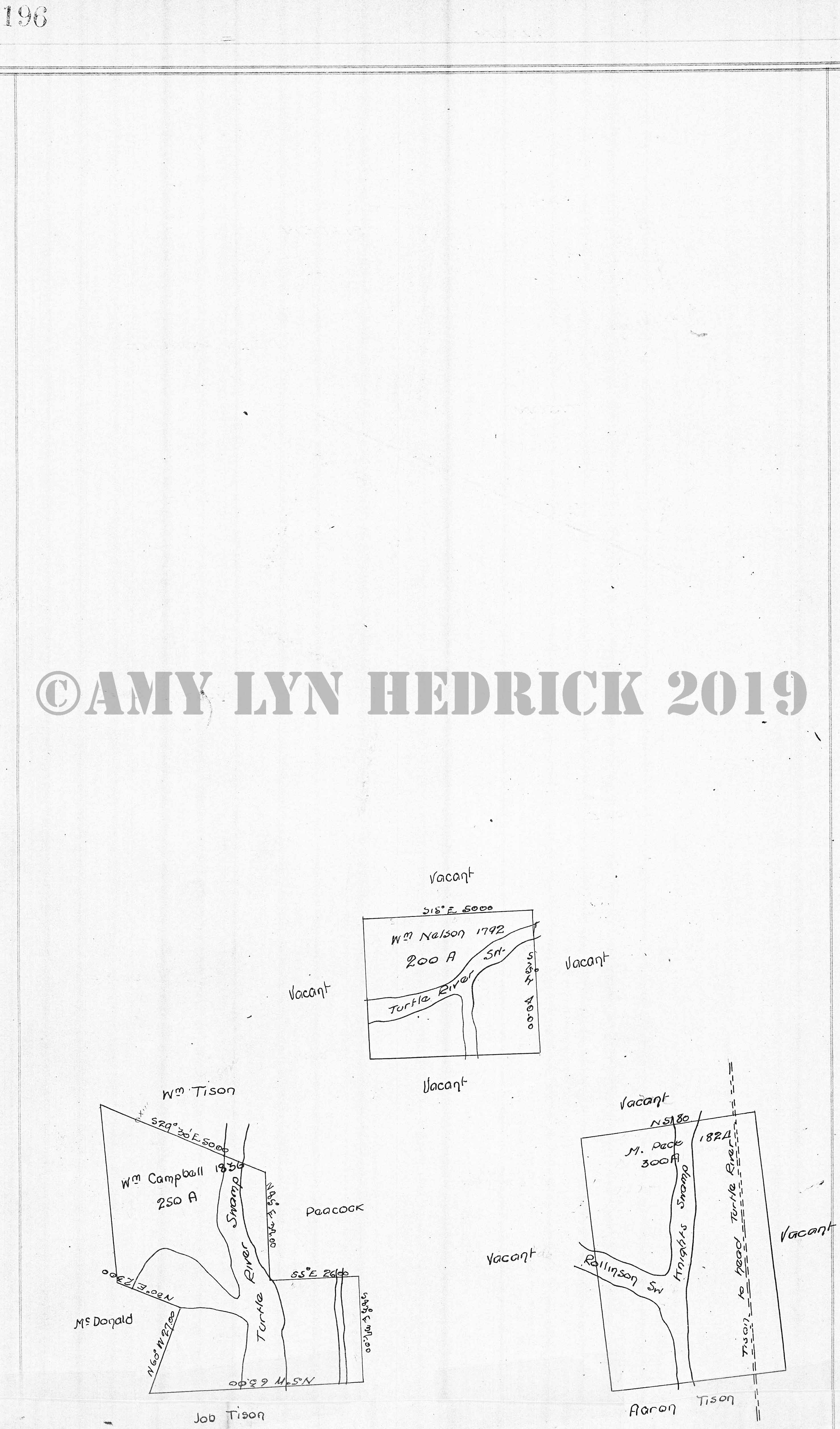
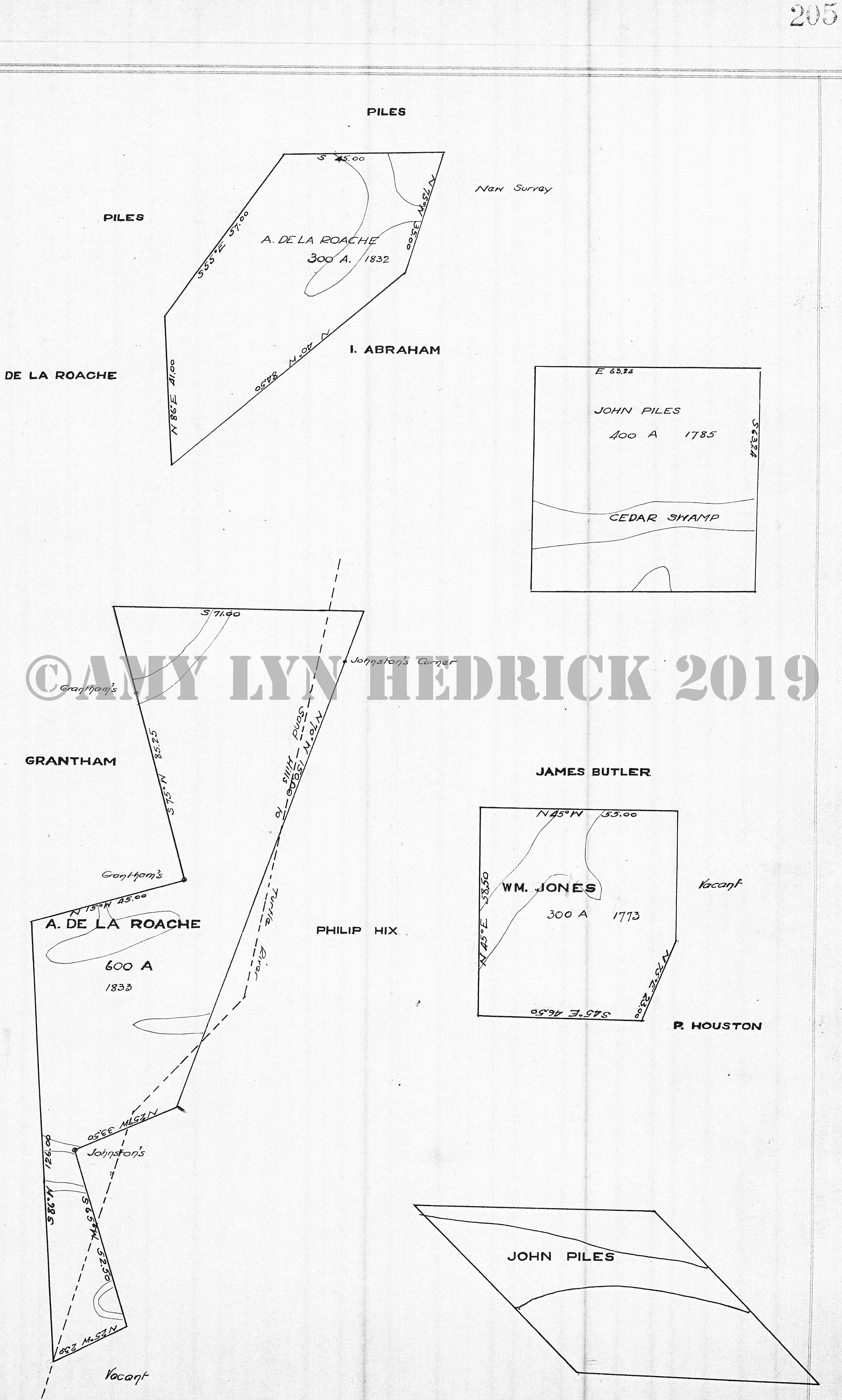
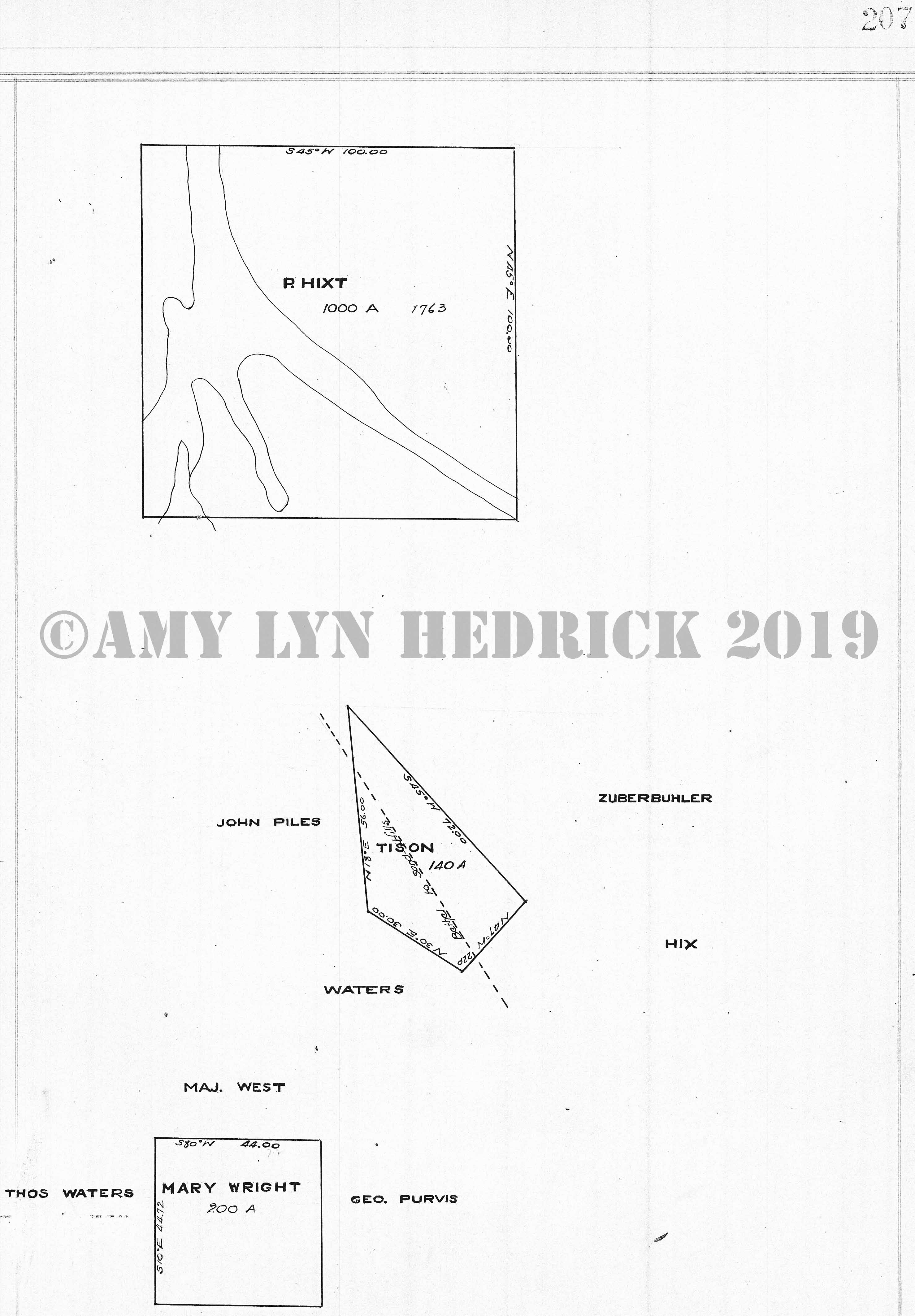
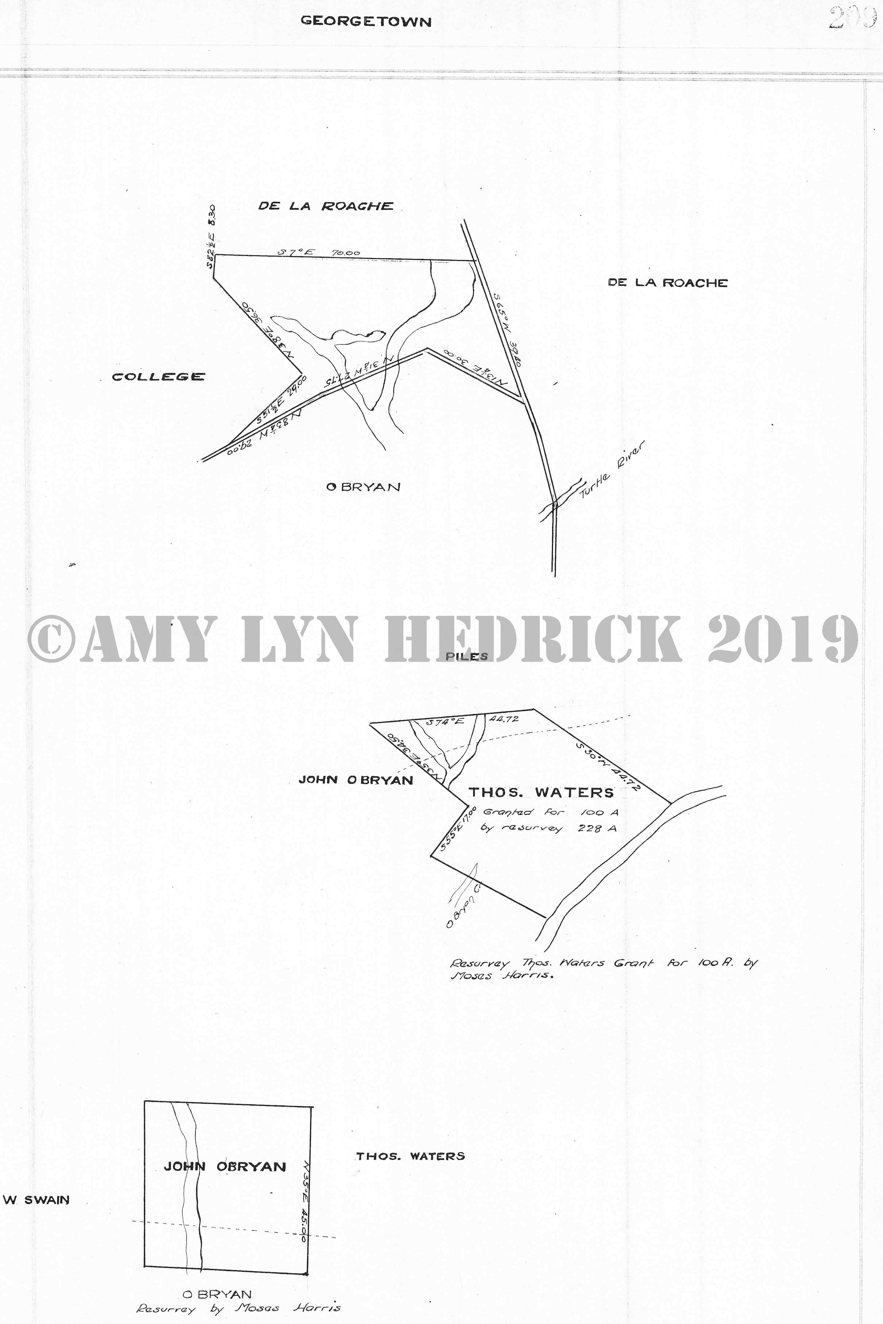
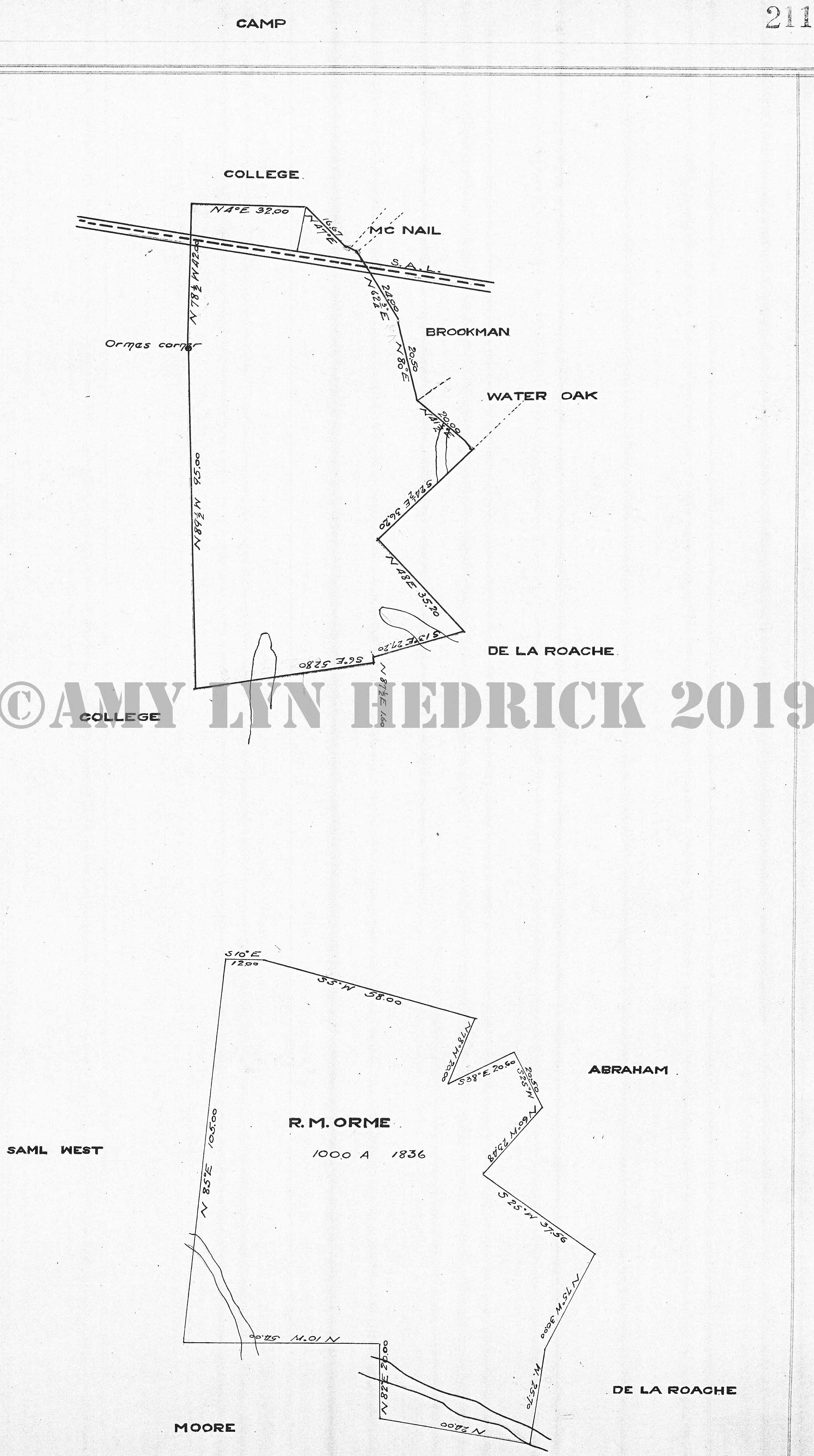
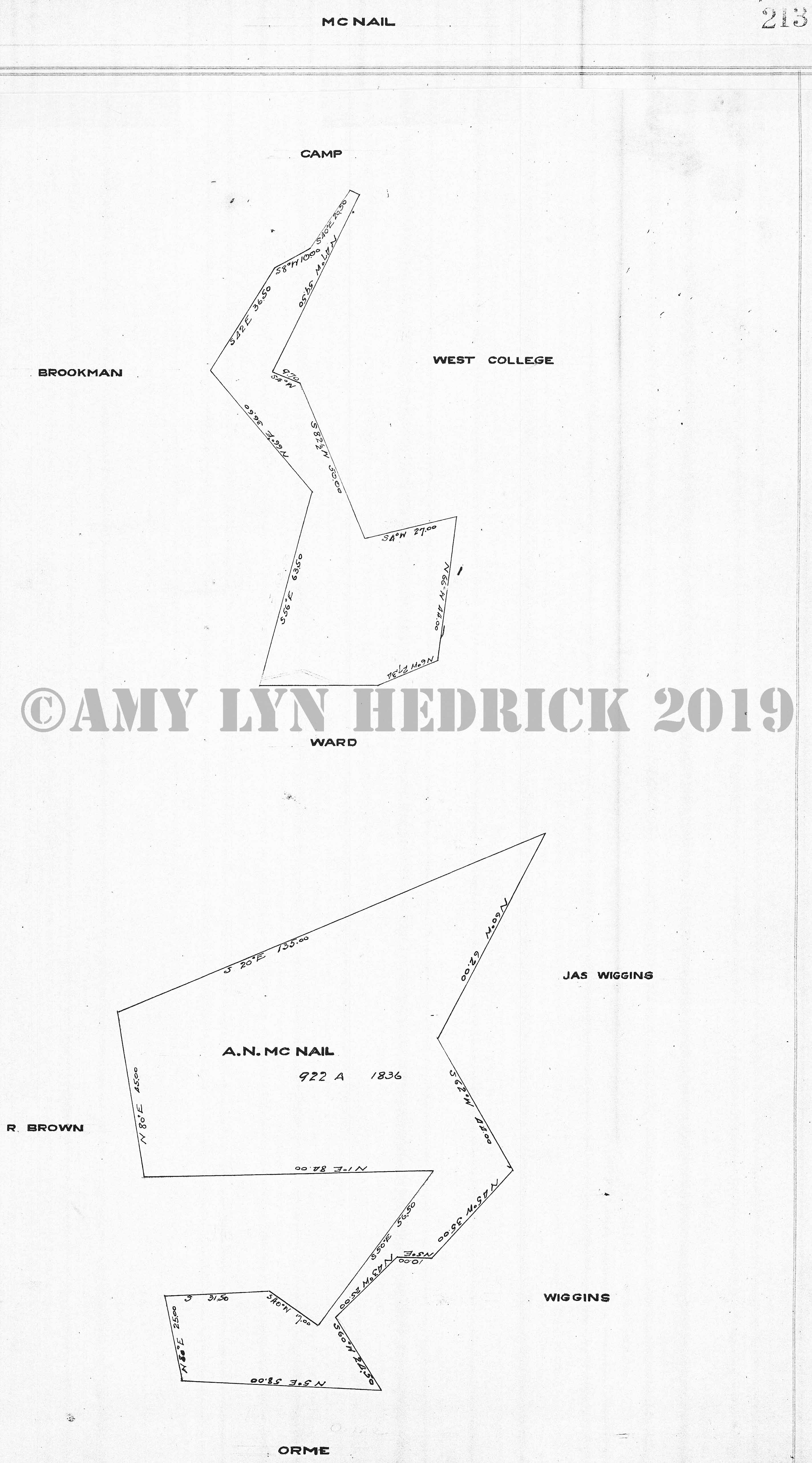
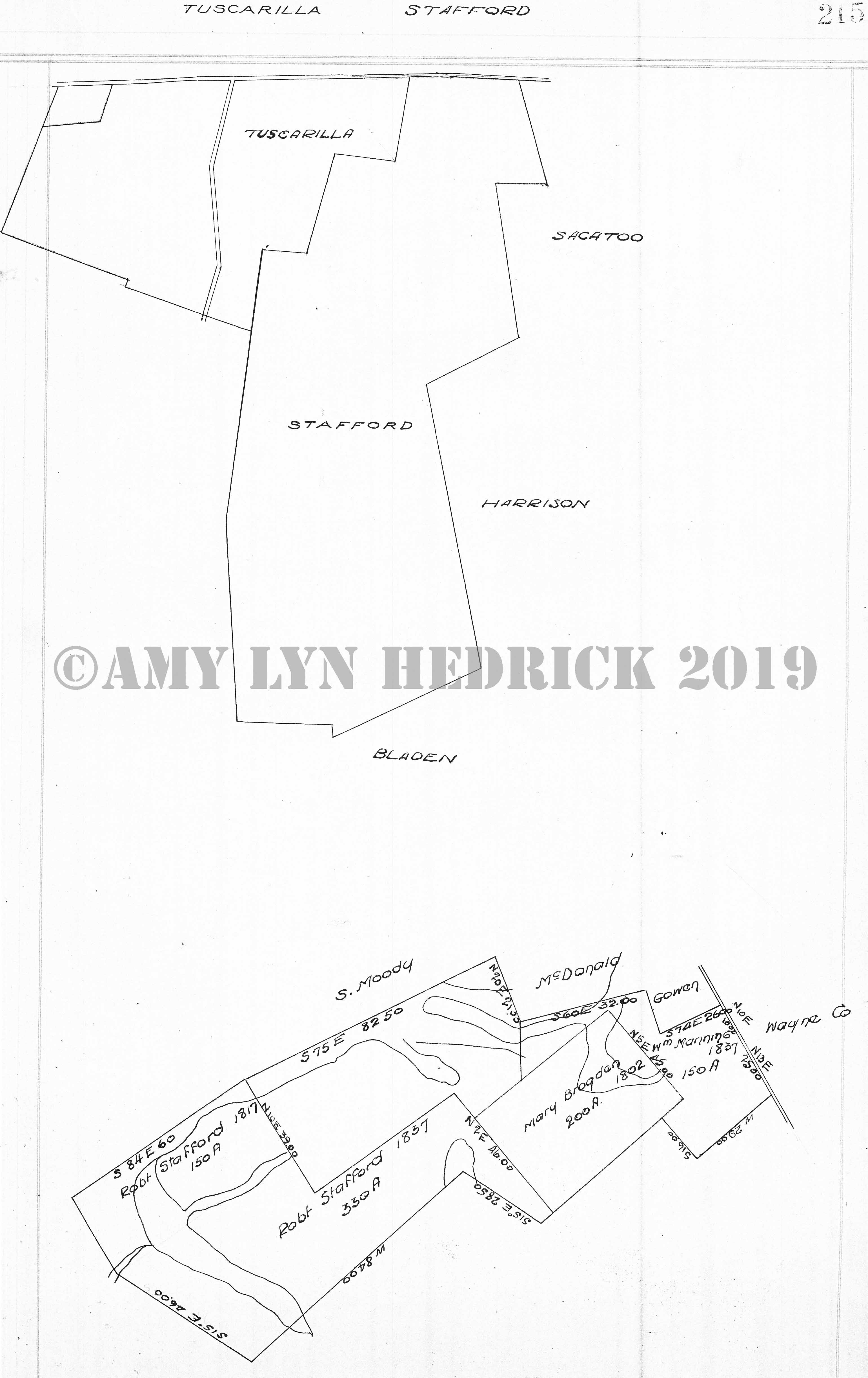
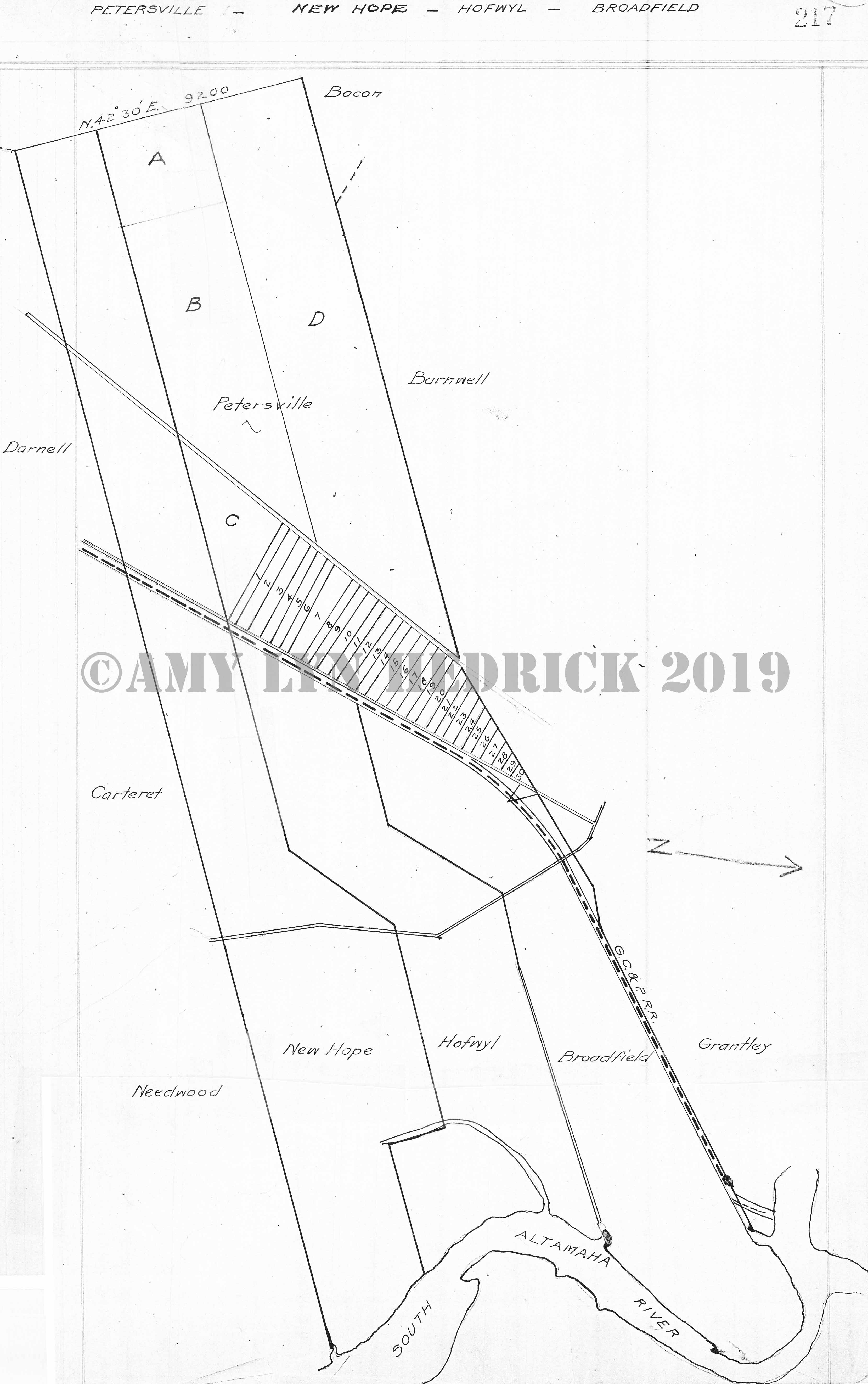
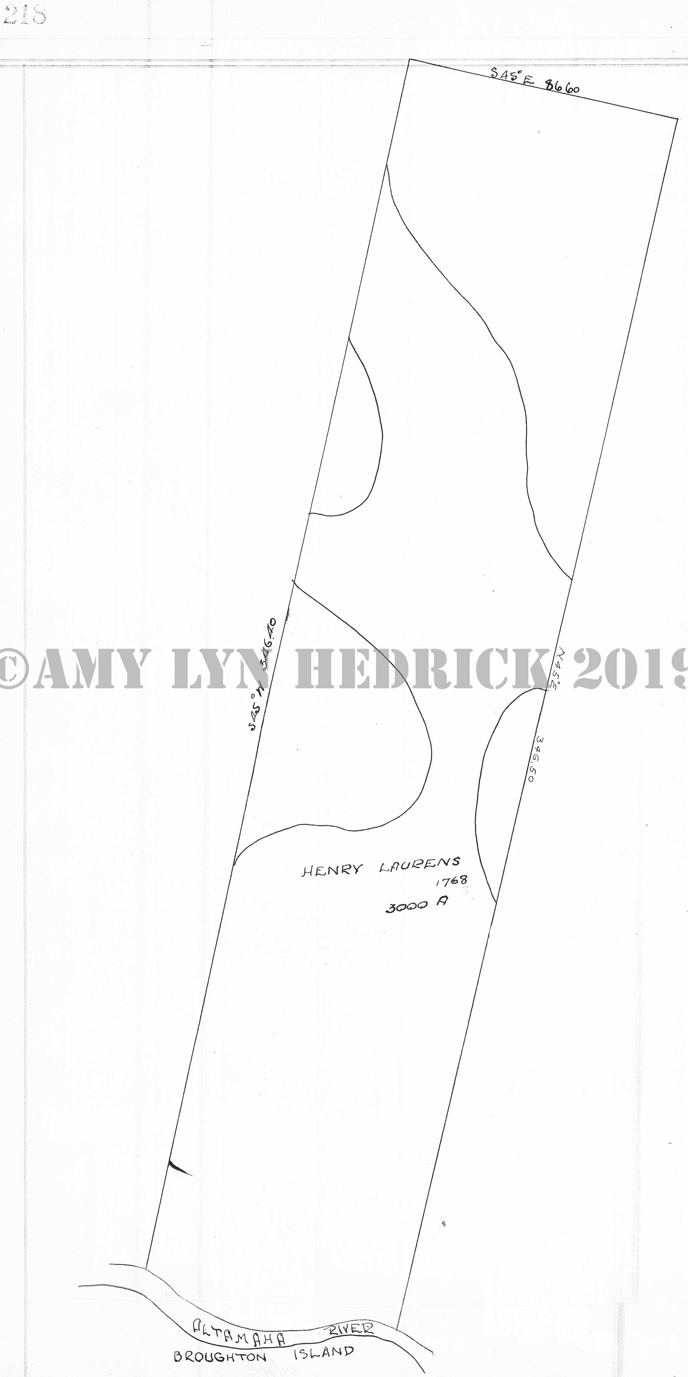
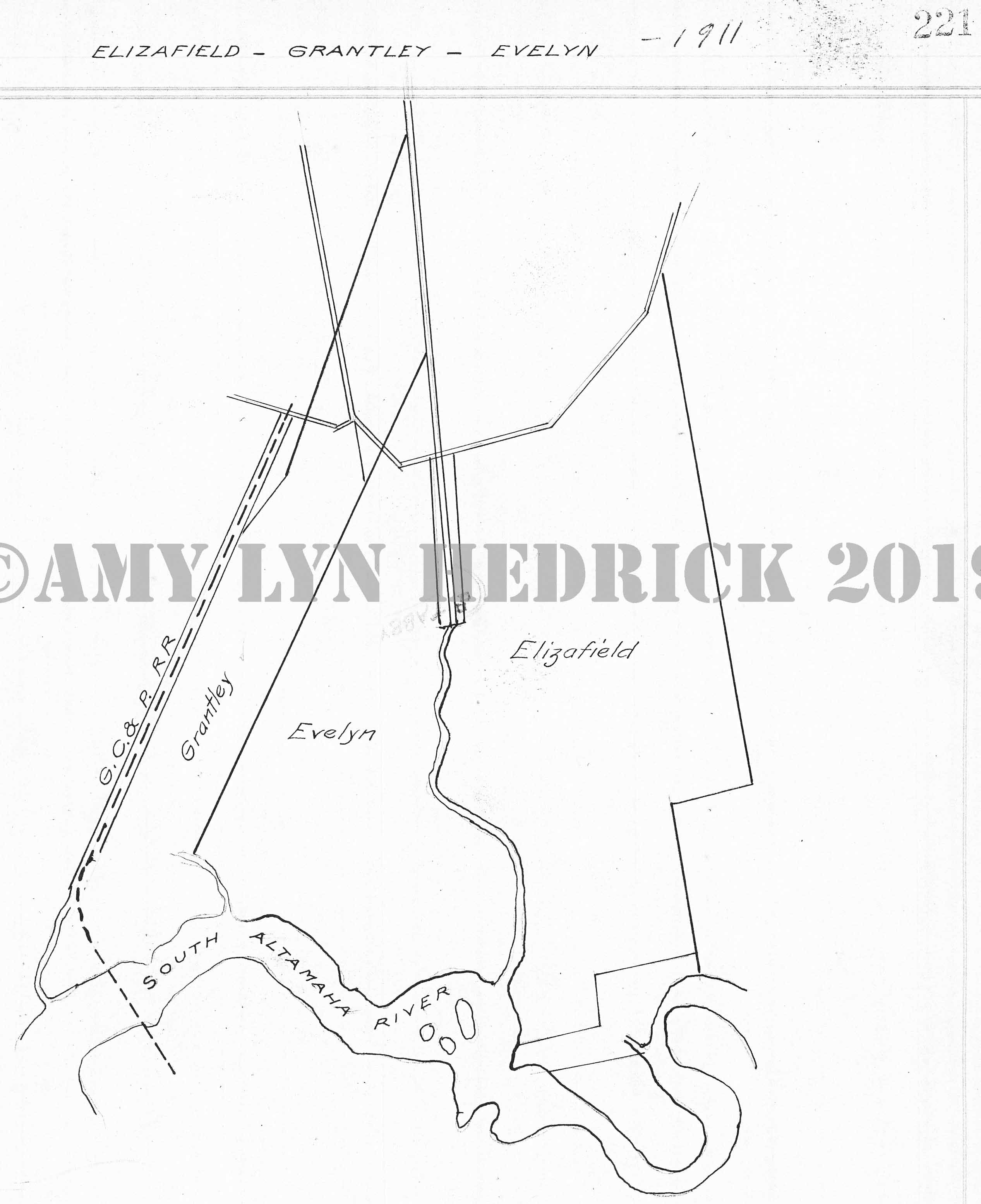
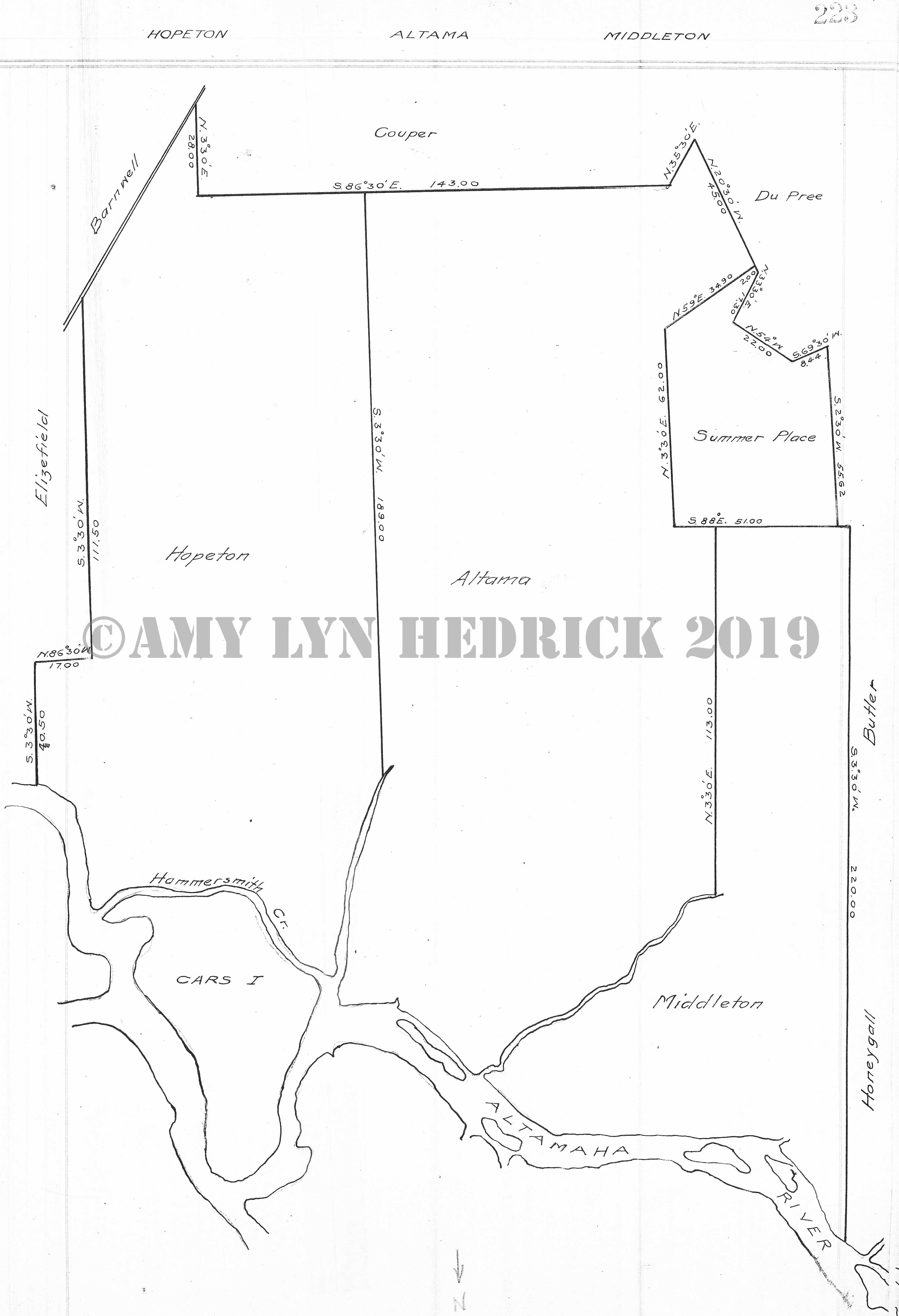
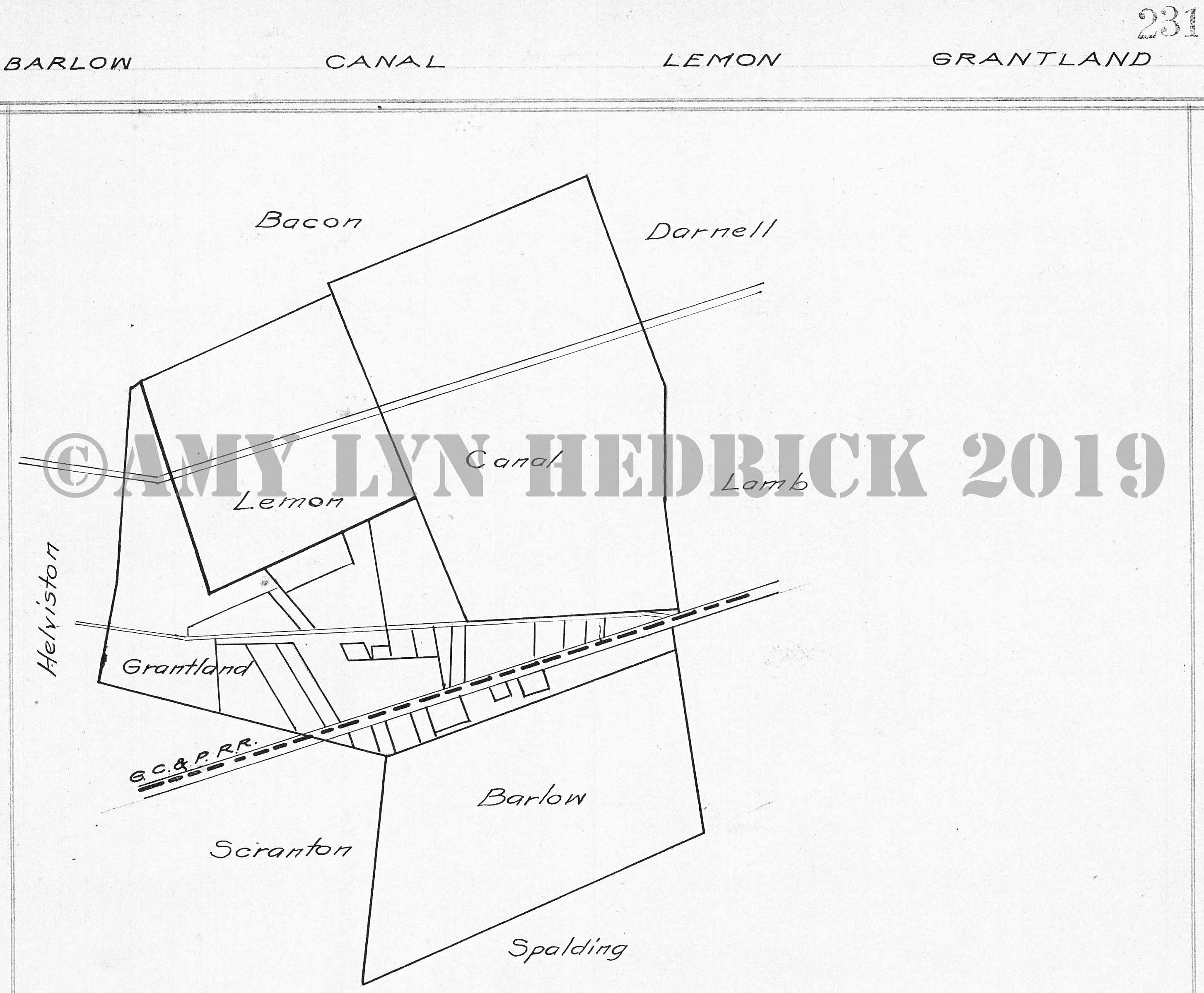
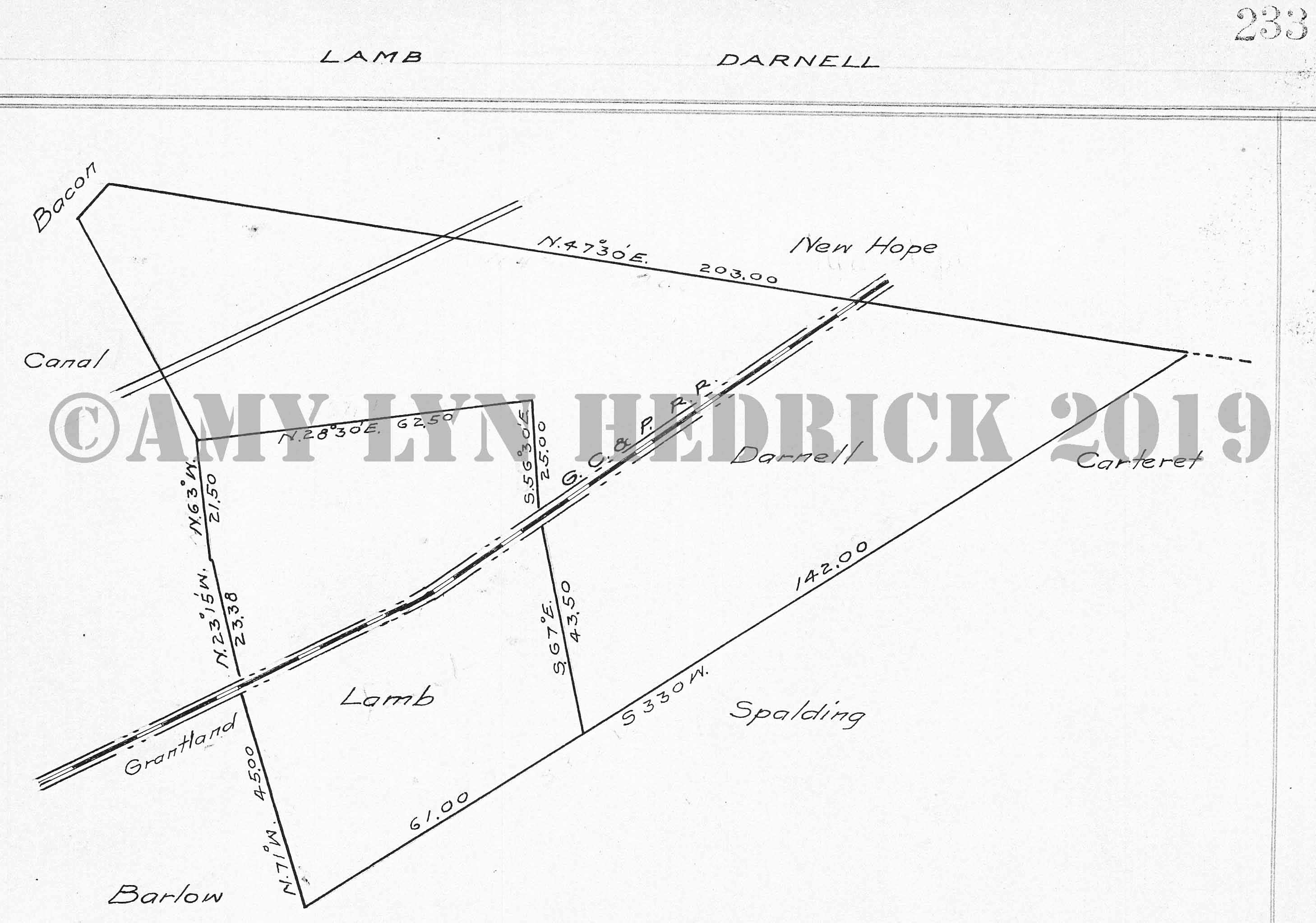
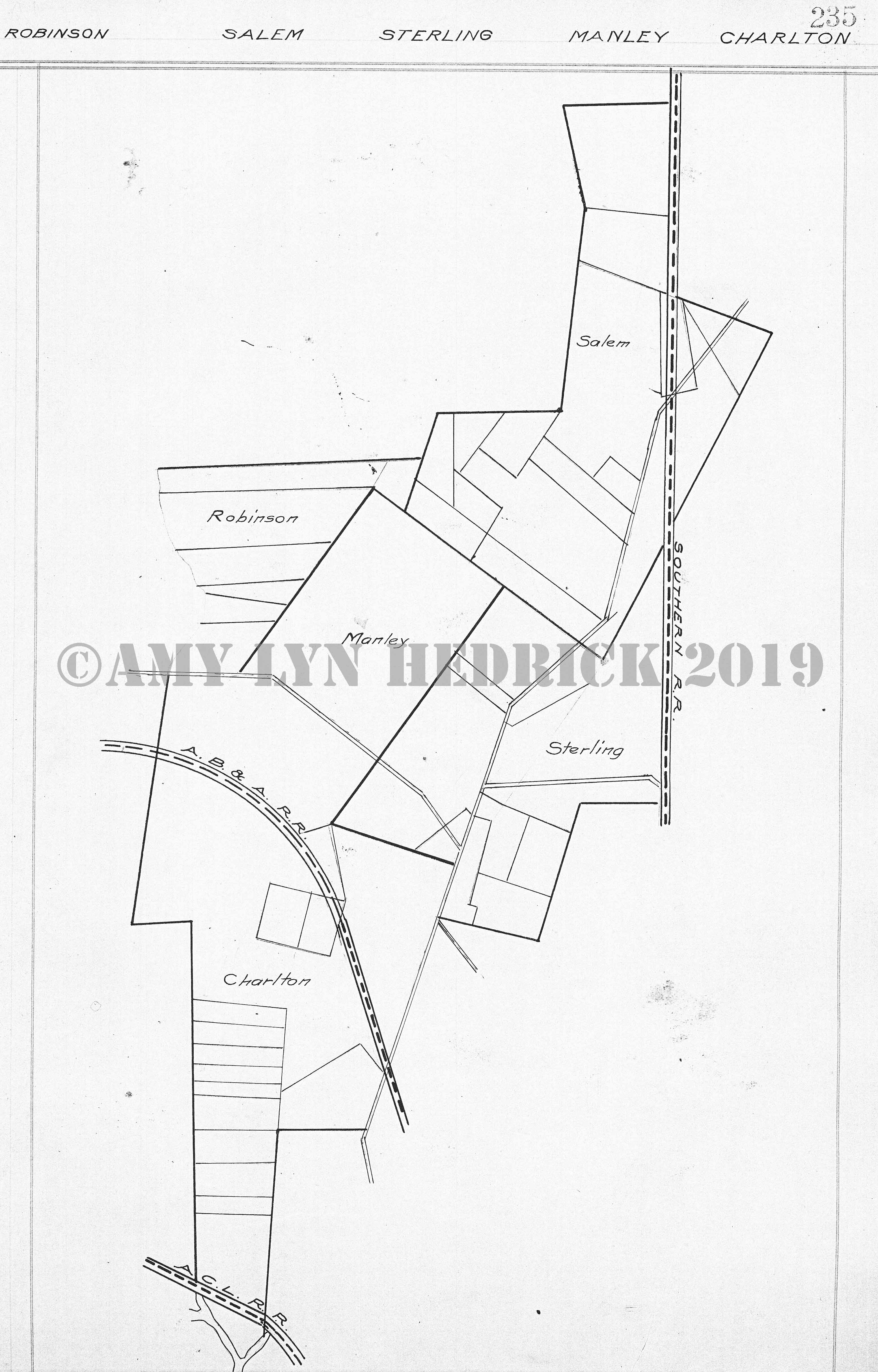
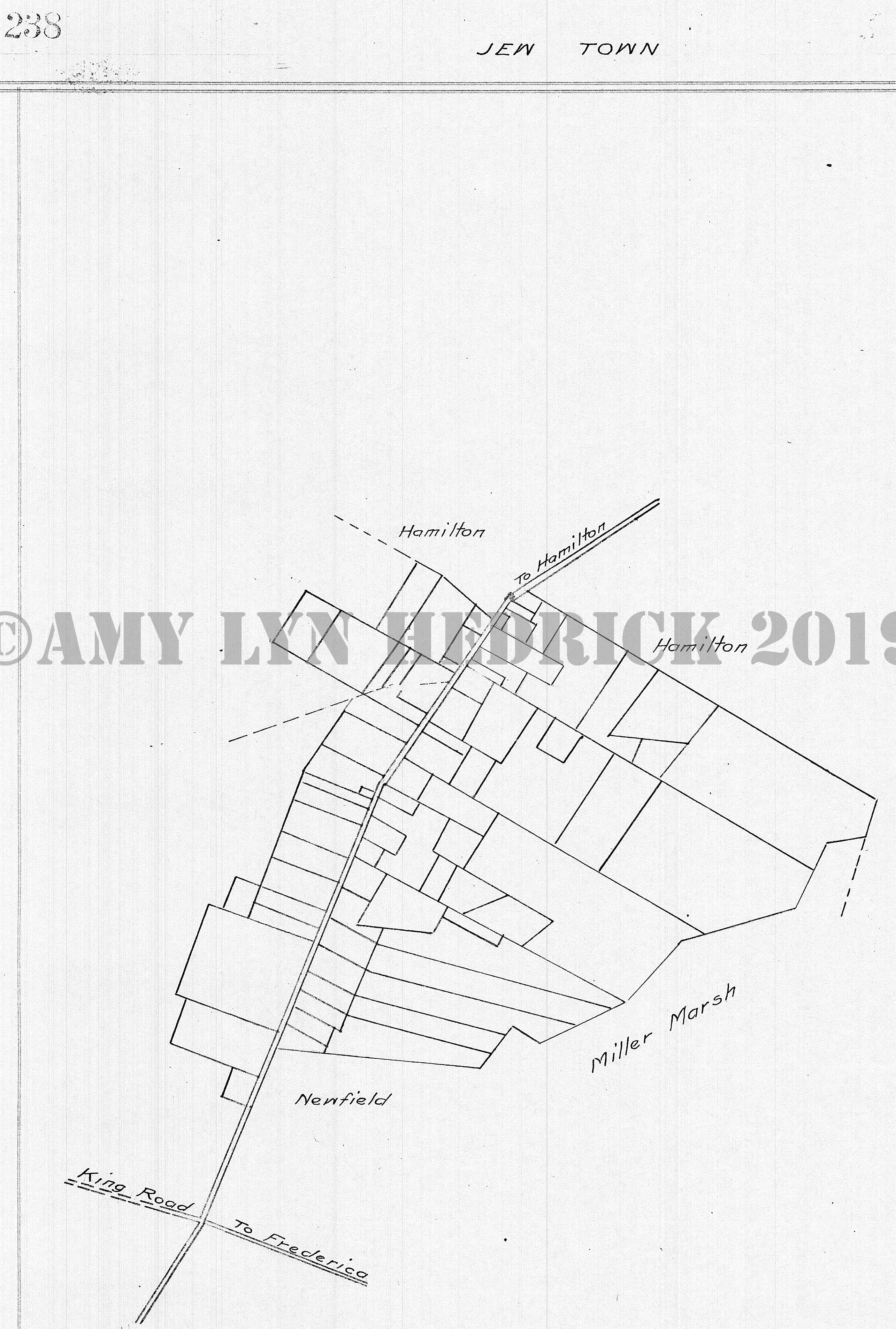
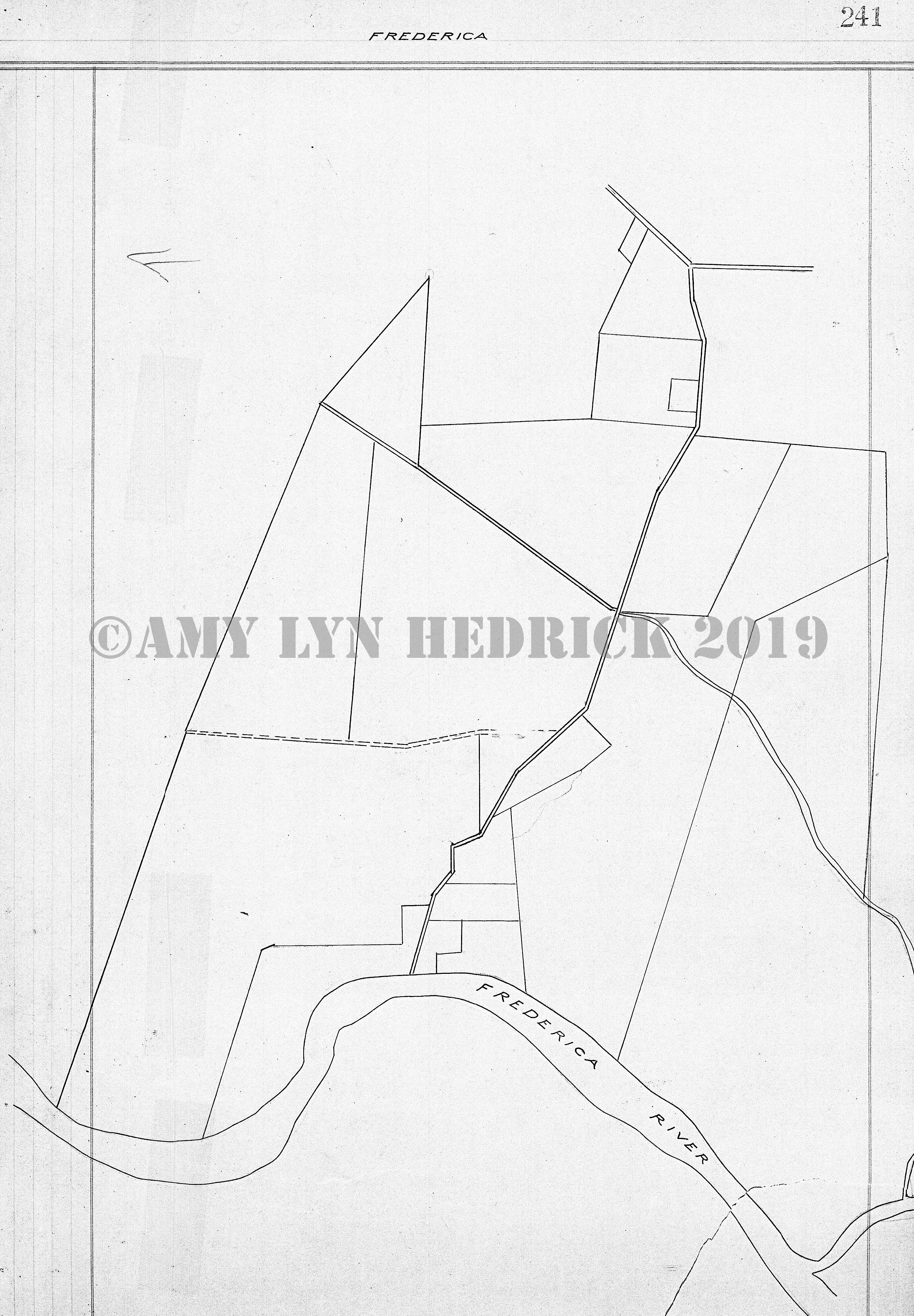
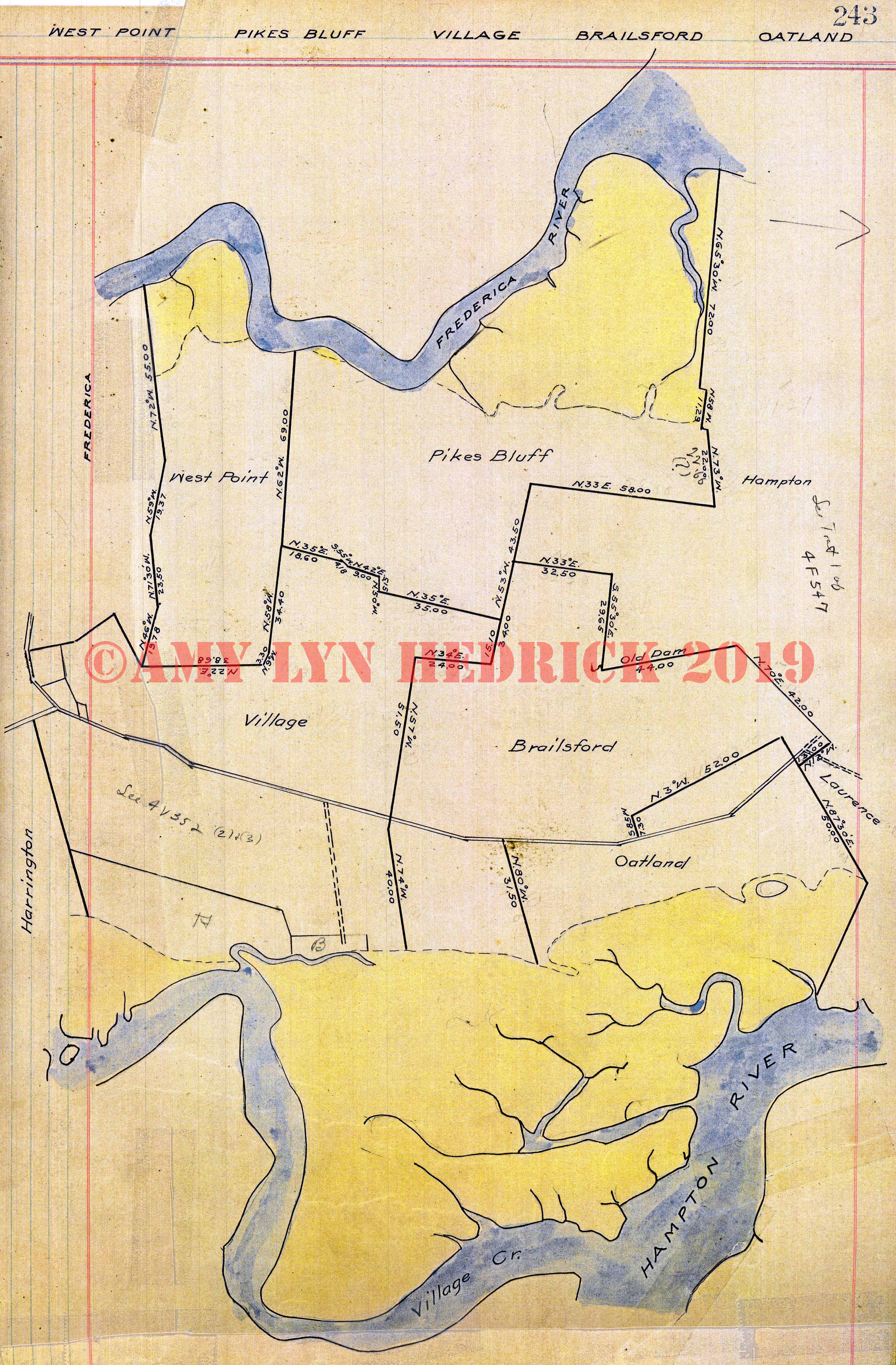
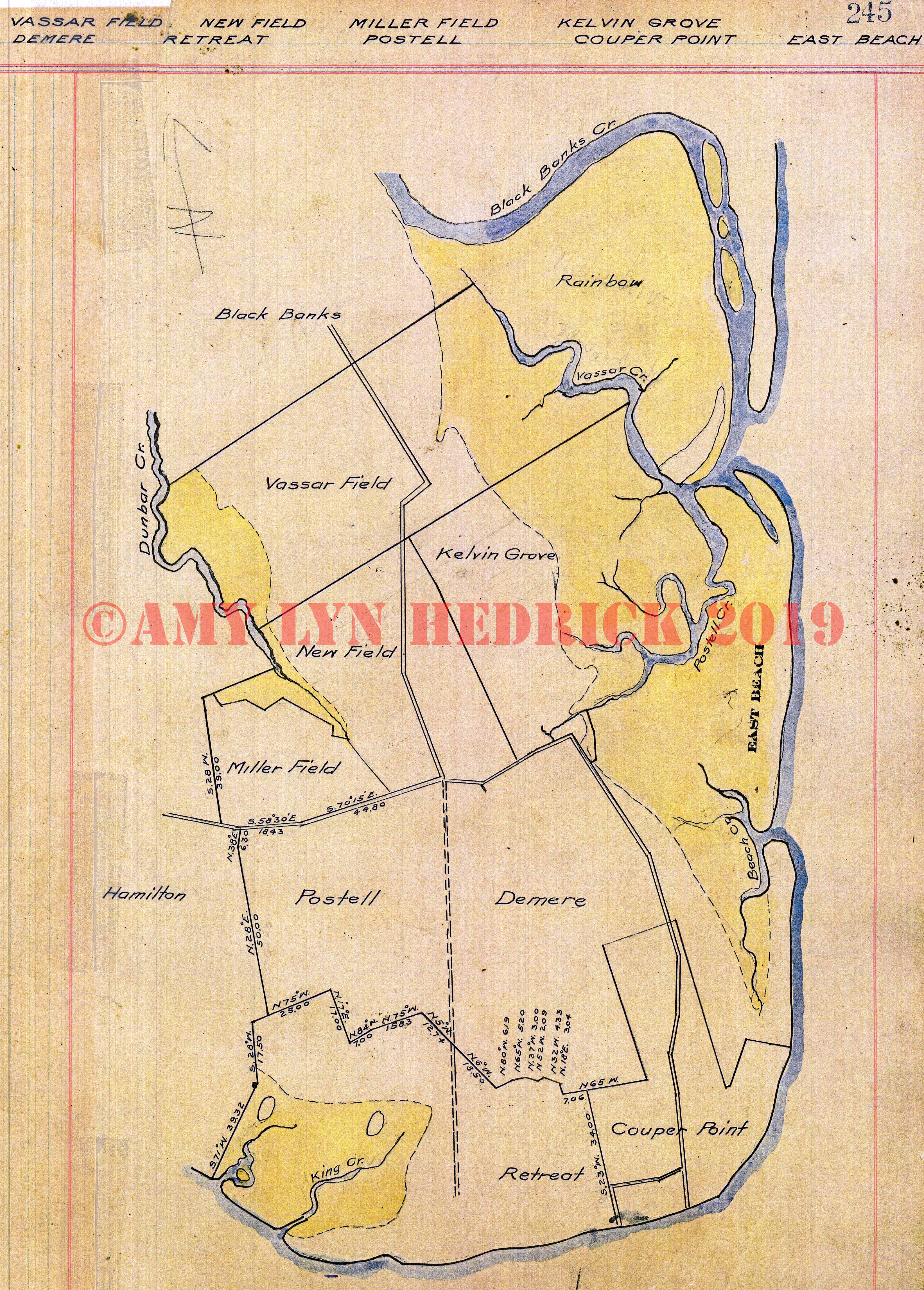
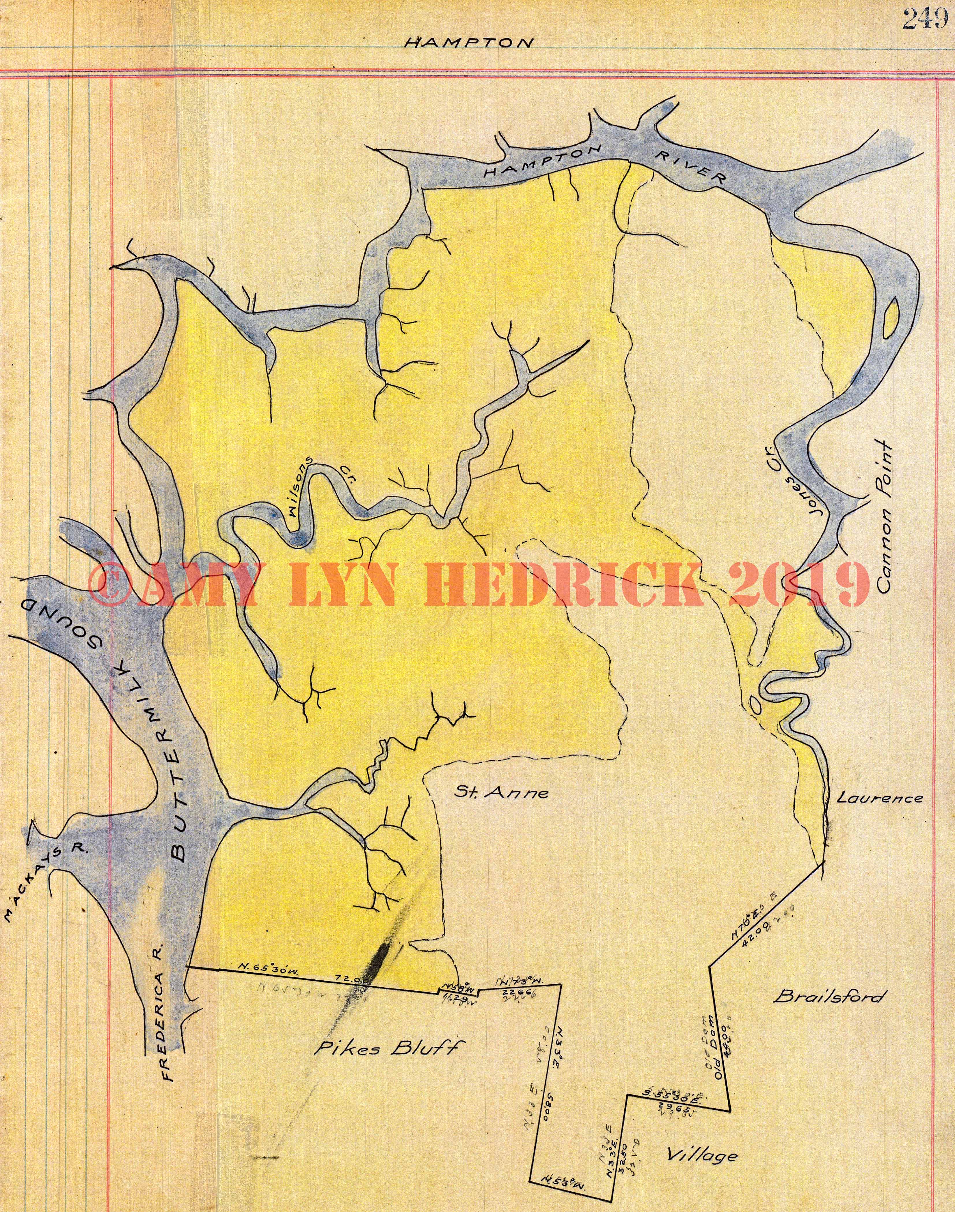
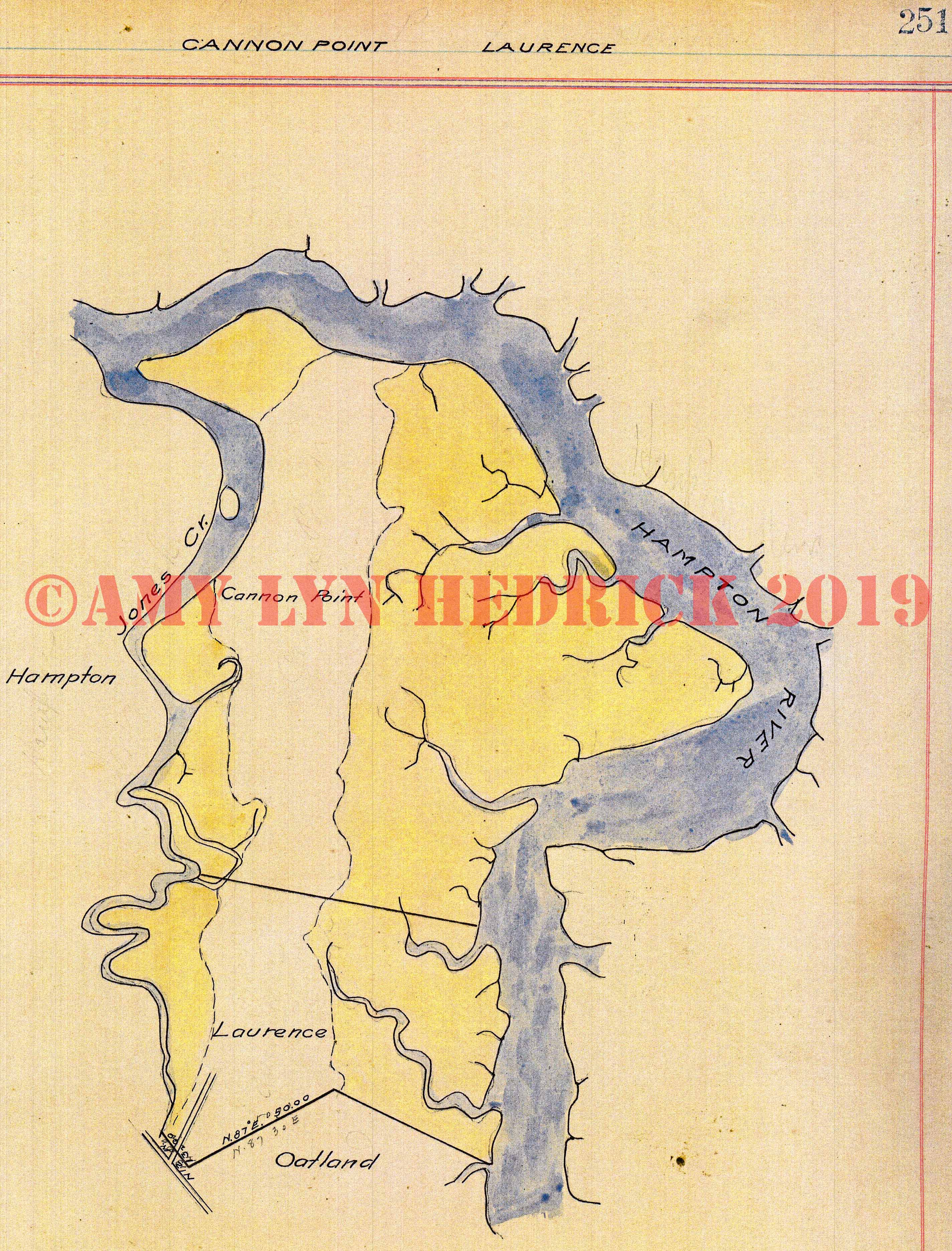
Page 190 Page 191 -- "Cabbage Bluff, Bethel, Green Creek" also: Dover Hall, Jamaica, De La Roache, College, O'Bryan, Bona Venture Page 192 Page 193 -- "Coleridge" also: Tuscarilla, Wayne County line, Ward, Tison, ACL railroad, Job Tison (1812), Wayne County line as Post Road, Vacant on two sides, Sidney Peck (should be Sidnah) (1837), Job Tison on two sides, Peck, Peacock, Wm. Campbell Page 194 Page 195 -- "Johnston, Bladen" also: ACL and SAL railroads intersecting at Bladen Page 196 -- "No Title" also: Wm. Nelson (1792), vacant on all sides, Wm. Campbell (1836), Wm. Tison, McDonald, Job Tison, Peacock, M. Peck (1824), vacant on 3 sides, Aaron Tison, Tison Road to Turtle River Page 197 -- "Tison" also: Coleridge, Ward, Water Oak, De La Roache, Bladen, Steven Mood(y) (1837), McDonald on two sides, Vacant, Wm. Campbell, Wm. Tison, plot not named, De La Roache, vacant on two sides, Peacock, M. Peck Page 198 Page 199 -- "Dewitt" also: Clark's Bluff, May, O'Bryan's Tram, Jasmine, Speight, Hooker, Barrington Road Page 200 Page 201 -- "De La Roache Tract" also: Tison, Grantham Corner, Zuberbuhler Corner, Water Oak Branch, Camp, College, Mary Wright, Morgan Branch, Georgetown, O'Bryan, Bethel, Hix Corner, Green Creek, Turkey Swamp, Johnston, Bladen, De La Roache Corner, ACL railroad, SAL railroad Page 202 Page 203 -- "No Title" also: John Grantham (1797), William Nelson, Ann Webster, Vacant on 3 sides, John Piles (1792), vacant on all sides, John Piles (1792), vacant on 3 sides, John Piles, Bartholomew/Zuberbuhler (1765), Wiggins, Unknown, John Piles, Philip Hix, John Butler, note at bottom of page says "Resurveyed per Dr. De La Roache & Wm. M. Riley in 1849" Page 204 Page 205 -- "No Title" also A. De La Roache (1832), Piles, Piles, De La Roache, L. Abraham, new survey, John Piles (1785), A De La Roache (1833), Grantham, Johnston's, Vacant, Philip Hix, Wm. Jones (1773), James Butler, P. Houston, Vacant, John Piles Page 206 Page 207 -- "No Title" also: R. Hixt (1763), Tison, John Piles, Waters, Hix, Zuberbuhler, Mary Wright, Maj. West, Thos. Waters, Geo. Purvis Page 208 Page 209 -- "Georgetown" also: De La Roache, College, O'Bryan, De La Roache, Thos. Waters, John O'Bryan, John O'Bryan, W. Swain, Thos. Waters Page 210 Page 211 -- "Camp" also: College, Orme's Corner, College, De La Roache, Water Oak, Brookman, McNail, SAL railroad, R.M. Orme (1836), Saml. West, Moore, De La Roache, Abraham Page 212 Page 213 -- "McNail" also: Camp, Brookman, Ward, West College, A.N. McNail (1836), R. Brown, Orme, Wiggins, Jas. Wiggins Page 214 Page 215 -- "Tuscarilla, Stafford" also Bladen, Harrison, Sacatoo, Robert Stafford (1817), Robt. Stafford (1837), Mary Brogden (1802), Wm. Manning (1837), S. Moody, Wayne County line, Gowen, McDonald Page 216 Page 217 -- "Petersville, New Hope, Hofwyl, Broadfield also: Bacon, Darnell, Carteret, Needwood, Grantley, Barnwell, GC&P railroad Page 218 -- "No Title" also: Henry Laurens (1768), Broughton Island Page 219 Page 220 Page 221 -- "Elizafield, Grantley, Evelyn" also: GC&P railroad Page 222 Page 223 -- "Hopeton, Altama, Middleton" also: Couper, Barnwell, Elizafield, Cars Island, Honeygall, Butler, Summer Place, Du Pree Page 224 Page 225 Page 226 Page 227 -- "Spalding, Barrett, Monticello, Thornhill, Sedgemoor" also: Carterett (as spelled), Darnell, Lamb, Barlow, Scranton Page 228 Page 229 Page 230 Page 231 -- "Barlow, Canal, Lemon, Grantland" also: Bacon, Helviston, Scranton, Spalding, Lamb, Darnell, GC&P railroad Page 232 Page 233 -- "Lamb, Darnell" also: Bacon, Canal, Grantland, Barlow, Spalding, Carteret, New Hope, GC&P railroad Page 234 Page 235 -- "Robinson, Salem, Sterling, Manley, Charlton" also: Southern, AB&A, ACL railroads Page 236 Page 237 Page 238 -- "Jew Town" also: Hamilton, Miller Marsh, Newfield, King Road to Frederica intersects road to Hamilton that runs through the property Page 239 Page 240 Page 241 -- "Frederica" Page 242 Page 243 -- "West Point, Pikes bluff, Village, Brailsford, Oatland" also: Frederica, Harrington, Hampton, Laurence Page 244 Page 245 -- "Vassar Field, Demere, New Field, Retreat, Miller Field, Postell, Kelvin Grove, Couper Point, East Beach" also: Black Banks, Rainbow, Hamilton Page 246 Page 247 Page 248 Page 249 -- "Hampton" also: Cannon Point, Laurence, Brailsford, Village, Pikes Bluff, St. Anne Page 250 Page 251 -- "Cannon Point & Laurence" also: Oatland, Hampton |
Home
Contact
Site Map
Copyright
©GlynnGen.com All Rights Reserved
Material on this site is one of kind,
having been published here for the first time ever. This data was compiled by
Amy Hedrick
for the GlynnGen website to be used for your personal use and
it is not to be reproduced in any manner on other websites or electronic media,
nor is it to be printed in any resource books or materials. Thank you!
Want to make a contribution?
Donate via PayPal: