![]()
Maps of Glynn County
This page is dedicated to maps, of Glynn County, cemeteries, links to other maps, and more.
Cemeteries
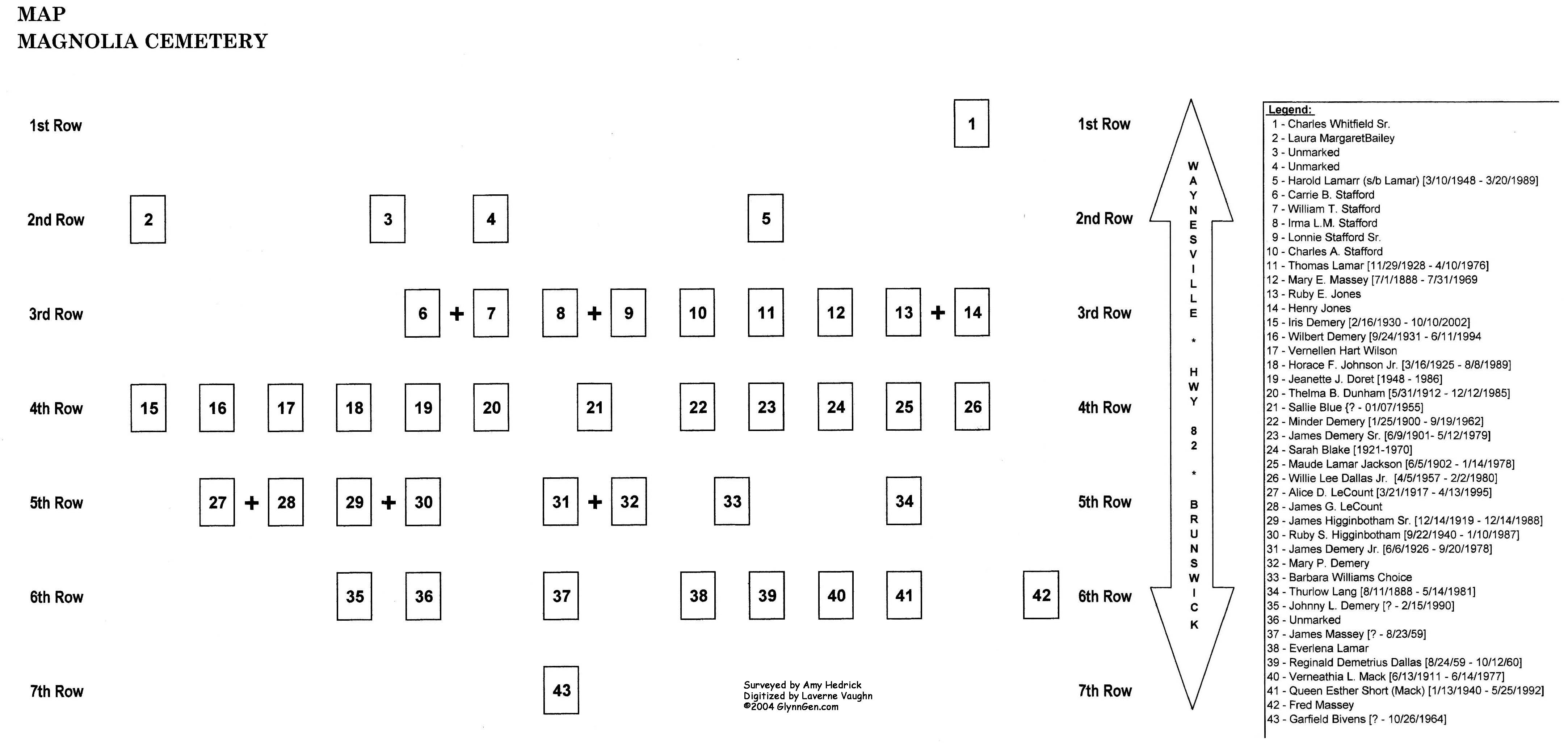
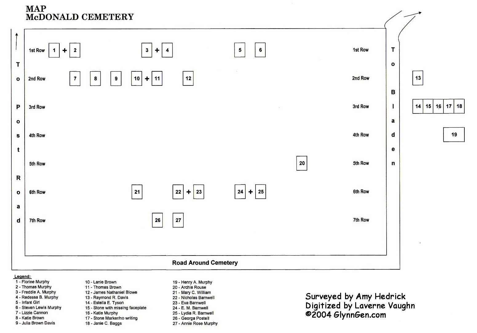
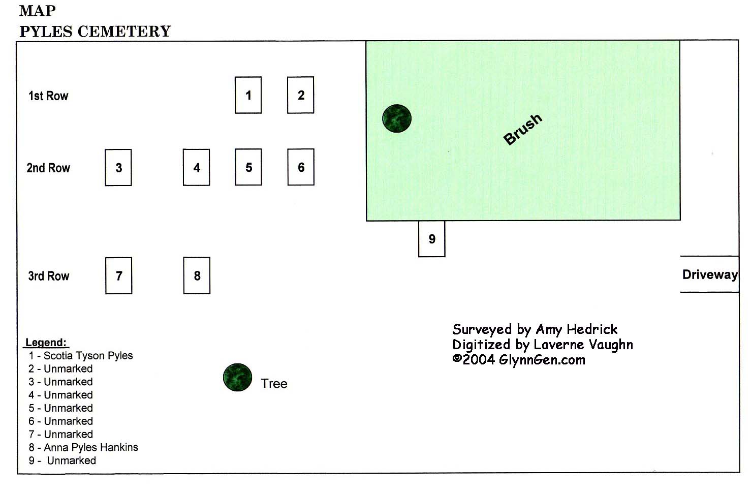
Many of these maps were hand drawn by Amy Lyn
Hedrick then digitized by Laverne Vaughn of New York.
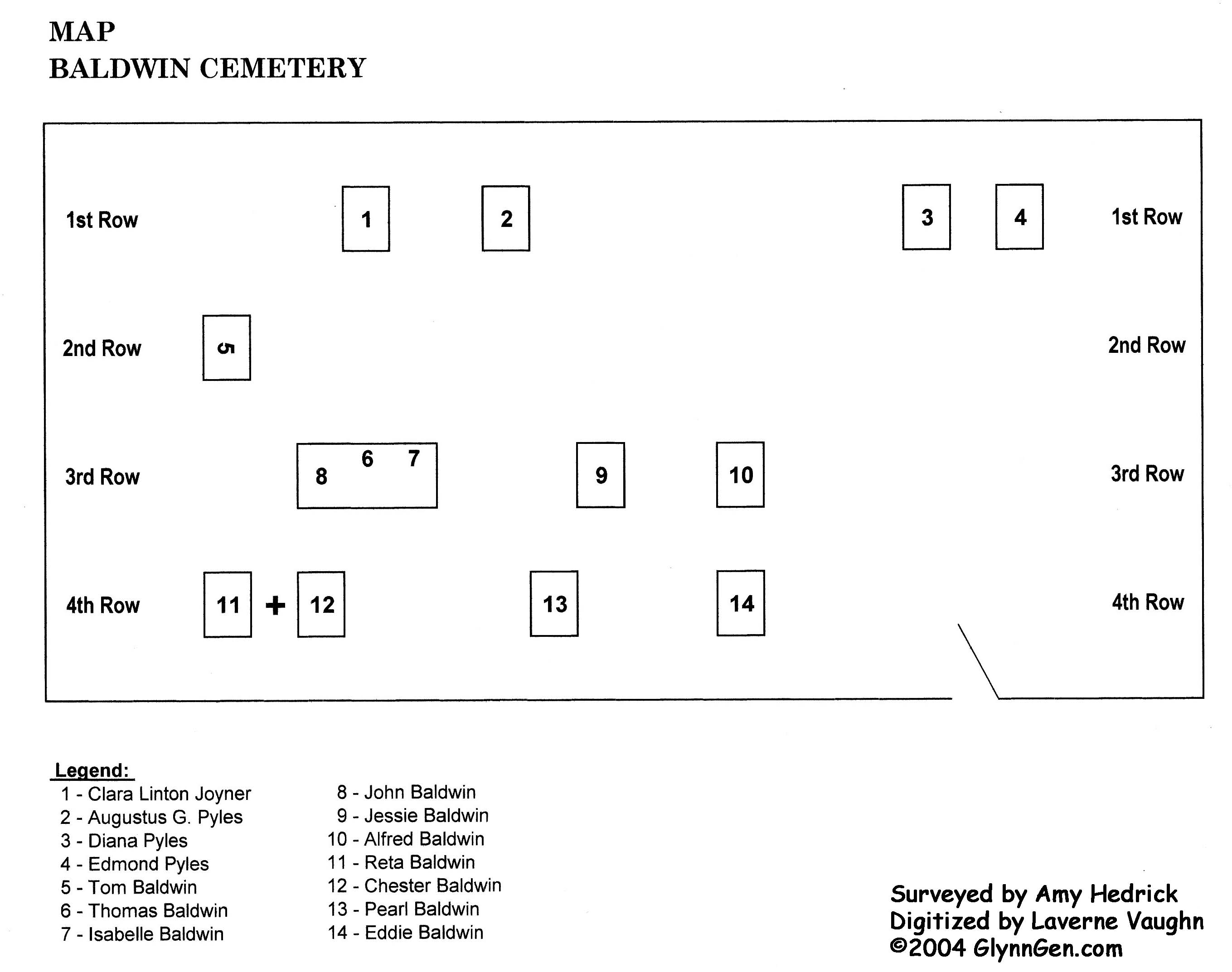
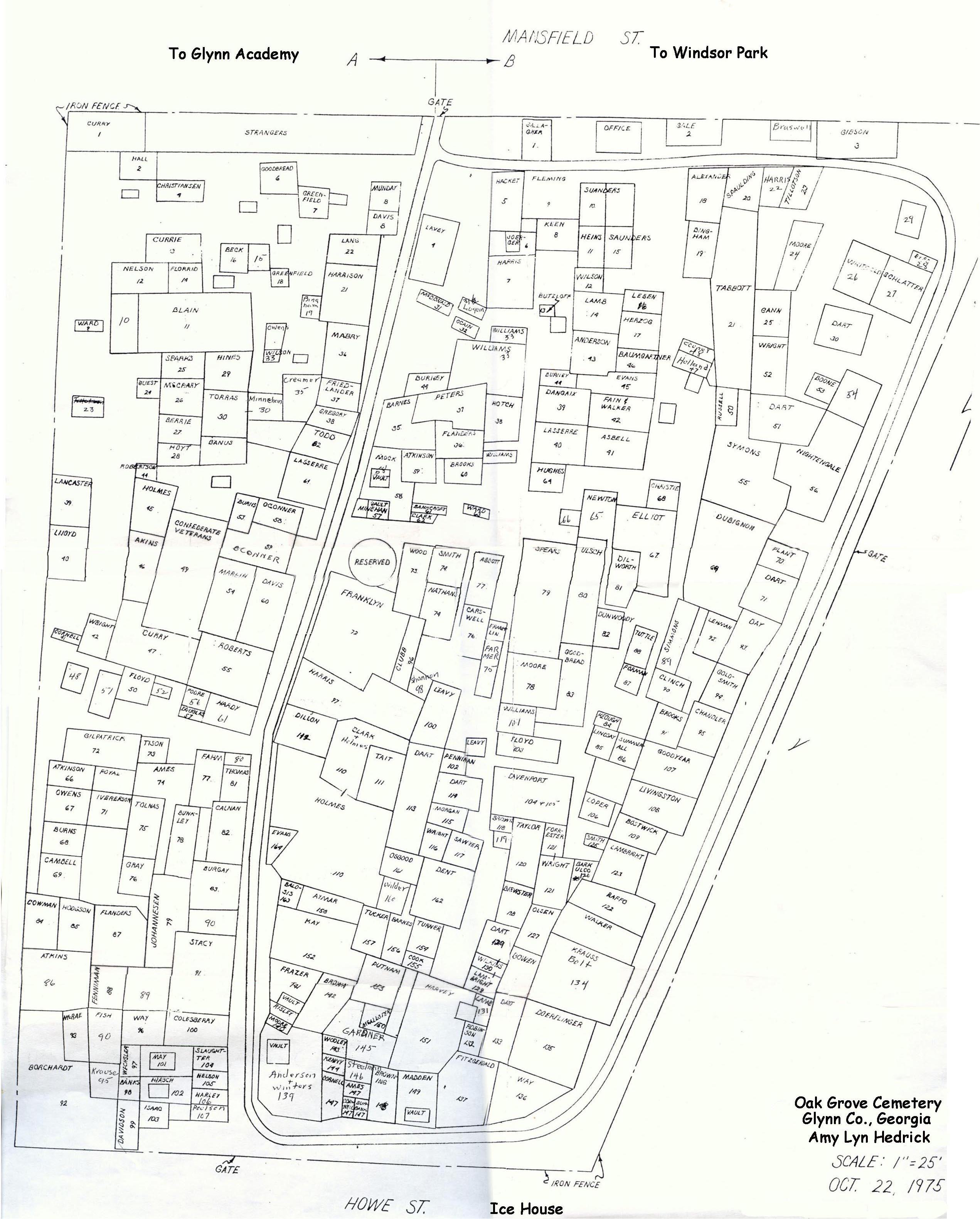
The Oak Grove Cemetery Map is an original digital map created by Amy Lyn Hedrick
The *listings are actual blueprint maps.
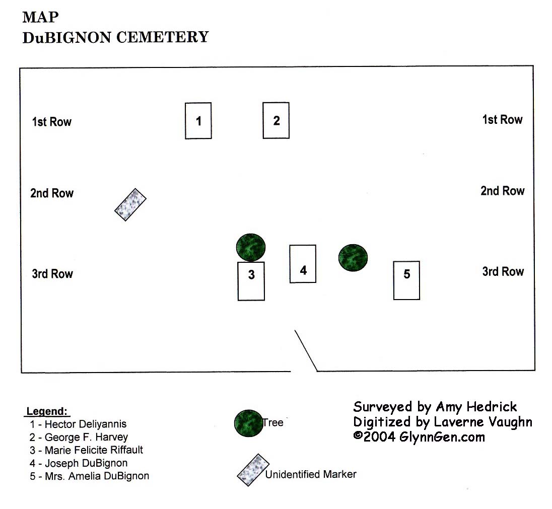
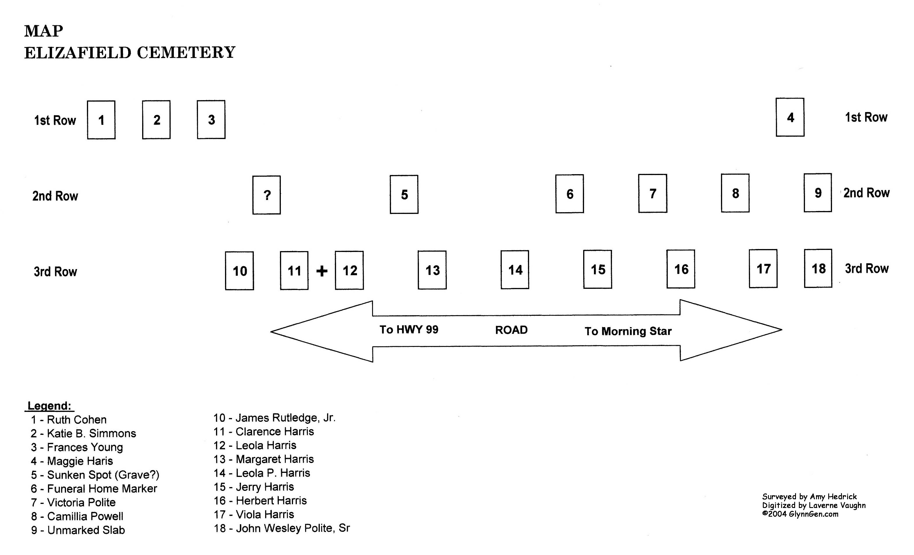
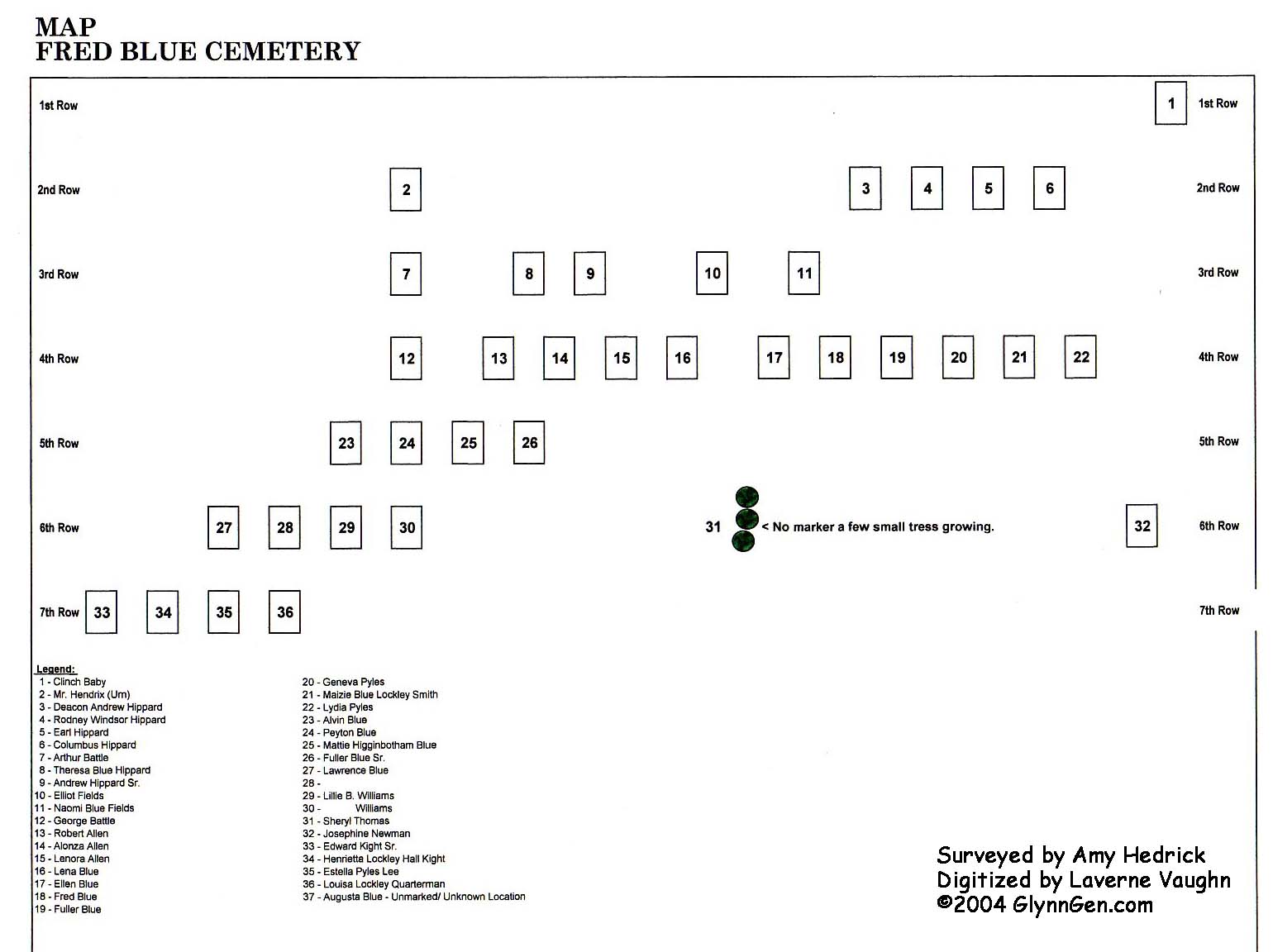
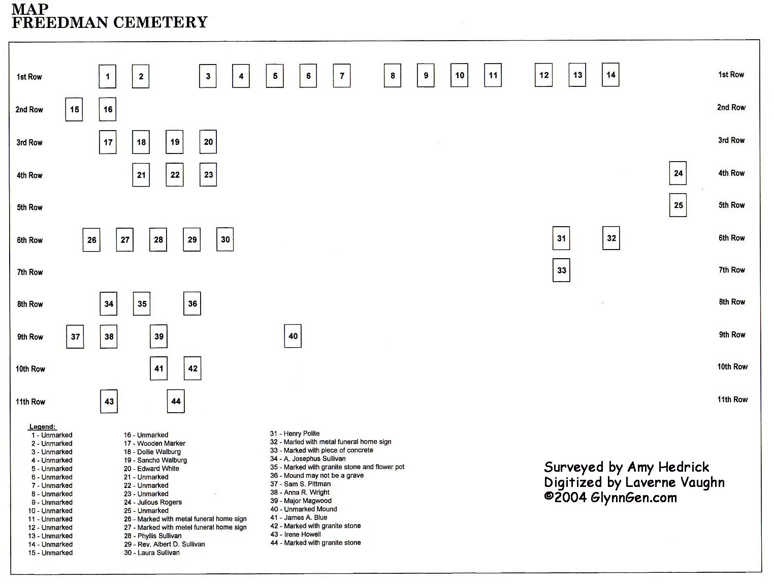
| BALDWIN | *CHRIST CHURCH | DUBIGNON | ELIZAFIELD |
| FRED BLUE | FREEDMAN | MAGNOLIA C.M.E | McDONALD |
| OAK GROVE | *OGLETHORPE MEM. GARDENS | PALMETTO | PYLES |
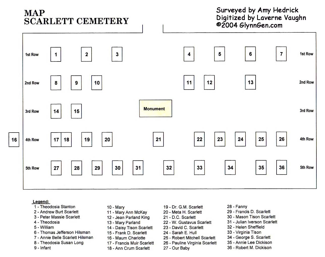
| SCARLETT |
Hwy. 82 Cemeteries
|
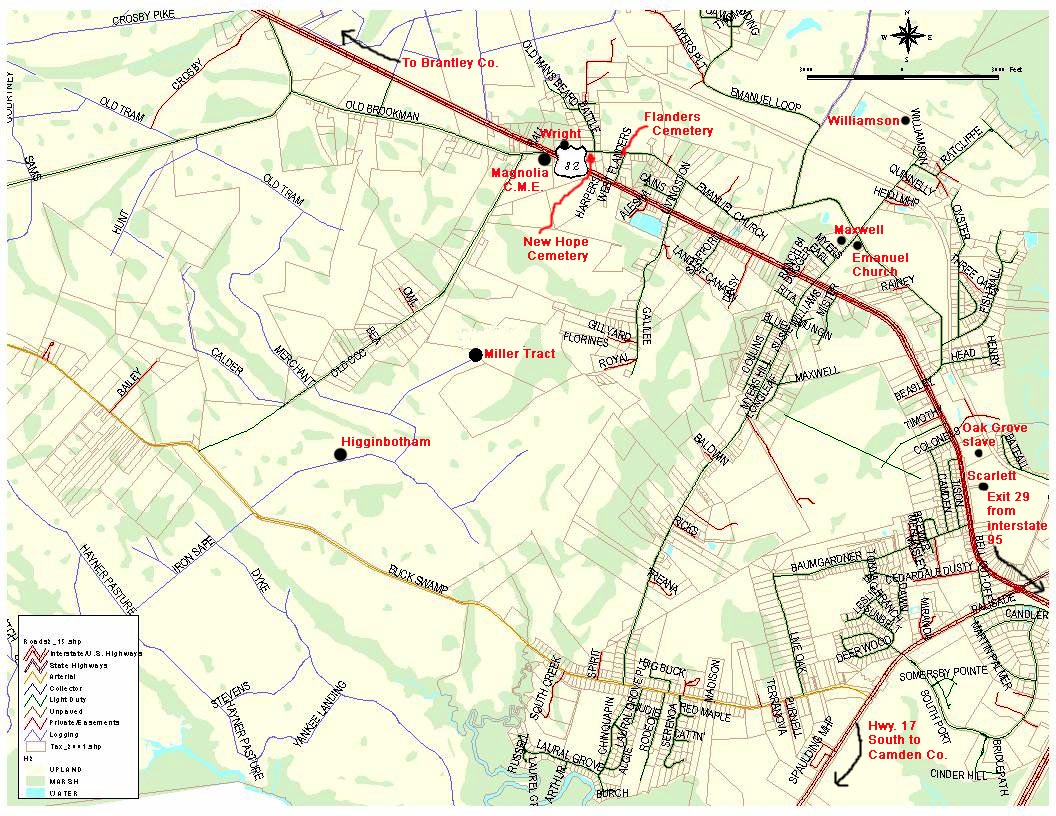
This map shows where on a street map the cemeteries for the Brookman Community are located. Not all cemeteries are noted yet. |
You will find the following cemeteries on this map:
|
Scarlett |
|
Maxwell |
Others not listed: Fred & Jim Blue, Baldwin, Allen-Richardson, Hippard, Davis-Drury, Mitchell/Waye.
1837 City of Brunswick
|
|
Maps
of Georgia Counties
GA State Archives
Glynn County Plantation Maps
The idea behind posting these maps, is for you to save them to
your computer
and taking them to a commercial printer, as many are too large to view online.
|
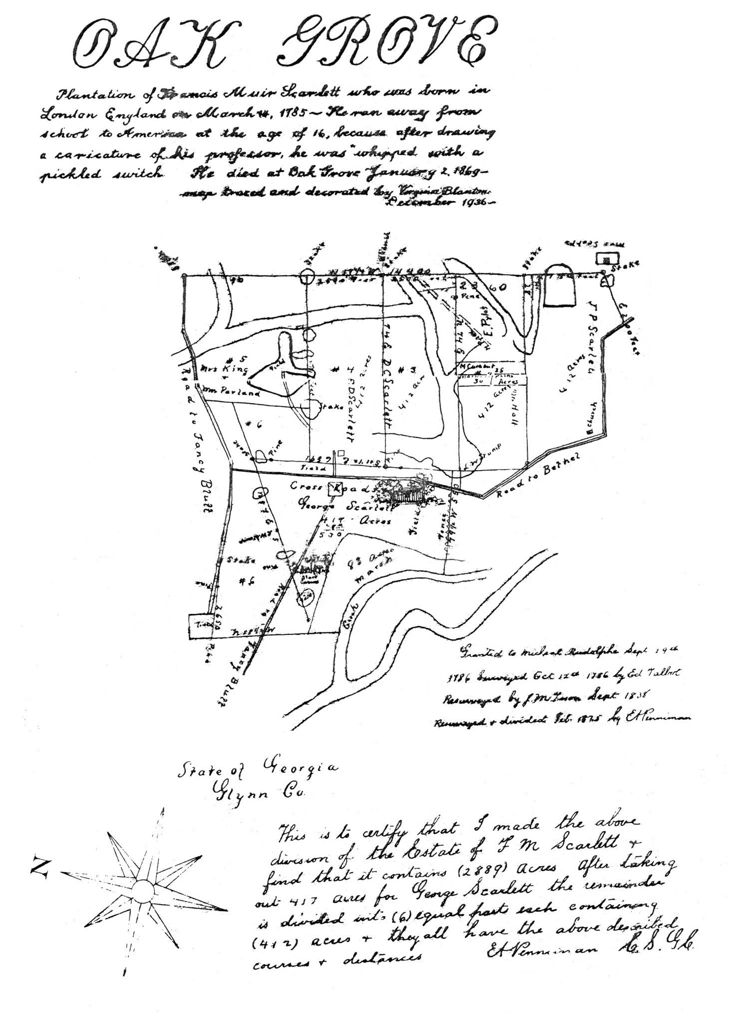
February 1875 survey of Oak Grove Plantation owned by the Scarlett Family |
|
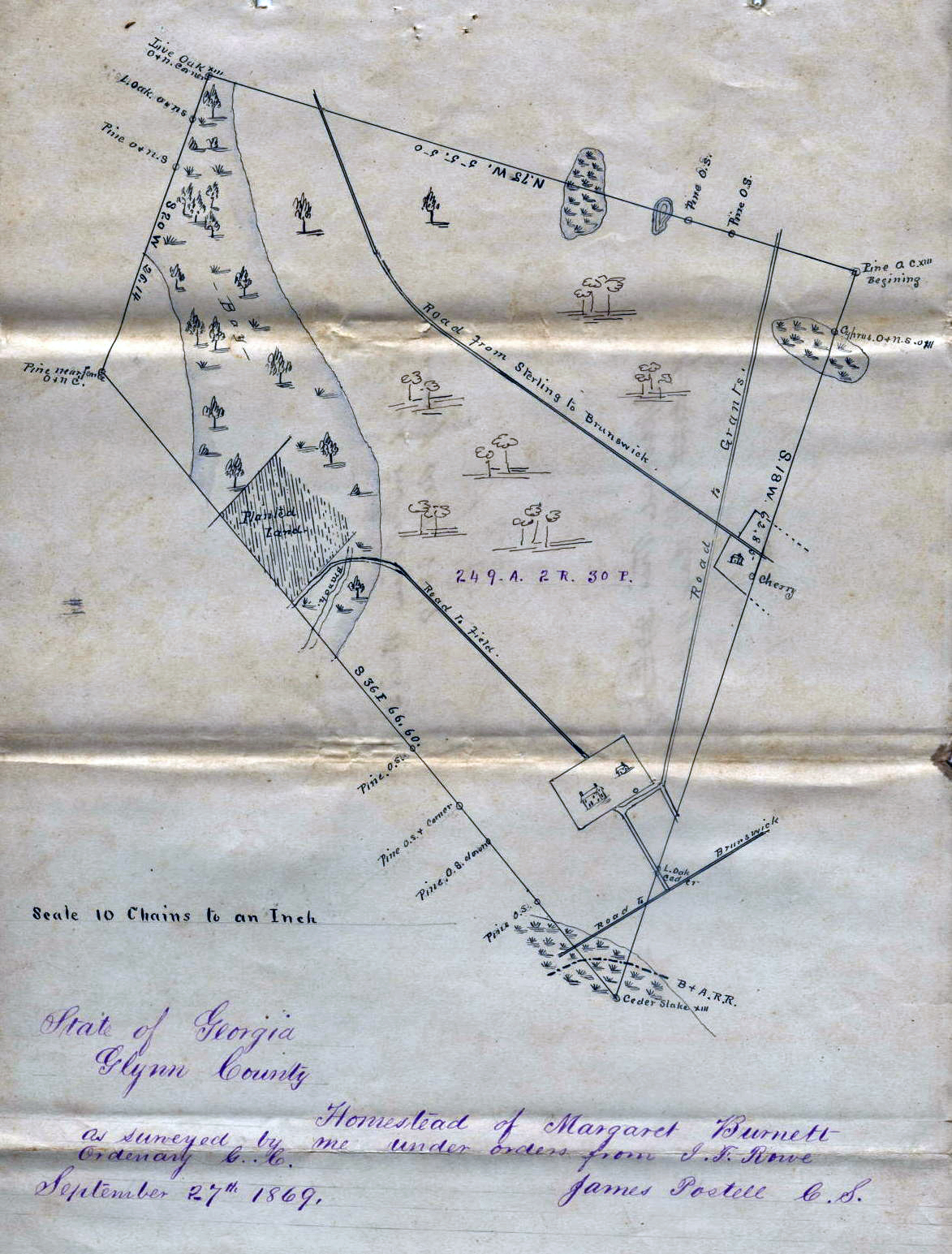
Homestead survey of land belonging to Margaret (Moore) Burnett 27 September 1869 |
 1935
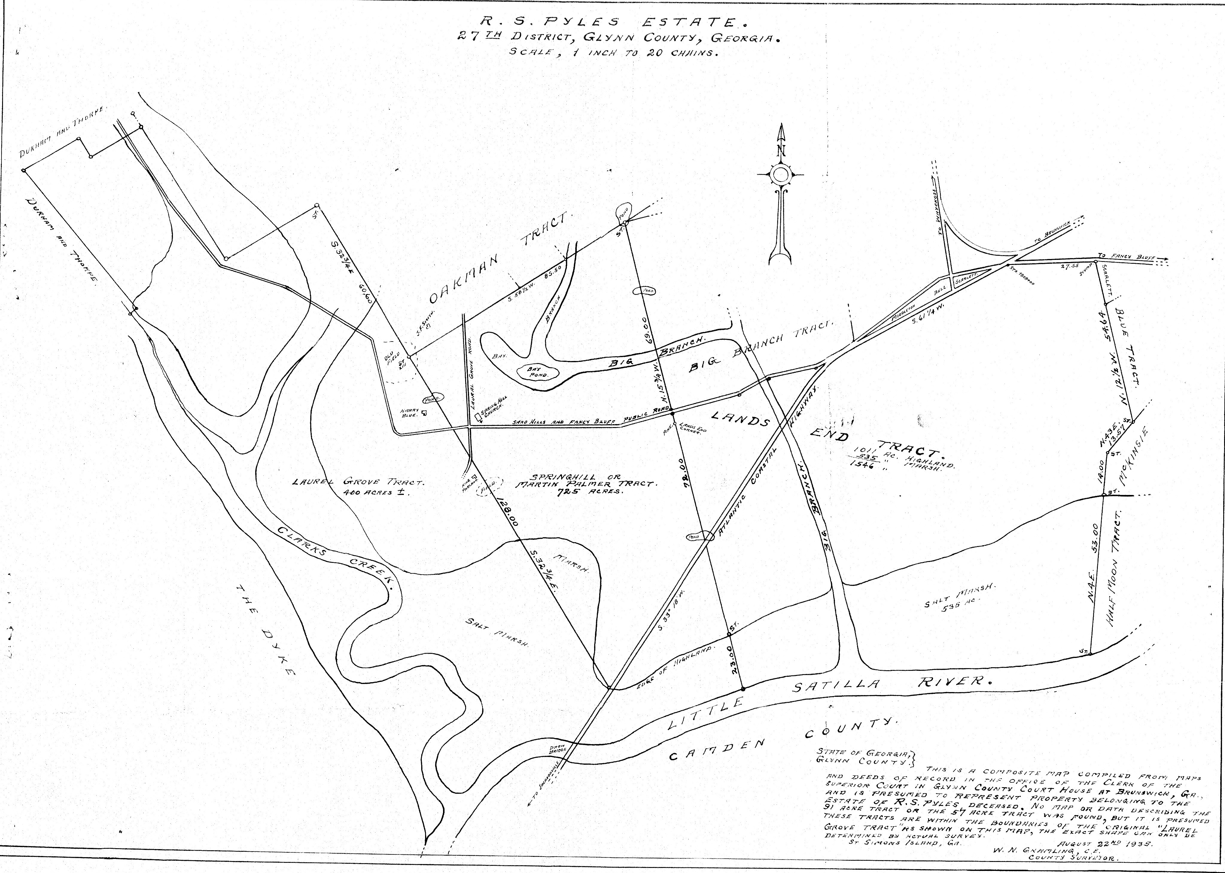
R.S. Pyles & Martin Palmer lands [Brookman Community] 1935
R.S. Pyles & Martin Palmer lands [Brookman Community] |
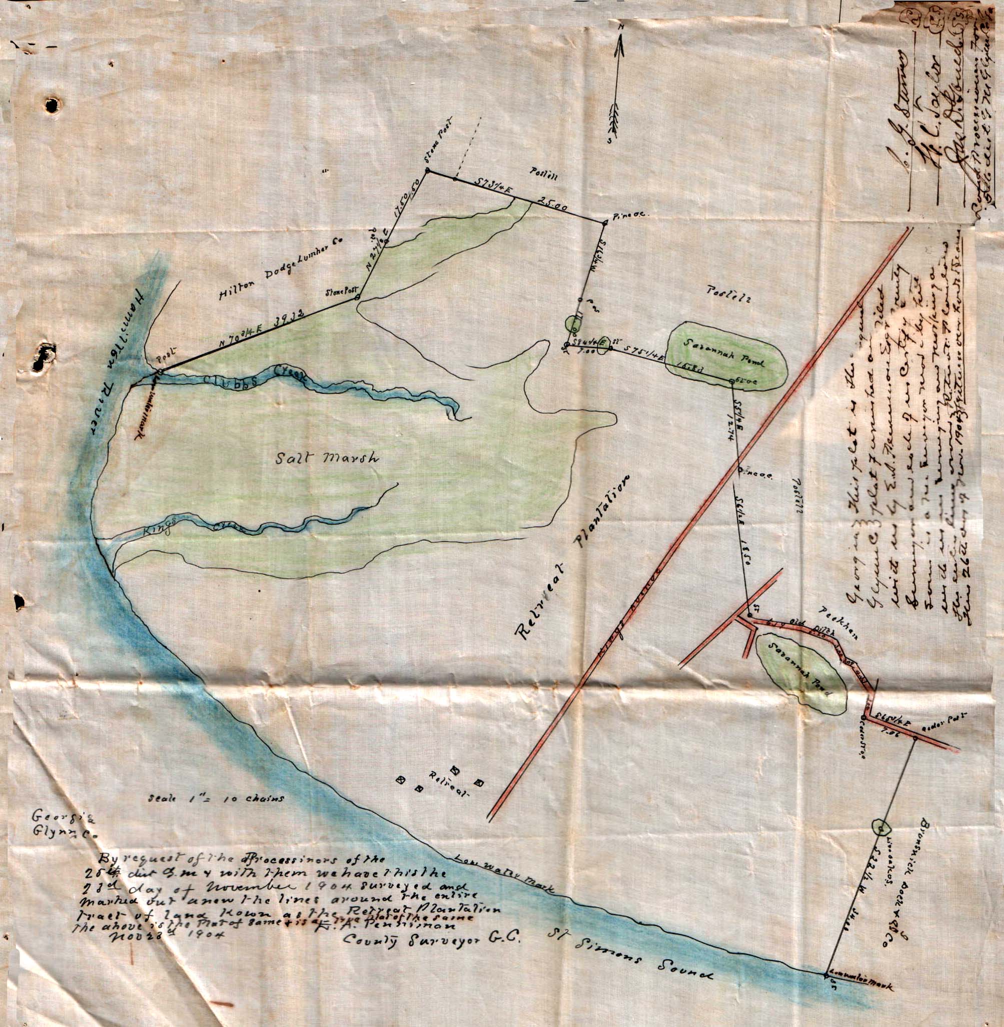
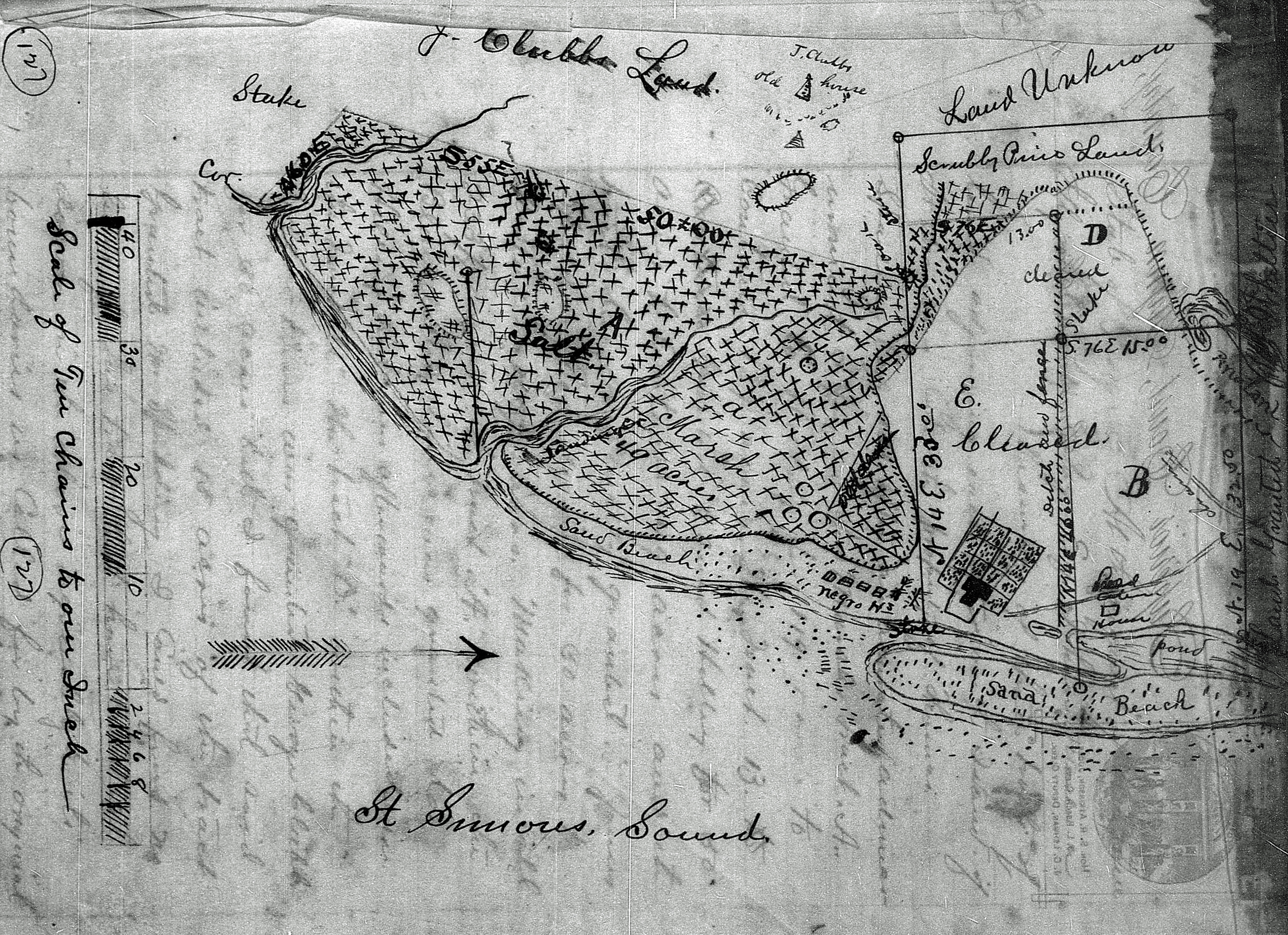 1804 Survey of the Clubb land St. Simons Island; Glynn County Deed Book ABEF pg. 275 |
Census Maps of Georgia
|
Glynn County Militia Map
Located at the
US GenWeb Archives
This map shows you what militia district was where.
Links
Historical Atlas of Georgia Counties
Genealogy Atlas
Historic maps of North America
Sanborn Fire Insurance Maps
Digital Library of Georgia
Home
Contact
Site Map
Copyright ©GlynnGen.com All Rights Reserved
Material on this site is one of kind,
having been published here for the first time ever. This data was compiled by
Amy Hedrick
for the GlynnGen website to be used for your personal use and it is not to be
reproduced in any manner on other websites or electronic media,
nor is it to be printed in any resource books or materials. Thank you!
Want to make a contribution?
Donate via PayPal: